Major Southeast Severe Weather Outbreak May 10 and 11th
Moderator: S2k Moderators
Forum rules

The posts in this forum are NOT official forecast and should not be used as such. They are just the opinion of the poster and may or may not be backed by sound meteorological data. They are NOT endorsed by any professional institution or STORM2K.

-
CrazyC83
- Professional-Met

- Posts: 34315
- Joined: Tue Mar 07, 2006 11:57 pm
- Location: Deep South, for the first time!
Re:
HarlequinBoy wrote:Btw, WMC said SPC upgraded to a PDS for the Mid South? Where did they get that?
Haven't heard it, but I wouldn't be surprised if that happened. Tornado Watch 298 would likely have to be dropped to make the upgrade, since that hypothetical PDS Tornado Watch 299 would be the same area.
0 likes
-
HarlequinBoy

- Category 5

- Posts: 1400
- Age: 35
- Joined: Wed Nov 29, 2006 1:57 am
- Location: Memphis

-
brunota2003

- S2K Supporter

- Posts: 9476
- Age: 35
- Joined: Sat Jul 30, 2005 9:56 pm
- Location: Stanton, KY...formerly Havelock, NC
- Contact:
-
HarlequinBoy
- Category 5
- Posts: 1400
- Age: 35
- Joined: Wed Nov 29, 2006 1:57 am
- Location: Memphis
THE NATIONAL WEATHER SERVICE IN MEMPHIS HAS ISSUED A
* TORNADO WARNING FOR...
SOUTHEASTERN CRAIGHEAD COUNTY IN EASTERN ARKANSAS...
CENTRAL MISSISSIPPI COUNTY IN EASTERN ARKANSAS...
NORTHEASTERN POINSETT COUNTY IN EASTERN ARKANSAS...
* UNTIL 645 PM CDT
* AT 609 PM CDT...NATIONAL WEATHER SERVICE DOPPLER RADAR WAS TRACKING
A TORNADO NEAR BAY...MOVING EAST SOUTHEAST AT 35 MPH.
* OTHER LOCATIONS IN THE WARNING INCLUDE BUT ARE NOT LIMITED TO
TRUMANN...LAKE CITY...CARAWAY...LEPANTO...THREE WAY...DYESS...
MARIE...KEISER AND BASSETT.
0 likes
-
6SpeedTA95
- Category 5
- Posts: 1206
- Joined: Wed Oct 19, 2005 3:25 pm
- Location: Oklahoma
- Contact:
Re:
Bunkertor wrote:Anyone an idea how to remove the registry of GRF3DSDGHJ
What is it? Editing the registry isn't much problem what does that key consist of?
0 likes
-
HarlequinBoy
- Category 5
- Posts: 1400
- Age: 35
- Joined: Wed Nov 29, 2006 1:57 am
- Location: Memphis
-
HarlequinBoy
- Category 5
- Posts: 1400
- Age: 35
- Joined: Wed Nov 29, 2006 1:57 am
- Location: Memphis
-
6SpeedTA95
- Category 5
- Posts: 1206
- Joined: Wed Oct 19, 2005 3:25 pm
- Location: Oklahoma
- Contact:
612 PM CDT SAT MAY 10 2008
...A TORNADO WARNING REMAINS IN EFFECT UNTIL 645 PM CDT FOR EASTERN
DELAWARE AND WESTERN BENTON COUNTIES...
AT 607 PM CDT...WEATHER SERVICE DOPPLER RADAR AND STORM SPOTTERS
CONTINUED TO TRACK A VERY DANGEROUS TORNADO. THIS TORNADIC STORM WAS
LOCATED NEAR CHEROKEE CITY...MOVING EAST AT 50 MPH. A TORNADO HAS
BEEN CONFIRMED...TAKE COVER NOW!
0 likes
-
HarlequinBoy
- Category 5
- Posts: 1400
- Age: 35
- Joined: Wed Nov 29, 2006 1:57 am
- Location: Memphis
-
MGC

- S2K Supporter
- Posts: 5940
- Joined: Sun Mar 23, 2003 9:05 pm
- Location: Pass Christian MS, or what is left.
Re: Major Southeast Severe Weather Outbreak May 10 and 11th
I can't keep up with the number of potential twisters that are happening now......MGC
0 likes
-
6SpeedTA95
- Category 5
- Posts: 1206
- Joined: Wed Oct 19, 2005 3:25 pm
- Location: Oklahoma
- Contact:
-
HarlequinBoy
- Category 5
- Posts: 1400
- Age: 35
- Joined: Wed Nov 29, 2006 1:57 am
- Location: Memphis
Re: Re:
6SpeedTA95 wrote:Bunkertor wrote:Anyone an idea how to remove the registry of GRF3DSDGHJ
What is it? Editing the registry isn't much problem what does that key consist of?
My version has expired. It´s grlevel3_setup.exe
0 likes
-
brunota2003
- S2K Supporter
- Posts: 9476
- Age: 35
- Joined: Sat Jul 30, 2005 9:56 pm
- Location: Stanton, KY...formerly Havelock, NC
- Contact:
Re: Major Southeast Severe Weather Outbreak May 10 and 11th
MGC wrote:I can't keep up with the number of potential twisters that are happening now......MGC
I'm having a hard time keeping up with the posts, let alone tornadoes!
0 likes
-
HarlequinBoy
- Category 5
- Posts: 1400
- Age: 35
- Joined: Wed Nov 29, 2006 1:57 am
- Location: Memphis
-
6SpeedTA95
- Category 5
- Posts: 1206
- Joined: Wed Oct 19, 2005 3:25 pm
- Location: Oklahoma
- Contact:
Re: Re:
Bunkertor wrote:6SpeedTA95 wrote:Bunkertor wrote:Anyone an idea how to remove the registry of GRF3DSDGHJ
What is it? Editing the registry isn't much problem what does that key consist of?
My version has expired. It´s grlevel3_setup.exe
They have a hidden key in the registry that they use, I dunno what it is...if you go to start>run then type "regedit" you can do a search for that key. But it wont help you reinstall it.
0 likes

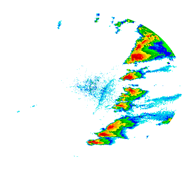
Based on rotational value alone with the storm currently in southern Missouri (McDonald, Newton...about to pass into Barry), I'm not liking it.
A high value of rotation found all the way down to 3700 feet. The values on the rotation (using prior tornadoes as examples, is putting this at possible EF4 rotational values...about the same as Enterprise, AL last year).
--snoopj
A high value of rotation found all the way down to 3700 feet. The values on the rotation (using prior tornadoes as examples, is putting this at possible EF4 rotational values...about the same as Enterprise, AL last year).
--snoopj
0 likes
Return to “USA & Caribbean Weather”
Who is online
Users browsing this forum: No registered users and 114 guests