SE TX/SW LA weather: Much cooler and WET after Tuesday

U.S. & Caribbean Weather Discussions and Severe Weather Events

Moderator: S2k Moderators

Forum rules

The posts in this forum are NOT official forecast and should not be used as such. They are just the opinion of the poster and may or may not be backed by sound meteorological data. They are NOT endorsed by any professional institution or STORM2K.

Help Support Storm2K
Message
Author
User avatar
srainhoutx
S2K Supporter
S2K Supporter
Posts: 6919
Age: 67
Joined: Sun Jan 14, 2007 11:34 am
Location: Haywood County, NC
Contact:

Re: SE TX/SW LA weather: Severe Weather Possible

#2181 Postby srainhoutx » Thu Mar 26, 2009 2:22 pm

Would not be surprised to see an Urban Flood Statement out of these training storms. :wink:

PRELIMINARY LOCAL STORM REPORT
NATIONAL WEATHER SERVICE HOUSTON/GALVESTON TX
202 PM CDT THU MAR 26 2009

..TIME... ...EVENT... ...CITY LOCATION... ...LAT.LON...
..DATE... ....MAG.... ..COUNTY LOCATION..ST.. ...SOURCE....
..REMARKS..

0155 PM HAIL 3 W SUGAR LAND 29.62N 95.67W
03/26/2009 E0.88 INCH FORT BEND TX PUBLIC

PUBLIC REPORT ROUTE 6 AND ELDRIDGE PARKWAY.
0 likes   

User avatar
JenBayles
Category 5
Category 5
Posts: 3461
Age: 62
Joined: Tue Aug 26, 2003 3:27 pm
Location: Houston, TX
Contact:

#2182 Postby JenBayles » Thu Mar 26, 2009 2:25 pm

I was wondering the same thing myself looking at training setting up. Not at all surprised to see the report from Hiway 6 and Eldridge. Naturally, that's just to my south. LOL
0 likes   

User avatar
JenBayles
Category 5
Category 5
Posts: 3461
Age: 62
Joined: Tue Aug 26, 2003 3:27 pm
Location: Houston, TX
Contact:

#2183 Postby JenBayles » Thu Mar 26, 2009 2:37 pm

FLOOD ADVISORY
NATIONAL WEATHER SERVICE HOUSTON/GALVESTON TX
234 PM CDT THU MAR 26 2009

TXC157-201-262130-
/O.NEW.KHGX.FA.Y.0002.090326T1934Z-090326T2130Z/
/00000.N.ER.000000T0000Z.000000T0000Z.000000T0000Z.OO/
HARRIS TX-FORT BEND TX-
234 PM CDT THU MAR 26 2009

THE NATIONAL WEATHER SERVICE IN LEAGUE CITY HAS ISSUED AN

* URBAN AND SMALL STREAM FLOOD ADVISORY FOR...
FORT BEND COUNTY IN SOUTHEAST TEXAS...
SOUTHWEST HARRIS COUNTY IN SOUTHEAST TEXAS...

* UNTIL 430 PM CDT

* AT 232 PM CDT...NATIONAL WEATHER SERVICE DOPPLER RADAR INDICATED
A BAND OF VERY HEAVY RAINFALL STRETCHING FROM NEEDVILLE TO ROSENBERG
TO SHARPSTOWN. HOURLY RAINFALL RATES ARE BETWEEN 1 AND 2 1/2 INCHES.

PRECAUTIONARY/PREPAREDNESS ACTIONS...

EXCESSIVE RUNOFF FROM HEAVY RAINFALL MAY CAUSE FLOODING OF LAND
ADJACENT TO SMALL CREEKS AND BAYOUS. ADDITIONALLY...FRONTAGE ROADS...
HIGHWAY UNDERPASSES...FARM-TO-MARKET AND OTHER SECONDARY ROADS MAY
FLOOD.

&&

PLEASE REPORT FLOODING TO THE COUNTY SHERIFF...LOCAL POLICE...OR
DEPARTMENT OF PUBLIC SAFETY AND ASK THEM TO RELAY YOUR REPORT TO THE
NATIONAL WEATHER SERVICE.
0 likes   

User avatar
jasons2k
Storm2k Executive
Storm2k Executive
Posts: 8245
Age: 51
Joined: Wed Jul 06, 2005 12:32 pm
Location: The Woodlands, TX

Re: SE TX/SW LA weather: Severe Weather Possible

#2184 Postby jasons2k » Thu Mar 26, 2009 2:51 pm

Latest update from Jeff Lindner:

Excessive rainfall pounding Wharton and Fort Bend counties now moving into Harris County along with penny size hail

Extensive band of slow moving thunderstorms extends from downtown Houston to Wharton and is training along US 59. Radar and station gage reports indicate 1 hour rainfall totals approaching 2.0 inches within this band. Even though grounds are very dry...the rapid rainfall is resulting in extensive run-off and flooding is starting to develop.

Excessive rainfall will develop over much of Harris County shortly with street flooding likely. A quick 2-4 inches will be common in the next 2-3 hours.

WW # 70 is in effect until 700pm for the southern 1/2 of the area. Will be watching new storms firing W of Victoria to possibly come across the Matagorda Bay region later this afternoon and possibly impact a larger part of the region this evening...after the first round pushes through.
0 likes   

User avatar
srainhoutx
S2K Supporter
S2K Supporter
Posts: 6919
Age: 67
Joined: Sun Jan 14, 2007 11:34 am
Location: Haywood County, NC
Contact:

Re: SE TX/SW LA weather: Severe Weather Possible

#2185 Postby srainhoutx » Thu Mar 26, 2009 3:13 pm

http://www.spc.noaa.gov/products/md/md0277.html

MESOSCALE DISCUSSION 0277
NWS STORM PREDICTION CENTER NORMAN OK
0306 PM CDT THU MAR 26 2009

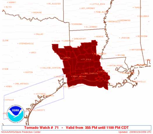
AREAS AFFECTED...SERN TX...SRN LA

CONCERNING...SEVERE POTENTIAL...WATCH LIKELY

VALID 262006Z - 262100Z

REMNANTS OF UPPER VORT/SHORTWAVE TROUGH ARE SHEARING EWD ACROSS
SCNTRL TX TOWARD THE UPPER TX COAST. THIS FEATURE APPEARS TO BE
PARTLY RESPONSIBLE FOR RETURN OF MARITIME BOUNDARY LAYER AIRMASS NWD
ACROSS THE UPPER TX COAST AND SRN LA WHERE SFC DEW POINTS ARE NEAR
70F. WEAK WARM ADVECTION PERSISTS ACROSS THIS REGION WHICH COMBINED
WITH ASCENT AHEAD OF UPPER VORT IS ENHANCING RASH OF NEW CONVECTION
ACROSS SERN TX. GIVEN THE STRONG DEEP LAYER SHEAR AND MLCAPE ON THE
ORDER OF 2000 J/KG...SUPERCELL DEVELOPMENT IS CERTAINLY POSSIBLE.
WW WILL LIKELY BE ISSUED TO ADDRESS THIS ACTIVITY WITHIN THE NEXT
HOUR.

..DARROW.. 03/26/2009


ATTN...WFO...JAN...LIX...LCH...SHV...HGX...
0 likes   

User avatar
JenBayles
Category 5
Category 5
Posts: 3461
Age: 62
Joined: Tue Aug 26, 2003 3:27 pm
Location: Houston, TX
Contact:

#2186 Postby JenBayles » Thu Mar 26, 2009 3:19 pm

And incredibly, Bear Creek misses out on the action again. Thunder all around and nothing but light showers here.
0 likes   

User avatar
vbhoutex
Storm2k Executive
Storm2k Executive
Posts: 29113
Age: 73
Joined: Wed Oct 09, 2002 11:31 pm
Location: Cypress, TX
Contact:

Re:

#2187 Postby vbhoutex » Thu Mar 26, 2009 3:30 pm

JenBayles wrote:And incredibly, Bear Creek misses out on the action again. Thunder all around and nothing but light showers here.

Don't give up hope Jen!!! Looks like this is turning into an ongoing event. Still raining here with heavier oeriods of rain interspersed, as well as still getting the T & L, just not as much as earlier.
0 likes   

User avatar
JenBayles
Category 5
Category 5
Posts: 3461
Age: 62
Joined: Tue Aug 26, 2003 3:27 pm
Location: Houston, TX
Contact:

#2188 Postby JenBayles » Thu Mar 26, 2009 3:36 pm

I'm actually a bit worried about some friends trying to come back from Denver. There's a blizzard warning there now, and Friend #1's flight to San Antonio was already canceled. Our neighbor and Friend #2, whose dog we are dog-sitting, still has a flight due in at 6:30, but may not be able to land here with our weather being so crazy.
0 likes   

Ed Mahmoud

Re: SE TX/SW LA weather: Severe Weather Possible

#2189 Postby Ed Mahmoud » Thu Mar 26, 2009 3:37 pm

Small, maybe pea sized hail 30 minutes ago Kuykendahl exit off I-45.

Plenty of rain and lightning, but probably not technically severe, as wind wasn't that strong.
0 likes   

User avatar
srainhoutx
S2K Supporter
S2K Supporter
Posts: 6919
Age: 67
Joined: Sun Jan 14, 2007 11:34 am
Location: Haywood County, NC
Contact:

Re: SE TX/SW LA weather: Severe Weather Possible

#2190 Postby srainhoutx » Thu Mar 26, 2009 3:42 pm

NATIONAL WEATHER SERVICE HOUSTON/GALVESTON TX
338 PM CDT THU MAR 26 2009

TXC157-201-339-262230-
/O.NEW.KHGX.FA.Y.0003.090326T2038Z-090326T2230Z/
/00000.N.ER.000000T0000Z.000000T0000Z.000000T0000Z.OO/
MONTGOMERY TX-HARRIS TX-FORT BEND TX-
338 PM CDT THU MAR 26 2009

THE NATIONAL WEATHER SERVICE IN LEAGUE CITY HAS ISSUED AN

* URBAN AND SMALL STREAM FLOOD ADVISORY FOR...
EASTERN FORT BEND COUNTY IN SOUTHEAST TEXAS...
EASTERN HARRIS COUNTY IN SOUTHEAST TEXAS...
SOUTHEASTERN MONTGOMERY COUNTY IN SOUTHEAST TEXAS...

* UNTIL 530 PM CDT

* AT 335 PM CDT...NATIONAL WEATHER SERVICE DOPPLER RADAR CONTINUED
TO INDICATE A CLUSTER OF THUNDERSTORMS PRODUCING HEAVY RAIN
EXTENDING FROM MISSOURI CITY TO HOUSTON TO HUMBLE TO NEW CANEY.
HOURLY RAINFALL RATES RANGE FROM 1 TO 2 INCHES.
0 likes   

User avatar
southerngale
Retired Staff
Retired Staff
Posts: 27418
Joined: Thu Oct 10, 2002 1:27 am
Location: Southeast Texas (Beaumont area)

#2191 Postby southerngale » Thu Mar 26, 2009 3:58 pm

Oh boy... another tornado watch today.


Tornado Watch

TORNADO WATCH OUTLINE UPDATE FOR WT 71
NWS STORM PREDICTION CENTER NORMAN OK
355 PM CDT THU MAR 26 2009

TORNADO WATCH 71 IS IN EFFECT UNTIL 1100 PM CDT FOR THE
FOLLOWING LOCATIONS

TXC005-073-199-241-245-347-351-361-403-405-419-457-270400-
/O.NEW.KWNS.TO.A.0071.090326T2055Z-090327T0400Z/

TX
. TEXAS COUNTIES INCLUDED ARE

ANGELINA CHEROKEE HARDIN
JASPER JEFFERSON NACOGDOCHES
NEWTON ORANGE SABINE
SAN AUGUSTINE SHELBY TYLER
$$
0 likes   

User avatar
srainhoutx
S2K Supporter
S2K Supporter
Posts: 6919
Age: 67
Joined: Sun Jan 14, 2007 11:34 am
Location: Haywood County, NC
Contact:

Re:

#2192 Postby srainhoutx » Thu Mar 26, 2009 4:02 pm

southerngale wrote:Oh boy... another tornado watch today.


Tornado Watch

TORNADO WATCH OUTLINE UPDATE FOR WT 71
NWS STORM PREDICTION CENTER NORMAN OK
355 PM CDT THU MAR 26 2009

TORNADO WATCH 71 IS IN EFFECT UNTIL 1100 PM CDT FOR THE
FOLLOWING LOCATIONS

TXC005-073-199-241-245-347-351-361-403-405-419-457-270400-
/O.NEW.KWNS.TO.A.0071.090326T2055Z-090327T0400Z/

TX
. TEXAS COUNTIES INCLUDED ARE

ANGELINA CHEROKEE HARDIN
JASPER JEFFERSON NACOGDOCHES
NEWTON ORANGE SABINE
SAN AUGUSTINE SHELBY TYLER
$$

Image
0 likes   

User avatar
southerngale
Retired Staff
Retired Staff
Posts: 27418
Joined: Thu Oct 10, 2002 1:27 am
Location: Southeast Texas (Beaumont area)

Re: SE TX/SW LA weather: Severe Weather Possible

#2193 Postby southerngale » Thu Mar 26, 2009 5:16 pm

Flood Advisory

FLOOD ADVISORY
NATIONAL WEATHER SERVICE LAKE CHARLES LA
505 PM CDT THU MAR 26 2009

TXC199-241-457-270100-
/O.NEW.KLCH.FA.Y.0006.090326T2205Z-090327T0100Z/
/00000.N.ER.000000T0000Z.000000T0000Z.000000T0000Z.OO/
JASPER TX-TYLER TX-HARDIN TX-
505 PM CDT THU MAR 26 2009

THE NATIONAL WEATHER SERVICE IN LAKE CHARLES HAS ISSUED AN

* URBAN AND SMALL STREAM FLOOD ADVISORY FOR...
HARDIN COUNTY IN SOUTHEAST TEXAS...
THIS INCLUDES THE CITIES OF...WILDWOOD...SARATOGA...KOUNTZE...
NORTHWESTERN JASPER COUNTY IN SOUTHEAST TEXAS...
THIS INCLUDES THE CITY OF JASPER...
TYLER COUNTY IN SOUTHEAST TEXAS...
THIS INCLUDES THE CITIES OF...WOODVILLE...WARREN...TOWN BLUFF...
ROCKLAND...FRED...COLMESNEIL...CHESTER...

* UNTIL 800 PM CDT

* AT 459 PM CDT NATIONAL WEATHER SERVICE RADAR INDICATED 2 TO 4
INCHES OF RAIN HAD FALLEN OVER PORTIONS OF THE WARNED AREA FROM
THUNDERSTORMS ADVANCING OVER THE REGION. ADDITIONAL HEAVY RAIN AND
THUNDERSTORMS MOVING NORTHEAST AT 20 MPH ARE EXPECTED TO BRING
ADDITIONAL RAINS OF 2 TO 4 INCHES BRINGING URBAN AND SMALL STREAM
FLOODING.

PRECAUTIONARY/PREPAREDNESS ACTIONS...

MOST FLOOD DEATHS OCCUR IN AUTOMOBILES. NEVER DRIVE YOUR VEHICLE INTO
AREAS WHERE THE WATER COVERS THE ROADWAY. FLOOD WATERS ARE USUALLY
DEEPER THAN THEY APPEAR. JUST ONE FOOT OF FLOWING WATER IS POWERFUL
ENOUGH TO SWEEP VEHICLES OFF THE ROAD. WHEN ENCOUNTERING FLOODED
ROADS MAKE THE SMART CHOICE...TURN AROUND...DONT DROWN.

EXCESSIVE RUNOFF FROM HEAVY RAINFALL MAY CAUSE ELEVATED LEVELS ON
SMALL CREEKS...STREAMS...AND BAYOUS. ADDITIONALLY...PONDING OF WATER
WILL OCCUR ON FARM-TO-MARKET OR OTHER SECONDARY ROADS.

TURN AROUND...DON`T DROWN... MOST FLOOD DEATHS OCCUR IN AUTOMOBILES.
NEVER DRIVE YOUR VEHICLE INTO AREAS WHERE THE WATER COVERS THE
ROADWAY. FLOOD WATERS ARE USUALLY DEEPER THAN THEY APPEAR. JUST ONE
FOOT OF FLOWING WATER IS POWERFUL ENOUGH TO SWEEP VEHICLES OFF THE
ROAD. WHEN ENCOUNTERING FLOODED ROADS MAKE THE SMART CHOICE...TURN
AROUND...DONT DROWN.
0 likes   

User avatar
JenBayles
Category 5
Category 5
Posts: 3461
Age: 62
Joined: Tue Aug 26, 2003 3:27 pm
Location: Houston, TX
Contact:

#2194 Postby JenBayles » Thu Mar 26, 2009 5:19 pm

And once again I got the 8 ball... :roll:
0 likes   

User avatar
southerngale
Retired Staff
Retired Staff
Posts: 27418
Joined: Thu Oct 10, 2002 1:27 am
Location: Southeast Texas (Beaumont area)

Re:

#2195 Postby southerngale » Thu Mar 26, 2009 5:27 pm

JenBayles wrote:And once again I got the 8 ball... :roll:


This blob is huge... how in the heck did it miss you? Are you sure you live in SE TX? :lol:
0 likes   

Jagno
Category 3
Category 3
Posts: 825
Joined: Tue Sep 07, 2004 10:40 pm
Location: SW Louisiana

Re: SE TX/SW LA weather: Severe Weather Possible

#2196 Postby Jagno » Thu Mar 26, 2009 6:44 pm

Statement as of 6:32 PM CDT on March 26, 2009


... Significant weather alert for Beauregard... Cameron and Calcasieu
parishes... significant weather alert for Newton and Orange counties
until 730 PM CDT...

At 628 PM CDT... a line of strong thunderstorms was indicated by
National Weather Service Doppler radar along a line extending from 7
miles north of Deweyville to 3 miles northwest of Johnson Bayou...
moving northeast at 25 mph.

* Other locations in the alert include but are not limited to Sabine
National wildlife... Westlake... Vinton... Sulphur... Starks...
Singer... Ragley... Oretta... Moss Bluff... Longville... Lake Charles...
Johnson Bayou... Hackberry... Grand Lake... Gillis... fields... de
Quincy... Carlyss... West Orange... Orange and Deweyville.

Frequent cloud to ground lightning... pea size hail... and wind gusts
to 50 mph are likely with this storm. Heavy rainfall will cause
ponding of water on area roadways... especially those in poor drainage
areas. Residents are encouraged to monitor the situation closely and
be prepared to take the proper actions should a warning be issued.

A Tornado Watch remains in effect until 1100 PM CDT Thursday evening
for southwestern Louisiana and southeast Texas.
0 likes   

User avatar
jasons2k
Storm2k Executive
Storm2k Executive
Posts: 8245
Age: 51
Joined: Wed Jul 06, 2005 12:32 pm
Location: The Woodlands, TX

Re: SE TX/SW LA weather: Severe Weather Possible

#2197 Postby jasons2k » Fri Mar 27, 2009 10:24 am

Storms already firing over Central Texas. Also the sun is peeking out here. With the dryline on the move it looks like mid afternoon is the target time for the Houston area.
0 likes   

Ed Mahmoud

Re: SE TX/SW LA weather: Severe Weather Possible

#2198 Postby Ed Mahmoud » Fri Mar 27, 2009 10:30 am

jasons wrote:Storms already firing over Central Texas. Also the sun is peeking out here. With the dryline on the move it looks like mid afternoon is the target time for the Houston area.


New MCD for SE Texas...
weak low level winds may reduce tornado threat, but hail threat seems decent...

Image
0 likes   

User avatar
jasons2k
Storm2k Executive
Storm2k Executive
Posts: 8245
Age: 51
Joined: Wed Jul 06, 2005 12:32 pm
Location: The Woodlands, TX

Re: SE TX/SW LA weather: Severe Weather Possible

#2199 Postby jasons2k » Fri Mar 27, 2009 11:43 am

Methinks this is going to punch thru much faster than they are forecasting. Looking at surface obs, the wind has already shifted to the west just west of the Giddings and LaGrange areas....
0 likes   

User avatar
southerngale
Retired Staff
Retired Staff
Posts: 27418
Joined: Thu Oct 10, 2002 1:27 am
Location: Southeast Texas (Beaumont area)

Re: SE TX/SW LA weather: Severe Weather Possible

#2200 Postby southerngale » Fri Mar 27, 2009 11:57 am

Severe Thunderstorm Watch

SEVERE THUNDERSTORM WATCH OUTLINE UPDATE FOR WS 77
NWS STORM PREDICTION CENTER NORMAN OK
1150 AM CDT FRI MAR 27 2009

SEVERE THUNDERSTORM WATCH 77 IS IN EFFECT UNTIL 500 PM CDT
FOR THE FOLLOWING LOCATIONS

TXC015-041-051-071-185-199-201-225-241-245-291-313-339-351-361-
373-407-455-457-471-473-477-272200-
/O.NEW.KWNS.SV.A.0077.090327T1650Z-090327T2200Z/

TX
. TEXAS COUNTIES INCLUDED ARE

AUSTIN BRAZOS BURLESON
CHAMBERS GRIMES HARDIN
HARRIS HOUSTON JASPER
JEFFERSON LIBERTY MADISON
MONTGOMERY NEWTON ORANGE
POLK SAN JACINTO TRINITY
TYLER WALKER WALLER
WASHINGTON
0 likes   


Return to “USA & Caribbean Weather”

Who is online

Users browsing this forum: No registered users and 14 guests