2009 Severe Weather thread

U.S. & Caribbean Weather Discussions and Severe Weather Events

Moderator: S2k Moderators

Forum rules

The posts in this forum are NOT official forecast and should not be used as such. They are just the opinion of the poster and may or may not be backed by sound meteorological data. They are NOT endorsed by any professional institution or STORM2K.

Help Support Storm2K
Message
Author
User avatar
Bunkertor
Category 5
Category 5
Posts: 3397
Joined: Tue May 09, 2006 3:48 pm

Re: 2009 Severe Weather thread

#221 Postby Bunkertor » Tue May 05, 2009 2:36 pm

Ed Mahmoud wrote:
Bunkertor wrote:
Ed Mahmoud wrote:NWS in Fort Worth to launch special sounding at 2 pm CDT to evaluate cap strength and severe probabilities.


Hey Ed where did you get that info from ?


I work until I get bored, I read local NWS office discussions and HPC discussions, look at PSU e-Wall model page and Northern Illinois University model skew-T generator page.

Then I start working again.


OK, thought there was a special announcement or so...
0 likes   

Ed Mahmoud

Re: 2009 Severe Weather thread

#222 Postby Ed Mahmoud » Tue May 05, 2009 2:44 pm

:uarrow: :uarrow: :uarrow:


They don't launch a balloon other than the normal 0Z and 12Z soundings unless they are concerned about significant weather.
0 likes   

Ed Mahmoud

Re: 2009 Severe Weather thread

#223 Postby Ed Mahmoud » Tue May 05, 2009 3:01 pm

Temps in the area only in the low 60s, probably too cool for surface storms, but maybe a thin enough stable layer to allow gusty winds along with hail.


Image
0 likes   

User avatar
Bunkertor
Category 5
Category 5
Posts: 3397
Joined: Tue May 09, 2006 3:48 pm

Re: 2009 Severe Weather thread

#224 Postby Bunkertor » Tue May 05, 2009 3:08 pm

Ed Mahmoud wrote::uarrow: :uarrow: :uarrow:


They don't launch a balloon other than the normal 0Z and 12Z soundings unless they are concerned about significant weather.


Yeah. Update is 10 minutes delayed, now. They seem to be in calculating.
0 likes   

Ed Mahmoud

Re: 2009 Severe Weather thread

#225 Postby Ed Mahmoud » Tue May 05, 2009 3:09 pm

Totally not where I was looking:


SEVERE WEATHER STATEMENT
NATIONAL WEATHER SERVICE NEWPORT/MOREHEAD CITY NC
351 PM EDT TUE MAY 5 2009

NCC061-107-052015-
/O.CON.KMHX.TO.W.0012.000000T0000Z-090505T2015Z/
DUPLIN NC-LENOIR NC-
351 PM EDT TUE MAY 5 2009

...A TORNADO WARNING REMAINS IN EFFECT UNTIL 415 PM EDT FOR LENOIR
AND DUPLIN COUNTIES...

AT 350 PM EDT...NATIONAL WEATHER SERVICE DOPPLER RADAR CONTINUED TO
INDICATE A TORNADO. THIS TORNADO WAS LOCATED NEAR ALBERTSON...OR 11
MILES SOUTHEAST OF MOUNT OLIVE...MOVING NORTHEAST AT 20 MPH.

THE TORNADO WILL BE NEAR...
ALBERTSON BY 400 PM EDT...
MOSS HILL AND DEEP RUN BY 415 PM EDT...
0 likes   

Ed Mahmoud

Re: 2009 Severe Weather thread

#226 Postby Ed Mahmoud » Tue May 05, 2009 3:48 pm

Still some capping around 800 mb, but if the incoming disturbance in New Mexico cools it a bit, or temps warm to the upper 80s, the cap would break.

Image

Strong wind shear present per sounding.


Abilene, about 200 km to the West is already near the calculated convective temperature, if the cap there isn't any stronger, it should break soon.
0 likes   

Ed Mahmoud

Re: 2009 Severe Weather thread

#227 Postby Ed Mahmoud » Tue May 05, 2009 4:07 pm

:uarrow: :uarrow: :uarrow:

Based on warm nose between 700 and 800 mb, SPC has dropped the MODERATE RISK, although the probabilities for tornadoes, hail, wind, and significant tornadoes and hail only dropped slightly.


DAY 1 CONVECTIVE OUTLOOK
NWS STORM PREDICTION CENTER NORMAN OK
0303 PM CDT TUE MAY 05 2009

VALID 052000Z - 061200Z

...THERE IS A SLGT RISK OF SVR TSTMS FROM THE CAROLINAS WSWWD INTO
THE SRN PLAINS...

...SRN OK/N TX EWD INTO THE ARKLATEX...
CAPPING INVERSION REMAINS IN PLACE ACROSS MUCH OF TX...S OF A WARM
FRONT LYING W-E ACROSS N TX. N OF THE FRONT IN A ZONE OF LOW-LEVEL
WARM ADVECTION...CONVECTION HAS PERSISTED...WITH A BOW ECHO NOW
CROSSING SERN OK.

MEANWHILE...HEATING CONTINUES ACROSS W TX AHEAD OF THE
DRYLINE...WITH A DRYLINE/WARM FRONT INTERSECTION NOW INDICATED NW OF
ABI. CAPPING IS EXPECTED TO HINDER CONVECTIVE DEVELOPMENT TO SOME
DEGREE...THOUGH ISOLATED STORMS SHOULD DEVELOP LATE THIS AFTERNOON
AND EVENING. GIVEN DEGREE OF INSTABILITY AND FAVORABLE
SHEAR...THESE STORMS -- WHICH WILL QUICKLY BECOME SUPERCELLULAR --
WILL BE CAPABLE OF PRODUCING VERY LARGE HAIL.
ADDITIONALLY...LOCALLY-DAMAGING WINDS AND/OR ISOLATED TORNADOES WILL
BE POSSIBLE -- PARTICULARLY NEAR THE WARM FRONT. WITH CAPPING
LIKELY TO LIMIT THE NUMBER OF STORMS...WILL DROP THE MDT RISK THIS
FORECAST BUT MAINTAIN THE PROBABILITY FOR ISOLATED/SIGNIFICANT
SUPERCELLS.

0 likes   

User avatar
srainhoutx
S2K Supporter
S2K Supporter
Posts: 6919
Age: 67
Joined: Sun Jan 14, 2007 11:34 am
Location: Haywood County, NC
Contact:

Re: 2009 Severe Weather thread

#228 Postby srainhoutx » Tue May 05, 2009 5:42 pm

Looks as if things are about to get going...

Image

MESOSCALE DISCUSSION 0714
NWS STORM PREDICTION CENTER NORMAN OK
0513 PM CDT TUE MAY 05 2009

AREAS AFFECTED...NCNTRL TX

CONCERNING...SEVERE POTENTIAL...WATCH LIKELY

VALID 052213Z - 052315Z

TORNADO WATCH WILL BE REQUIRED SHORTLY FOR PART OF THE BIG COUNTRY
AND NCNTRL TX.

TSTM INITIATION APPEARS IMMINENT IN AREAS JUST NE OF KABI ALONG THE
NOSE OF A LOW-LEVEL THERMAL RIDGE. 20Z FWD SOUNDING WAS
CAPPED...BUT MODIFYING FOR AN 88/65 PARCEL YIELDS NO CAP AND OVER
3000 J/KG MLCAPE. EXPECT STORMS WILL RAPIDLY BECOME SUPERCELLULAR
GIVEN MAGNITUDE OF INSTABILITY AND AROUND 60 KTS OF BULK SHEAR.
FCST STORM MOTION OF 280-300 AT 20 KTS WOULD TAKE THE STORMS ALONG/S
OF THE WRMFNT LOCATED ALONG I-20...MAINTAINING VERY BUOYANT INFLOW.
VERY LARGE HAIL WILL BE LIKELY ALONG WITH A COUPLE OF TORNADOES.
ACTIVITY COULD BEGIN IMPACTING AT LEAST PARTS OF WRN/SRN PORTIONS OF
THE DFW METROPLEX BY MID-EVENING.

..RACY.. 05/05/2009


ATTN...WFO...FWD...SJT...
0 likes   

Ed Mahmoud

Re: 2009 Severe Weather thread

#229 Postby Ed Mahmoud » Tue May 05, 2009 6:12 pm

First cell breaks the cap, but can it last?


Image


SPECIAL WEATHER STATEMENT
NATIONAL WEATHER SERVICE FORT WORTH TX
555 PM CDT TUE MAY 5 2009

TXZ115-052330-
STEPHENS TX-
555 PM CDT TUE MAY 5 2009

...SIGNIFICANT WEATHER ADVISORY FOR...
CENTRAL STEPHENS COUNTY

AT 555 PM CDT...NATIONAL WEATHER SERVICE METEOROLOGISTS DETECTED A
STRONG THUNDERSTORM 6 MILES NORTHEAST OF BRECKENRIDGE...MOVING EAST
AT 20 MPH.

CITIES IN THE PATH OF THIS STORM INCLUDE BRECKENRIDGE AND CRYSTAL
FALLS.

FREQUENT CLOUD TO GROUND LIGHTNING...VERY HEAVY RAINFALL...HALF
INCH SIZE HAIL...AND WIND GUSTS TO 50 MPH CAN BE EXPECTED FROM THIS
STORM.

IF THIS STORM INTENSIFIES...A SEVERE WEATHER WARNING MAY BE NEEDED.

A TORNADO WATCH REMAINS IN EFFECT UNTIL MIDNIGHT CDT WEDNESDAY
MORNING FOR NORTH CENTRAL TEXAS.
0 likes   

lurkey
Category 5
Category 5
Posts: 2381
Joined: Tue Aug 31, 2004 4:54 pm
Location: Raleigh, NC

Re: 2009 Severe Weather thread

#230 Postby lurkey » Tue May 05, 2009 6:31 pm

http://www.wral.com/weather/video/5088665/

http://www.wral.com/weather/story/5083933/


Tornado on path for downtown Raleigh


RALEIGH, N.C. — Sirens sounded across the campus of North Carolina State University Tuesday evening as a severe storm with tornadic potential moved towards downtown Raleigh. A funnel cloud was spotted over Lyons Park in East Raleigh just after 7 p.m., WRAL Chief Meteorologist Greg Fishel reported.
At the Carolina Ale House off of Wake Forest Road in Raleigh, rain was pouring down and the parking lot was starting to flood.

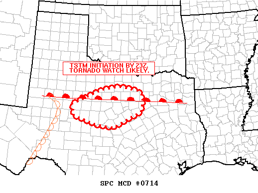
The National Weather Service has posted a tornado watch for dozens of counties until midnight. The watch indicates that conditions are right for a tornado. Tornadoes usually form during heavy thunderstorms when warm, moist air collides with cold air. The storms can also produce large hail and strong winds.
A warning, meaning the presence of a tornado has been spotted, is in effect for Durham and Wake counties until 7:15 p.m. Residents of Morrisville and Cary are urged to take cover. Doppler radar spotted a tornado over Cary near U.S. Highway 1 and Cary Parkway at 6:45 p.m. The storm was on a path for downtown Raleigh.

There were reports of trees down in Apex at Jenks Carpenter Road and Holt Road.
Severe storms that moved across the state Tuesday surfaced in the Triangle just after 5:30 p.m. A severe thunderstorm was over Pittsboro at 5:35 p.m. and moving east at 20 mph.

In Edgecombe, Nash and Wilson counties, a tornado warning was in effect until 6:45 p.m. Heavy rain and hail continued to fall in the area.


The Antioch Fire Department reported a tornado touched down just after 5:30 p.m. near N.C. Highway 96 and Antioch Church Road, moving on a path toward Sims and New Hope.The department headquarters sustained minor damage to the roof.

The storm that prompted the warning showed up on radar with rotation near New Hope at 5:10 p.m. That storm was moving north and east at up to 30 mph, on a path toward Nashville.
The area near N.C. Highway 42 and Interstate 95 was under the greatest threat, WRAL meteorologist Mike Maze said.

"If you are in the vicinity of Sims, you are most likely seeing some very heavy rain," WRAL Chief Meteorologist Greg Fishel said.

Walt Dixon, of Land Rush Road in Wilson County, reported seeing homes damaged in his Rock Ridge neighborhood. He said the homes, near N.C. Highway 42, appeared to have wind damage.
A second wave of strong thunderstorms was west of Raleigh, moving through Randolph, Chatham and southern Orange counties.
Farther east, the counties of Pitt and Beaufort were also under a tornado warning until 5:45 p.m. Radar indicated a severe thunderstorm with strong rotation over Honolulu at 5:10 p.m., on a path toward Black Jack and Washington.

Mobile home residents are especially vulnerable to tornadoes. If a tornado warning has been issued, mobile home residents should get to a pre-arranged shelter immediately.

At schools, the safest part of the building is in the hallway with no windows. Office workers are urged to get under something sturdy, like a desk or table.

Drivers who see a tornado forming or approaching should leave the car and take shelter in a ditch or some other low-lying area.

For those at home, the safest place is in a basement. If there is not one available, they should go into a hallway or closet.

Storms brought mid-day hit to eastern counties

A tornado touched down in Duplin County at 3:40 p.m about nine miles southeast of Mount Olive, the National Weather Service reported. Sheriff's deputies reported several buildings damaged by high winds near the intersection of Dowden and Wards Bridge roads.

Duplin County Fire Marshal Ricky Deaver said he saw three poultry houses damaged along Revelle Road.
A spotter reported a funnel cloud near N.C. Highway 111, but said that cloud did not reach the ground.


Image
Tornado near Rocky Mount


More pictures here http://www.wral.com/weather/image_gallery/5087962/
Last edited by lurkey on Tue May 05, 2009 6:34 pm, edited 2 times in total.
0 likes   

Ed Mahmoud

Re: 2009 Severe Weather thread

#231 Postby Ed Mahmoud » Tue May 05, 2009 6:32 pm

:uarrow: :uarrow: :uarrow:


Cap may be holding farther East towards Dallas, looks like the cell is weakening.
0 likes   

Ed Mahmoud

Re: 2009 Severe Weather thread

#232 Postby Ed Mahmoud » Tue May 05, 2009 6:33 pm

Yikes on that Carolina tornado picture!
0 likes   

Ed Mahmoud

Re: 2009 Severe Weather thread

#233 Postby Ed Mahmoud » Tue May 05, 2009 6:36 pm

SEVERE WEATHER STATEMENT
NATIONAL WEATHER SERVICE PEACHTREE CITY GA
733 PM EDT TUE MAY 5 2009

GAC303-060000-
/O.CON.KFFC.TO.W.0119.000000T0000Z-090506T0000Z/
WASHINGTON GA-
733 PM EDT TUE MAY 5 2009

...A TORNADO WARNING REMAINS IN EFFECT UNTIL 800 PM EDT FOR CENTRAL
WASHINGTON COUNTY...

AT 733 PM EDT...NATIONAL WEATHER SERVICE DOPPLER RADAR CONTINUED TO
INDICATE A TORNADO. THIS TORNADO WAS LOCATED NEAR SANDERSVILLE...
MOVING SOUTHEAST AT 20 MPH.

OTHER LOCATIONS IN THE WARNING INCLUDE BUT ARE NOT LIMITED TO
TENNILLE...RIDDLEVILLE...DAVISBORO AND HARRISON.


Not in a weather watch box...

Image
0 likes   

Ed Mahmoud

Re: 2009 Severe Weather thread

#234 Postby Ed Mahmoud » Tue May 05, 2009 6:44 pm

Besides being a few degrees cooler to begin with in DFW, the anvil blowing towartd the Southeast and shading the ground the storms inflow is crossing to get to the storm may be surpressing the cell between ABI and FTW


Image
0 likes   

Ed Mahmoud

Re: 2009 Severe Weather thread

#235 Postby Ed Mahmoud » Tue May 05, 2009 7:04 pm

Will this poof as it approaches the Metroplex like the last cell?


WWUS84 KFWD 052352
SPSFWD

SPECIAL WEATHER STATEMENT
NATIONAL WEATHER SERVICE FORT WORTH TX
652 PM CDT TUE MAY 5 2009

TXZ115-060030-
STEPHENS TX-
652 PM CDT TUE MAY 5 2009

...SIGNIFICANT WEATHER ADVISORY FOR...
CENTRAL STEPHENS COUNTY

AT 653 PM CDT...NATIONAL WEATHER SERVICE METEOROLOGISTS DETECTED A
STRONG THUNDERSTORM 4 MILES EAST OF BRECKENRIDGE...MOVING EAST AT 20
MPH.

CITIES IN THE PATH OF THIS STORM INCLUDE BRECKENRIDGE.

PEA-SIZED HAIL AND WIND GUSTS TO 40 MPH CAN BE EXPECTED FROM THIS
STORM.

IF THIS STORM INTENSIFIES...A SEVERE WEATHER WARNING MAY BE NEEDED.

A TORNADO WATCH REMAINS IN EFFECT UNTIL MIDNIGHT CDT WEDNESDAY
MORNING FOR NORTH CENTRAL TEXAS.
0 likes   

Ed Mahmoud

Re: 2009 Severe Weather thread

#236 Postby Ed Mahmoud » Tue May 05, 2009 7:23 pm

That cell isn't just holding its own in Palo Pinto county, I think I see an inflow notch. Just a severe warning for now.

[img]empty[/img]


Radar image blank as cell died, but not before producing 4" hail

NWUS54 KFWD 060114
LSRFWD

PRELIMINARY LOCAL STORM REPORT
NATIONAL WEATHER SERVICE FORT WORTH TX
814 PM CDT TUE MAY 05 2009

..TIME.. ...EVENT... ...CITY LOCATION... ...LAT.LON...
..DATE.. ....MAG.... ..COUNTY LOCATION..ST.. ...SOURCE....
..REMARKS..

0801 PM HAIL 5 W STRAWN 32.55N 98.58W
05/05/2009 E4.00 INCH STEPHENS TX TRAINED SPOTTER

STORM CHASER HAD CAR DAMAGED BY 4 TO 5 INCH HAIL ON HWY
207 WEST OF STRAWN.

$$

0 likes   

User avatar
somethingfunny
ChatStaff
ChatStaff
Posts: 3926
Age: 36
Joined: Thu May 31, 2007 10:30 pm
Location: McKinney, Texas

Re: 2009 Severe Weather thread

#237 Postby somethingfunny » Wed May 06, 2009 5:08 am

Well I'm awake about 4 hours too early this morning. Looks like it beat the NWS's estimates by about 15 minutes too!

I wish I knew how to paste a non-reloading radar image but I don't so I'll describe: A pink bow echo currently crossing the Red River, with a my home directly in its' center. I don't have a camera either so I need to describe that too...it went from foggy with distant lightning to tropical storm conditions within 30 seconds! :eek:

I guess I'll shut down the computer now.

SEVERE THUNDERSTORM WARNING
TXC181-061045-
/O.NEW.KFWD.SV.W.0170.090506T0948Z-090506T1045Z/

BULLETIN - EAS ACTIVATION REQUESTED
SEVERE THUNDERSTORM WARNING
NATIONAL WEATHER SERVICE FORT WORTH TX
448 AM CDT WED MAY 6 2009

THE NATIONAL WEATHER SERVICE IN FORT WORTH HAS ISSUED A

* SEVERE THUNDERSTORM WARNING FOR...
GRAYSON COUNTY IN NORTH CENTRAL TEXAS...

* UNTIL 545 AM CDT

* AT 448 AM CDT...NATIONAL WEATHER SERVICE METEOROLOGISTS DETECTED A
LINE OF SEVERE THUNDERSTORMS CAPABLE OF PRODUCING GOLF BALL SIZE
HAIL...AND DAMAGING WINDS IN EXCESS OF 60 MPH.
THESE STORMS WERE
LOCATED ALONG A LINE EXTENDING FROM 12 MILES NORTH OF EISENHOWER
STATE PARK TO 19 MILES NORTHWEST OF WHITESBORO...AND MOVING
SOUTHEAST AT 40 MPH.

* SEVERE THUNDERSTORMS WILL BE NEAR...
EISENHOWER STATE PARK BY 510 AM
WHITESBORO AND POTTSBORO BY 515 AM
HENDRIX AND DENISON BY 520 AM
KNOLLWOOD BY 530 AM
SHERMAN BY 535 AM
GUNTER AND DORCHESTER BY 540 AM

PRECAUTIONARY/PREPAREDNESS ACTIONS...

FOR YOUR PROTECTION MOVE TO A STURDY SHELTER AND STAY AWAY FROM
WINDOWS UNTIL THE STORM HAS PASSED.


Image

edit- it looks like the core (left hook) of the bow is going to pass to my east out towards Carpenter's Bluff and Bonham.
0 likes   

User avatar
somethingfunny
ChatStaff
ChatStaff
Posts: 3926
Age: 36
Joined: Thu May 31, 2007 10:30 pm
Location: McKinney, Texas

Re: 2009 Severe Weather thread

#238 Postby somethingfunny » Wed May 06, 2009 9:40 am

A significant tornado outbreak is occurring this morning across Alabama.

SEVERE WEATHER STATEMENT
NATIONAL WEATHER SERVICE HUNTSVILLE AL
915 AM CDT WED MAY 6 2009

ALC089-061430-
/O.CON.KHUN.TO.W.0056.000000T0000Z-090506T1430Z/
MADISON AL-
915 AM CDT WED MAY 6 2009

...A TORNADO WARNING REMAINS IN EFFECT UNTIL 930 AM CDT FOR NORTHERN
MADISON COUNTY...

AT 912 AM CDT...NATIONAL WEATHER SERVICE DOPPLER RADAR AND NUMEROUS
SPOTTER REPORTS
REPORTED A TORNADO. THIS TORNADO WAS LOCATED NEAR
HIGHWAY 53 JUST NORTH OF UNIVERSITY DRIVE...MOVING NORTHEAST AT 35
MPH.

OTHER LOCATIONS IN THE WARNING INCLUDE BUT ARE NOT LIMITED TO NORTH
HUNTSVILLE...GLADSTONE...NORMAL...MERIDIANVILLE...DEPOSIT...MOORES
MILL AND HAZEL GREEN.

WIDESPREAD DAMAGE WAS REPORTED IN MADISON ALONG HUGHES ROAD...BROWNS
FERRY...AND SURROUNDING LOCATIONS.


PRECAUTIONARY/PREPAREDNESS ACTIONS...

IF YOU ARE CAUGHT OUTSIDE...SEEK SHELTER IN A NEARBY REINFORCED
BUILDING. AS A LAST RESORT...SEEK SHELTER IN A CULVERT...DITCH OR LOW
SPOT AND COVER YOUR HEAD WITH YOUR HANDS.

&&

LAT...LON 3499 8649 3480 8635 3466 8678 3478 8679
TIME...MOT...LOC 1412Z 236DEG 30KT 3477 8669

$$


SEVERE WEATHER STATEMENT
NATIONAL WEATHER SERVICE BIRMINGHAM AL
914 AM CDT WED MAY 6 2009

ALC125-061430-
/O.CON.KBMX.TO.W.0130.000000T0000Z-090506T1430Z/
TUSCALOOSA AL-
914 AM CDT WED MAY 6 2009

...A TORNADO WARNING REMAINS IN EFFECT UNTIL 930 AM CDT FOR CENTRAL
TUSCALOOSA COUNTY...

AT 914 AM CDT...THE NATIONAL WEATHER SERVICE CONTINUES TO DETECT A
TORNADO. THIS TORNADO WAS LOCATED NEAR LAKE LURLEEN STATE PARK...OR
NEAR NORTHPORT...MOVING EAST AT 40 MPH.

THE TORNADO WILL BE NEAR...
TUSCALOOSA...6 MILES NORTH OF UNIVERSITY OF ALABAMA...7 MILES NORTH
OF UNIVERSITY MALL AND 9 MILES NORTH OF MCFARLAND MALL BY 920 AM
CDT...
LAKE TUSCALOOSA AND HOLT BY 925 AM CDT...

THIS INCLUDES...
INTERSTATE 20 EXIT NUMBERS 68 THROUGH 76...
AND INTERSTATE 59 EXIT NUMBERS 130 THROUGH 137.

PRECAUTIONARY/PREPAREDNESS ACTIONS...

THE SAFEST PLACE TO BE DURING A TORNADO IS IN A BASEMENT. GET UNDER A
WORKBENCH OR OTHER PIECE OF STURDY FURNITURE. IF NO BASEMENT IS
AVAILABLE...SEEK SHELTER ON THE LOWEST FLOOR OF THE BUILDING IN AN
INTERIOR HALLWAY OR ROOM SUCH AS A CLOSET. USE BLANKETS OR PILLOWS TO
COVER YOUR BODY AND ALWAYS STAY AWAY FROM WINDOWS.

IF IN MOBILE HOMES OR VEHICLES...EVACUATE THEM AND GET INSIDE A
SUBSTANTIAL SHELTER. IF NO SHELTER IS AVAILABLE...LIE FLAT IN THE
NEAREST DITCH OR OTHER LOW SPOT AND COVER YOUR HEAD WITH YOUR HANDS.

A SEVERE THUNDERSTORM WATCH REMAINS IN EFFECT UNTIL 1000 AM CDT
WEDNESDAY MORNING FOR NORTHERN ALABAMA.

&&


TORNADO WARNING
ALC043-061500-
/O.NEW.KHUN.TO.W.0058.090506T1420Z-090506T1500Z/

BULLETIN - EAS ACTIVATION REQUESTED
TORNADO WARNING
NATIONAL WEATHER SERVICE HUNTSVILLE AL
920 AM CDT WED MAY 6 2009

THE NATIONAL WEATHER SERVICE IN HUNTSVILLE HAS ISSUED A

* TORNADO WARNING FOR...
SOUTHERN CULLMAN COUNTY IN NORTH CENTRAL ALABAMA...

* UNTIL 1000 AM CDT

* AT 918 AM CDT...NATIONAL WEATHER SERVICE DOPPLER RADAR INDICATED A
SEVERE THUNDERSTORM CAPABLE OF PRODUCING A TORNADO 9 MILES
SOUTHWEST OF WILBURN...OR ABOUT 6 MILES NORTHEAST OF JASPER...
MOVING EAST AT 35 MPH.

* LOCATIONS NEAR THE PATH OF THIS TORNADO INCLUDE...
WILBURN.
BREMEN.
COLONY.
BLACK BOTTOM.
GARDEN CITY.

PRECAUTIONARY/PREPAREDNESS ACTIONS...

IF IN MOBILE HOMES OR VEHICLES...EVACUATE THEM AND GET INSIDE A
STURDY SHELTER. IF NO SHELTER IS AVAILABLE...LIE FLAT IN THE NEAREST
DITCH OR OTHER LOW SPOT AND COVER YOUR HEAD WITH YOUR HANDS.

A SEVERE THUNDERSTORM WATCH REMAINS IN EFFECT UNTIL 1000 AM CDT
WEDNESDAY MORNING FOR NORTHERN ALABAMA.

&&


SEVERE WEATHER STATEMENT
NATIONAL WEATHER SERVICE HUNTSVILLE AL
917 AM CDT WED MAY 6 2009

ALC043-061430-
/O.CON.KHUN.TO.W.0055.000000T0000Z-090506T1430Z/
CULLMAN AL-
917 AM CDT WED MAY 6 2009

...A TORNADO WARNING REMAINS IN EFFECT UNTIL 930 AM CDT FOR NORTHERN
CULLMAN COUNTY...

AT 916 AM CDT...NATIONAL WEATHER SERVICE DOPPLER RADAR CONTINUED TO
INDICATE A TORNADO. THIS TORNADO WAS LOCATED NEAR BALDWIN...OR ABOUT
NEAR CULLMAN...MOVING EAST AT 30 MPH.

OTHER LOCATIONS IN THE WARNING INCLUDE BUT ARE NOT LIMITED TO SOUTH
VINEMONT...PHELAN AND FAIRVIEW

PRECAUTIONARY/PREPAREDNESS ACTIONS...

IF IN MOBILE HOMES OR VEHICLES...EVACUATE THEM AND GET INSIDE A
STURDY SHELTER. IF NO SHELTER IS AVAILABLE...LIE FLAT IN THE NEAREST
DITCH OR OTHER LOW SPOT AND COVER YOUR HEAD WITH YOUR HANDS.

A SEVERE THUNDERSTORM WATCH REMAINS IN EFFECT UNTIL 1000 AM CDT
WEDNESDAY MORNING FOR NORTHERN ALABAMA.

&&


TORNADO WARNING
TNC103-127-061445-
/O.NEW.KHUN.TO.W.0057.090506T1417Z-090506T1445Z/

BULLETIN - EAS ACTIVATION REQUESTED
TORNADO WARNING
NATIONAL WEATHER SERVICE HUNTSVILLE AL
917 AM CDT WED MAY 6 2009

THE NATIONAL WEATHER SERVICE IN HUNTSVILLE HAS ISSUED A

* TORNADO WARNING FOR...
LINCOLN COUNTY IN TENNESSEE...
MOORE COUNTY IN TENNESSEE...

* UNTIL 945 AM CDT

* AT 916 AM CDT...NATIONAL WEATHER SERVICE DOPPLER RADAR INDICATED A
SEVERE THUNDERSTORM CAPABLE OF PRODUCING A TORNADO NEAR
FAYETTEVILLE...MOVING NORTHEAST AT 35 MPH.

* LOCATIONS NEAR THE PATH OF THIS TORNADO INCLUDE...
MIMOSA.
MULBERRY.
BOONEVILLE.
LYNCHBURG.

PRECAUTIONARY/PREPAREDNESS ACTIONS...

IF YOU ARE CAUGHT OUTSIDE...SEEK SHELTER IN A NEARBY REINFORCED
BUILDING. AS A LAST RESORT...SEEK SHELTER IN A CULVERT...DITCH OR LOW
SPOT AND COVER YOUR HEAD.

A SEVERE THUNDERSTORM WATCH REMAINS IN EFFECT UNTIL 1000 AM CDT
WEDNESDAY MORNING FOR NORTHERN ALABAMA.

&&


-------------------------------------------------------------------------------

TORNADO WARNING
ALC125-061445-
/O.NEW.KBMX.TO.W.0132.090506T1417Z-090506T1445Z/

BULLETIN - EAS ACTIVATION REQUESTED
TORNADO WARNING
NATIONAL WEATHER SERVICE BIRMINGHAM AL
917 AM CDT WED MAY 6 2009

THE NATIONAL WEATHER SERVICE IN BIRMINGHAM HAS ISSUED A

* TORNADO WARNING FOR...
CENTRAL TUSCALOOSA COUNTY IN WEST CENTRAL ALABAMA...
THIS INCLUDES THE CITY OF HOLT...

* UNTIL 945 AM CDT

* AT 916 AM CDT...THE NATIONAL WEATHER SERVICE DETECTED A SEVERE
THUNDERSTORM CAPABLE OF PRODUCING A TORNADO NEAR HOLT...MOVING EAST
AT 25 MPH.

* THE TORNADO WILL BE NEAR...
DEERLICK CREEK CAMPGROUNDS BY 930 AM CDT...
7 MILES SOUTH OF BANKHEAD LOCK AND DAM BY 945 AM CDT...

THIS INCLUDES
AND INTERSTATE 59 EXIT NUMBERS 134 THROUGH 156.

PRECAUTIONARY/PREPAREDNESS ACTIONS...

IF YOU ARE CAUGHT OUTSIDE...SEEK SHELTER IN A NEARBY REINFORCED
BUILDING. AS A LAST RESORT...SEEK SHELTER IN A CULVERT...DITCH OR LOW
SPOT AND COVER YOUR HEAD WITH YOUR HANDS.

THE SAFEST PLACE TO BE DURING A TORNADO IS IN A BASEMENT. GET UNDER A
WORKBENCH OR OTHER PIECE OF STURDY FURNITURE. IF NO BASEMENT IS
AVAILABLE...SEEK SHELTER ON THE LOWEST FLOOR OF THE BUILDING IN AN
INTERIOR HALLWAY OR ROOM SUCH AS A CLOSET. USE BLANKETS OR PILLOWS TO
COVER YOUR BODY AND ALWAYS STAY AWAY FROM WINDOWS.

IF IN MOBILE HOMES OR VEHICLES...EVACUATE THEM AND GET INSIDE A
SUBSTANTIAL SHELTER. IF NO SHELTER IS AVAILABLE...LIE FLAT IN THE
NEAREST DITCH OR OTHER LOW SPOT AND COVER YOUR HEAD WITH YOUR HANDS.

A SEVERE THUNDERSTORM WATCH REMAINS IN EFFECT UNTIL 1000 AM CDT
WEDNESDAY MORNING FOR NORTHERN ALABAMA.

&&

TO REPORT SEVERE WEATHER...
CALL 1-800-856-0758.

LAT...LON 3350 8736 3339 8724 3331 8717 3325 8751
3343 8753
TIME...MOT...LOC 1417Z 257DEG 20KT 3332 8752

$$


Severe Thunderstorm Warnings cover the entire length of this squall line from west-central Alabama to the Tennessee state line, and Flash Flood Warnings stretch in a solid line from my location north of Dallas, TX, all the way across TX, LA, AR, MS, and AL, to the Huntsville, AL area.

Image
0 likes   

User avatar
somethingfunny
ChatStaff
ChatStaff
Posts: 3926
Age: 36
Joined: Thu May 31, 2007 10:30 pm
Location: McKinney, Texas

Re: 2009 Severe Weather thread

#239 Postby somethingfunny » Wed May 06, 2009 9:48 am

Downtown Asheville, NC, is also under a tornado warning.

SEVERE WEATHER STATEMENT
NATIONAL WEATHER SERVICE GREENVILLE-SPARTANBURG SC
1023 AM EDT WED MAY 6 2009

NCC021-089-061445-
/O.CON.KGSP.TO.W.0016.000000T0000Z-090506T1445Z/
HENDERSON NC-BUNCOMBE NC-
1023 AM EDT WED MAY 6 2009

...A TORNADO WARNING REMAINS IN EFFECT UNTIL 1045 AM EDT FOR SOUTHERN
BUNCOMBE AND NORTHWESTERN HENDERSON COUNTIES...

AT 1023 AM EDT...NATIONAL WEATHER SERVICE DOPPLER RADAR CONTINUED TO
INDICATE A TORNADO. THIS TORNADO WAS LOCATED NEAR CANDLER...OR 10
MILES SOUTHWEST OF ASHEVILLE...MOVING NORTHEAST AT 30 MPH.

OTHER LOCATIONS IN THE WARNING INCLUDE BUT ARE NOT LIMITED TO BENT
CREEK...AVERY CREEK...I-26 AT I-40...FLETCHER...SKYLAND...BILTMORE
FOREST...UNC ASHEVILLE...DOWNTOWN ASHEVILLE...ASHEVILLE MALL...
FAIRVIEW AND SWANNANOA

LAT...LON 3546 8232 3536 8269 3542 8274 3544 8278
3546 8280 3552 8277 3556 8277 3569 8243
TIME...MOT...LOC 1423Z 240DEG 27KT 3550 8266

$$

BSH
0 likes   

Ed Mahmoud

Re: 2009 Severe Weather thread

#240 Postby Ed Mahmoud » Wed May 06, 2009 9:59 am

We should probably recruit this pro-met for Storm2K, he answers e-mails from the public...


I wrote that--- my bad!! I should have said the 16z RUC run 21z output.....

I try to be precise...but I didn't succeed that time! I was indicating that I was tossing out the RUC because it insisted on convection that wasn't occurring. RUC had thunder at the airports at 21z.

Dan


Ed Mahmoud wrote:18Z RUC shows a supercell forming somewhere between Abilene and Fort Worth. NWS Fort Worth-Dallas has seen the 21Z RUC already, and discounted it because it didn't initialize well. Maybe they meant the 18Z RUC, because it isn't 21Z yet.


So, maybe this is from the run discounted, but a mega-scary forecast sounding...

Image
0 likes   


Return to “USA & Caribbean Weather”

Who is online

Users browsing this forum: AnnularCane, Google [Bot], Google Adsense [Bot], South Texas Storms, TomballEd and 73 guests