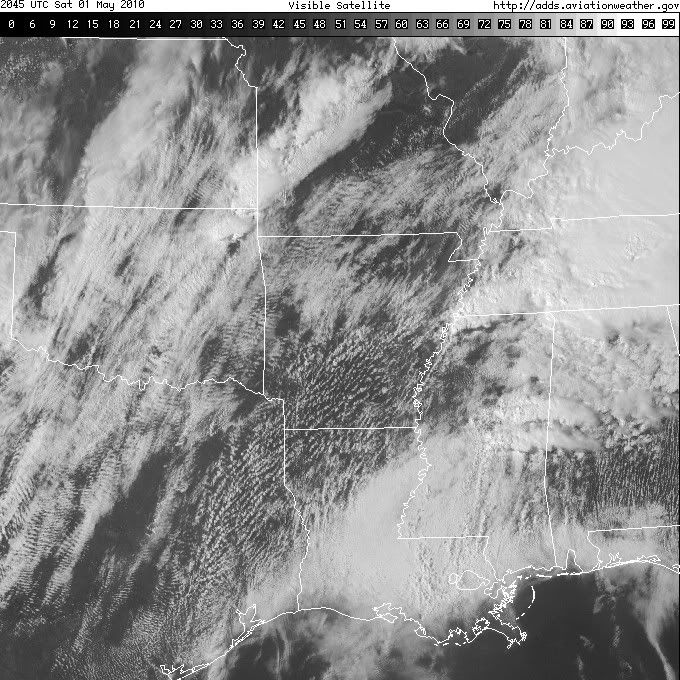
CURRENT CONDITIONS in the initiation/threat area:
Arkansas
El Dorado - A few clouds, 88 (73)
Hot Springs - A few clouds, 81 (69)
Jonesboro - A few clouds, 75 (68)
Little Rock - Partly cloudy, 81 (71)
Monticello - Partly cloudy, 83 (72)
Mount Ida - Partly cloudy, 75 (62)
Mountain Home - Partly cloudy, 72 (57)
Pine Bluff - A few clouds, 85 (73)
Russellville - A few clouds, 80 (57)
Texarkana - Clear, 86 (69)
Louisiana
Alexandria - Mostly cloudy, 84 (74)
Monroe - Partly cloudy, 85 (76)
Shreveport - A few clouds, 87 (72)
Tallulah - Mostly cloudy, 80 (74)
Mississippi
Columbus - Light rainshower, 79 (72)
Greenville - Partly cloudy, 83 (78)
Greenwood - Partly cloudy, 83 (76)
Jackson - Light rainshower, 77 (74)
Tupelo - Light rainshower, 75 (72)
Vicksburg - Mostly cloudy, 80 (74)
Missouri
Cape Girardeau - A few clouds, 75 (67)
Poplar Bluff - A few clouds, 76 (67)
St. Louis - Mostly cloudy, 73 (56)
Tennessee
Dyersburg - Mostly cloudy, 70 (64)
Jackson - Light rainshower, 70 (68)
Memphis - Overcast, 77 (73)
Nashville - Thunderstorm, 63 (62)
Union City - Overcast, 65 (65)
Texas
Longview - A few clouds, 89 (67)
Lufkin - A few clouds, 89 (72)
Tyler - A few clouds, 83 (65)
Tornado Outbreak April 29-May 2, HIGH RISK AR, TN, MS
Moderator: S2k Moderators
Forum rules

The posts in this forum are NOT official forecast and should not be used as such. They are just the opinion of the poster and may or may not be backed by sound meteorological data. They are NOT endorsed by any professional institution or STORM2K.
-
CrazyC83
- Professional-Met

- Posts: 34315
- Joined: Tue Mar 07, 2006 11:57 pm
- Location: Deep South, for the first time!
MESOSCALE DISCUSSION 0447
NWS STORM PREDICTION CENTER NORMAN OK
0311 PM CDT SAT MAY 01 2010
AREAS AFFECTED...SW MO INTO NE OK
CONCERNING...SEVERE POTENTIAL...WATCH UNLIKELY
VALID 012011Z - 012145Z
ELEVATED THUNDERSTORMS WILL TRACK NORTHEAST WITH MARGINALLY SEVERE
HAIL POSSIBLE THROUGH LATE AFTERNOON. A WW IS NOT ANTICIPATED AT
THIS TIME.
ELEVATED THUNDERSTORMS HAVE INCREASED IN INTENSITY OVER THE LAST
HOUR AHEAD OF A SHORT WAVE IMPULSE /AS NOTED ON LATEST WV IMAGERY/
LIFTING INTO WRN OK. INCREASING SLY MID LEVEL SHEAR OF 30-50 KT
COUPLED WITH ELEVATED CAPE VALUES /200 J/KG/ AND MARGINAL MID LEVEL
LAPSE RATES /7 C/KM/ WILL SUPPORT AT LEAST SMALL HAIL. GIVEN STRONG
MID LEVEL WINDS AND A RELATIVELY DRY LAYER FROM THE SFC TO AROUND
850 MB SOME GUSTY WINDS WILL ALSO BE POSSIBLE WITH THE STRONGER
CELLS.
..STOPPKOTTE.. 05/01/2010
ATTN...WFO...SGF...EAX...TSA...ICT...
LAT...LON 35399616 36049629 36479596 37099528 37849431 38139391
38219355 38119304 37589299 36879353 36209443 35609536
35399616
0 likes
-
Texas Snowman

- Storm2k Moderator

- Posts: 6197
- Joined: Fri Jan 25, 2008 11:29 am
- Location: Denison, Texas
Re: Tornado Outbreak April 29-May 2, HIGH RISK AR, TN, MS
Looks like a cell trying to pop southwest of Little Rock...
0 likes
The above post and any post by Texas Snowman is NOT an official forecast and should not be used as such. It is just the opinion of the poster and may or may not be backed by sound meteorological data. It is NOT endorsed by any professional institution including storm2k.org. For official information, please refer to NWS products.


That Memphis temps/dews are really rather impressive, as is pretty much a big part of AR in the intiation zone.
Things going to go boom very soon, I can't imagine it'll be long before intiation occurs somewhere in the clear slot in AR.
Things going to go boom very soon, I can't imagine it'll be long before intiation occurs somewhere in the clear slot in AR.
0 likes
Personal Forecast Disclaimer:
The posts in this forum are NOT official forecast and should not be used as such. They are just the opinion of the poster and may or may not be backed by sound meteorological data. They are NOT endorsed by any professional institution or storm2k.org. For official information, please refer to the NHC and NWS products
The posts in this forum are NOT official forecast and should not be used as such. They are just the opinion of the poster and may or may not be backed by sound meteorological data. They are NOT endorsed by any professional institution or storm2k.org. For official information, please refer to the NHC and NWS products
-
srainhoutx

- S2K Supporter

- Posts: 6919
- Age: 68
- Joined: Sun Jan 14, 2007 11:34 am
- Location: Haywood County, NC
- Contact:
Re: Tornado Outbreak April 29-May 2, HIGH RISK AR, TN, MS
URGENT - IMMEDIATE BROADCAST REQUESTED
TORNADO WATCH NUMBER 125
NWS STORM PREDICTION CENTER NORMAN OK
320 PM CDT SAT MAY 1 2010
THE NWS STORM PREDICTION CENTER HAS ISSUED A
TORNADO WATCH FOR PORTIONS OF
SOUTHERN AND EASTERN ARKANSAS
NORTHWEST LOUISIANA
NORTHEAST TEXAS
EFFECTIVE THIS SATURDAY AFTERNOON AND EVENING FROM 320 PM UNTIL
1000 PM CDT.
...THIS IS A PARTICULARLY DANGEROUS SITUATION...
DESTRUCTIVE TORNADOES...LARGE HAIL TO 2.5 INCHES IN DIAMETER...
THUNDERSTORM WIND GUSTS TO 80 MPH...AND DANGEROUS LIGHTNING ARE
POSSIBLE IN THESE AREAS.
THE TORNADO WATCH AREA IS APPROXIMATELY ALONG AND 85 STATUTE
MILES EAST AND WEST OF A LINE FROM 25 MILES EAST NORTHEAST OF
BATESVILLE ARKANSAS TO 15 MILES SOUTHEAST OF SHREVEPORT
LOUISIANA. FOR A COMPLETE DEPICTION OF THE WATCH SEE THE
ASSOCIATED WATCH OUTLINE UPDATE (WOUS64 KWNS WOU5).
REMEMBER...A TORNADO WATCH MEANS CONDITIONS ARE FAVORABLE FOR
TORNADOES AND SEVERE THUNDERSTORMS IN AND CLOSE TO THE WATCH
AREA. PERSONS IN THESE AREAS SHOULD BE ON THE LOOKOUT FOR
THREATENING WEATHER CONDITIONS AND LISTEN FOR LATER STATEMENTS
AND POSSIBLE WARNINGS.
OTHER WATCH INFORMATION...CONTINUE...WW 124...
DISCUSSION...INTENSE SUPERCELL THUNDERSTORMS ARE EXPECTED TO DEVELOP
THIS AFTERNOON ALONG SURFACE COLD FRONT FROM NORTHEAST TX INTO
CENTRAL AR. RAPIDLY STRENGTHENING LOW LEVEL WIND FIELDS...COUPLED
WITH A VERY MOIST AND MODERATELY UNSTABLE AIR MASS WILL PROMOTE A
RISK OF STRONG AND POTENTIALLY LONG-TRACK TORNADOES.
0 likes
Carla/Alicia/Jerry(In The Eye)/Michelle/Charley/Ivan/Dennis/Katrina/Rita/Wilma/Ike/Harvey
Member: National Weather Association
Wx Infinity Forums
http://wxinfinity.com/index.php
Facebook.com/WeatherInfinity
Twitter @WeatherInfinity
Member: National Weather Association
Wx Infinity Forums
http://wxinfinity.com/index.php
Facebook.com/WeatherInfinity
Twitter @WeatherInfinity
-
CrazyC83
- Professional-Met
- Posts: 34315
- Joined: Tue Mar 07, 2006 11:57 pm
- Location: Deep South, for the first time!
Re: Tornado Outbreak April 29-May 2, HIGH RISK AR, TN, MS
A bit later than expected but it is mostly clear in that area so expect intense storms soon - this seems to be Super Tuesday redux in some ways, just with May temperatures and dynamics. Probs are 95/80.
0 likes
-
Texas Snowman
- Storm2k Moderator
- Posts: 6197
- Joined: Fri Jan 25, 2008 11:29 am
- Location: Denison, Texas
Re: Tornado Outbreak April 29-May 2, HIGH RISK AR, TN, MS
CrazyC83 wrote:A bit later than expected but it is mostly clear in that area so expect intense storms soon - this seems to be Super Tuesday redux in some ways, just with May temperatures and dynamics. Probs are 95/80.
Please don't say that...there were close to 60 fatalities in that outbreak.
I hope this evening isn't anywhere near that bad.
But there seems to be plenty of tinderbox dry wood on the fire...just waiting for the match to light I guess.
0 likes
The above post and any post by Texas Snowman is NOT an official forecast and should not be used as such. It is just the opinion of the poster and may or may not be backed by sound meteorological data. It is NOT endorsed by any professional institution including storm2k.org. For official information, please refer to NWS products.
-
CrazyC83
- Professional-Met
- Posts: 34315
- Joined: Tue Mar 07, 2006 11:57 pm
- Location: Deep South, for the first time!
As for what lies ahead - Watch 124 expires in 30 minutes. Here is what I would do:
Tornado Watch 126 (probs 60/40) for Western and Middle Tennessee, extreme northern Mississippi and Alabama, southwestern and central Kentucky. I don't think a PDS watch is warranted there at this time though. I'd issue it until 10 pm (then re-assess the situation).
Nothing at the moment farther south is necessary IMO, since it is likely to see a break in the late afternoon and early evening. A watch (probably PDS) would likely be needed there by early to mid-evening though.
0 likes
-
srainhoutx
- S2K Supporter
- Posts: 6919
- Age: 68
- Joined: Sun Jan 14, 2007 11:34 am
- Location: Haywood County, NC
- Contact:
Re: Tornado Outbreak April 29-May 2, HIGH RISK AR, TN, MS
Our "trigger" is a shortwave currently in SW TX. The shortwave should move slowly ENE and we should see cells begin to fire in the next couple of hours IMHO.
0 likes
Carla/Alicia/Jerry(In The Eye)/Michelle/Charley/Ivan/Dennis/Katrina/Rita/Wilma/Ike/Harvey
Member: National Weather Association
Wx Infinity Forums
http://wxinfinity.com/index.php
Facebook.com/WeatherInfinity
Twitter @WeatherInfinity
Member: National Weather Association
Wx Infinity Forums
http://wxinfinity.com/index.php
Facebook.com/WeatherInfinity
Twitter @WeatherInfinity
-
CrazyC83
- Professional-Met
- Posts: 34315
- Joined: Tue Mar 07, 2006 11:57 pm
- Location: Deep South, for the first time!
Re: Tornado Outbreak April 29-May 2, HIGH RISK AR, TN, MS
srainhoutx wrote:Our "trigger" is a shortwave currently in SW TX. The shortwave should move slowly ENE and we should see cells begin to fire in the next couple of hours IMHO.
I agree that NE TX/NW LA needs to REALLY be watched. Only a few clouds there now - BAD sign. Only hope is to have an unexpected cap develop FAST.
Last edited by CrazyC83 on Sat May 01, 2010 3:34 pm, edited 1 time in total.
0 likes
Re: Tornado Outbreak April 29-May 2, HIGH RISK AR, TN, MS
CrazyC83 wrote:A bit later than expected but it is mostly clear in that area so expect intense storms soon - this seems to be Super Tuesday redux in some ways, just with May temperatures and dynamics. Probs are 95/80.
Yep sadly does seem like thats the case, the worrying thing is as you say conditions are probably even more explosive now then they were then as well!
Keep safe everyone!
0 likes
Personal Forecast Disclaimer:
The posts in this forum are NOT official forecast and should not be used as such. They are just the opinion of the poster and may or may not be backed by sound meteorological data. They are NOT endorsed by any professional institution or storm2k.org. For official information, please refer to the NHC and NWS products
The posts in this forum are NOT official forecast and should not be used as such. They are just the opinion of the poster and may or may not be backed by sound meteorological data. They are NOT endorsed by any professional institution or storm2k.org. For official information, please refer to the NHC and NWS products
-
brunota2003

- S2K Supporter
- Posts: 9476
- Age: 35
- Joined: Sat Jul 30, 2005 9:56 pm
- Location: Stanton, KY...formerly Havelock, NC
- Contact:
Re: Tornado Outbreak April 29-May 2, HIGH RISK AR, TN, MS
Here is the 2020Z radar image from Little Rock, AR...for comparison to later radar images.

0 likes
-
CrazyC83
- Professional-Met
- Posts: 34315
- Joined: Tue Mar 07, 2006 11:57 pm
- Location: Deep South, for the first time!
Re: Tornado Outbreak April 29-May 2, HIGH RISK AR, TN, MS
Little Rock has a good handle on this:
000
FXUS64 KLZK 012021
AFDLZK
AREA FORECAST DISCUSSION
NATIONAL WEATHER SERVICE LITTLE ROCK AR
321 PM CDT SAT MAY 1 2010
.SHORT TERM...TONIGHT THROUGH TUESDAY NIGHT
CLOUDS BROKE UP EARLY THIS AFTERNOON...AND HEATING HAS
OCCURRED WITH TEMPERATURES CLIMBING INTO THE UPPER 70S TO MID 80S
ACROSS CENTRAL/SOUTHERN ARKANSAS. 18Z SOUNDING FROM LITTLE ROCK
SHOWED WEAK CAPPING...WHICH HAS HELD SO FAR. HOWEVER...A STORM
SYSTEM WAS HEADING THROUGH NORTHEAST TEXAS...AND WILL BE THE
FORCING MECHANISM TO GET STORMS GOING BY 22Z.
0-1KM HELICITY VALUES WILL CLIMB OVER 250 M2/S2 IN THE
CENTRAL/SOUTHERN COUNTIES. STORMS WITH ROTATING UPDRAFTS ARE
LIKELY...WITH TORNADOES EXPECTED. A FEW STRONG LONG TRACK
TORNADOES ARE POSSIBLE.
AS THE NIGHT PROGRESSES...SHOWERS/THUNDERSTORMS WILL BECOME MORE
WIDESPREAD IN THE SOUTHEAST HALF OF ARKANSAS...AND THE FOCUS WILL
GRADUALLY SHIFT TO HEAVY/EXCESSIVE RAIN. ONE TO FOUR INCHES OF
RAIN IS IN THE FORECAST...WITH A FLASH FLOOD WATCH REMAINING IN
EFFECT.
AS THE SYSTEM PASSES TO THE NORTHEAST...A COLD FRONT WILL PUSH
THROUGH THE REGION. SHOWERS/THUNDERSTORMS SHOULD LINGER IN AREAS
TOWARD THE MISSISSIPPI RIVER SUNDAY MORNING...BUT PRECIPITATION
WILL END BY AFTERNOON.
HIGH PRESSURE WILL BUILD INTO THE REGION FROM THE PLAINS
MONDAY/TUESDAY...WITH SLIGHTLY COOLER AND DRIER AIR.
0 likes
-
CrazyC83
- Professional-Met
- Posts: 34315
- Joined: Tue Mar 07, 2006 11:57 pm
- Location: Deep South, for the first time!
Re: Tornado Outbreak April 29-May 2, HIGH RISK AR, TN, MS
WUS54 KHUN 012038
SVSHUN
SEVERE WEATHER STATEMENT
NATIONAL WEATHER SERVICE HUNTSVILLE AL
338 PM CDT SAT MAY 1 2010
ALC077-012100-
/O.CON.KHUN.TO.W.0022.000000T0000Z-100501T2100Z/
LAUDERDALE AL-
338 PM CDT SAT MAY 1 2010
...A TORNADO WARNING REMAINS IN EFFECT UNTIL 400 PM CDT FOR NORTH
CENTRAL LAUDERDALE COUNTY...
AT 337 PM CDT...A TORNADO WAS REPORTED. THIS TORNADO WAS LOCATED
JUST NORTH OF THREET...OR ABOUT 10 MILES NORTHWEST OF
UNDERWOOD-PETERSVILLE...MOVING NORTHEAST AT 30 MPH.
OTHER LOCATIONS IN THE WARNING INCLUDE BUT ARE NOT LIMITED TO ZIP
CITY AND GREEN HILL.
PRECAUTIONARY/PREPAREDNESS ACTIONS...
HEAVY RAINFALL MAY OBSCURE THIS TORNADO. TAKE COVER NOW! IF YOU WAIT
TO SEE OR HEAR IT COMING...IT MAY BE TOO LATE TO GET TO A SAFE PLACE.
A TORNADO WATCH REMAINS IN EFFECT UNTIL 400 PM CDT SATURDAY AFTERNOON
FOR NORTHWESTERN ALABAMA AND MIDDLE TENNESSEE.
&&
LAT...LON 3492 8745 3492 8789 3491 8797 3493 8795
3502 8795 3501 8746
TIME...MOT...LOC 2037Z 251DEG 24KT 3499 8779
$$
0 likes
I think tomorrow will probably be a good moderate but I'm not sure about a high risk, I suppose it can't be totally ruled out given its still the same set-up that has caused the last two nights more or less...
Also back to the here and now, plenty of boundaries left over that could spark some instablity in AR.
Also back to the here and now, plenty of boundaries left over that could spark some instablity in AR.
0 likes
Personal Forecast Disclaimer:
The posts in this forum are NOT official forecast and should not be used as such. They are just the opinion of the poster and may or may not be backed by sound meteorological data. They are NOT endorsed by any professional institution or storm2k.org. For official information, please refer to the NHC and NWS products
The posts in this forum are NOT official forecast and should not be used as such. They are just the opinion of the poster and may or may not be backed by sound meteorological data. They are NOT endorsed by any professional institution or storm2k.org. For official information, please refer to the NHC and NWS products
-
srainhoutx
- S2K Supporter
- Posts: 6919
- Age: 68
- Joined: Sun Jan 14, 2007 11:34 am
- Location: Haywood County, NC
- Contact:
Re: Tornado Outbreak April 29-May 2, HIGH RISK AR, TN, MS
0 likes
Carla/Alicia/Jerry(In The Eye)/Michelle/Charley/Ivan/Dennis/Katrina/Rita/Wilma/Ike/Harvey
Member: National Weather Association
Wx Infinity Forums
http://wxinfinity.com/index.php
Facebook.com/WeatherInfinity
Twitter @WeatherInfinity
Member: National Weather Association
Wx Infinity Forums
http://wxinfinity.com/index.php
Facebook.com/WeatherInfinity
Twitter @WeatherInfinity
-
CrazyC83
- Professional-Met
- Posts: 34315
- Joined: Tue Mar 07, 2006 11:57 pm
- Location: Deep South, for the first time!
Re: Tornado Outbreak April 29-May 2, HIGH RISK AR, TN, MS
CURRENT CONDITIONS in the initiation/threat area - 4:00 pm CDT:
Arkansas
El Dorado - A few clouds, 87 (73)
Hot Springs - A few clouds, 81 (70)
Jonesboro - Clear, 77 (67)
Little Rock - A few clouds, 81 (72)
Monticello - Partly cloudy, 84 (73)
Mount Ida - A few clouds, 75 (61)
Mountain Home - Partly cloudy, 73 (55)
Pine Bluff - A few clouds, 86 (74)
Russellville - Mostly cloudy, 79 (58)
Texarkana - A few clouds, 88 (68)
Louisiana
Alexandria - Mostly cloudy, 83 (74)
Monroe - A few clouds, 85 (75)
Shreveport - A few clouds, 87 (72)
Tallulah - Mostly cloudy, 78 (75)
Mississippi
Columbus - Partly cloudy, 78 (72)
Greenville - Partly cloudy, 81 (75)
Greenwood - Mostly cloudy, 82 (74)
Jackson - Mostly cloudy, 77 (73)
Tupelo - Light rainshower, 76 (73)
Vicksburg - Mostly cloudy, 78 (75)
Missouri
Cape Girardeau - Partly cloudy, 74 (67)
Poplar Bluff - Mostly cloudy, 77 (67)
St. Louis - A few clouds, 74 (51)
Tennessee
Dyersburg - Partly cloudy, 72 (64)
Jackson - Light rainshower, 70 (68)
Memphis - Thunderstorm, 73 (72)
Nashville - Thunderstorm, 63 (61)
Union City - Partly cloudy, 67 (65)
Texas
Longview - Partly cloudy, 87 (68)
Lufkin - A few clouds, 89 (72)
Tyler - A few clouds, 82 (66)
0 likes
-
brunota2003
- S2K Supporter
- Posts: 9476
- Age: 35
- Joined: Sat Jul 30, 2005 9:56 pm
- Location: Stanton, KY...formerly Havelock, NC
- Contact:
Return to “USA & Caribbean Weather”
Who is online
Users browsing this forum: HockeyTx82, SnowyOwl31 and 123 guests