Florida Weather
Moderator: S2k Moderators
Forum rules

The posts in this forum are NOT official forecast and should not be used as such. They are just the opinion of the poster and may or may not be backed by sound meteorological data. They are NOT endorsed by any professional institution or STORM2K.
-
Tampa Bay Hurricane

- Category 5

- Posts: 5597
- Age: 38
- Joined: Fri Jul 22, 2005 7:54 pm
- Location: St. Petersburg, FL
Re: Florida Weather Thread: Cool weather/chance of showers
Had light to moderate rain with a band of showers earlier today.
0 likes
-
Tampa Bay Hurricane
- Category 5
- Posts: 5597
- Age: 38
- Joined: Fri Jul 22, 2005 7:54 pm
- Location: St. Petersburg, FL
Cooler today. Around the mid 60s right now.
For Saint Petersburg, forecasted low is 50*F based on
the weather channel local forecast (nice music on that local
forecast, by the way).
Also, on Monday-Wednesday, enough moisture and heat, with highs
nearing or exceeding 80 by Tuesday and Wednesday, will return to the
Gulf of Mexico ahead of a strong cold front. This should give us a good
chance of thunderstorms late Wednesday afternoon along Florida's
West Coast. Some storms could be strong, given pressure gradient
and strong upper level jet winds. Expect beneficial rain for the most
part.
0 likes
-
Tampa Bay Hurricane
- Category 5
- Posts: 5597
- Age: 38
- Joined: Fri Jul 22, 2005 7:54 pm
- Location: St. Petersburg, FL
A local Tropical Weather Summary:
Tropical Storm Fay and Hurricane Gustav, brought
tropical storm force wind gusts to the Tampa Bay Area. Hence
there were 2 occasions and 2 storms with tropical storm winds impacting
Tampa Bay:
Fay: Maximum Sustained: 35 mph, Gusts 43 mph (August 19)
Gustav: Maximum Sustained: 39 mph (Sustained Tropical Storm
Force Winds), Gusts 47 mph, strongest impact by far (August 31)
http://www.wunderground.com/weatherstat ... hspan=year
0 likes
Re: Florida Weather Thread: Tornado Watch for the Panhandle
As of 2pm est, Punta Gorda is warm spot at 86 deg
FLORIDA REGIONAL WEATHER ROUNDUP
200 PM EST WED DEC 10 2008
PENSACOLA 68
PANAMA CITY 73
APALACHICOLA 72
TALLAHASSEE 68
GAINESVILLE 78
JACKSONVILLE 77
ORLANDO INTL 80
DAYTONA BEACH 82
MELBOURNE 80
VERO BEACH 81
CLEARWATER 84
TAMPA 79
ST PETERSBURG 79
SARASOTA 81
PUNTA GORDA 86 (heat index 89)
FT MYERS 85
NAPLES 83
KEY WEST INTL MOSUNNY 80
W PALM BEACH 81
FT LAUDERDALE 82
MIAMI 81
0 likes
-
Tampa Bay Hurricane
- Category 5
- Posts: 5597
- Age: 38
- Joined: Fri Jul 22, 2005 7:54 pm
- Location: St. Petersburg, FL
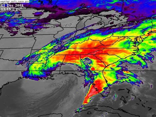
Heavy Squall forming into the gulf:
http://www.goes.noaa.gov/ECIR4.html
off the FL WEST coast and also in the Panhandle.
http://www.goes.noaa.gov/ECIR4.html
off the FL WEST coast and also in the Panhandle.
0 likes


-
JonathanBelles
- Professional-Met

- Posts: 11430
- Age: 35
- Joined: Sat Dec 24, 2005 9:00 pm
- Location: School: Florida State University (Tallahassee, FL) Home: St. Petersburg, Florida
- Contact:

-
JonathanBelles
- Professional-Met
- Posts: 11430
- Age: 35
- Joined: Sat Dec 24, 2005 9:00 pm
- Location: School: Florida State University (Tallahassee, FL) Home: St. Petersburg, Florida
- Contact:


-
JonathanBelles
- Professional-Met
- Posts: 11430
- Age: 35
- Joined: Sat Dec 24, 2005 9:00 pm
- Location: School: Florida State University (Tallahassee, FL) Home: St. Petersburg, Florida
- Contact:
-
JonathanBelles
- Professional-Met
- Posts: 11430
- Age: 35
- Joined: Sat Dec 24, 2005 9:00 pm
- Location: School: Florida State University (Tallahassee, FL) Home: St. Petersburg, Florida
- Contact:


-
Tampa Bay Hurricane
- Category 5
- Posts: 5597
- Age: 38
- Joined: Fri Jul 22, 2005 7:54 pm
- Location: St. Petersburg, FL
-
HURRICANELONNY
- Category 5
- Posts: 1390
- Joined: Wed May 07, 2003 6:48 am
- Location: HOLLYWOOD.FL
Re: Florida Weather Thread: Cooler Weather
Any models showing the Siberian express coming our way? Any time soon. Seems like most of the Artic air so far. Heads down the mid west straight South then back out to sea. It snowed in New Orleans 
0 likes
Return to “USA & Caribbean Weather”
Who is online
Users browsing this forum: No registered users and 29 guests