Texas Summer 2012

U.S. & Caribbean Weather Discussions and Severe Weather Events

Moderator: S2k Moderators

Forum rules

The posts in this forum are NOT official forecast and should not be used as such. They are just the opinion of the poster and may or may not be backed by sound meteorological data. They are NOT endorsed by any professional institution or STORM2K.

Help Support Storm2K
Message
Author
aggiecutter
Category 5
Category 5
Posts: 1751
Joined: Thu Oct 14, 2004 9:22 pm
Location: Texarkana

Re: Re:

#41 Postby aggiecutter » Wed Jun 06, 2012 1:30 pm

Portastorm wrote:
Ntxw wrote:NAM is performing poorly. Euro has done well with initiation with a lot happening in Oklahoma. As the low progresses east/se the heaviest precip axis will be along the Red River valley bounded by I-20 to the south and I-40 to the north. Scattered storms with daytime heating elsewhere especially along an old boundary in the eastern half of the state. Euro is even pointing at good precip in the northeastern tip of Texas so for those that lost some hope there has something to look forward to!


Where's aggiecutter? He's going to owe me for removing the Austin Omega Block from northeast Texas. My loss will be his gain! :(


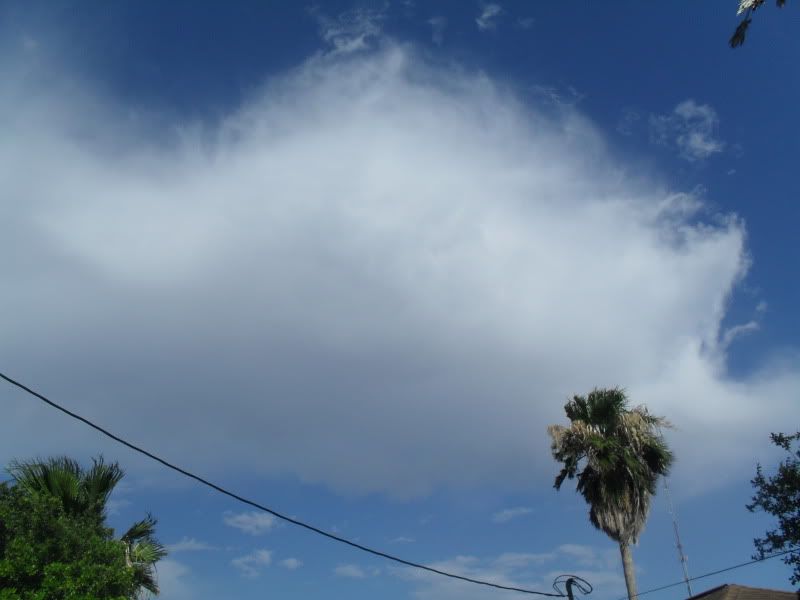
Last night at around 10:30, there were a couple of strong thunderstorms in SE Oklahoma, heading directly toward Texarkana. I thought there was no way the storms would miss us. However, the storms dissipated about 10 miles NW of town.

I hope NTXW is right about the EURO model because we have only had .70" of rain the past five weeks. The only thing that has bailed us out is a wet winter and early spring. The long range GFS looks wet. Hopefully, it will verify.

As far as the Omega block moving back to Austin, all I can say is:"You enjoy the weather, its the only weather you've got".
0 likes   

User avatar
Ntxw
Storm2k Moderator
Storm2k Moderator
Posts: 22730
Joined: Wed Oct 21, 2009 6:34 pm
Location: DFW, Texas

#42 Postby Ntxw » Wed Jun 06, 2012 2:43 pm

Well the latest euro is not as optimistic as last night's run for far NE Texas. Still has appreciable rain though for aggiecutter on the eastern flank. Noticeable difference is it stalls the low over/near the metroplex and pours. Mesoscale features will be important to pinning down areas that might flood.

Edit: To add these freakish slow moving cutoff from flow lows are a tough forecast so just because the models waver and you currently don't have much in the way rain forecasted at the moment doesn't mean you won't.
0 likes   
The above post and any post by Ntxw is NOT an official forecast and should not be used as such. It is just the opinion of the poster and may or may not be backed by sound meteorological data. It is NOT endorsed by any professional institution including Storm2k. For official information, please refer to NWS products.

  Help support Storm2K!
Help Support Storm2K

User avatar
ravyrn
S2K Supporter
S2K Supporter
Posts: 1000
Age: 42
Joined: Sun Aug 31, 2008 5:10 am
Location: Alderbranch, TX

Re: Texas Summer 2012

#43 Postby ravyrn » Wed Jun 06, 2012 4:26 pm

Had a nice storm pass through here in Little Elm around 4:15pm CDT. It was packing some nice winds with it, blowing the rain sideways and making me worry bout one of our young trees in the yard and also poured some pea-sized hail on us. I think that's the 4th time we've had hail in a week now.
0 likes   

User avatar
Rgv20
S2K Supporter
S2K Supporter
Posts: 2466
Age: 38
Joined: Wed Jan 05, 2011 5:42 pm
Location: Edinburg/McAllen Tx

#44 Postby Rgv20 » Wed Jun 06, 2012 6:54 pm

Had a pretty good downpour when I was driving home from work cause by these one cloud! :eek:

Image
0 likes   
The following post is NOT an official forecast and should not be used as such. It is just the opinion of the poster and may or may not be backed by sound meteorological data. It is NOT endorsed by any professional institution including storm2k.org For Official Information please refer to the NHC and NWS products.

User avatar
gboudx
S2K Supporter
S2K Supporter
Posts: 4080
Joined: Thu Sep 04, 2003 1:39 pm
Location: Rockwall, Tx but from Harvey, La

#45 Postby gboudx » Wed Jun 06, 2012 8:10 pm

Here in Rockwall, my rain gauge has about 3.33" with rain continuing to fall.
0 likes   

User avatar
Ntxw
Storm2k Moderator
Storm2k Moderator
Posts: 22730
Joined: Wed Oct 21, 2009 6:34 pm
Location: DFW, Texas

#46 Postby Ntxw » Wed Jun 06, 2012 8:58 pm

MCS slowly heading east. As that batch fades, we look towards the TX/OK border for initiation tonight. This looks to be the main show with big precip rates rotating near the warm core low. It should meander I-20 until possibly tomorrow evening. Tomorrow could be a repeat of today.

HRRR short range model is pinpointing 4+ inches additional within the next 12 hours in around the vicinity along and east of I-35.
0 likes   
The above post and any post by Ntxw is NOT an official forecast and should not be used as such. It is just the opinion of the poster and may or may not be backed by sound meteorological data. It is NOT endorsed by any professional institution including Storm2k. For official information, please refer to NWS products.


  Help support Storm2K!

Help Support Storm2K


User avatar
gboudx
S2K Supporter
S2K Supporter
Posts: 4080
Joined: Thu Sep 04, 2003 1:39 pm
Location: Rockwall, Tx but from Harvey, La

Re:

#47 Postby gboudx » Wed Jun 06, 2012 10:19 pm

Ntxw wrote:MCS slowly heading east. As that batch fades, we look towards the TX/OK border for initiation tonight. This looks to be the main show with big precip rates rotating near the warm core low. It should meander I-20 until possibly tomorrow evening. Tomorrow could be a repeat of today.

HRRR short range model is pinpointing 4+ inches additional within the next 12 hours in around the vicinity along and east of I-35.


I emptied my gauge at about 3.6". Another round of storms coming through now.
0 likes   

User avatar
Ntxw
Storm2k Moderator
Storm2k Moderator
Posts: 22730
Joined: Wed Oct 21, 2009 6:34 pm
Location: DFW, Texas

#48 Postby Ntxw » Thu Jun 07, 2012 1:13 pm

Well the heavy rain rates did not materialize overnight with the low center. We'll see what daytime heating does this afternoon as the low stalls. Decided to take a jog this morning and boy was it nice. Temps around 70 breeze and drizzle and still is. Was humid though but I'll take it. Last year at this time we were making a run at the first 100+ stretch streak. What a difference a year makes.
0 likes   
The above post and any post by Ntxw is NOT an official forecast and should not be used as such. It is just the opinion of the poster and may or may not be backed by sound meteorological data. It is NOT endorsed by any professional institution including Storm2k. For official information, please refer to NWS products.


  Help support Storm2K!

Help Support Storm2K


User avatar
Texas Snowman
Storm2k Moderator
Storm2k Moderator
Posts: 6151
Joined: Fri Jan 25, 2008 11:29 am
Location: Denison, Texas

#49 Postby Texas Snowman » Thu Jun 07, 2012 2:50 pm

Nice 24-hours of on-again, off-again rains in the Lake Texoma area. Heavy rains yesterday afternoon that totaled 1-2 inches locally. Minor urban street and backyard flooding as the heaviest downpours fell.

Still raining lightly, more rain in the forecast the next 24-hours. NWS says heavy rain is still a possibility overnight, we'll see.

In addition to the current stalled out low causing North and Central Texas rains today, noticed that Fort Worth NWS has introduced 20% pops early next week. Highs are in the upper 80s to around 90 throughout the period.

That takes us up towards mid-June. Wow, what a difference from a year ago. I'll take it! :D
0 likes   
The above post and any post by Texas Snowman is NOT an official forecast and should not be used as such. It is just the opinion of the poster and may or may not be backed by sound meteorological data. It is NOT endorsed by any professional institution including storm2k.org. For official information, please refer to NWS products.

weatherdude1108
Category 5
Category 5
Posts: 4228
Joined: Tue Dec 13, 2011 1:04 pm
Location: Northwest Austin/Cedar Park, TX

#50 Postby weatherdude1108 » Thu Jun 07, 2012 4:14 pm

Wonderful news for those of you who have gotten rain, substantial at that! :)

However, we (most of we) in the Austin area have not received one drop of precipitation so far since this "event" began. I even turned off my sprinkler system which was supposed to water on Wednesday. I've decided I will take these forecasts of heavy rains in the future with a grain of salt, and not get caught up in any false hopes. I'm slightly peeved, :x but I'll get over it once we get a good soaking again...whenever that is, maybe tonight(?), and the developing soil cracks get moist again. I'm watering Saturday regardless of the forecast. :wink:

AREA FORECAST DISCUSSION
NATIONAL WEATHER SERVICE AUSTIN/SAN ANTONIO TX
346 PM CDT THU JUN 7 2012

.DISCUSSION...
A 500MB SHORT WAVE TROUGH IS DROPPING DOWN THROUGH CENTRAL TX THIS
AFTERNOON. THIS FEATURE IS WEAK AND ONLY PRODUCING AN AREA OF
SHOWERS WITH ISOLATED THUNDERSTORMS. THERE IS ALSO A STATIONARY
BOUNDARY LYING ACROSS OUR CWA FROM VAL VERDE COUNTY THROUGH
ATASCOSA COUNTY AND OFF TO THE EAST. THESE TWO FEATURES WILL
CONTINUE TO GIVE US A CHANCE FOR PRECIP TONIGHT AND TOMORROW. THE
BEST CHANCE FOR ANY RAIN WILL BE OVER THE NORTHEASTERN COUNTIES
TONIGHT. ANY STORM THAT FORMS THIS EVENING COULD BE STRONG...BUT
SO FAR NOTHING SIGNIFICANT HAS DEVELOPED. AFTER FRI...A STACKED
RIDGE WILL MOVE INTO THE SOUTHERN PLAINS AND WILL FEEL LIKE SUMMER
HAS ARRIVED. SAT WE WILL BEGIN AN UPWARD TREND IN TEMPS. HIGHS
WILL BE UP TO 105 OVER THE RIO GRANDE PLAINS BY EARLY NEXT WEEK
AND NEAR 100 IN THE SAN ANTONIO AREA. LOWS WILL CONTINUE IN THE
MID 70S PROVIDING SOME RELIEF. WE MAY NEED HEAT ADVISORIES LATE IN
THE WEEKEND OR EARLY NEXT WEEK.
0 likes   
The preceding post is NOT an official forecast, and should not be used as such. It is only the opinion of the poster and may or may not be backed by sound meteorological data. It is NOT endorsed by any professional institution including storm2k.org. For Official Information please refer to the NHC and NWS products.

User avatar
Texas Snowman
Storm2k Moderator
Storm2k Moderator
Posts: 6151
Joined: Fri Jan 25, 2008 11:29 am
Location: Denison, Texas

#51 Postby Texas Snowman » Thu Jun 07, 2012 10:06 pm

As per WFAA's TV met Steve McCauley tonight on his Facebook page:

"The widespread rains are over, and they will not return tonight. Just a few spotty showers can be expected as the atmosphere still looks like it will be unable to support widespread rainfall.

Hope everyone got some good totals (nearly 3 " here!), and if you did not, do not fear...yet another good rain setup is coming next week!"
0 likes   
The above post and any post by Texas Snowman is NOT an official forecast and should not be used as such. It is just the opinion of the poster and may or may not be backed by sound meteorological data. It is NOT endorsed by any professional institution including storm2k.org. For official information, please refer to NWS products.

weatherdude1108
Category 5
Category 5
Posts: 4228
Joined: Tue Dec 13, 2011 1:04 pm
Location: Northwest Austin/Cedar Park, TX

#52 Postby weatherdude1108 » Fri Jun 08, 2012 6:20 am

Well, I did get sprinkled on (literally) last night as I was driving to and from Wendy's to get my wife and I Frosties.:P One last shot today. Sprinkler in standby mode.
0 likes   

weatherdude1108
Category 5
Category 5
Posts: 4228
Joined: Tue Dec 13, 2011 1:04 pm
Location: Northwest Austin/Cedar Park, TX

#53 Postby weatherdude1108 » Fri Jun 08, 2012 8:18 am

El Nino Watch Issued yesterday. Something to look forward to as we get through this Summer! :D

http://blogs.kxan.com/category/weather/
0 likes   
The preceding post is NOT an official forecast, and should not be used as such. It is only the opinion of the poster and may or may not be backed by sound meteorological data. It is NOT endorsed by any professional institution including storm2k.org. For Official Information please refer to the NHC and NWS products.

User avatar
Portastorm
Storm2k Moderator
Storm2k Moderator
Posts: 9914
Age: 62
Joined: Fri Jul 11, 2003 9:16 am
Location: Round Rock, TX
Contact:

Re:

#54 Postby Portastorm » Fri Jun 08, 2012 9:17 am

weatherdude1108 wrote:Well, I did get sprinkled on (literally) last night as I was driving to and from Wendy's to get my wife and I Frosties.:P One last shot today. Sprinkler in standby mode.


I feel your pain, weatherdude. Just our luck that both the mesoscale convective system from yesterday and the weak front both pass through our area and we get NOTHING. Ugh!

I did see some sprinkles on the way into work today. Hope that grows into something more substantial for us.
0 likes   
Any forecasts under my name are to be taken with a grain of salt. Get your best forecasts from the National Weather Service and National Hurricane Center.

User avatar
Rgv20
S2K Supporter
S2K Supporter
Posts: 2466
Age: 38
Joined: Wed Jan 05, 2011 5:42 pm
Location: Edinburg/McAllen Tx

#55 Postby Rgv20 » Fri Jun 08, 2012 10:44 am

This mornings NWS Brownsville discussion....It's going to feel like Summer!

LONG TERM /SATURDAY NIGHT THROUGH WEDNESDAY NIGHT/...MID-LEVEL
THROUGH MOVES EAST OF THE AREA SATURDAY NIGHT AS HIGH PRESSURE
BUILDS OVER DEEP SOUTH TEXAS. SUBSTANTIAL HEAT IS EXPECTED ACROSS
THE REGION EARLY NEXT WEEK WITH HIGHS WELL PAST 100 DEGREES AS FAR
EAST AS WESTERN CAMERON COUNTY. RECORD HEAT POSSIBLE MAINLY OVER
THE WESTERN PORTIONS OF THE AREA.
WIDESPREAD HEAT INDEX VALUES
SUNDAY THROUGH EARLY NEXT ARE EXPECTED TO BE IN THE 105-109 DEGREE
RANGE INLAND. SOME LOCATIONS OVER THE FAR WESTERN PORTIONS OF THE
AREA...ZAPATA COUNTY...COULD REACH HEAT ADVISORY CRITERIA FOR HEAT
INDICES AT OR EXCEEDING 111 DEGREES.
0 likes   
The following post is NOT an official forecast and should not be used as such. It is just the opinion of the poster and may or may not be backed by sound meteorological data. It is NOT endorsed by any professional institution including storm2k.org For Official Information please refer to the NHC and NWS products.

User avatar
Ntxw
Storm2k Moderator
Storm2k Moderator
Posts: 22730
Joined: Wed Oct 21, 2009 6:34 pm
Location: DFW, Texas

#56 Postby Ntxw » Fri Jun 08, 2012 7:59 pm

Warm spell does look likely this weekend. But once again as theme of this year continues, gulf moisture returns middle of the week with more daytime showers coming back to Texas and cool things off by June standards. Blocking is still prevalent on our side of the world so don't expect any prolonged heat waves this month.
0 likes   
The above post and any post by Ntxw is NOT an official forecast and should not be used as such. It is just the opinion of the poster and may or may not be backed by sound meteorological data. It is NOT endorsed by any professional institution including Storm2k. For official information, please refer to NWS products.


  Help support Storm2K!

Help Support Storm2K


User avatar
jasons2k
Storm2k Executive
Storm2k Executive
Posts: 8238
Age: 51
Joined: Wed Jul 06, 2005 12:32 pm
Location: The Woodlands, TX

#57 Postby jasons2k » Fri Jun 08, 2012 8:31 pm

I managed to get 2.11" overnight and another .06" so far today. Maybe I can get some more overnight - we'll see. Those storms to the east are still holding together (for now).
0 likes   

User avatar
somethingfunny
ChatStaff
ChatStaff
Posts: 3926
Age: 36
Joined: Thu May 31, 2007 10:30 pm
Location: McKinney, Texas

#58 Postby somethingfunny » Sat Jun 09, 2012 3:27 am

Heads up everybody, it's too damn hot. I'll be over in the Winter Thread waiting for posts to appear. 8-)

Or in Talkin' Tropics.... (heads up!)
0 likes   
I am not a meteorologist, and any posts made by me are not official forecasts or to be interpreted as being intelligent. These posts are just my opinions and are probably silly opinions.

User avatar
Texas Snowman
Storm2k Moderator
Storm2k Moderator
Posts: 6151
Joined: Fri Jan 25, 2008 11:29 am
Location: Denison, Texas

#59 Postby Texas Snowman » Sat Jun 09, 2012 1:49 pm

Per Steve McCauley on his latest FB update:

"Latest data continue to reveal slowly sinking air over north Texas which will keep our cloud development limited for the remainder of the weekend and probably into Monday as well. But there still seems to be evidence of a small - but unusually strong - upper-level distrubance that will materialize over northern New Mexico Monday night and move into north Texas Tuesday.

The projected path of this disturbance will bring the best of the rains across the northern half of north Texas. But again, since this pocket of energy has not even formed yet, it is probably wise not to talk too confidently about its precise path at this point.

But at least the data remain consistent that this disturbance will actually form and pass close - if not directly over - north Texas on Tuesday."
0 likes   
The above post and any post by Texas Snowman is NOT an official forecast and should not be used as such. It is just the opinion of the poster and may or may not be backed by sound meteorological data. It is NOT endorsed by any professional institution including storm2k.org. For official information, please refer to NWS products.

User avatar
Portastorm
Storm2k Moderator
Storm2k Moderator
Posts: 9914
Age: 62
Joined: Fri Jul 11, 2003 9:16 am
Location: Round Rock, TX
Contact:

Re: Texas Summer 2012

#60 Postby Portastorm » Sun Jun 10, 2012 10:35 am

Meanwhile, it's gonna be a hot few days here in the land of ROT Rally, Bevo, and Weirdness.

****************
AREA FORECAST DISCUSSION
NATIONAL WEATHER SERVICE AUSTIN/SAN ANTONIO TX
640 AM CDT SUN JUN 10 2012

.CLIMATE...
TODAY`S FORECAST HIGH TEMPERATURES ARE NEAR THE RECORDS. DEL RIO
WILL LIKELY BREAK THEIR RECORD. THE RECORDS FOR JUNE 10TH ARE...

AUSTIN BERGSTROM...100 SET IN 1948
AUSTIN CAMP MABRY..102 SET IN 2008
DEL RIO.....................103 SET IN 1996
SAN ANTONIO.............100 SET IN 1948..1917..1906

&&
0 likes   
Any forecasts under my name are to be taken with a grain of salt. Get your best forecasts from the National Weather Service and National Hurricane Center.


Return to “USA & Caribbean Weather”

Who is online

Users browsing this forum: Edwards Limestone and 42 guests