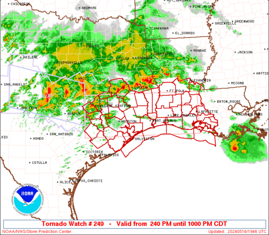
Extremeweatherguy wrote:wow...it is up to 88F at IAH, and 87F at Tomball. These current numbers exceed the forecasted highs by 2-3F. Also...dewpoints remain the upper 60s under variably changing skies. We are certaintly primed for severe weather today!
Well yes and no. We certainly have the surface heating, but the cap has been a little stonger than was anticipated and convergence along the front & low level shear are almost non-existent. Maybe some hailers and some strong gusts but it doesn't look like a very violent or widespread event.