Texas Fall 2012

U.S. & Caribbean Weather Discussions and Severe Weather Events

Moderator: S2k Moderators

Forum rules

The posts in this forum are NOT official forecast and should not be used as such. They are just the opinion of the poster and may or may not be backed by sound meteorological data. They are NOT endorsed by any professional institution or STORM2K.

Help Support Storm2K
Message
Author
User avatar
Ntxw
Storm2k Moderator
Storm2k Moderator
Posts: 22783
Joined: Wed Oct 21, 2009 6:34 pm
Location: DFW, Texas

Re: Texas Fall 2012

#401 Postby Ntxw » Mon Nov 26, 2012 6:01 pm

cycloneye wrote:Ntxw, do you think there will be a teleconnection from what may be left of soon to be Typhoon BOPHA at WPAC to send precipitation to Texas?


Typhoons become less of an indicator this time of season because polar westerlies have taken hold of the mid latitudes. Anything that forms in the WPAC recurves so it doesn't really tell much. Good food for thought though for anyone who knows more on the subject!

TeamPlayersBlue wrote:Based on the Nino chart with past historical ONI values, anyone else think this could be like 2006-07? Remember that winter was very warm in the first half, then was EXTREMELY cold the second half of winter. It started in January basically and we had some form of winter precip in East Texas where i was going to school three different times.


It isn't on the higher end, but a middle pack possibility I think. That was on the tail end of the warm PDO so SST's overall were much different. Also the 5h pattern that fall doesn't match too well with this year as of Sept-Nov.

In terms of the weather pattern (Cool-neutral October to warm November) 2003, 2009 <- yes people forget the amazing winter that year was warm November until mid December, are the closest. 1976 is similar in the form of 500mb but at the surface it was much colder then. I haven't checked pre 1970s, but the early 50s is probably in there somewhere.

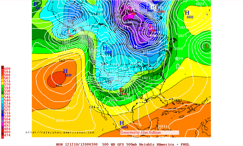
http://www.hpc.ncep.noaa.gov/ncepreanal/ -Good site to look at past weather patterns
0 likes   
The above post and any post by Ntxw is NOT an official forecast and should not be used as such. It is just the opinion of the poster and may or may not be backed by sound meteorological data. It is NOT endorsed by any professional institution including Storm2k. For official information, please refer to NWS products.

  Help support Storm2K!
Help Support Storm2K

weatherdude1108
Category 5
Category 5
Posts: 4228
Joined: Tue Dec 13, 2011 1:04 pm
Location: Northwest Austin/Cedar Park, TX

#402 Postby weatherdude1108 » Mon Nov 26, 2012 7:52 pm

Looking at the precious rain on the radar north of here around Leander -- hearing thunder and watching it weaken -- once again as it nears, without a drop to be had. We may go the entire month without a drop after all. I guess I expect too much. :roll: :cry:
0 likes   
The preceding post is NOT an official forecast, and should not be used as such. It is only the opinion of the poster and may or may not be backed by sound meteorological data. It is NOT endorsed by any professional institution including storm2k.org. For Official Information please refer to the NHC and NWS products.

User avatar
gboudx
S2K Supporter
S2K Supporter
Posts: 4080
Joined: Thu Sep 04, 2003 1:39 pm
Location: Rockwall, Tx but from Harvey, La

#403 Postby gboudx » Tue Nov 27, 2012 11:35 am

DFW NWS gives a glimmer of hope on the horizon. Hopefully it's not Lucy pulling the football away again. It does appear my garden will continue producing into December. It's usually all dead by now. Anyone need fresh bell peppers and poblanos? We have more in our freezer than any family should. :)

HEMISPHERIC LONGWAVE FLOW DOES BEGIN TO SHOW MORE AMPLIFICATION BY
EARLY NEXT WEEK AS A DEEP TROUGH BEGINS SETTING UP THE WEST COAST
AND GREAT BASIN ON MONDAY. WE SHOULD HAVE SEVERAL DAYS THROUGH THE
WEEKEND OF MODIFIED GULF MOISTURE RETURN AHEAD OF NEXT WEEKS SYSTEM.
MEDIUM RANGE MODELS INDICATE A POTENTIAL FOR A MORE SIGNIFICANT
RAIN EVENT WITH A COLD FRONT BY NEXT TUESDAY OR WEDNESDAY...WITH
SOME MINOR TIMING DIFFERENCES. ITS STILL A WEEK AWAY...BUT SOMETHING
TO LOOK FORWARD TO WITH DROUGHT CONDITIONS CONTINUING TO WORSEN
ACROSS NORTH TEXAS.
0 likes   

User avatar
Ntxw
Storm2k Moderator
Storm2k Moderator
Posts: 22783
Joined: Wed Oct 21, 2009 6:34 pm
Location: DFW, Texas

#404 Postby Ntxw » Tue Nov 27, 2012 2:06 pm

Nice little cold front we had! I wasn't expecting much but it sure had a little more bite than thought. With most of the trees changing or already changed it sure got me in the holiday spirit with that overcast chill. Good time to put up some lights :cheesy:
0 likes   
The above post and any post by Ntxw is NOT an official forecast and should not be used as such. It is just the opinion of the poster and may or may not be backed by sound meteorological data. It is NOT endorsed by any professional institution including Storm2k. For official information, please refer to NWS products.


  Help support Storm2K!

Help Support Storm2K


weatherdude1108
Category 5
Category 5
Posts: 4228
Joined: Tue Dec 13, 2011 1:04 pm
Location: Northwest Austin/Cedar Park, TX

Re:

#405 Postby weatherdude1108 » Tue Nov 27, 2012 2:15 pm

gboudx wrote:DFW NWS gives a glimmer of hope on the horizon. Hopefully it's not Lucy pulling the football away again. It does appear my garden will continue producing into December. It's usually all dead by now. Anyone need fresh bell peppers and poblanos? We have more in our freezer than any family should. :)

HEMISPHERIC LONGWAVE FLOW DOES BEGIN TO SHOW MORE AMPLIFICATION BY
EARLY NEXT WEEK AS A DEEP TROUGH BEGINS SETTING UP THE WEST COAST
AND GREAT BASIN ON MONDAY. WE SHOULD HAVE SEVERAL DAYS THROUGH THE
WEEKEND OF MODIFIED GULF MOISTURE RETURN AHEAD OF NEXT WEEKS SYSTEM.
MEDIUM RANGE MODELS INDICATE A POTENTIAL FOR A MORE SIGNIFICANT
RAIN EVENT WITH A COLD FRONT BY NEXT TUESDAY OR WEDNESDAY...WITH
SOME MINOR TIMING DIFFERENCES. ITS STILL A WEEK AWAY...BUT SOMETHING
TO LOOK FORWARD TO WITH DROUGHT CONDITIONS CONTINUING TO WORSEN
ACROSS NORTH TEXAS.


:uarrow:
Bring it! :) Anything to get us out of this rainless rut.
0 likes   

weatherdude1108
Category 5
Category 5
Posts: 4228
Joined: Tue Dec 13, 2011 1:04 pm
Location: Northwest Austin/Cedar Park, TX

Re:

#406 Postby weatherdude1108 » Tue Nov 27, 2012 2:18 pm

Ntxw wrote:Nice little cold front we had! I wasn't expecting much but it sure had a little more bite than thought. With most of the trees changing or already changed it sure got me in the holiday spirit with that overcast chill. Good time to put up some lights :cheesy:


Oh yeah, nice Fall/Wintery CHILL in the air today. Love it! The deciduous trees around here have exploded in various orange/red and yellow colors within the past week. Puts me in the holiday spirit too! :)
0 likes   

User avatar
Portastorm
Storm2k Moderator
Storm2k Moderator
Posts: 9914
Age: 63
Joined: Fri Jul 11, 2003 9:16 am
Location: Round Rock, TX
Contact:

Re: Re:

#407 Postby Portastorm » Tue Nov 27, 2012 4:37 pm

weatherdude1108 wrote:
Ntxw wrote:Nice little cold front we had! I wasn't expecting much but it sure had a little more bite than thought. With most of the trees changing or already changed it sure got me in the holiday spirit with that overcast chill. Good time to put up some lights :cheesy:


Oh yeah, nice Fall/Wintery CHILL in the air today. Love it! The deciduous trees around here have exploded in various orange/red and yellow colors within the past week. Puts me in the holiday spirit too! :)


Yeah, we busted "low" on the high temps today. Forecasted high was in the low 60s. We only hit 58 at Camp Mabry and 59 at the airport with temps lowering now thanks to a pesky deck of stratus. I'd like to see that trend continue in a month or two. :wink:
0 likes   
Any forecasts under my name are to be taken with a grain of salt. Get your best forecasts from the National Weather Service and National Hurricane Center.

User avatar
Rgv20
S2K Supporter
S2K Supporter
Posts: 2466
Age: 38
Joined: Wed Jan 05, 2011 5:42 pm
Location: Edinburg/McAllen Tx

#408 Postby Rgv20 » Wed Nov 28, 2012 1:06 am

The GFS continues to hint of a possible pattern change as we head to mid December.....It is still ways off but its worth keeping an eye on :D


0zGFS 500mb Heights forecast for December 10....Forecasting a strong 1048mb high in Western Canada and some ridging pinching to Southern Alaska.
Image
0 likes   
The following post is NOT an official forecast and should not be used as such. It is just the opinion of the poster and may or may not be backed by sound meteorological data. It is NOT endorsed by any professional institution including storm2k.org For Official Information please refer to the NHC and NWS products.

ndale
Category 1
Category 1
Posts: 429
Joined: Tue Dec 29, 2009 11:12 am
Location: Pflugerville/Austin Tx

#409 Postby ndale » Wed Nov 28, 2012 8:32 am

For the first time this fall we have frost on the rooftops.
0 likes   
Any opinions stated are those of an amateur, please take with several grains of salt and for official forecast refer to the National Weather Service.

weatherdude1108
Category 5
Category 5
Posts: 4228
Joined: Tue Dec 13, 2011 1:04 pm
Location: Northwest Austin/Cedar Park, TX

Re:

#410 Postby weatherdude1108 » Wed Nov 28, 2012 8:58 am

ndale wrote:For the first time this fall we have frost on the rooftops.


:uarrow:
I was just going to mention that! Beat me to the punch. :wink:

Yeah, when I was leaving the house this morning, I noticed the neighbor's roof had frost on it. But my thermometer only read 38 degrees. It has frosted in the past and been above freezing. Is that possible?? The thermometer is under an eave. Anyway, I left one of my potted plants outside. We'll see if it survived.
0 likes   

User avatar
gboudx
S2K Supporter
S2K Supporter
Posts: 4080
Joined: Thu Sep 04, 2003 1:39 pm
Location: Rockwall, Tx but from Harvey, La

Re: Re:

#411 Postby gboudx » Wed Nov 28, 2012 10:28 am

weatherdude1108 wrote:
ndale wrote:For the first time this fall we have frost on the rooftops.


:uarrow:
I was just going to mention that! Beat me to the punch. :wink:

Yeah, when I was leaving the house this morning, I noticed the neighbor's roof had frost on it. But my thermometer only read 38 degrees. It has frosted in the past and been above freezing. Is that possible?? The thermometer is under an eave. Anyway, I left one of my potted plants outside. We'll see if it survived.


We've had frost at least 4 times now, including this morning. Thru it all, our potted plants, vegetable garden and basil have survived.
0 likes   

User avatar
Portastorm
Storm2k Moderator
Storm2k Moderator
Posts: 9914
Age: 63
Joined: Fri Jul 11, 2003 9:16 am
Location: Round Rock, TX
Contact:

Re: Texas Fall 2012

#412 Postby Portastorm » Wed Nov 28, 2012 2:59 pm

Both the 12z GFS and Euro are in agreement that a major Arctic airmass will be moving into the Plains around or shortly after December 10th. The GFS has been consistent in showing this now for several days.

Wxman57 better get his polar weather cycling gear ready! :cheesy:
0 likes   
Any forecasts under my name are to be taken with a grain of salt. Get your best forecasts from the National Weather Service and National Hurricane Center.

User avatar
wxman57
Moderator-Pro Met
Moderator-Pro Met
Posts: 22977
Age: 67
Joined: Sat Jun 21, 2003 8:06 pm
Location: Houston, TX (southwest)

Re: Re:

#413 Postby wxman57 » Wed Nov 28, 2012 4:37 pm

weatherdude1108 wrote: :uarrow:
I was just going to mention that! Beat me to the punch. :wink:

Yeah, when I was leaving the house this morning, I noticed the neighbor's roof had frost on it. But my thermometer only read 38 degrees. It has frosted in the past and been above freezing. Is that possible?? The thermometer is under an eave. Anyway, I left one of my potted plants outside. We'll see if it survived.


It's possible because the temperature on your neighbor's roof was 32F or colder. Dark surfaces radiate heat better than the surrounding air, so they can cool down more than the ambient air temperature.
0 likes   

User avatar
wxman57
Moderator-Pro Met
Moderator-Pro Met
Posts: 22977
Age: 67
Joined: Sat Jun 21, 2003 8:06 pm
Location: Houston, TX (southwest)

Re: Texas Fall 2012

#414 Postby wxman57 » Wed Nov 28, 2012 5:06 pm

Portastorm wrote:Both the 12z GFS and Euro are in agreement that a major Arctic airmass will be moving into the Plains around or shortly after December 10th. The GFS has been consistent in showing this now for several days.

Wxman57 better get his polar weather cycling gear ready! :cheesy:


I was just discussing that with my long-range guy (the cold-mongerer). My first freeze date in the office contest is Dec. 17th. Hopefully I win one of these after 11 years of attempts.

Meanwhile, I plan on biking in a short-sleeved jersey and shorts this weekend. And, with any luck, this is the only winter we get all season. ;-)
0 likes   

User avatar
Ntxw
Storm2k Moderator
Storm2k Moderator
Posts: 22783
Joined: Wed Oct 21, 2009 6:34 pm
Location: DFW, Texas

Re: Texas Fall 2012

#415 Postby Ntxw » Wed Nov 28, 2012 5:48 pm

Portastorm wrote:Both the 12z GFS and Euro are in agreement that a major Arctic airmass will be moving into the Plains around or shortly after December 10th. The GFS has been consistent in showing this now for several days.

Wxman57 better get his polar weather cycling gear ready! :cheesy:


Pretty bold statement there :wink:. I'm still a little weary of the PNA, it just won't relax. There is a silver lining for it though, in general we've averaged as whole overall for the past 6-7 months of negative PNA. It too has cycles like the AO/NAO and EPO (PNA though probably has ties closer to ENSO) and during any favored state the longest runs were about 7-8 months. So if this were true we should be escaping at least the very negative state soon, maybe in time for winter hopefully.

Image

Average monthly PNA values.
http://www.cpc.ncep.noaa.gov/products/p ... scii.table

Our cold/snow outbreaks were almost always tied to the PNA being at least +0.5 or greater month/month before.
0 likes   
The above post and any post by Ntxw is NOT an official forecast and should not be used as such. It is just the opinion of the poster and may or may not be backed by sound meteorological data. It is NOT endorsed by any professional institution including Storm2k. For official information, please refer to NWS products.


  Help support Storm2K!

Help Support Storm2K


User avatar
horselattitudesfarm
Category 1
Category 1
Posts: 315
Joined: Thu Jul 16, 2009 5:55 pm
Location: Asheville, NC (formerly from Dallas, TX)

Re:

#416 Postby horselattitudesfarm » Thu Nov 29, 2012 8:39 am

gboudx wrote:DFW NWS gives a glimmer of hope on the horizon. Hopefully it's not Lucy pulling the football away again. It does appear my garden will continue producing into December. It's usually all dead by now. Anyone need fresh bell peppers and poblanos? We have more in our freezer than any family should. :)

HEMISPHERIC LONGWAVE FLOW DOES BEGIN TO SHOW MORE AMPLIFICATION BY
EARLY NEXT WEEK AS A DEEP TROUGH BEGINS SETTING UP THE WEST COAST
AND GREAT BASIN ON MONDAY. WE SHOULD HAVE SEVERAL DAYS THROUGH THE
WEEKEND OF MODIFIED GULF MOISTURE RETURN AHEAD OF NEXT WEEKS SYSTEM.
MEDIUM RANGE MODELS INDICATE A POTENTIAL FOR A MORE SIGNIFICANT
RAIN EVENT WITH A COLD FRONT BY NEXT TUESDAY OR WEDNESDAY...WITH
SOME MINOR TIMING DIFFERENCES. ITS STILL A WEEK AWAY...BUT SOMETHING
TO LOOK FORWARD TO WITH DROUGHT CONDITIONS CONTINUING TO WORSEN
ACROSS NORTH TEXAS.

It looks like Lucy IS holding the football with a gleam in her eye. Not only that, but she is going to go over and kick Charlie Brown after he does his backward flip and lands on the dry dusty drought-stricken hardpan :wink: :
Per latest forecast discussion this morning for DFW:

"ISOLATED TO SCATTERED SHOWERS AND THUNDERSTORMS WILL BE POSSIBLE
LATE MONDAY NIGHT AND ON TUESDAY AHEAD OF THE COLD FRONT...BUT
UPPER DYNAMICS...FORCING AND FRONTAL TIMING INDICATE ONLY A LOW
CONCERN FOR SEVERE THUNDERSTORMS TUESDAY AFTERNOON OVER THE FAR
EAST AND SOUTHEAST COUNTIES. WHAT EVER RAINFALL OCCURS WILL NOT
BE ENOUGH TO ALLEVIATE THE DROUGHT CONDITIONS THAT CURRENTLY EXIST
ACROSS NORTH TEXAS.

LOOKING FURTHER OUT IN TIME...A CONSOLIDATION OF BELOW NORMAL
HEIGHTS IS EXPECTED TO OCCUR ABOVE THE ARCTIC CIRCLE AFTER MID
NEXT WEEK WHICH COULD HELP DRIVE SOME COLDER AIR SOUTHWARD ACROSS
THE NORTHERN PLAINS...GREAT LAKES AND NORTHEASTERN STATES. IF THIS
OCCURS...THERE WILL BE LITTLE OPPORTUNITY FOR ANY DROUGHT RELIEF
THROUGH MID DECEMBER AS UPPER DYNAMICS AND THE POTENTIAL FOR
RAINFALL PASS NORTHEAST OF THE REGION AND REGIONAL TEMPERATURES
REMAIN SIGNIFICANTLY ABOVE NORMAL. "
0 likes   

weatherdude1108
Category 5
Category 5
Posts: 4228
Joined: Tue Dec 13, 2011 1:04 pm
Location: Northwest Austin/Cedar Park, TX

#417 Postby weatherdude1108 » Thu Nov 29, 2012 5:28 pm

Talk of a pattern change (AGAIN) next weekend. "PLAN ACCORDINGLY." :wink:

AREA FORECAST DISCUSSION
NATIONAL WEATHER SERVICE AUSTIN/SAN ANTONIO TX
328 PM CST THU NOV 29 2012

.DISCUSSION...
A COMBINATION OF CLOUDS AT DIFFERENT LEVELS COVERS MUCH OF THE
AREA THIS AFTERNOON. THAT WILL BE A COMMON THEME THROUGH THE NEXT
FIVE DAYS. THE MAIN FORECAST ISSUES ARE RETURN FLOW FROM THE
GULF...WHICH WILL IMPACT CLOUDCOVER...TEMPS...AND FOG/DRIZZLE.
OTHERWISE...THE TIMING AND STRENGTH OF A COLD FRONT TUESDAY...AND
A STRONGER FRONT BEYOND THE FORECAST PERIOD NEXT WEEKEND...ARE THE
FORECAST CONCERNS. OVERALL...THE FORECAST WILL BE FAIRLY CLOSE TO
THE GFS MODEL...ALTHOUGH WITH CHANGES FOR WARMER THAN THE MODEL
FOR THE DAY OR TWO BEFORE FRONTAL PASSAGES...AND COOLER THAN THE
MODEL FOR THE DAY OR TWO AFTER...WHICH IS A LONG STANDING BIAS
WITH FRONTAL PASSAGES IN THE SOUTHERN PLAINS.

EXPECT A REPEAT OF THURSDAY MORNING FOR FRIDAY THROUGH SUNDAY
MORNINGS...AS GULF RETURN FLOW DEEPENS THROUGH THE PERIOD...BUT
ALSO HAS A DIURNAL FLUCTUATION DUE TO MIXING. TONIGHT SHOULD STILL
BE PATCHY FOG...ALTHOUGH A FEW SPOTS COULD SEE VISIBILITY LESS
THAN 1/4 MILE AT TIMES. FRIDAY NIGHT SHOULD BE AREAS OF FOG...WITH
PATCHY DRIZZLE ALONG THE BALCONES ESCARPMENT. NO SIGNIFICANT IMPACT
IS EXPECTED FROM THE DRIZZLE FOR ROADWAYS. SATURDAY NIGHT WILL
ALSO HAVE AREAS OF FOG...WITH PATCHY DRIZZLE AGAIN ONLY ALONG THE
BALCONES ESCARPMENT.

OTHER THAN GENERALLY WARMER AND MORE HUMID CONDITIONS AS THE
WEEKEND PROGRESSES...THE NEXT CHANCE OF RAIN IS WITH A COLD FRONT
PASSAGE ON TUESDAY. THE VARIOUS MODELS SEEM FAIRLY WELL LOCKED
INTO TUESDAY AFTERNOON...BUT THE STRENGTH OF THE FRONT AND HOW FAR
SOUTH IT WILL GO SEEM TO BE WANING WITH SUCCESSIVE RUNS. LACK OF
UPPER LEVEL TROUGH SUPPORT IS A GOOD REASON FOR THAT...SO WILL
REFLECT THAT IN THE FORECAST WITH ONLY 20 PCT POPS ALONG AND EAST
OF I-35. RAINFALL AMOUNTS SHOULD BE LESS THAN 1/4 INCH.

A MUCH STRONGER FRONT AND ASSOCIATED UPPER LEVEL PATTERN CHANGE
TOWARD COLDER CONDITIONS APPEARS IN STORE FOR NEXT WEEKEND. WHILE
BEYOND OUR FORECAST RANGE FOR SPECIFICITY...OUTDOOR ACTIVITIES
WILL BE MUCH MORE PLEASANT THIS WEEKEND THAN NEXT...PLAN ACCORDINGLY
.
0 likes   
The preceding post is NOT an official forecast, and should not be used as such. It is only the opinion of the poster and may or may not be backed by sound meteorological data. It is NOT endorsed by any professional institution including storm2k.org. For Official Information please refer to the NHC and NWS products.

User avatar
Portastorm
Storm2k Moderator
Storm2k Moderator
Posts: 9914
Age: 63
Joined: Fri Jul 11, 2003 9:16 am
Location: Round Rock, TX
Contact:

Re: Texas Fall 2012

#418 Postby Portastorm » Thu Nov 29, 2012 6:02 pm

Thanks for posting weatherdude. Shame on me, I broke the rule of posting a "Fall" weather item in the "Winter" thread as I mentioned that last paragraph of EWX's AFD this afternoon.

Encouraging word though, right?! :wink:
0 likes   
Any forecasts under my name are to be taken with a grain of salt. Get your best forecasts from the National Weather Service and National Hurricane Center.

User avatar
amawea
S2K Supporter
S2K Supporter
Posts: 385
Age: 73
Joined: Mon Aug 09, 2004 3:36 pm
Location: Horseshoe Bend, Ar. but from Baytown, Tx

Re: Texas Fall 2012

#419 Postby amawea » Thu Nov 29, 2012 6:26 pm

Portastorm wrote:Thanks for posting weatherdude. Shame on me, I broke the rule of posting a "Fall" weather item in the "Winter" thread as I mentioned that last paragraph of EWX's AFD this afternoon.

Encouraging word though, right?! :wink:


Well, doesn't meteorlogical winter begin Saturday?
0 likes   

User avatar
gboudx
S2K Supporter
S2K Supporter
Posts: 4080
Joined: Thu Sep 04, 2003 1:39 pm
Location: Rockwall, Tx but from Harvey, La

Re: Texas Fall 2012

#420 Postby gboudx » Thu Nov 29, 2012 7:13 pm

Portastorm wrote:Thanks for posting weatherdude. Shame on me, I broke the rule of posting a "Fall" weather item in the "Winter" thread as I mentioned that last paragraph of EWX's AFD this afternoon.

Encouraging word though, right?! :wink:


I say we just call this the year without a Fall and move to the Winter thread. Just my humble suggestion. :D
0 likes   


Return to “USA & Caribbean Weather”

Who is online

Users browsing this forum: No registered users and 15 guests