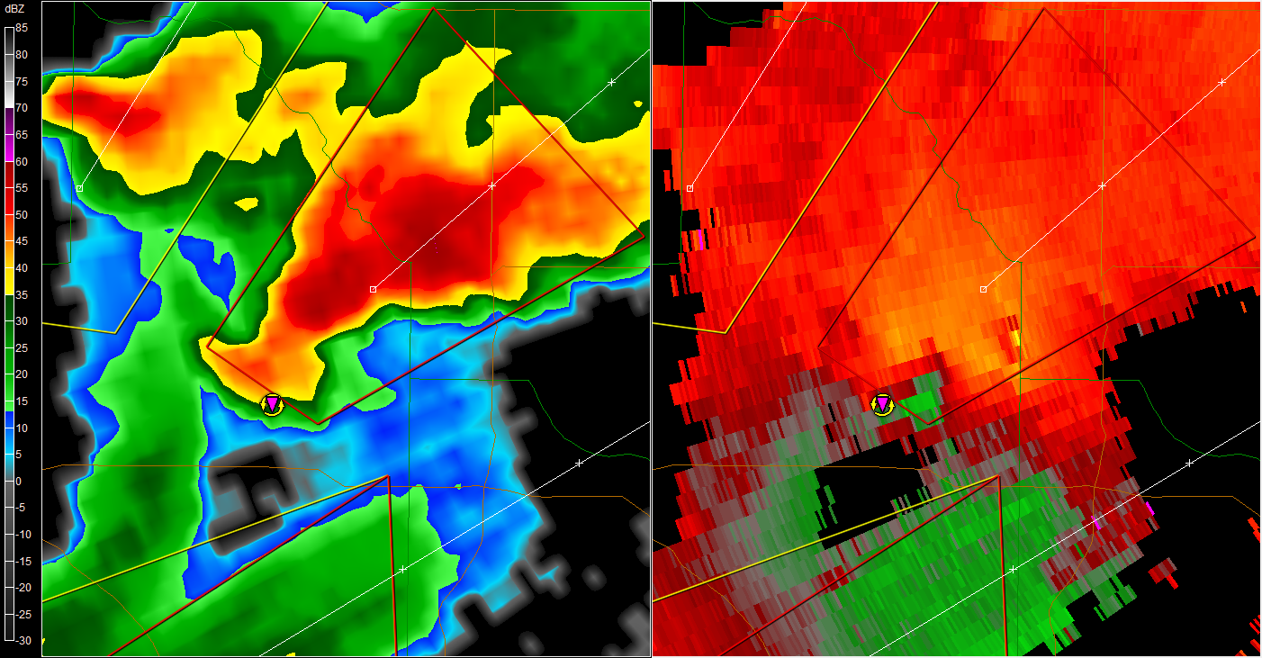
BULLETIN - EAS ACTIVATION REQUESTED
TORNADO WARNING
NATIONAL WEATHER SERVICE WICHITA KS
558 PM CDT SAT APR 14 2012
THE NATIONAL WEATHER SERVICE IN WICHITA HAS ISSUED A
* TORNADO WARNING FOR...
WESTERN KINGMAN COUNTY IN SOUTH CENTRAL KANSAS...
* UNTIL 645 PM CDT
* AT 556 PM CDT...A SEVERE THUNDERSTORM CAPABLE OF PRODUCING A
TORNADO WAS LOCATED 6 MILES SOUTHWEST OF NASHVILLE...AND MOVING
NORTHEAST AT 35 MPH.
HAZARD...DEVELOPING TORNADO AND HALF DOLLAR SIZE HAIL.
SOURCE...RADAR INDICATED ROTATION.
IMPACT...SIGNIFICANT HOUSE AND BUILDING DAMAGE POSSIBLE. MOBILE
HOMES COMPLETELY DESTROYED IF HIT. SOME TREES UPROOTED OR
SNAPPED. VEHICLES WILL LIKELY BE THROWN BY TORNADIC WINDS.
* LOCATIONS IMPACTED INCLUDE...
NASHVILLE...ZENDA...WILLOWDALE AND CLEVELAND.
PRECAUTIONARY/PREPAREDNESS ACTIONS...
TAKE COVER NOW. MOVE TO AN INTERIOR ROOM ON THE LOWEST FLOOR OF A
STURDY BUILDING. AVOID WINDOWS. IF IN A MOBILE HOME...A VEHICLE OR
OUTDOORS...MOVE TO THE CLOSEST SUBSTANTIAL SHELTER AND PROTECT
YOURSELF FROM FLYING DEBRIS.
THIS STORM HAS A HISTORY OF PRODUCING STRONG ROTATION AND FUNNEL
CLOUDS. TAKE COVER IN A BASEMENT OR STORM SHELTER NOW!
Plains Tornado Outbreak 4/14-15
Moderator: S2k Moderators
Forum rules

The posts in this forum are NOT official forecast and should not be used as such. They are just the opinion of the poster and may or may not be backed by sound meteorological data. They are NOT endorsed by any professional institution or STORM2K.
-
vbhoutex

- Storm2k Executive

- Posts: 29149
- Age: 74
- Joined: Wed Oct 09, 2002 11:31 pm
- Location: Cypress, TX
- Contact:
Re: Plains Tornado Outbreak: High Risk on 4/14-15 at OK,KS,NEB
0 likes
Skywarn, C.E.R.T.
Please click below to donate to STORM2K to help with the expenses of keeping the site going:

Please click below to donate to STORM2K to help with the expenses of keeping the site going:

-
vbhoutex
- Storm2k Executive
- Posts: 29149
- Age: 74
- Joined: Wed Oct 09, 2002 11:31 pm
- Location: Cypress, TX
- Contact:
Re: Plains Tornado Outbreak: High Risk on 4/14-15 at OK,KS,NEB
BULLETIN - EAS ACTIVATION REQUESTED
TORNADO WARNING
NATIONAL WEATHER SERVICE NORTH PLATTE NE
601 PM CDT SAT APR 14 2012
THE NATIONAL WEATHER SERVICE IN NORTH PLATTE HAS ISSUED A
* TORNADO WARNING FOR...
NORTH CENTRAL LINCOLN COUNTY IN SOUTHWEST NEBRASKA...
* UNTIL 630 PM CDT
* AT 555 PM CDT...NATIONAL WEATHER SERVICE DOPPLER RADAR INDICATED A
SEVERE THUNDERSTORM CAPABLE OF PRODUCING A TORNADO. THIS DANGEROUS
STORM WAS LOCATED 6 MILES EAST OF NORTH PLATTE...AND MOVING NORTH
AT 15 MPH.
* LOCATIONS IMPACTED INCLUDE...
HIGHWAY 83 MILE MARKER 90...HIGHWAY 83 MILE MARKER 100 AND HIGHWAY
97 MILE MARKER 10.
PRECAUTIONARY/PREPAREDNESS ACTIONS...
TAKE COVER NOW. MOVE TO AN INTERIOR ROOM ON THE LOWEST FLOOR OF A
STURDY BUILDING. AVOID WINDOWS. IF IN A MOBILE HOME...A VEHICLE OR
OUTDOORS...MOVE TO THE CLOSEST SUBSTANTIAL SHELTER AND PROTECT
YOURSELF FROM FLYING DEBRIS.
0 likes
Skywarn, C.E.R.T.
Please click below to donate to STORM2K to help with the expenses of keeping the site going:
Please click below to donate to STORM2K to help with the expenses of keeping the site going:
-
CrazyC83
- Professional-Met

- Posts: 34315
- Joined: Tue Mar 07, 2006 11:57 pm
- Location: Deep South, for the first time!
KSC053-113-169-142330-
/O.CON.KICT.TO.W.0016.000000T0000Z-120414T2330Z/
SALINE KS-MCPHERSON KS-ELLSWORTH KS-
555 PM CDT SAT APR 14 2012
...A TORNADO WARNING REMAINS IN EFFECT FOR SOUTHEASTERN ELLSWORTH...
NORTHWESTERN MCPHERSON AND SOUTHWESTERN SALINE COUNTIES UNTIL 630 PM
CDT...
AT 552 PM CDT...A CONFIRMED LARGE AND EXTREMELY DANGEROUS TORNADO WAS
LOCATED 8 MILES SOUTH OF KANOPOLIS STATE PARK...AND MOVING NORTHEAST
AT 40 MPH.
THIS IS A PARTICULARLY DANGEROUS SITUATION.
HAZARD...DAMAGING TORNADO.
SOURCE...LAW ENFORCEMENT CONFIRMED TORNADO.
IMPACT...MAJOR HOUSE AND BUILDING DAMAGE LIKELY AND COMPLETE
DESTRUCTION POSSIBLE. NUMEROUS TREES SNAPPED. MAJOR POWER
OUTAGES IN PATH OF TORNADO HIGHLY LIKELY. SOME ROADS
POSSIBLY BLOCKED BY TORNADO DEBRIS. COMPLETE DESTRUCTION OF
VEHICLES LIKELY.
LOCATIONS IMPACTED INCLUDE...
MARQUETTE AND LINDSBORG.
PRECAUTIONARY/PREPAREDNESS ACTIONS...
TO REPEAT...A LARGE...EXTREMELY DANGEROUS AND POTENTIALLY DEADLY
TORNADO IS ON THE GROUND. TO PROTECT YOUR LIFE...TAKE COVER NOW. MOVE
TO AN INTERIOR ROOM ON THE LOWEST FLOOR OF A STURDY BUILDING. AVOID
WINDOWS. IF IN A MOBILE HOME...A VEHICLE OR OUTDOORS...MOVE TO THE
CLOSEST SUBSTANTIAL SHELTER AND PROTECT YOURSELF FROM FLYING DEBRIS.
&&
LAT...LON 3856 9765 3848 9792 3852 9793 3853 9819
3878 9782
TIME...MOT...LOC 2255Z 230DEG 35KT 3856 9796
TORNADO...OBSERVED
TORNADO DAMAGE THREAT...SIGNIFICANT
HAIL...2.50IN
$$
BILLINGS
0 likes
-
vbhoutex
- Storm2k Executive
- Posts: 29149
- Age: 74
- Joined: Wed Oct 09, 2002 11:31 pm
- Location: Cypress, TX
- Contact:
Re:
EF-5bigj wrote:Large violent wedge on the ground
If you are posting things like this we must have location information, verification,etc. Otherwise do not post it as it is not of any use to anyone. We are striving to get the very latest CORRECT information out.
0 likes
Skywarn, C.E.R.T.
Please click below to donate to STORM2K to help with the expenses of keeping the site going:
Please click below to donate to STORM2K to help with the expenses of keeping the site going:
-
vbhoutex
- Storm2k Executive
- Posts: 29149
- Age: 74
- Joined: Wed Oct 09, 2002 11:31 pm
- Location: Cypress, TX
- Contact:
Re: Plains Tornado Outbreak: High Risk on 4/14-15 at OK,KS,NEB
BULLETIN - EAS ACTIVATION REQUESTED
TORNADO WARNING
NATIONAL WEATHER SERVICE OMAHA/VALLEY NEBRASKA
606 PM CDT SAT APR 14 2012
THE NATIONAL WEATHER SERVICE IN OMAHA HAS ISSUED A
* TORNADO WARNING FOR...
NORTH CENTRAL MONTGOMERY COUNTY IN SOUTHWESTERN IOWA...
* UNTIL 630 PM CDT
* AT 604 PM CDT...DOPPLER RADAR INDICATED A SEVERE THUNDERSTORM
CAPABLE OF PRODUCING A TORNADO. THIS DANGEROUS STORM WAS LOCATED
NEAR EMERSON...OR 36 MILES EAST OF OMAHA...AND MOVING NORTHEAST AT
50 MPH.
* LOCATIONS IMPACTED INCLUDE...
ELLIOTT AND GRANT.
PRECAUTIONARY/PREPAREDNESS ACTIONS...
TAKE COVER NOW. MOVE TO A BASEMENT OR AN INTERIOR ROOM ON THE
LOWEST FLOOR OF A STURDY BUILDING. AVOID WINDOWS. IF IN A MOBILE
HOME OR OUTDOORS...MOVE TO THE CLOSEST SUBSTANTIAL SHELTER AND
PROTECT YOURSELF FROM FLYING DEBRIS.
0 likes
Skywarn, C.E.R.T.
Please click below to donate to STORM2K to help with the expenses of keeping the site going:
Please click below to donate to STORM2K to help with the expenses of keeping the site going:

-
cycloneye

- Admin
- Posts: 149508
- Age: 69
- Joined: Thu Oct 10, 2002 10:54 am
- Location: San Juan, Puerto Rico
Re:
EF-5bigj wrote:Large violent wedge on the ground
You can reply at the 2012 U.S Severe Season thread up with sticky as is not busy,and you can see there the stormchasers.
viewtopic.php?f=24&t=112438&p=2219497#p2219497
0 likes
Visit the Caribbean-Central America Weather Thread where you can find at first post web cams,radars
and observations from Caribbean basin members Click Here
and observations from Caribbean basin members Click Here
-
CrazyC83
- Professional-Met
- Posts: 34315
- Joined: Tue Mar 07, 2006 11:57 pm
- Location: Deep South, for the first time!
Re:
RL3AO wrote:Do we want to post every tornado warning or just those with confirmed tornadoes? Its starting to pick up and its what we've done in the past during large outbreaks.
Confirmed only at this point, unless headed for a large populated area.
0 likes
-
vbhoutex
- Storm2k Executive
- Posts: 29149
- Age: 74
- Joined: Wed Oct 09, 2002 11:31 pm
- Location: Cypress, TX
- Contact:
Re: Plains Tornado Outbreak: High Risk on 4/14-15 at OK,KS,NEB
BULLETIN - IMMEDIATE BROADCAST REQUESTED
SEVERE THUNDERSTORM WARNING
NATIONAL WEATHER SERVICE NORMAN OK
607 PM CDT SAT APR 14 2012
THE NATIONAL WEATHER SERVICE IN NORMAN HAS ISSUED A
* SEVERE THUNDERSTORM WARNING FOR...
SOUTHEASTERN HARPER COUNTY IN NORTHWESTERN OKLAHOMA...
NORTHWESTERN WOODS COUNTY IN NORTHWESTERN OKLAHOMA...
EXTREME NORTH CENTRAL WOODWARD COUNTY IN NORTHWESTERN OKLAHOMA...
* UNTIL 645 PM CDT
* AT 605 PM CDT...NATIONAL WEATHER SERVICE METEOROLOGISTS DETECTED
A SEVERE THUNDERSTORM CAPABLE OF PRODUCING HALF DOLLAR SIZE HAIL
AND DAMAGING WINDS IN EXCESS OF 65 MPH. THIS STORM WAS LOCATED 13
MILES NORTH OF WOODWARD...MOVING NORTHEAST AT 70 MPH.
* LOCATIONS IMPACTED INCLUDE...
FREEDOM AND CAMP HOUSTON.
PRECAUTIONARY/PREPAREDNESS ACTIONS...
SEVERE THUNDERSTORMS CAN PRODUCE TORNADOES WITH NO WARNING. GET
TO A STORM SHELTER OR STURDY BUILDING IF A TORNADO APPROACHES.
MOVE INSIDE A STURDY BUILDING UNTIL THE STORM HAS PASSED
0 likes
Skywarn, C.E.R.T.
Please click below to donate to STORM2K to help with the expenses of keeping the site going:
Please click below to donate to STORM2K to help with the expenses of keeping the site going:
-
Texas Snowman

- Storm2k Moderator

- Posts: 6197
- Joined: Fri Jan 25, 2008 11:29 am
- Location: Denison, Texas
Someone with Storm Prediction Center just stated on TWC that this is "...only the beginning."
Chaser video of the large wedge moving near Salina is fearsome looking. Violent rotation and 1/4 mile or better in width. Hope it passes south of the city.
EDIT: BTW, told my father-in-law as we watched it that it looked almost identical to the Tuscaloosa tornado last year. And then I saw a storm chaser tweet virtually the same thing. It is a mean looking tornado for sure.
Last edited by Texas Snowman on Sat Apr 14, 2012 6:20 pm, edited 1 time in total.
0 likes
The above post and any post by Texas Snowman is NOT an official forecast and should not be used as such. It is just the opinion of the poster and may or may not be backed by sound meteorological data. It is NOT endorsed by any professional institution including storm2k.org. For official information, please refer to NWS products.
-
vbhoutex
- Storm2k Executive
- Posts: 29149
- Age: 74
- Joined: Wed Oct 09, 2002 11:31 pm
- Location: Cypress, TX
- Contact:
Re: Re:
CrazyC83 wrote:RL3AO wrote:Do we want to post every tornado warning or just those with confirmed tornadoes? Its starting to pick up and its what we've done in the past during large outbreaks.
Confirmed only at this point, unless headed for a large populated area.
If any populated area is mentioned in the warning I think we need to post it, not just large populated areas. If we can't keep up that is one thing, but so far I think we are keeping up. I am open to discussion, but I don't understand why we would only try and warn large populated areas as long as we can warn everyone.
0 likes
Skywarn, C.E.R.T.
Please click below to donate to STORM2K to help with the expenses of keeping the site going:
Please click below to donate to STORM2K to help with the expenses of keeping the site going:
-
apocalypt-flyer
- Category 1

- Posts: 468
- Joined: Sat Aug 27, 2005 11:51 am
Re:
Texas Snowman wrote:Chaser video of the large wedge moving near Salina is fearsome looking. Violent rotation and 1/4 mile or better in width. Hope it passes south of the city.
Looks like chasertv is having some issues right now though - probably server overload.
Also, that tornado southwest of Salina still scarily on track for Salina.
Last edited by apocalypt-flyer on Sat Apr 14, 2012 6:22 pm, edited 1 time in total.
0 likes
-
CrazyC83
- Professional-Met
- Posts: 34315
- Joined: Tue Mar 07, 2006 11:57 pm
- Location: Deep South, for the first time!
Re: Plains Tornado Outbreak: High Risk on 4/14-15 at OK,KS,NEB
Spotters say it has weakened, but probably only temporarily. Salina, a decent sized city - population 50,000, lies ahead:
WFUS53 KICT 142319
TORICT
KSC169-150000-
/O.NEW.KICT.TO.W.0018.120414T2319Z-120415T0000Z/
BULLETIN - EAS ACTIVATION REQUESTED
TORNADO WARNING
NATIONAL WEATHER SERVICE WICHITA KS
619 PM CDT SAT APR 14 2012
THE NATIONAL WEATHER SERVICE IN WICHITA HAS ISSUED A
* TORNADO WARNING FOR...
SALINE COUNTY IN CENTRAL KANSAS...
* UNTIL 700 PM CDT
* AT 615 PM CDT...A CONFIRMED LARGE AND EXTREMELY DANGEROUS TORNADO
WAS LOCATED 7 MILES SOUTH OF BROOKVILLE...AND MOVING NORTHEAST AT
35 MPH.
THIS IS A PARTICULARLY DANGEROUS SITUATION.
HAZARD...DAMAGING TORNADO.
SOURCE...LAW ENFORCEMENT CONFIRMED TORNADO.
IMPACT...MAJOR HOUSE AND BUILDING DAMAGE LIKELY AND COMPLETE
DESTRUCTION POSSIBLE. NUMEROUS TREES SNAPPED. MAJOR POWER
OUTAGES IN PATH OF TORNADO HIGHLY LIKELY. SOME ROADS
POSSIBLY BLOCKED BY TORNADO DEBRIS. COMPLETE DESTRUCTION
OF VEHICLES LIKELY.
* LOCATIONS IMPACTED INCLUDE...
SALINA...BROOKVILLE...SMOLAN...ASSARIA...GYPSUM...NEW CAMBRIA AND
SALINA AIRPORT.
THIS INCLUDES INTERSTATE 70 BETWEEN MILE MARKERS 241 AND 266. THIS
INCLUDES INTERSTATE 135 BETWEEN MILE MARKERS 79 AND 95.
PRECAUTIONARY/PREPAREDNESS ACTIONS...
THIS TORNADO WARNING REPLACES THE PREVIOUS TORNADO WARNING THAT WAS
IN EFFECT FOR SALINE COUNTY.
TO REPEAT...A LARGE...EXTREMELY DANGEROUS AND POTENTIALLY DEADLY
TORNADO IS ON THE GROUND. TO PROTECT YOUR LIFE...TAKE COVER NOW. MOVE
TO AN INTERIOR ROOM ON THE LOWEST FLOOR OF A STURDY BUILDING. AVOID
WINDOWS. IF IN A MOBILE HOME...A VEHICLE OR OUTDOORS...MOVE TO THE
CLOSEST SUBSTANTIAL SHELTER AND PROTECT YOURSELF FROM FLYING DEBRIS.
&&
LAT...LON 3895 9737 3893 9737 3892 9738 3887 9736
3872 9737 3861 9767 3861 9787 3866 9793
3875 9793 3896 9779
TIME...MOT...LOC 2319Z 226DEG 29KT 3870 9779
TORNADO...OBSERVED
TORNADO DAMAGE THREAT...SIGNIFICANT
HAIL...1.75IN
$$
BILLINGS
Last edited by CrazyC83 on Sat Apr 14, 2012 6:22 pm, edited 1 time in total.
0 likes
-
vbhoutex
- Storm2k Executive
- Posts: 29149
- Age: 74
- Joined: Wed Oct 09, 2002 11:31 pm
- Location: Cypress, TX
- Contact:
Re:
RL3AO wrote:vb, unless its something unusual (100 mph winds or something), I don't think we need to have SVRs posted. Just clogs up the thread too much.
I've already stopped it since it is "tornado outbreak" thread.
0 likes
Skywarn, C.E.R.T.
Please click below to donate to STORM2K to help with the expenses of keeping the site going:
Please click below to donate to STORM2K to help with the expenses of keeping the site going:
-
vbhoutex
- Storm2k Executive
- Posts: 29149
- Age: 74
- Joined: Wed Oct 09, 2002 11:31 pm
- Location: Cypress, TX
- Contact:
Re: Plains Tornado Outbreak: High Risk on 4/14-15 at OK,KS,NEB
BULLETIN - EAS ACTIVATION REQUESTED
TORNADO WARNING
NATIONAL WEATHER SERVICE NORMAN OK
614 PM CDT SAT APR 14 2012
THE NATIONAL WEATHER SERVICE IN NORMAN HAS ISSUED A
* TORNADO WARNING FOR...
SOUTHEASTERN WOODWARD COUNTY IN NORTHWESTERN OKLAHOMA...
EXTREME NORTHWESTERN DEWEY COUNTY IN NORTHWESTERN OKLAHOMA...
* UNTIL 645 PM CDT
* AT 613 PM CDT...NATIONAL WEATHER SERVICE METEOROLOGISTS DETECTED
A SEVERE THUNDERSTORM CAPABLE OF PRODUCING A TORNADO. THIS
DANGEROUS STORM WAS LOCATED NEAR VICI...MOVING NORTHEAST AT 40
MPH.
* LOCATIONS IMPACTED INCLUDE...
VICI...MUTUAL AND CESTOS.
PRECAUTIONARY/PREPAREDNESS ACTIONS...
GET IN...GET DOWN AND COVER UP. TAKE COVER NOW IN A STORM SHELTER
OR AN INTERIOR ROOM OF A STURDY BUILDING. STAY AWAY FROM DOORS AND
WINDOWS.
0 likes
Skywarn, C.E.R.T.
Please click below to donate to STORM2K to help with the expenses of keeping the site going:
Please click below to donate to STORM2K to help with the expenses of keeping the site going:
-
Texas Snowman
- Storm2k Moderator
- Posts: 6197
- Joined: Fri Jan 25, 2008 11:29 am
- Location: Denison, Texas
Mike Bettes tweeted that the tornado SW of Salina is regenerating...
0 likes
The above post and any post by Texas Snowman is NOT an official forecast and should not be used as such. It is just the opinion of the poster and may or may not be backed by sound meteorological data. It is NOT endorsed by any professional institution including storm2k.org. For official information, please refer to NWS products.
Return to “USA & Caribbean Weather”
Who is online
Users browsing this forum: No registered users and 116 guests