Texas Spring 2021
Moderator: S2k Moderators
Forum rules

The posts in this forum are NOT official forecast and should not be used as such. They are just the opinion of the poster and may or may not be backed by sound meteorological data. They are NOT endorsed by any professional institution or STORM2K.


Re: Texas Spring 2021
Dallas County is definitely hammered right now, very slow moving and training.
0 likes
The above post and any post by Ntxw is NOT an official forecast and should not be used as such. It is just the opinion of the poster and may or may not be backed by sound meteorological data. It is NOT endorsed by any professional institution including Storm2k. For official information, please refer to NWS products.
Help support Storm2K!
-
Iceresistance

- Category 5

- Posts: 9579
- Age: 22
- Joined: Sat Oct 10, 2020 9:45 am
- Location: Tecumseh, OK/Norman, OK
Re: Texas Spring 2021
Ntxw wrote:Dallas County is definitely hammered right now, very slow moving and training.
Also Oklahoma & Cleveland Counties, already 1.5 to 2 inches has fallen, I checked the rain gauge an hour ago & it measured .3 inch . . .
That Rainband is slowly heading out way, this system is acting like a tropical system!
0 likes
Bill 2015 & Beta 2020
Winter 2020-2021
All observations are in Tecumseh, OK unless otherwise noted.
Winter posts are focused mainly for Oklahoma & Texas.
Take any of my forecasts with a grain of salt, refer to the NWS, SPC, and NHC for official information
Never say Never with weather! Because ANYTHING is possible!
Winter 2020-2021
All observations are in Tecumseh, OK unless otherwise noted.
Winter posts are focused mainly for Oklahoma & Texas.
Take any of my forecasts with a grain of salt, refer to the NWS, SPC, and NHC for official information
Never say Never with weather! Because ANYTHING is possible!
Re: Texas Spring 2021
bubba hotep wrote:I'm becoming increasingly convinced that this is a historic type event setting up for Texas.
Agreed. We've had more rain already today than I thought we would get all day. Absolutely dumping right now.
2 likes
-
bubba hotep

- S2K Supporter

- Posts: 6013
- Joined: Wed Dec 28, 2016 1:00 am
- Location: Collin County Texas
Re: Texas Spring 2021
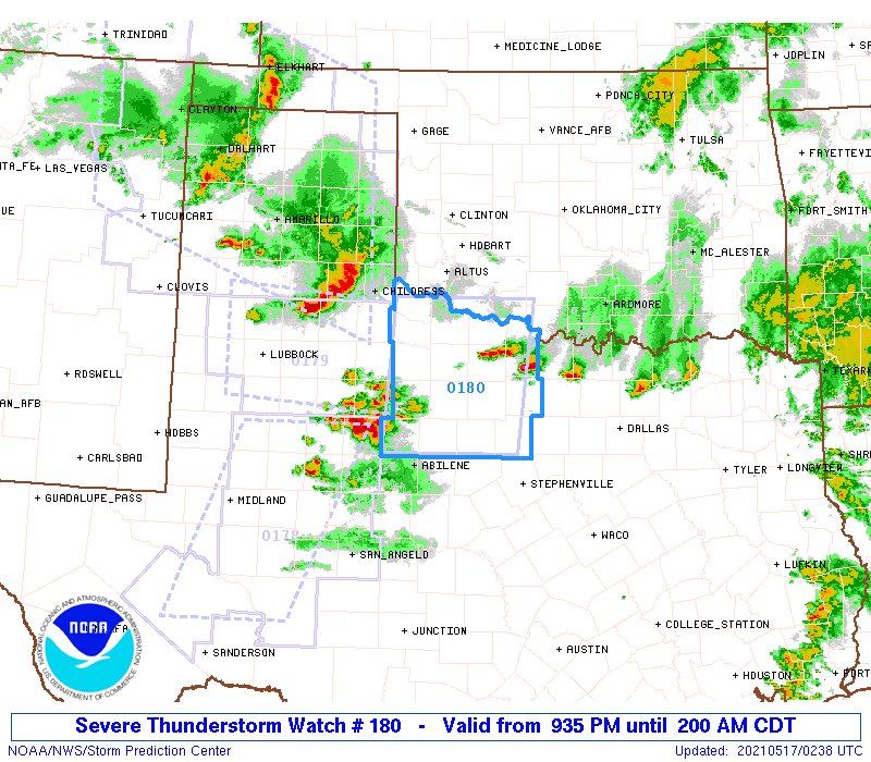
FWD keeping busy with a tornado warning and flash flood warning issued in the last 5 min
0 likes
Winter time post are almost exclusively focused on the DFW area.
-
Haris

- Category 5
- Posts: 1814
- Joined: Mon Nov 27, 2017 8:19 pm
- Location: ( Bee Cave) West Austin, Texas
Re: Texas Spring 2021
bubba hotep wrote:I'm becoming increasingly convinced that this is a historic type event setting up for Texas.

Inclined to believe you after the euro Lol

1 likes
Weather geek and a storm spotter in West Austin. Not a degreed meteorologist. Big snow fan. Love rain and cold! Despise heat!
Re: Texas Spring 2021
BULLETIN - EAS ACTIVATION REQUESTED
Flash Flood Warning
National Weather Service Fort Worth TX
122 PM CDT Sun May 16 2021
The National Weather Service in Fort Worth has issued a
* Flash Flood Warning for...
Western Dallas County in north central Texas...
* Until 430 PM CDT.
* At 122 PM CDT, Doppler radar indicated thunderstorms producing
heavy rain across the warned area. Up to 4 inches of rain has
already fallen near I-30 and Loop 12. Some roads are already
experiencing minor flooding and conditions are expected to worsen.
HAZARD...Flash flooding caused by thunderstorms.
SOURCE...Doppler radar.
IMPACT...Flooding of small creeks and streams, urban areas,
highways, streets, and underpasses as well as other
poor drainage and low lying areas.
0 likes
The above post and any post by Ntxw is NOT an official forecast and should not be used as such. It is just the opinion of the poster and may or may not be backed by sound meteorological data. It is NOT endorsed by any professional institution including Storm2k. For official information, please refer to NWS products.
Help support Storm2K!
Help support Storm2K!
-
bubba hotep
- S2K Supporter
- Posts: 6013
- Joined: Wed Dec 28, 2016 1:00 am
- Location: Collin County Texas
Re: Texas Spring 2021
Rain wrapped tornado in North Dallas!
0 likes
Winter time post are almost exclusively focused on the DFW area.

Re: Texas Spring 2021
I'm about 1 mile W of NorthPark Center in North Dallas and saw what I believe was the circulation move past, west-to-east, about 3 minutes before the warning was issued. Winds were due east for a few minutes (clouds were RACING E-W), then the circulation came past as sort of a dark "mass" within the heavy rain, then they were hard from the west. Very heavy rain throughout. Never saw power flashes or anything that would make me believe there was anything on the ground. I'd been watching that cell move up from SW Dallas Co, and the signature looked suspicious but on RadarScope I can't see velocity so was trusting the folks in the know would issue a warning if needed. 3.58" IMBY - all of it since 11:00a. Hopefully we're going to get a break for a few hours!
5 likes
-
Iceresistance
- Category 5
- Posts: 9579
- Age: 22
- Joined: Sat Oct 10, 2020 9:45 am
- Location: Tecumseh, OK/Norman, OK
Re: Texas Spring 2021
DallasAg wrote:I'm about 1 mile W of NorthPark Center in North Dallas and saw what I believe was the circulation move past, west-to-east, about 3 minutes before the warning was issued. Winds were due east for a few minutes (clouds were RACING E-W), then the circulation came past as sort of a dark "mass" within the heavy rain, then they were hard from the west. Very heavy rain throughout. Never saw power flashes or anything that would make me believe there was anything on the ground. I'd been watching that cell move up from SW Dallas Co, and the signature looked suspicious but on RadarScope I can't see velocity so was trusting the folks in the know would issue a warning if needed. 3.58" IMBY - all of it since 11:00a. Hopefully we're going to get a break for a few hours!
Glad that missed you! And Welcome to the team!
0 likes
Bill 2015 & Beta 2020
Winter 2020-2021
All observations are in Tecumseh, OK unless otherwise noted.
Winter posts are focused mainly for Oklahoma & Texas.
Take any of my forecasts with a grain of salt, refer to the NWS, SPC, and NHC for official information
Never say Never with weather! Because ANYTHING is possible!
Winter 2020-2021
All observations are in Tecumseh, OK unless otherwise noted.
Winter posts are focused mainly for Oklahoma & Texas.
Take any of my forecasts with a grain of salt, refer to the NWS, SPC, and NHC for official information
Never say Never with weather! Because ANYTHING is possible!
-
cheezyWXguy

- Category 5
- Posts: 6281
- Joined: Mon Feb 13, 2006 12:29 am
- Location: Dallas, TX
Re: Texas Spring 2021
DallasAg wrote:I'm about 1 mile W of NorthPark Center in North Dallas and saw what I believe was the circulation move past, west-to-east, about 3 minutes before the warning was issued. Winds were due east for a few minutes (clouds were RACING E-W), then the circulation came past as sort of a dark "mass" within the heavy rain, then they were hard from the west. Very heavy rain throughout. Never saw power flashes or anything that would make me believe there was anything on the ground. I'd been watching that cell move up from SW Dallas Co, and the signature looked suspicious but on RadarScope I can't see velocity so was trusting the folks in the know would issue a warning if needed. 3.58" IMBY - all of it since 11:00a. Hopefully we're going to get a break for a few hours!
This is about what my experience was. Never saw anything on the ground, but a very obviously rotating, very low base with a lot of scud and what appeared to be some weak transient funnels. Passed pretty close to my north.
0 likes


Re: Texas Spring 2021
Agree with Delkus on the astronomical part in short amount of time. Most water in backyard I've seen. :-O
https://twitter.com/wfaaweather/status/1394037719781842950
https://twitter.com/wfaaweather/status/1394037719781842950
1 likes
-
vbhoutex

- Storm2k Executive

- Posts: 29145
- Age: 74
- Joined: Wed Oct 09, 2002 11:31 pm
- Location: Cypress, TX
- Contact:
Re: Texas Spring 2021
This is the latest from Jeff Lindner at Harris County Flood Control. This is mostly SE TX and upper Texas coast centric.
Threat for heavy to excessive rainfall for the next several days.
Flooding and flash flooding threat will be increasing.
Ongoing heavy rainfall and flash flooding to the southwest of Houston will be ending in the next few hours. LNRA rain gage east of Ganado, TX in Jackson County recorded 10.87 inches of rainfall with nearby radar totals of 10-14 inches…much of this falling in a 4-6 hour period. This shows the capability of the air mass we will be dealing with nearly all week and expect additional “big totals” over parts of the area through the week.
Should get a break tonight with the current short wave near Matagorda Bay exiting the area to the east and slight drying of the air column, but next short wave approaches on Monday late morning into the afternoon and expect another flare up of showers and thunderstorms. Meso scale influences such as outflow boundaries will likely to some degree determine where the heaviest rains will fall on Monday and there is not much certainty on where this may occur at this point.
Will likely see another break on Monday night and then additional showers and storms on Tuesday with heating although these may be more scattered in nature.
Wednesday-Thursday:
Concerning period continues to point toward Wednesday into Thursday as the upper low over the SW US ejects toward the central plains and anchors a low level jet feed of moisture into SE TX from the Bay of Campeche. A tropical air mass with PWS of 2.0 inches will surge northward over the western Gulf of Mexico and into our area. Upper level winds become divergent helping to lift the surface moisture into thunderstorms and training of storms from SSW to NNE looks increasingly likely. Potential formation of a coastal trough feature or weak surface low near the lower TX coast only help to further promote rainfall. Since we are still talking 3 days out…don’t want to get carried away with rainfall totals just yet, but some of the global guidance is fairly aggressive and the overall pattern favors heavy rainfall and flash flooding.
Rainfall Amounts:
Additional rainfall amounts on top of wat has fallen will average 4-8 inches over the region with isolated totals of 10-15 inches certainly possible. The expected widespread nature of the rainfall along with potential high hourly rainfall rates of 2-4 inches support rapid onset flash flooding and rises on area watersheds especially our river system.
Hydro:
Rises on area watersheds are likely this week with flooding along area rivers increasing possible as rainfall totals pile up over time. Creeks and bayous in urban areas will tend to respond to the short duration higher rainfall rates and will need to be monitored closely.
1 likes
Skywarn, C.E.R.T.
Please click below to donate to STORM2K to help with the expenses of keeping the site going:

Please click below to donate to STORM2K to help with the expenses of keeping the site going:
-
HockeyTx82
- S2K Supporter
- Posts: 2784
- Joined: Tue Oct 27, 2009 11:17 am
- Location: Ponder, TX
Re: Texas Spring 2021
Quite the line of storms coming out of Oklahoma into NTX
0 likes
Don't hold me accountable for anything I post on this forum. Leave the real forecasting up to the professionals.
Location: Ponder, TX (all observation posts are this location unless otherwise noted)
Location: Ponder, TX (all observation posts are this location unless otherwise noted)
-
bubba hotep
- S2K Supporter
- Posts: 6013
- Joined: Wed Dec 28, 2016 1:00 am
- Location: Collin County Texas
-
HockeyTx82
- S2K Supporter
- Posts: 2784
- Joined: Tue Oct 27, 2009 11:17 am
- Location: Ponder, TX
Re: Texas Spring 2021
My house is shaking, this wind is horrible..... what is going on and why are there no warnings or advisories for this wind. It was enough to wake me up.
Also, weather looks to have ticked up a bit in terms of severity chance today. Don't sleep on it later. Looks to be mainly for hail and some wind.
https://www.spc.noaa.gov/products/outlook/day1otlk.html
Also, weather looks to have ticked up a bit in terms of severity chance today. Don't sleep on it later. Looks to be mainly for hail and some wind.
https://www.spc.noaa.gov/products/outlook/day1otlk.html
0 likes
Don't hold me accountable for anything I post on this forum. Leave the real forecasting up to the professionals.
Location: Ponder, TX (all observation posts are this location unless otherwise noted)
Location: Ponder, TX (all observation posts are this location unless otherwise noted)
-
mcallum177
- Tropical Depression

- Posts: 98
- Joined: Sun Jun 14, 2009 12:39 am
- Location: Dallas, TX
Re: Texas Spring 2021
I'm pretty sure it was a wake meso low, the low level clouds were moving in all directions but no storms.
HockeyTx82 wrote:My house is shaking, this wind is horrible..... what is going on and why are there no warnings or advisories for this wind. It was enough to wake me up.
Also, weather looks to have ticked up a bit in terms of severity chance today. Don't sleep on it later. Looks to be mainly for hail and some wind.
https://www.spc.noaa.gov/products/outlook/day1otlk.html
0 likes
-
Haris
- Category 5
- Posts: 1814
- Joined: Mon Nov 27, 2017 8:19 pm
- Location: ( Bee Cave) West Austin, Texas
Re: Texas Spring 2021

1 likes
Weather geek and a storm spotter in West Austin. Not a degreed meteorologist. Big snow fan. Love rain and cold! Despise heat!
-
rwfromkansas
- Category 5
- Posts: 3023
- Joined: Sat Aug 27, 2005 12:47 am
- Location: North Fort Worth
Re: Texas Spring 2021
Almost up to 2 inches in north Fort Worth. With a lot coming tonight/tomorrow, I think 4-6 inches is pretty much a sure bet, with Dallas likely over 8 most places by the time it's done due to the heavier rain before. DFW will be quite above average here, as well as probably most areas along 35.
0 likes
-
jasons2k

- Storm2k Executive
- Posts: 8290
- Age: 52
- Joined: Wed Jul 06, 2005 12:32 pm
- Location: The Woodlands, TX
Re: Texas Spring 2021
A bit late posting this, but a great discussion from the NWS here in SE Texas:
Area Forecast Discussion
National Weather Service Houston/Galveston TX
427 AM CDT Mon May 17 2021
.DISCUSSION...
We are now firmly into what will be a week-long pattern of
considerably more disturbed weather, complete with multiple rounds
of showers and thunderstorms, some of them with heavy rain
involved, and only brief respites between aforementioned rounds of
rain.
There are a lot of words below that really dig into specifics of
what we`re expecting, why we expect them, and beyond that, what we
can and cannot confidently predict on this early Monday morning.
Please enjoy them for the technical breakdown they are. If you`re
in a hurry, the TL;DR is this: We find ourselves in a very
conducive environment for showers and thunderstorms each day
across Southeast Texas. The Tuesday night through Thursday morning
stretch likely carries the highest threat for flooding rains, but
that threat is not entirely absent any day this week. Please make
it a point to be aware of the weather situation this week and keep
up with the latest forecast information.
.SHORT TERM [Through Tuesday]...
Today will be the second day of the multi-day wet weather pattern
across SE Texas. Another upper level shortwave will round the base
of an upper low located over the Four Corners today and better upper
level diffluence sets up over Southeast TX. Though low level
moisture content will be somewhat less today (roughly around 0.20-
0.30 inches less), the air mass in place continues to be quite
unstable, in particular, during the afternoon to early evening
hours. The 06Z NAM forecast sounding, for example, show MUCAPE
values between the 3000-4000 J/kg around 21-00Z with 0 CIN. It also
contains 700-500MB lapse rates in the 7 C/km range. A pocket of much
drier air lies between the 800-600MB levels with a moisture increase
just above it. It seems that the areas north of I-10 will be the
most vulnerable for todays` weather. Strong gusty winds and hail may
accompany the stronger storms. The potential for minor flooding due
to slow moving storms producing heavy to torrential rainfall is also
possible, though knowing an exact location for it is still hard to
tell. A Flash Flood Watch may be needed, however, models continue to
have difficulty with initiation, timing, and intensity and have thus
decided to wait and see how the weather develops today before
pulling the trigger on the Flash Flood Watch. The potential is
definitely there however, so it is best to stay watchful and ready.
Tuesday will be the third consecutive stormy day given that
Southeast TX will still have the unstable airmass in place while
having a stronger influence with the trough deepening southward as
the upper closed low finally begins to shift and a more favorable
wind pattern for storms develops aloft. There is also a bigger
consensus on strong storm development along a dry line situated
along the TX panhandle and Western TX. Storms amplifying over
Central TX look to propagate into our northern counties sometime in
the afternoon/evening where locally the environment could very well
support their livelihood. Thus, Southeast TX may end up having a
combination of both locally developed storms and storms rolling in
from the NW. Again, the higher PoPs lie along areas north of I-10.
Therefore, if we are able to obtain enough rainfall today to issue a
Flash Flood Watch for our northern counties, then it will be likely
that the Watch will be continued well into Tuesday or Wednesday due
to this second wave of activity across these sectors. WPC has a
Slight Risk for Excessive Rainfall for northern and western portions
of the CWA for Tuesday with a Marginal Risk extending elsewhere. SPC
also has a Slight Risk for Severe Thunderstorms for the northern
portions of the CWA. It will definitely be an interesting couple of
days for us here in SE Texas.
.LONG TERM [Tuesday Night Through Monday]...
From a deterministic standpoint, I`m not sure there`s much that
can be said about this midweek period that I haven`t already
written about in the past few nights. There remains strong model
consensus for an environment conducive to heavy rains across
Southeast Texas deep into this week. Weather will still be driven
by a closed upper low that will definitely overstay its welcome,
if it hasn`t already. Per NAEFS, precipitable water still looks
to rise to around or above the 90th percentile, while an inflow
jet from the Gulf will also start to be nudging up towards the
90th percentile as well. The Euro ensemble is even more
aggressive, with precipitable water exceeding the 99th percentile
and the inflow jet easily exceeding the 90th percentile; perhaps
even beginning the push the 98th percentile.
It seems pretty safe to say that somebody, somewhere in the
eastern half of Texas is going to get slammed with a lot of rain.
The deterministics have actually been trending downward in their
QPF, though trending down from a cumulative 20 inches closer to
"just" a foot doesn`t seem terribly helpful. Location also varies
significantly among the models. The GFS, Canadian, and possibly
the NAM, now that it`s coming into range, tend to favor the
heaviest axis of rain well inland, perhaps even northwest of our
area entirely. The Euro, on the other hand, swings a lobe of
midlevel vorticity further south, and really tries to focus the
action on a coastal trough.
I`m not even sure, given all the mesoscale factors that will
influence rainfall placement and amounts, that these trends are
even real or particularly helpful to the forecast. When it comes
to the big picture, best to focus on the environment and a broad
sketch of the potential than the specifics right now. Yesterday,
even short range CAM guidance struggled mightily with exactly
where and how much rain would fall. What they did show? Potential
for heavy rain somewhere, and where we got heavy rain was around
Matagorda Bay.
There are probably some things we can see as relatively mutually
exclusive. Typically in these setups, convection offshore or near
the coast can rob moisture from areas further inland, cutting off
areas further north from the rich moisture inflow jet. So if
guidance tends to start favoring a coastal trough more, we may
focus our strongest wording there. On the flip side, if
significant coastal convection doesn`t materialize, that would
increase the danger for heavy rains further inland as that rich
Gulf moisture surges north.
We`ll be searching for signs for a specific scenario such as the
couple I`ve laid out here to try to give as much lead time as
possible on where the highest risk is. It is the primary reason
why a flash flood watch is not being issued on this shift, in
hopes that the highest threat area will become apparent to the day
shift (regardless, expect a watch fairly soon - we are running out
of time). But sometimes, mesoscale features are just so
important, and so difficult to forecast at range, that we'll be
refining the forecast right into an event. In other words, to
quote the s c i e n t i s t who must predict the future,
"Sometimes science is so difficult it makes me sad".
Beyond the midweek, there are also not much large-scale change in
the forecast into the upcoming weekend. Even though the main
upper low gets drawn up towards the Great Lakes, remnant vorticity
continues to linger over the area. This should allow the broad
environment to back down from the amped up levels leading to the
heavy midweek rain, but should still support more rounds of
showers and thunderstorms late this week and into the weekend.
Eventually - I promise! - the strong eastern US ridge will build
far enough west to return us to a drier, more typical late spring
setup. This is still not entirely dry...but at least should be
more in the vein of a handful of showers and storms through the
course of a day while most stay dry, rather than widespread
wettings for large swaths of the area.
0 likes
-
TheProfessor

- Professional-Met

- Posts: 3506
- Age: 29
- Joined: Tue Dec 03, 2013 10:56 am
- Location: Wichita, Kansas
Re: Texas Spring 2021
I think I got more rain in 1 week of being in Louisiana than I got 9 months in Miami. Looks like the ridge is a bit further east than expected so we've been getting more rain today. Some of the CAMs are actually a bit concerning showing 5-10" for this area through Wednesday morning.
0 likes
An alumnus of The Ohio State University.
Your local National Weather Service office is your best source for weather information.
Your local National Weather Service office is your best source for weather information.
Return to “USA & Caribbean Weather”
Who is online
Users browsing this forum: Cpv17, rwfromkansas and 211 guests