Tornado outbreak - February 10-11, 8+ dead
Moderator: S2k Moderators
Forum rules

The posts in this forum are NOT official forecast and should not be used as such. They are just the opinion of the poster and may or may not be backed by sound meteorological data. They are NOT endorsed by any professional institution or STORM2K.
-
brunota2003

- S2K Supporter

- Posts: 9476
- Age: 35
- Joined: Sat Jul 30, 2005 9:56 pm
- Location: Stanton, KY...formerly Havelock, NC
- Contact:
Seems I am on the western edge of the SLT risk area. Tomorrow ought to be interesting here near Lawton, OK.
As for last night...storms rolled through around 250 am...woke me up as the wind drove the rain into my window (second story), and got me slightly wet, as I had my window open about two inches. Local airport weather station recorded a wind gust of 53 mph as the line hit.
As for last night...storms rolled through around 250 am...woke me up as the wind drove the rain into my window (second story), and got me slightly wet, as I had my window open about two inches. Local airport weather station recorded a wind gust of 53 mph as the line hit.
0 likes
-
Ed Mahmoud
Re:
CrazyC83 wrote:IMO, all of the 45 - and much of the 30 - should be hatched. I'd almost consider hinting an upgrade to High Risk for the Day 1 tomorrow.
There does seem to be the combination of wind dynamics, fairly low LFCs/LCLs and high instability...
Someone back on page 3 hotlinked a new and wonderful resource I had not seen before, the College of DuPage...


0 likes

-
Ed Mahmoud
Re: Severe weather returns? February 8-12
Giant hail threat as well, meteograms from both WRF and GFS suggest freezing levels down near 6000 feet above surface late tomorrow afternoon.
I got my son's Cub Scout meeting tomorrow night during all the DFW action.
I guess I'll catch up reading the this thread. Thank goodness for whoever it is who has GR3 radar and an imageshack account!
I got my son's Cub Scout meeting tomorrow night during all the DFW action.
I guess I'll catch up reading the this thread. Thank goodness for whoever it is who has GR3 radar and an imageshack account!
0 likes
-
Tampa Bay Hurricane

- Category 5

- Posts: 5597
- Age: 38
- Joined: Fri Jul 22, 2005 7:54 pm
- Location: St. Petersburg, FL
-
srainhoutx

- S2K Supporter
- Posts: 6919
- Age: 68
- Joined: Sun Jan 14, 2007 11:34 am
- Location: Haywood County, NC
- Contact:
Re: Severe weather returns? February 8-12
Dallas/Ft Worth AFD offers some tidbits concerning tomorrow afternoon/evening...snipet...
AREA FORECAST DISCUSSION
NATIONAL WEATHER SERVICE FORT WORTH TX
330 PM CST MON FEB 9 2009
.DISCUSSION...
SEVERE WEATHER EVENT FOR TOMORROW LOOKS PROMISING AND SPC HAS
UPGRADED THE NORTHEAST QUADRANT TO A MODERATE RISK WITH THE REST
OF THE AREA IN A SLIGHT RISK. UPPER LEVEL TROUGH AND SHORTWAVE ARE
CURRENTLY MOVING ACROSS SOUTHERN CALIFORNIA. MODELS ARE IN GOOD
AGREEMENT THAT BULK OF ENERGY ASSOCIATED WITH THE APPROACHING
UPPER LEVEL TROUGH WILL MOVE THROUGH NORTH TEXAS TUESDAY NIGHT. AS
THIS FEATURE APPROACHES WEST TEXAS...IT IS FORECAST TO CLOSE OFF
AND DEEPEN. IN RESPONSE...THE SURFACE LOW OVER THE TX PANHANDLE
IS ALSO FORECAST TO STRENGTHEN AND THIS WILL INCREASE THE WINDS
ACROSS THE REGION TOMORROW. THE GFS IS THE FARTHEST SOUTH IN IT/S
TRACK OF THE UPPER LEVEL LOW BRINGING IT RIGHT OVER NORTH TEXAS
WHILE OTHER MODELS TRACK THE UPPER LEVEL LOW ACROSS OKLAHOMA.
THERE IS HIGH CONFIDENCE THAT A SQUALL LINE WILL DEVELOP TOMORROW
AROUND SUNSET ALONG THE DRYLINE JUST NORTHWEST OF THE CWA. WITH
STRONG DYNAMICAL FORCING AND SUPPORT AND INSTABILITY...THIS
SQUALL LINE SHOULD SUSTAIN ITSELF AS IT TRACKS ACROSS THE CWA
PRODUCING HAIL...DAMAGING WINDS...AND POSSIBLY TORNADOES.
THE QUESTION REMAINS OF EXACTLY WHAT WILL HAPPEN TOMORROW
AFTERNOON BEFORE THE SQUALL LINE ARRIVES. CURRENT THINKING IS THAT
THE AFTERNOON HOURS WILL SEE CONVECTION BUT TIMING AND LOCATION IS
TOO UNCERTAIN TO PINPOINT. THEREFORE...HAVE ADJUSTED TOMORROW
AFTERNOON/S POPS TO 40-50 PERCENT ACROSS THE ENTIRE REGION.
EXTENSIVE CLOUD COVER IS EXPECTED TOMORROW BUT WARM AIR ADVECTION
AND ISENTROPIC LIFTING SHOULD AIDE IN LIFTING PARCELS SUFFICIENTLY
TO PRODUCE THUNDERSTORMS IN THE AFTERNOON. MODELS CONTINUE TO
ADVERTISE GOOD INSTABILITY TOMORROW AFTERNOON WITH SURFACE CAPES
INCREASING TO NEAR 2000 J/KG BY SUNSET...WEAK INHIBITION...AND
SHEAR VALUES ON THE ORDER OF 50-60 KTS WITH STEEP LAPSE RATES IN
THE LOWER AND MID LEVELS. SO ANY CONVECTION THAT DEVELOPS IN THE
AFTERNOON HOURS WILL HAVE THE POTENTIAL TO BECOME SEVERE AND WILL
LIKELY RAPIDLY MOVE OFF TO THE NORTH OR NORTHEAST. HAIL...DAMAGING
WINDS... AND TORNADOES WILL ALSO BE POSSIBLE IN THE AFTERNOON
HOURS.
EVEN WITH CONVECTION AND SEVERE WEATHER DEVELOPING IN THE
AFTERNOON HOURS...STILL REMAIN CONFIDENT THAT UPPER LEVEL SUPPORT
AND FORECASTED SEVERE PARAMETERS WILL SUPPORT A SEVERE SQUALL
LINE OVERNIGHT.
0 likes
-
Shockwave
- Tropical Storm

- Posts: 167
- Joined: Fri Jul 25, 2008 7:33 am
- Location: Lafayette, TN
- Contact:
Re: Severe weather returns? February 8-12
Wednesday: Showers and thunderstorms before 3pm, then showers likely. Some storms could be severe, with damaging winds. High near 64. Windy, with a south wind 25 to 30 mph becoming west. Chance of precipitation is 100%.
Updated outlook from OHX for my area...
0 likes
-
Ed Mahmoud
Re: Severe weather returns? February 8-12
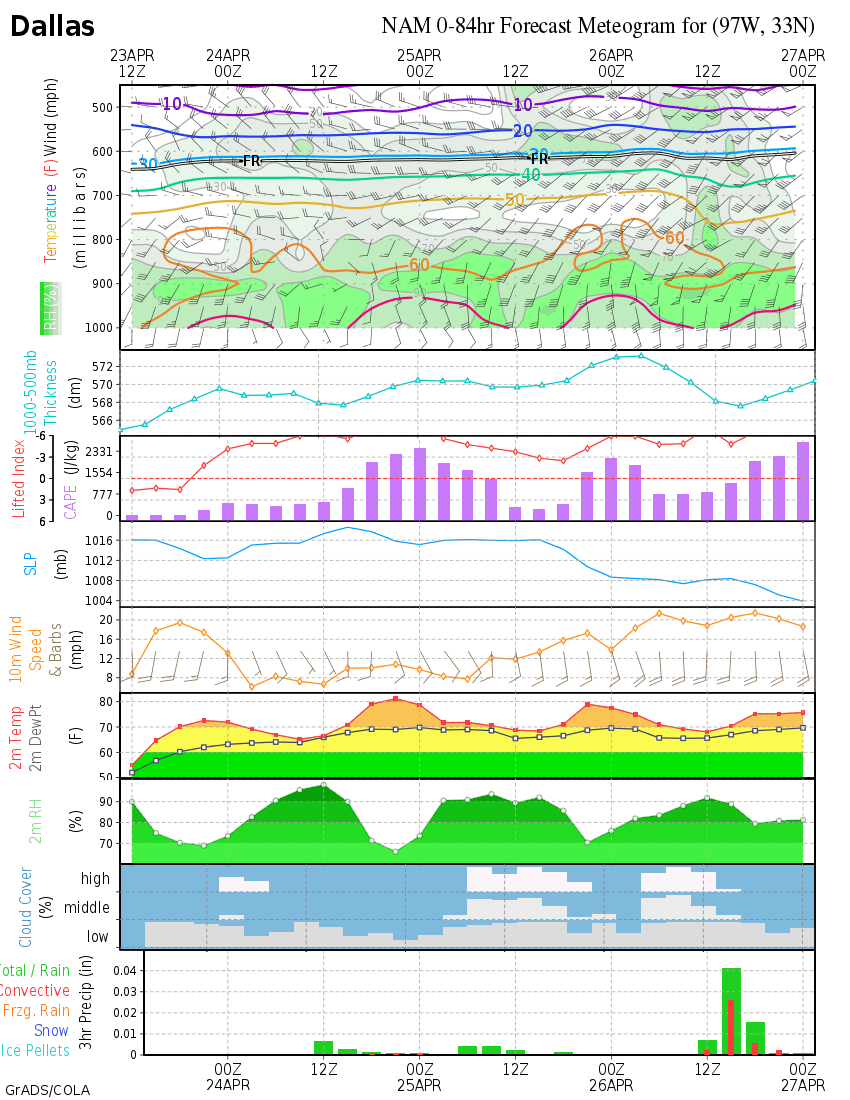
Tomorrow late commute- dinner time,near DFW area.

DFW Metro forecast skew-T's a tiny bit less scary than 12Z, just South of the Metroplex at 6pm looks most impressive...
Decent CAPE, low cloud bases/LFC's, impressive low level shear...

DFW Metro forecast skew-T's a tiny bit less scary than 12Z, just South of the Metroplex at 6pm looks most impressive...
Decent CAPE, low cloud bases/LFC's, impressive low level shear...
0 likes
-
Extremeweatherguy

- Category 5
- Posts: 11095
- Joined: Mon Oct 10, 2005 8:13 pm
- Location: Florida
Re: Severe weather returns? February 8-12
Looks like things will be getting interesting along the dry-line tomorrow afternoon and on into the evening. North Texas and South Oklahoma along the I-35 corridor looks like a prime spot for severe weather IMO, with the threat then spreading east overnight and into Wednesday.
0 likes
-
Ed Mahmoud
Re: Severe weather returns? February 8-12
GFS max action area looks a tad North of WRF, closer to the Red River.
DUA sounding

ETA: Sounding South of Dallas looks more impressive, similar to WRF, but GFS's heaviest rain action, and I assume t-storms, is North of DFW...

DUA sounding
ETA: Sounding South of Dallas looks more impressive, similar to WRF, but GFS's heaviest rain action, and I assume t-storms, is North of DFW...
0 likes
-
CrazyC83
- Professional-Met

- Posts: 34315
- Joined: Tue Mar 07, 2006 11:57 pm
- Location: Deep South, for the first time!
Re: Severe weather returns? February 8-12
Latest parameters for the next couple days - tomorrow not quite as explosive (enough to prevent a high risk probably), but Wednesday looking more interesting:
TOMORROW
EHI - low levels around 3.00, mid-levels around 3.25 (peaking late evening)
Helicity - peaking around 500
CAPE - peaking around 2,250
LI - peaking around -8
WEDNESDAY
EHI - low levels around 1.50, mid-levels around 1.75
Helicity - peaking around 600
CAPE - peaking around 1,500
LI - peaking around -6
0 likes
-
CrazyC83
- Professional-Met
- Posts: 34315
- Joined: Tue Mar 07, 2006 11:57 pm
- Location: Deep South, for the first time!
Re: Severe weather returns? February 8-12
For comparison, here were the parameters for the early season events the last couple years (green - less than forecast for this week, red - more than forecast):
FEBRUARY 24, 2007
EHI - around 4.5
Helicity - around 900
CAPE - around 1,000
LI - around -4
MARCH 1, 2007
EHI - around 5.5
Helicity - around 700
CAPE - around 2,250
LI - around -7
JANUARY 7, 2008
EHI - around 3.5
Helicity - around 600
CAPE - around 1,250
LI - around -5
JANUARY 10, 2008
EHI - around 4.0
Helicity - around 600
CAPE - around 1,000
LI - around -5
FEBRUARY 5, 2008
EHI - around 4.5
Helicity - around 800
CAPE - around 1,500
LI - around -8
FEBRUARY 17, 2008
EHI - around 2.0
Helicity - around 400
CAPE - around 1,000
LI - around -4
0 likes
-
Ed Mahmoud
Re: Severe weather returns? February 8-12
CrazyC83 wrote:Latest parameters for the next couple days - tomorrow not quite as explosive (enough to prevent a high risk probably), but Wednesday looking more interesting:
TOMORROW
EHI - low levels around 3.00, mid-levels around 3.25 (peaking late evening)
Helicity - peaking around 500
CAPE - peaking around 2,250
LI - peaking around -8
WEDNESDAY
EHI - low levels around 1.50, mid-levels around 1.75
Helicity - peaking around 600
CAPE - peaking around 1,500
LI - peaking around -6
Depends on the model of choice, I found EHI's over 3.5 near DFW on the WRF.
0 likes
-
Ed Mahmoud
Re: Severe weather returns? February 8-12
Wednesday, deep layer shear 60 knots plus, and enough instability, Tennessee and Kentucky look like Wednesday's target areas.

Decent mid-level instability, and wicked shear there, but surface instability may be a tad lacking. IMHO, tomorrow may be the more likely tornado day. Looks more like a squall line scenario. But I'm no expert.

Decent mid-level instability, and wicked shear there, but surface instability may be a tad lacking. IMHO, tomorrow may be the more likely tornado day. Looks more like a squall line scenario. But I'm no expert.
0 likes
-
srainhoutx
- S2K Supporter
- Posts: 6919
- Age: 68
- Joined: Sun Jan 14, 2007 11:34 am
- Location: Haywood County, NC
- Contact:
Re: Severe weather returns? February 8-12
Updated WRF run for SPC link for those that might be interested...
http://wwwt.emc.ncep.noaa.gov/mmb/mpyle/cent4km/v2/
http://wwwt.emc.ncep.noaa.gov/mmb/mpyle/cent4km/v2/
0 likes

Return to “USA & Caribbean Weather”
Who is online
Users browsing this forum: Cpv17 and 130 guests