An overall look at the drought conditions in Canada, the United States and Mexico: http://www.ncdc.noaa.gov/img/climate/mo ... urrent.gif Unfortunately the map is currently 1 month behind.
Historical drought maps, to 2003, are also available: http://www.ncdc.noaa.gov/oa/climate/mon ... -2009.html
North American Drought Monitor Thread
Moderator: S2k Moderators
Forum rules

The posts in this forum are NOT official forecast and should not be used as such. They are just the opinion of the poster and may or may not be backed by sound meteorological data. They are NOT endorsed by any professional institution or STORM2K.

-
bob rulz
- Category 5

- Posts: 1711
- Age: 36
- Joined: Sat Jan 28, 2006 7:30 pm
- Location: Salt Lake City, Utah
Re: Re:
vbhoutex wrote:bob rulz wrote:It's been a while since I've looked at that map...I must say it looks much better than it did a year ago.
I guess that would depend on where you live.
I just mean overall there's less drought. With the exception of southern Texas and California, the country looks like it's in fairly good shape right now compared to how it's been not just a year or 2 ago, but even this entire decade.
0 likes
-
SaskatchewanScreamer
I'm amazed that with all the storms Alberta had that it is still in the red, Saskatchewan is looking better though. The drought area below the Great Lakes worsening was also a surprise (the radar has shown a lot of storms going over that area).
And given the deep red over Texas vbhoutex you really should be doing your rain dance above outside!!!
[img]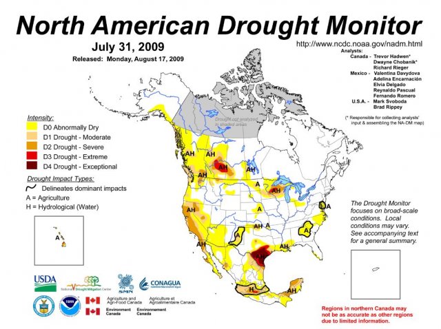
And given the deep red over Texas vbhoutex you really should be doing your rain dance above outside!!!
[img]

0 likes
-
vbhoutex

- Storm2k Executive

- Posts: 29147
- Age: 74
- Joined: Wed Oct 09, 2002 11:31 pm
- Location: Cypress, TX
- Contact:
Re: Re:
bob rulz wrote:vbhoutex wrote:bob rulz wrote:It's been a while since I've looked at that map...I must say it looks much better than it did a year ago.
I guess that would depend on where you live.
I just mean overall there's less drought. With the exception of southern Texas and California, the country looks like it's in fairly good shape right now compared to how it's been not just a year or 2 ago, but even this entire decade.
You are correct. I think everyone shipped their drought to Texas.
SS they keep making me go back inside when I dance in the street in my speedo!!


0 likes
-
southerngale

- Retired Staff

- Posts: 27418
- Joined: Thu Oct 10, 2002 1:27 am
- Location: Southeast Texas (Beaumont area)
Re: Re:
vbhoutex wrote:SS they keep making me go back inside when I dance in the street in my speedo!!
I can't imagine why.


0 likes
-
SaskatchewanScreamer


-
SaskatchewanScreamer
Can't lift an image on this computer but what a difference since 2009:
http://www.ncdc.noaa.gov/temp-and-preci ... itted=true
Now to find a map that shows areas with too much water.
http://www.ncdc.noaa.gov/temp-and-preci ... itted=true
Now to find a map that shows areas with too much water.
0 likes
's ok they seem to release the NA less often than the US one. The latest NA they have is Ap 30.
current US monitor
current US monitor
0 likes
-
SaskatchewanScreamer
Has anyone looked at the North American drought monitor map lately? With a *little* bit of imagination (and turning one's head sideways) it looks like a dragon is down there.
http://www1.ncdc.noaa.gov/pub/data/cmb/drought/nadm/nadm-201108.jpg
As mentioned above this map isn't right up-to-date as is the U.S. one.
http://www1.ncdc.noaa.gov/pub/data/cmb/drought/nadm/nadm-201108.jpg
As mentioned above this map isn't right up-to-date as is the U.S. one.
0 likes
-
SaskatchewanScreamer
Drought has now spread from Texas up to Manitoba/Ontario.
http://www.ncdc.noaa.gov/temp-and-precip/drought/nadm/nadm-maps.php?lang=en&year=2011&month=9&submitted=true
Again map is a month out.
http://www.ncdc.noaa.gov/temp-and-precip/drought/nadm/nadm-maps.php?lang=en&year=2011&month=9&submitted=true
Again map is a month out.
0 likes
Return to “USA & Caribbean Weather”
Who is online
Users browsing this forum: Cpv17, Stratton23, txtwister78 and 98 guests