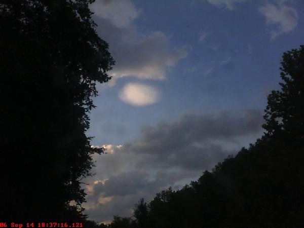
I thought I would post this here, as some of you might like this. I love taking time-lapse videos with my webcam here in east-central Kentucky, and today I captured what appeared to be a small lenticular cloud. There are 3 types of lenticular clouds, stratocumulus standing lenticularis, altocumulus standing lenticularis, and cirrocumulus standing lenticularis...my local weather office and I both agreed that this particular cloud appears to be above the altocumulus level, which would make it a cirrocumulus standing lenticularis. The CCLS is rare, and generally occur between 18,000 ft and 40,000 ft. In this particular case, east-central Kentucky does not have really tall mountains...so this cloud may have been caused by upper level turbulence from today's thunderstorms. If this was a CCLS, I would guess it was a good capture!

Here is a still shot of the cloud:
Here is a short YouTube video of the time-lapse, for some reason YouTube likes playing the videos in low quality, so click the gear looking button in the bottom right to increase the quality (remember though, this was taken using a webcam, so it isn't going to be the best image quality ever!)
[youtube]http://www.youtube.com/watch?v=1t5wvVK-jWs[/youtube]


