Xenia Tornado April 4, 1974 (30 Year Anniversary)
Moderator: S2k Moderators
Forum rules

The posts in this forum are NOT official forecast and should not be used as such. They are just the opinion of the poster and may or may not be backed by sound meteorological data. They are NOT endorsed by any professional institution or STORM2K.
-
ohiostorm

- Category 5

- Posts: 1582
- Age: 41
- Joined: Sat Oct 12, 2002 2:51 pm
- Location: Orlando, FL
- Contact:
Xenia Tornado April 4, 1974 (30 Year Anniversary)
30 year anniversary of the Xenia Tornado coming here this weekend. Any one have any info on it? Pass it along.
Last edited by ohiostorm on Sat Apr 03, 2004 12:47 pm, edited 2 times in total.
0 likes
-
GalvestonDuck
- Category 5
- Posts: 15941
- Age: 58
- Joined: Fri Oct 11, 2002 8:11 am
- Location: Galveston, oh Galveston (And yeah, it's a barrier island. Wanna make something of it?)
I remember the Super Outbreak when I was younger and living in Louisville. Actually, I was only 6 when it happened.
And I could have sworn I just turned 36 on my birthday a couple of weekends ago.
(IOW -- 30th anniversary, not 40th. )
)
Great link -- http://www.april31974.com/
And I could have sworn I just turned 36 on my birthday a couple of weekends ago.
(IOW -- 30th anniversary, not 40th.
Great link -- http://www.april31974.com/
0 likes
-
azskyman

- S2K Supporter

- Posts: 4104
- Joined: Thu Mar 13, 2003 7:36 am
- Location: Scottsdale Arizona
- Contact:
Actually, it is the 30th anniversary...but it is still very fresh in my memory.
I participated in a seminar and forum about that historic day in Ohio...must have been the 20th anniversary, about 1994. Met up with some folks who witnessed it first hand.
That was one incredible day. I have a framed black and white glossy satellite photo of the storms at the time that Xenia was being hit. Unfortunately it, along with a number of super weather photos, are back in Illinois where I can't get at them til my next trip...June of this year.
0 likes
-
Guest
Hey Luke! Good to see you!
Not sure if you have seen this site. Probably have but it has some related info on the event! Hope this helps!
http://www.erh.noaa.gov/iln/supoutbr.htm
I will pass more links along as i come across them! Have a few just a matter of finding them!
Not sure if you have seen this site. Probably have but it has some related info on the event! Hope this helps!
http://www.erh.noaa.gov/iln/supoutbr.htm
I will pass more links along as i come across them! Have a few just a matter of finding them!
0 likes
-
therock1811

- Category 5
- Posts: 5163
- Age: 40
- Joined: Thu May 15, 2003 2:15 pm
- Location: Kentucky
- Contact:
Here's some info about the 1974 outbreak in general, and the Sayler Park, Ohio F5 in particular...
http://www.shorstmeyer.com/tornadoes/index.html
Click where it says 1974 to read about the 1974 Sayler Park tornado, and there's some stats about other tornadoes of the 1974 outbreak as well as the five links at the top of the page about Xenia...
http://www.shorstmeyer.com/tornadoes/index.html
Click where it says 1974 to read about the 1974 Sayler Park tornado, and there's some stats about other tornadoes of the 1974 outbreak as well as the five links at the top of the page about Xenia...
0 likes

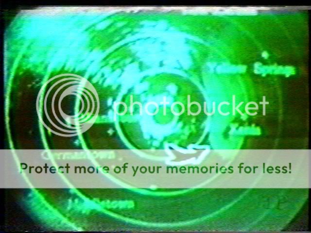
Here is a radar scope photograph from the Cincinnati area WSR-57 at about 3 PM that afternoon. I overlayed a map for easier reference of the cells. You can clearly see that there is four supercells in the image, and the three Indiana cells were producing tornadoes at the time of the image.

This one is zoomed-in and much sharper

Here is two images from the WHIO-TV radar. First is on the 50 mile scope, second is about 25 miles

Tornado is just southwest of Xenia in this image...
Here is some related links to the outbreak:
Pages from NOAA
http://www.publicaffairs.noaa.gov/storms/index.html
http://www.publicaffairs.noaa.gov/storms/boyd.html
WFO North Webster, IN
http://www.crh.noaa.gov/iwx/events/Supe ... ndex.shtml
WFO Louisville, KY
http://www.crh.noaa.gov/lmk/1974tor-30th-anniv.htm
WFO Huntsville, AL
http://www.srh.noaa.gov/hun/April1974/a ... break.html
WFO Birmingham, AL
http://www.srh.noaa.gov/bmx/april1974/a ... break.html
Scott Koene's site
http://www.april31974.com
Steve Horstmeyer's site (WKRC-TV Cincinnati meteorologist)
http://www.shorstmeyer.com/tornadoes/1974.html
http://www.shorstmeyer.com/tornadoes/1974_stats.html
Kitty Merchant's site
http://kitty.net.tripod.com/321/id10.html
Homer G. Ramby's site
http://www.interaxs.net/pub/hgr/tornado.htm (link appears broken at this time)
NCDC site
http://lwf.ncdc.noaa.gov/oa/climate/ext ... s0499.html (large map and case study)
This one is zoomed-in and much sharper
Here is two images from the WHIO-TV radar. First is on the 50 mile scope, second is about 25 miles
Tornado is just southwest of Xenia in this image...
Here is some related links to the outbreak:
Pages from NOAA
http://www.publicaffairs.noaa.gov/storms/index.html
http://www.publicaffairs.noaa.gov/storms/boyd.html
WFO North Webster, IN
http://www.crh.noaa.gov/iwx/events/Supe ... ndex.shtml
WFO Louisville, KY
http://www.crh.noaa.gov/lmk/1974tor-30th-anniv.htm
WFO Huntsville, AL
http://www.srh.noaa.gov/hun/April1974/a ... break.html
WFO Birmingham, AL
http://www.srh.noaa.gov/bmx/april1974/a ... break.html
Scott Koene's site
http://www.april31974.com
Steve Horstmeyer's site (WKRC-TV Cincinnati meteorologist)
http://www.shorstmeyer.com/tornadoes/1974.html
http://www.shorstmeyer.com/tornadoes/1974_stats.html
Kitty Merchant's site
http://kitty.net.tripod.com/321/id10.html
Homer G. Ramby's site
http://www.interaxs.net/pub/hgr/tornado.htm (link appears broken at this time)
NCDC site
http://lwf.ncdc.noaa.gov/oa/climate/ext ... s0499.html (large map and case study)
0 likes


The main reason for the location of the tornado and the shape of the supercell is related to the updraft and wind shear. Once the updraft develops, the wind shear (comprised of a directional change with height and increase of speed with height) helps to push the heavier precipitation away from the developing updraft (often to the northeast, for storms traveling southwest to northeast). With the strengthening updraft and wind shear, the area where the tornado develops is often rain-free (but not always). Most tornadoes develop at the base of the updraft. While there are a number of good ideas on tornadogenesis, no one knows all the exact way tornadoes form (there is likely more than one). As for the rear-flank downdraft, it is believed that this can help induce tornado formation. It probably doesn't determine storm structure, however.
0 likes
I found some videos and an audio file yesterday while visiting WHAS-TV's (Louisville, KY) website.
http://www.whas11.com/weather/tornado/index.html
The video files (Windows Media Video format) cover the 30th anniversary special, 25th anniversary and 10th anniversary specials that the station did. There is also two files that show actual news coverage of the Louisville tornadoes, and others in the "Kentuckiana" region. The audio file is from a special that WHAS radio did, which includes the actual radio broadcast from when the tornado was moving through Louisville.
0 likes
-
vbhoutex

- Storm2k Executive

- Posts: 29149
- Age: 74
- Joined: Wed Oct 09, 2002 11:31 pm
- Location: Cypress, TX
- Contact:
The thing I remember more than anything about the Xenia tornado is the utter destruction it caused. Even though I had had a definite interest in the weather prior to that, it is one of the events that brought into focus for me what a ferocious horrible monster a tornado is.
0 likes
Skywarn, C.E.R.T.
Please click below to donate to STORM2K to help with the expenses of keeping the site going:

Please click below to donate to STORM2K to help with the expenses of keeping the site going:

Awesome links guys, thanks! It's enough to keep me busy all day!
Polarbear, I remember when you posted those images last year, which I printed and have been part of my wall collection ever since. They're great, thanks a bunch!
Last year we took a detour through Xenia on a trip back from Ohio. The first thing I noticed when driving in from Rt.42 is a prominent "Tornado Shelter" sign. They are highly prepared, and rightly so. Also took some pics of the memorial.
0 likes
isobar wrote:The first thing I noticed when driving in from Rt.42 is a prominent "Tornado Shelter" sign.
I've visited the Air Force Museum in Dayton a few times, and always walk by a door that is marked with a sign that says "Tornado Shelter" with instructions. I believe it is after you pass the gift shop (from the front entrance), and turn left.
While Xenia was devastated by their tornado, I believe it somewhat overshadowed some of the other very destructive tornadoes that day (Cincinnati, Louisville and Huntsville were major cities also hit).
Some interesting facts...
The storm developed just north of Cincinnati and tracked northeast. A tornado warning was issued for Montgomery and Greene counties in Ohio at about 3:20 PM EST, giving the city of Xenia a 15-20 minute lead-time on the tornado. The warning was based on the Dayton Weather Service Office examining the facsimile chart from the Cincinnati radar and calling the Cincinnati office for their interpretation of the storm. Neither office was exactly sure whether the storm would become tornadic, as they really couldn't see a hook echo. The decision was made to issue the warning anyway. You can clearly see a hook echo on the WHIO-TV radar, but it wasn't nearly as evident on the Cincinnati WSR-57.
In Cincinnati, the Weather Service office was aware that a tornadic storm was approaching the the area. Radio reports indicated "funnels dipping up and down" in southeast Indiana. The weather office spotted a funnel cloud touching down about 13 miles southwest of the Greater Cincinnati Airport at about 4:10 PM EST. Hamilton County civil defense director Liore Maccarone is informed of the approaching severe weather through the National Warning System (NAWAS). Maccarone radios the Cincinnati weather service for the location of the tornado. It is "thirteen mile southwest of Greater Cincinnati Airport, moving northeast at 50 mph". For the first time in seventeen years, the civil defense sirens begin sounding in Hamilton County. The first tornado passes four miles west of the Greater Cincinnati Airport before ripping through Sayler Park and the western suburbs of Cincinnati. As this tornado was weakening, a second funnel touches down and becomes a tornado in Elmwood Place (just north of downtown) and tracks northeast through the northeast suburbs and into the Mason area.
In Louisville, the Weather Service office at Standiford Field received a report of a tornado near Hardinsburg. It is moving northeast at 45 to 50 mph. They begin typing up a Tornado warning for Jefferson, Meade, Bullitt and Hardin counties in Kentucky, as well as Harrison, Floyd and Clark counties in Indiana (in effect until 5 PM). By the time the warning is out on the teletype circuit, the tornado is bearing down on Brandenburg. Meteorologist Dave Reeves phones civil defense and urges the sounding of the sirens in Jefferson county (Louisville). Chief Meteorologist John Burke is on the phone with WHAS radio as the funnel touches down at Standiford field and heads northeast towards downtown. SKYWatch 84 traffic reporter (for WHAS) Dick Gilbert relays reports of the tornado from the air as it tears through the city. Another storm is indicated by radar to possibly produce tornadoes later moves through the southern Louisville area, but does not produce a tornado. Most of these storms from southern Indiana to Kentucky and Ohio had echo tops to 60,000 feet or more.
0 likes
-
Skywatch_NC

- Category 5
- Posts: 10949
- Joined: Wed Feb 05, 2003 9:31 pm
- Location: Raleigh, NC
- Contact:
I remember you telling me about that, Eric.
Here's a map of Hamilton County tornadoes since 1950, for those interested
http://albums.photo.epson.com/j/ViewPho ... p=67653486
Sayler Park is located where the tornado labeled "F5" crosses the Ohio River, on the Ohio side, of course. The second tornado, labeled "F4" actually started while the previous tornado was still in progress.
0 likes
Return to “USA & Caribbean Weather”
Who is online
Users browsing this forum: A1A, AnnularCane, Captmorg70, Cpv17, South Texas Storms and 144 guests