But first before we get into that; let’s learn how to predict daily MAX temperatures using geopotential thicknesses.
Geopotential thicknesses are used to define the difference in geopotential height between two specified layers and will be proportional to the mean VIRTUAL temperature within the layers in question. Thicknesses may also be used to determine areas of temperature and moisture advection. For example warm air will have a higher thickness b/c it is not as dense and expands, while cold air will have the opposite (lower thickness) since it’s more dense and sinks.
Normally most forecasters are concerned with 1000-500mb for reasons such as deciding precipitation type during the winter as well as the separation of air masses from one another. The 510 meter thickness line will normally separate ARTIC air from polar air, the 540 meter line is normally the rain/snow cutoff line (rain south of the line and snow north) and the 570 meter line is the demarcation boundary between tropical and mid latitude air masses. These (510, 540, 570 meter) thickness lines will usually appear in most plots as SOLID lines, while other thickness lines will be DASHED.
Here, we are focusing on lower-level partial thicknesses to determine MAX temps. Or more specifically, we’re using the thickness of the 1000-850mb layer to forecast the daily maximum temperature.
Massie and Rose (1997) first studied the use of ETA-forecasted low level thicknesses in forecasting Daily MAX temperatures, but the regression equation which was derived from the data in the study was NOT proportional to the time of the year. A later study focused on the collection of data from 802 days with 65% of total sun.
A new set of regression equations were developed from the data which relates the Daily maximum temperature (Tmax) to the 1000-850mb thickness value and the time of year (i.e. sun angle). The Equations are listed as follows:
Winter: Tmax = 0.36 * Thk 850-1000mb – 422
Spring: Tmax = 0.33 * Thk 850-1000mb – 381
Summer: Tmax = 0.30 * Thk 850-1000mb – 338
Fall: Tmax = 0.35 * Thk 850-1000mb – 414
Where, Tmax is the Maximum daily temperature, Thk 850-1000mb is the 1000-850mb thickness value (in meters).
Back to the heat in the SE. This afternoons ETA had widespread 850H temps of > 20 DEG C over the region with an area of +22 to +23 DEG C over interior SC and East-central GA as noted at the beginning of the post.

Meanwhile, LLVL thickness values are PROGGED between 1435 and 1450 meters with the HIGHEST values centered over Interior SC and E central GA. Using the methods we have discussed above for determining the MAX temperature based on these values, areas could see Highs up to 97F !!
850H temps of +20-23 DEG C suggest 95-100F (35-38 DEG C) given near full sun in all locations. This also is proportionate with what the low level thicknesses would suggest.
There will be a mean NW flow in the lower levels which is a strong downsloping component east of the Appalachians and could POSSIBLY boost temps up above 100F in some areas.
It will be harder further north to get the FULL potential out of the warm 850mb temps due to cloud debits or anvil blow off from possible ongoing MCS over the northern Mid Atlantic. Thus, it will be warmer further south into the Carolinas where there will be more sun and stronger surface heating.
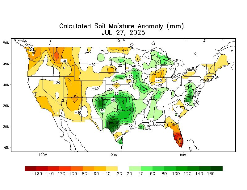
Soil moisture is still somewhat LOW over the Carolinas and Georgia which will add to the excessive heat potential.

In summary, I expect WIDESPREAD 95-100F readings over the SE on WED afternoon w/ a few areas possibly exceeding 100F. With the northwest flow, dewpoints may be lower over the interior portions of the Carolinas and GA (perhaps in the Upper 60s or lower 70s) which should cut down on the heat index, keeping it within a few degrees of the Actual temperature.
Records for the day may be in trouble as well in the warmer locations.
MAV numbers at CLT, GSP, CHS, and NBC suggest 90s to 100F as well. With lower dewpoints inland and OPPRESSIVE numbers closer to the coast. It is in those locations where heat index values could reach dangerous levels given the combination of the abundant moisture and VERY high temps.
http://www.nws.noaa.gov/cgi-bin/mos/get ... S&sta=KGSP


