SPC issues slight risk of severe wx for South/Southeast Tx

U.S. & Caribbean Weather Discussions and Severe Weather Events

Moderator: S2k Moderators

Forum rules

The posts in this forum are NOT official forecast and should not be used as such. They are just the opinion of the poster and may or may not be backed by sound meteorological data. They are NOT endorsed by any professional institution or STORM2K.

Help Support Storm2K
Message
Author
User avatar
wxman22
Category 5
Category 5
Posts: 1493
Joined: Mon Jan 30, 2006 12:39 am
Location: Wichita Falls, TX
Contact:

SPC issues slight risk of severe wx for South/Southeast Tx

#1 Postby wxman22 » Sun Apr 23, 2006 5:40 am

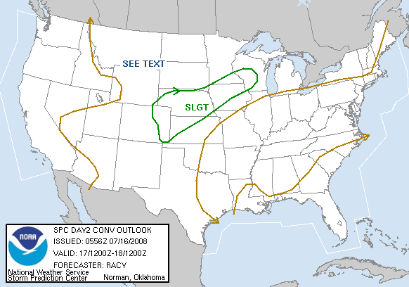
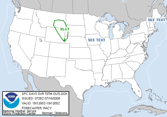
Looks like the Spc has issued a chance of severe wx tuesday also what catches my eye is that they have allready placed a 30% chance over us thats high for the 3 day outlook...:

Image


Image


DAY 3 CONVECTIVE OUTLOOK
NWS STORM PREDICTION CENTER NORMAN OK
0245 AM CDT SUN APR 23 2006

VALID 251200Z - 261200Z

...THERE IS A SLGT RISK OF SVR TSTMS ACROSS WRN AND CENTRAL GULF
COAST STATES...

...SYNOPSIS...
STRONG NRN STREAM MID/UPPER LEVEL TROUGH CENTERED OVER NRN GREAT
LAKES 12Z TUESDAY EXPECTED TO UNDERGO FURTHER INTENSIFICATION AS IT
TRACKS EWD BECOMING NEGATIVELY TILTED ACROSS QUEBEC/NERN STATES
DURING DAY 3 FORECAST PERIOD. SRN STREAM SHORT WAVE TROUGH
INITIALLY OVER CENTRAL/SRN HIGH PLAINS WILL WEAKEN AS IT MOVES EWD
INTO CONFLUENT FLOW REGIME OVER LOWER MO/MID MS VALLEYS.

PROGRESSIVE COLD FRONT ASSOCIATED WITH STRONG NRN STREAM TROUGH
SHOULD EXTEND FROM THE LOWER GREAT LAKES/UPPER OH VALLEY SWWD
THROUGH THE TN VALLEY TO SRN AR AND CENTRAL TX AT 12Z TUESDAY. THIS
FRONT IS EXPECTED TO ADVANCE E/SE ACROSS THE REMAINDER OF THE ERN/
SRN U.S. DAY 3...AND SHOULD EXTEND FROM THE MID-ATLANTIC STATES TO
SRN AL/MS INTO SRN TX BY LATE TUESDAY AFTERNOON...BEFORE MOVING INTO
THE ATLANTIC AND GULF OF MEXICO TUESDAY NIGHT.

...GULF COAST STATES...
BAND OF 40-50 KT WSWLY MID-LEVEL FLOW IS EXPECTED TO EXTEND FROM NRN
MEXICO ACROSS SRN PLAINS TO MID-ATLANTIC/SERN STATES CONTRIBUTING TO
STRONG DEEP LAYER SHEAR FROM CENTRAL/SRN TX EWD TO GA. TSTMS SHOULD
BE ONGOING TUESDAY MORNING ALONG EXTENT OF COLD FRONT FROM CENTRAL
APPALACHIANS/TN VALLEY SWWD TO CENTRAL TX.

MOIST AIR MASS S OF COLD FRONT COMBINED WITH SURFACE HEATING
EXPECTED TO RESULT IN SUFFICIENT DESTABILIZATION FOR ADDITIONAL
THUNDERSTORMS AS COLD FRONT ADVANCES SE/S. STEEP LAPSE RATES
REMAINING OVER CENTRAL/SRN TX EXPECTED TO CONTRIBUTE TO GREATEST
INSTABILITY OVER THIS PORTION OF THE SLIGHT RISK...WHILE SELY
LOW-LEVEL WINDS AID IN STRONGER DEEP LAYER SHEAR OVER THIS REGION.
THUS...GREATEST CONCENTRATION OF SEVERE STORMS EXPECTED TO BE OVER
SRN-SERN TX TUESDAY AFTERNOON/EVENING.

FARTHER EAST INTO CENTRAL GULF COAST STATES...INSTABILITY MAY BE
SOMEWHAT WEAKER...BUT DEEP LAYER SHEAR WILL BE SUPPORTIVE FOR SEVERE
WEATHER ACROSS THIS PART OF THE SLIGHT RISK AS WELL.

...CAROLINAS...
DESPITE WEAK INSTABILITY IN ADVANCE OF THE COLD FRONT...DEEP LAYER
SHEAR EXPECTED TO BE STRONG ENOUGH FOR A FEW ORGANIZED SEVERE STORMS
BEFORE THE COLD FRONT MOVES OFFSHORE TUESDAY EVENING.

..PETERS.. 04/23/2006
0 likes   

User avatar
cheezyWXguy
Category 5
Category 5
Posts: 6108
Joined: Mon Feb 13, 2006 12:29 am
Location: Dallas, TX

#2 Postby cheezyWXguy » Sun Apr 23, 2006 7:33 am

apparently tomorrow will bring me severe weather...I have a 30% hatched area over my head...finally some real severe weather
0 likes   

User avatar
Yankeegirl
Category 5
Category 5
Posts: 3417
Age: 49
Joined: Sun May 23, 2004 11:59 pm
Location: Cy-Fair, Northwest Houston
Contact:

#3 Postby Yankeegirl » Sun Apr 23, 2006 9:55 am

The rain chances here for the Houston area have gone up for the past few days... I noticed that the rain chances for Tuesday night are now at 50/50, which last night they were only at 20% ... I guess its looking better for some mid week rain and storms...
0 likes   

User avatar
Extremeweatherguy
Category 5
Category 5
Posts: 11095
Joined: Mon Oct 10, 2005 8:13 pm
Location: Florida

#4 Postby Extremeweatherguy » Sun Apr 23, 2006 10:02 am

looks like Tuesday afternoon/evening will be the times to watch. This will also occur during PERFECT heating time (likely between 2pm and 9pm). I have the feeling that this could be one of the best SE Texas severe days in awhile.
0 likes   

User avatar
Extremeweatherguy
Category 5
Category 5
Posts: 11095
Joined: Mon Oct 10, 2005 8:13 pm
Location: Florida

#5 Postby Extremeweatherguy » Sun Apr 23, 2006 1:22 pm

I also want to point out this:

DAY 4-8 CONVECTIVE OUTLOOK
NWS STORM PREDICTION CENTER NORMAN OK
0358 AM CDT SUN APR 23 2006

VALID 261200Z - 011200Z

...DISCUSSION...
MEDIUM RANGE MODELS CONTINUE TO SUGGEST SRN PART OF UPPER TROUGH...
CURRENTLY LOCATED OVER THE NERN PACIFIC /S OF AK/...WILL BECOME A
CUT-OFF LOW ACROSS THE SWRN STATES DURING DAYS 4-5 /WED-THU/.
DESPITE MODELS DIFFERENCES BEYOND DAY 5 WITH THE EWD MOVEMENT OF
THIS SYSTEM...SWLY MID-LEVEL FLOW ACROSS SRN PLAINS SHOULD PROMOTE
MOISTURE RETURN INTO THIS REGION...WITH POTENTIAL FOR A FEW SEVERE
STORMS DAYS 5-7 /THU-SAT/...MAINLY ACROSS TX
.

HOWEVER...GIVEN MODEL UNCERTAINTIES WITH EWD MOVEMENT OF CLOSED
LOW...PREDICTABILITY FOR A GREATER SEVERE THREAT/REGIONAL SEVERE
WEATHER AREA IS TOO LOW TO DELINEATE.

..PETERS.. 04/23/2006


Looks like it will not just be Tuesday, but instead Days 3-7 that all have the risk to be active here in the lone star state!
0 likes   

User avatar
PTrackerLA
Category 5
Category 5
Posts: 5277
Age: 41
Joined: Thu Oct 10, 2002 8:40 pm
Location: Lafayette, LA

#6 Postby PTrackerLA » Sun Apr 23, 2006 1:33 pm

Hopefully we get some decent rains with this tuesday system. Only picked up .41" of rain Tuesday which makes a total of .56" since March 1. Hopefully we'll get the soaker that we desperately need this week.
0 likes   

User avatar
Yankeegirl
Category 5
Category 5
Posts: 3417
Age: 49
Joined: Sun May 23, 2004 11:59 pm
Location: Cy-Fair, Northwest Houston
Contact:

#7 Postby Yankeegirl » Sun Apr 23, 2006 6:33 pm

Tuesday is cool. I am off of work that day!!
0 likes   

User avatar
jasons2k
Storm2k Executive
Storm2k Executive
Posts: 8245
Age: 51
Joined: Wed Jul 06, 2005 12:32 pm
Location: The Woodlands, TX

#8 Postby jasons2k » Sun Apr 23, 2006 7:11 pm

Extremeweatherguy wrote:looks like Tuesday afternoon/evening will be the times to watch. This will also occur during PERFECT heating time (likely between 2pm and 9pm). I have the feeling that this could be one of the best SE Texas severe days in awhile.


Yep, hopefully the timing will be good for a change :-)
0 likes   

User avatar
southerngale
Retired Staff
Retired Staff
Posts: 27418
Joined: Thu Oct 10, 2002 1:27 am
Location: Southeast Texas (Beaumont area)

#9 Postby southerngale » Sun Apr 23, 2006 10:17 pm

Hopefully, it will be more than 30 seconds of rain this time. We didn't even get the burn bans lifted with the lightning fast shower the other day. I can live without the severe...wouldn't be too great with the damaged homes/roofs still here. I'm really not sure what those blue roofs can handle though.
Oh, and Tuesday and Wednesday evenings are out...I have outdoor plans. So jschlitz and Extreme...would ya mind arranging this around that and meeting my other requests? :wink: Thanks!
0 likes   

User avatar
Extremeweatherguy
Category 5
Category 5
Posts: 11095
Joined: Mon Oct 10, 2005 8:13 pm
Location: Florida

#10 Postby Extremeweatherguy » Sun Apr 23, 2006 10:59 pm

southerngale wrote:Hopefully, it will be more than 30 seconds of rain this time. We didn't even get the burn bans lifted with the lightning fast shower the other day. I can live without the severe...wouldn't be too great with the damaged homes/roofs still here. I'm really not sure what those blue roofs can handle though.
Oh, and Tuesday and Wednesday evenings are out...I have outdoor plans. So jschlitz and Extreme...would ya mind arranging this around that and meeting my other requests? :wink: Thanks!
Hmm..I can try. Let me just put in a quick call to mother nature and get that arranged for you. :wink: lol.
0 likes   

User avatar
jasons2k
Storm2k Executive
Storm2k Executive
Posts: 8245
Age: 51
Joined: Wed Jul 06, 2005 12:32 pm
Location: The Woodlands, TX

#11 Postby jasons2k » Mon Apr 24, 2006 9:37 am

Extremeweatherguy wrote:
southerngale wrote:Hopefully, it will be more than 30 seconds of rain this time. We didn't even get the burn bans lifted with the lightning fast shower the other day. I can live without the severe...wouldn't be too great with the damaged homes/roofs still here. I'm really not sure what those blue roofs can handle though.
Oh, and Tuesday and Wednesday evenings are out...I have outdoor plans. So jschlitz and Extreme...would ya mind arranging this around that and meeting my other requests? :wink: Thanks!
Hmm..I can try. Let me just put in a quick call to mother nature and get that arranged for you. :wink: lol.


:lol:
0 likes   

User avatar
Extremeweatherguy
Category 5
Category 5
Posts: 11095
Joined: Mon Oct 10, 2005 8:13 pm
Location: Florida

#12 Postby Extremeweatherguy » Mon Apr 24, 2006 9:55 am

Image

Looks like we are still under a slight risk for tomorrow. Models continue to support a blow up of storms on Tuesday evening and lasting through Wednesday morning and upper dynamics look pretty good for severe storms. Can't wait to see the SPC Day 2 update which comes out around noon.

BTW: The NWS is calling for a 10% chance of a storm today as well, so if anything pops today it will likely also go severe (though it would be very isolated).
0 likes   

User avatar
PTrackerLA
Category 5
Category 5
Posts: 5277
Age: 41
Joined: Thu Oct 10, 2002 8:40 pm
Location: Lafayette, LA

#13 Postby PTrackerLA » Mon Apr 24, 2006 10:48 am

It's sure starting to feel closer to June outside today, warm and muggy. Hopefully we'll receive some decent rains tomorrow rather than that thin squall line that raced through here a few days ago.
0 likes   

Johnny
Category 5
Category 5
Posts: 1428
Joined: Thu Jul 10, 2003 1:35 pm
Location: No Snow For You, Texas

#14 Postby Johnny » Mon Apr 24, 2006 12:21 pm

It looks pretty good tomorrow. Also this weekend could be pretty wet and stormy too.
0 likes   

User avatar
Extremeweatherguy
Category 5
Category 5
Posts: 11095
Joined: Mon Oct 10, 2005 8:13 pm
Location: Florida

#15 Postby Extremeweatherguy » Mon Apr 24, 2006 3:02 pm

Hmm...the afternoon AFD from the Houston NWS seems to have some doubts concerning the severe threat tomorrow. They are saying that they are worried about the amount of instability that will be around. Let's hope the early morning stratus can burn off in time for storms!
0 likes   

User avatar
PTrackerLA
Category 5
Category 5
Posts: 5277
Age: 41
Joined: Thu Oct 10, 2002 8:40 pm
Location: Lafayette, LA

#16 Postby PTrackerLA » Mon Apr 24, 2006 3:32 pm

The NWS New Orleans says we'll see some pulse severe storms in the area tomorrow, an MCS overnight, and more pulse severe storms on Wednesday. I'm keeping my fingers crossed.
0 likes   

User avatar
southerngale
Retired Staff
Retired Staff
Posts: 27418
Joined: Thu Oct 10, 2002 1:27 am
Location: Southeast Texas (Beaumont area)

#17 Postby southerngale » Mon Apr 24, 2006 5:06 pm

Extremeweatherguy wrote:Hmm...the afternoon AFD from the Houston NWS seems to have some doubts concerning the severe threat tomorrow. They are saying that they are worried about the amount of instability that will be around. Let's hope the early morning stratus can burn off in time for storms!

They have doubts, but are worried about the amount of instability? I don't get it. Those two statements seem to be contradicting. That or I'm just reading it wrong. Image
0 likes   

User avatar
Extremeweatherguy
Category 5
Category 5
Posts: 11095
Joined: Mon Oct 10, 2005 8:13 pm
Location: Florida

#18 Postby Extremeweatherguy » Mon Apr 24, 2006 5:37 pm

southerngale wrote:
Extremeweatherguy wrote:Hmm...the afternoon AFD from the Houston NWS seems to have some doubts concerning the severe threat tomorrow. They are saying that they are worried about the amount of instability that will be around. Let's hope the early morning stratus can burn off in time for storms!

They have doubts, but are worried about the amount of instability? I don't get it. Those two statements seem to be contradicting. That or I'm just reading it wrong. Image
Well they are not sure if there will be enough instability because of possible morning stratocumulus clouds. I have a feeling that they will be wrong though. Basically...if we get some sunshine; we will have a big severe day...and if we do not; it will only be isolated severe weather.
0 likes   

User avatar
southerngale
Retired Staff
Retired Staff
Posts: 27418
Joined: Thu Oct 10, 2002 1:27 am
Location: Southeast Texas (Beaumont area)

#19 Postby southerngale » Mon Apr 24, 2006 9:53 pm

Extremeweatherguy wrote:
southerngale wrote:
Extremeweatherguy wrote:Hmm...the afternoon AFD from the Houston NWS seems to have some doubts concerning the severe threat tomorrow. They are saying that they are worried about the amount of instability that will be around. Let's hope the early morning stratus can burn off in time for storms!

They have doubts, but are worried about the amount of instability? I don't get it. Those two statements seem to be contradicting. That or I'm just reading it wrong. Image
Well they are not sure if there will be enough instability because of possible morning stratocumulus clouds. I have a feeling that they will be wrong though. Basically...if we get some sunshine; we will have a big severe day...and if we do not; it will only be isolated severe weather.

Ohhhh. When you said they were worried about the amount of instability, I assumed you meant they were worried about there being a lot of it, since I wouldn't think they would worry about there "not" being severe weather. I see what you meant now though.
In my mind, I would worry if there WAS severe weather, not if there WASN'T. I love good ol thunderstorms though.
0 likes   

User avatar
Extremeweatherguy
Category 5
Category 5
Posts: 11095
Joined: Mon Oct 10, 2005 8:13 pm
Location: Florida

#20 Postby Extremeweatherguy » Tue Apr 25, 2006 6:30 am

well it looks like SPC is still predicting severe weather and storms...some of which may be supercells. Showtime for the storms today will likely start around 1 or 2pm and last through the early to middle part of the evening. A few showers and storms may linger as long as tomorrow morning. Main threats for today are going to be: large hail, damaging winds and may be one or two tornadoes.
0 likes   


Return to “USA & Caribbean Weather”

Who is online

Users browsing this forum: No registered users and 27 guests