Our local forcasters are calling for a mdt svr risk tomorrow from about 25 miles west of I35 east to washington county and north to wichita
It'll be interesting to see what SPC does and what actually happens tomorrow.
Local forcasters calling for moderate risk tomorrow 4/24....
Moderator: S2k Moderators
Forum rules

The posts in this forum are NOT official forecast and should not be used as such. They are just the opinion of the poster and may or may not be backed by sound meteorological data. They are NOT endorsed by any professional institution or STORM2K.
-
6SpeedTA95
- Category 5

- Posts: 1206
- Joined: Wed Oct 19, 2005 3:25 pm
- Location: Oklahoma
- Contact:
-
6SpeedTA95
- Category 5
- Posts: 1206
- Joined: Wed Oct 19, 2005 3:25 pm
- Location: Oklahoma
- Contact:
-
6SpeedTA95
- Category 5
- Posts: 1206
- Joined: Wed Oct 19, 2005 3:25 pm
- Location: Oklahoma
- Contact:


-
6SpeedTA95
- Category 5
- Posts: 1206
- Joined: Wed Oct 19, 2005 3:25 pm
- Location: Oklahoma
- Contact:
-
CrazyC83
- Professional-Met

- Posts: 34315
- Joined: Tue Mar 07, 2006 11:57 pm
- Location: Deep South, for the first time!
Gorky wrote:Another upgrade to the probabilities....
Tornado threat now up to 15% (moderate risk on its own)
Hail threat now at 60% hatched
The main event won't start for another few hours yet at least, probably coinciding with me going to the pub so I miss all the action
60-hatched, isn't that a high risk?
0 likes
CrazyC83 wrote:Gorky wrote:Another upgrade to the probabilities....
Tornado threat now up to 15% (moderate risk on its own)
Hail threat now at 60% hatched
The main event won't start for another few hours yet at least, probably coinciding with me going to the pub so I miss all the action
60-hatched, isn't that a high risk?
Not for hail. High risks aren't issued for hail.
0 likes
-
6SpeedTA95
- Category 5
- Posts: 1206
- Joined: Wed Oct 19, 2005 3:25 pm
- Location: Oklahoma
- Contact:
jkt21787 wrote:CrazyC83 wrote:Gorky wrote:Another upgrade to the probabilities....
Tornado threat now up to 15% (moderate risk on its own)
Hail threat now at 60% hatched
The main event won't start for another few hours yet at least, probably coinciding with me going to the pub so I miss all the action
60-hatched, isn't that a high risk?
Not for hail. High risks aren't issued for hail.
Correct...
Tornado watch is up pretty much west of I35. Conditions are looking good out there for supercell development. LCL and LFC's aren't too bad for tornado development although I dont think we're looking at anything close to an outbreak. But I wouldn't be surprised if we had 3 to 5 tornadoes out of the weather today.
0 likes
-
soonertwister
- Category 5
- Posts: 1091
- Joined: Mon Jun 16, 2003 2:52 pm
6SpeedTA95 wrote:jkt21787 wrote:CrazyC83 wrote:Gorky wrote:Another upgrade to the probabilities....
Tornado threat now up to 15% (moderate risk on its own)
Hail threat now at 60% hatched
The main event won't start for another few hours yet at least, probably coinciding with me going to the pub so I miss all the action
60-hatched, isn't that a high risk?
Not for hail. High risks aren't issued for hail.
Correct...
Tornado watch is up pretty much west of I35. Conditions are looking good out there for supercell development. LCL and LFC's aren't too bad for tornado development although I dont think we're looking at anything close to an outbreak. But I wouldn't be surprised if we had 3 to 5 tornadoes out of the weather today.
Not really west of I35, it includes all of the OKC metro area and significant areas east of I35, including where half my immediate family live.
Given the complex scenarios we are dealing with here, I wouldn't rule out a significant outbreak, including multiple long-track tornadoes. There are three surface lows, two occluded fronts, an approaching dryline, an approaching sharply contrasting cold front, high dewpoints, lots of vorticity, dissipating cap with high cape values. Could get dicey...
If individual supercells develop, I'd say tornadoes are likely.
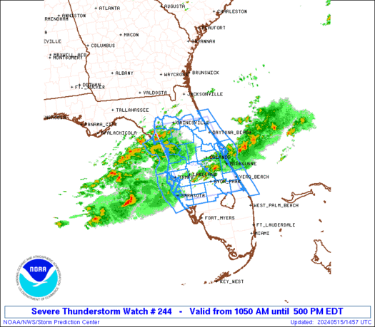
http://www.spc.noaa.gov/products/watch/ww0244_radar.gif
0 likes
-
6SpeedTA95
- Category 5
- Posts: 1206
- Joined: Wed Oct 19, 2005 3:25 pm
- Location: Oklahoma
- Contact:
-
6SpeedTA95
- Category 5
- Posts: 1206
- Joined: Wed Oct 19, 2005 3:25 pm
- Location: Oklahoma
- Contact:
soonertwister wrote:6SpeedTA95 wrote:jkt21787 wrote:CrazyC83 wrote:Gorky wrote:Another upgrade to the probabilities....
Tornado threat now up to 15% (moderate risk on its own)
Hail threat now at 60% hatched
The main event won't start for another few hours yet at least, probably coinciding with me going to the pub so I miss all the action
60-hatched, isn't that a high risk?
Not for hail. High risks aren't issued for hail.
Correct...
Tornado watch is up pretty much west of I35. Conditions are looking good out there for supercell development. LCL and LFC's aren't too bad for tornado development although I dont think we're looking at anything close to an outbreak. But I wouldn't be surprised if we had 3 to 5 tornadoes out of the weather today.
Not really west of I35, it includes all of the OKC metro area and significant areas east of I35, including where half my immediate family live.
Given the complex scenarios we are dealing with here, I wouldn't rule out a significant outbreak, including multiple long-track tornadoes. There are three surface lows, two occluded fronts, an approaching dryline, an approaching sharply contrasting cold front, high dewpoints, lots of vorticity, dissipating cap with high cape values. Could get dicey...
If individual supercells develop, I'd say tornadoes are likely.
http://www.spc.noaa.gov/products/watch/ww0244_radar.gif
I wasn't trying to downplay the area east of I35, I'm east of I35, but the vast majority of the box is west of I35 thats the only point I was trying to make. Bad wording on my part I apologize.
0 likes
-
6SpeedTA95
- Category 5
- Posts: 1206
- Joined: Wed Oct 19, 2005 3:25 pm
- Location: Oklahoma
- Contact:
CrazyC83 wrote:This year, however, has not been conducive to tornadoes west of the I-35/I-29 corridor...
Yeah the svr weather season for us has gotten off to a fairly slow start. We officially hit peak season tomorrow and it runs through June 6th. So far we've only had 3 or 4 rounds of svr weather.
0 likes
-
6SpeedTA95
- Category 5
- Posts: 1206
- Joined: Wed Oct 19, 2005 3:25 pm
- Location: Oklahoma
- Contact:
-
6SpeedTA95
- Category 5
- Posts: 1206
- Joined: Wed Oct 19, 2005 3:25 pm
- Location: Oklahoma
- Contact:
-
CrazyC83
- Professional-Met
- Posts: 34315
- Joined: Tue Mar 07, 2006 11:57 pm
- Location: Deep South, for the first time!
6SpeedTA95 wrote:CrazyC83 wrote:This year, however, has not been conducive to tornadoes west of the I-35/I-29 corridor...
Yeah the svr weather season for us has gotten off to a fairly slow start. We officially hit peak season tomorrow and it runs through June 6th. So far we've only had 3 or 4 rounds of svr weather.
Basically it seems the 35/29 corridor has been a consistent dryline...it has been downright explosive to the east of there...
0 likes
-
6SpeedTA95
- Category 5
- Posts: 1206
- Joined: Wed Oct 19, 2005 3:25 pm
- Location: Oklahoma
- Contact:
CrazyC83 wrote:6SpeedTA95 wrote:CrazyC83 wrote:This year, however, has not been conducive to tornadoes west of the I-35/I-29 corridor...
Yeah the svr weather season for us has gotten off to a fairly slow start. We officially hit peak season tomorrow and it runs through June 6th. So far we've only had 3 or 4 rounds of svr weather.
Basically it seems the 35/29 corridor has been a consistent dryline...it has been downright explosive to the east of there...
Yeah we've had more late may/early june setups this year which is a bit odd.
0 likes
Return to “USA & Caribbean Weather”
Who is online
Users browsing this forum: No registered users and 57 guests