
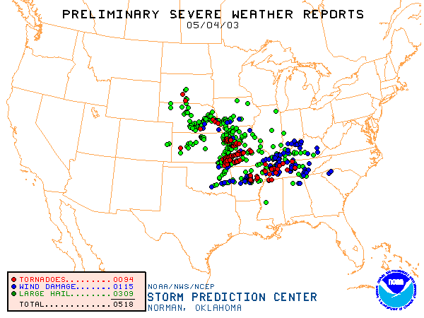
Listed as the 5-4-3 storms, I have the unique experience of being too close to one of the tornadoes in the Kansas City metro area. This was the prolific day in an outbreak sequence that brought 400+ confirmed tornadoes from April 30th to May 11th.
On May 4th, 86 confirmed tornadoes were reported (32 F0, 29 F1, 13 F2, 8 F3, 4 F4, 0 F5). A total of 38 people died that day.
Wikipedia recap of May 4, 2003 - http://en.wikipedia.org/wiki/May_2003_T ... ay_4_Event
NWS Pleasant Hill event page - http://www.crh.noaa.gov/eax/events/may042003/
Evolution of an outbreak:
0800 Day 2 Convective Outlook - http://www.spc.noaa.gov/products/outloo ... _0800.html
1730 Day 2 Convective Outlook - http://www.spc.noaa.gov/products/outloo ... _1730.html
0100 Day 1 Convective Outlook - http://www.spc.noaa.gov/products/outloo ... _0100.html
0600 Day 1 Convective Outlook - http://www.spc.noaa.gov/products/outloo ... _1200.html
1300 Day 1 Convective Outlook - http://www.spc.noaa.gov/products/outloo ... _1300.html
1630 Day 1 Convective Outlook - http://www.spc.noaa.gov/products/outloo ... _1630.html
2000 Day 1 Convective Outlook - http://www.spc.noaa.gov/products/outloo ... _2000.html
My personal experience of this day stems from the longest track Kansas City metro tornado. At it's peak intensity, it was rated an F4 on the Kansas side of the metro area. This tornado got within a mile of my apartment and I was standing on a hill watching a pitch black cloud come towards my direction. It didn't hit home how close this tornado was until I saw pieces of insulation and wood fall from the sky and start to fill the courtyard around my apartment. I immediately took cover. However, the tornado dissipated about 3/4 mile away from my location. The storm later regenerated and dropped a short lived tornado that roared up to F4 damage in the Gladstone area. This has been the closest I've ever gotten to a tornado.
--snoopj
Four years ago today (05.04.03)
Moderator: S2k Moderators
Forum rules

The posts in this forum are NOT official forecast and should not be used as such. They are just the opinion of the poster and may or may not be backed by sound meteorological data. They are NOT endorsed by any professional institution or STORM2K.
Four years ago today (05.04.03)
0 likes
-
simplykristi
- S2K Supporter

- Posts: 1220
- Joined: Sat May 10, 2003 1:59 pm
- Location: Near KCMO
- Contact:
I remember that day all too well. Everything stayed in the northern part of the metro area. I can remember watching TV of the live shots of tornadoes in the northern part of the KC area.
My teammate and I were talking about that day today. She and her family were in the tornado's path that came thru Norborne MO that day. Their house sustaimed minor damage while others around her had structural damage.
Kristi
My teammate and I were talking about that day today. She and her family were in the tornado's path that came thru Norborne MO that day. Their house sustaimed minor damage while others around her had structural damage.
Kristi
0 likes
-
Category 5

- Category 5

- Posts: 10074
- Age: 36
- Joined: Sun Feb 11, 2007 10:00 pm
- Location: New Brunswick, NJ
- Contact:
-
HurricaneBill
- Category 5
- Posts: 3419
- Joined: Sun Apr 11, 2004 5:51 pm
- Location: East Longmeadow, MA, USA
Return to “USA & Caribbean Weather”
Who is online
Users browsing this forum: No registered users and 128 guests