Disturbance Well SW of Baja

This is the general tropical discussion area. Anyone can take their shot at predicting a storms path.

Moderator: S2k Moderators

Forum rules

The posts in this forum are NOT official forecasts and should not be used as such. They are just the opinion of the poster and may or may not be backed by sound meteorological data. They are NOT endorsed by any professional institution or STORM2K. For official information, please refer to products from the National Hurricane Center and National Weather Service.

Help Support Storm2K
Message
Author
User avatar
cycloneye
Admin
Admin
Posts: 146109
Age: 69
Joined: Thu Oct 10, 2002 10:54 am
Location: San Juan, Puerto Rico

Disturbance Well SW of Baja

#1 Postby cycloneye » Thu Nov 09, 2006 2:31 pm

09/1800 UTC 7.5N 128.0W T1.0/1.0 96E -- East Pacific Ocean


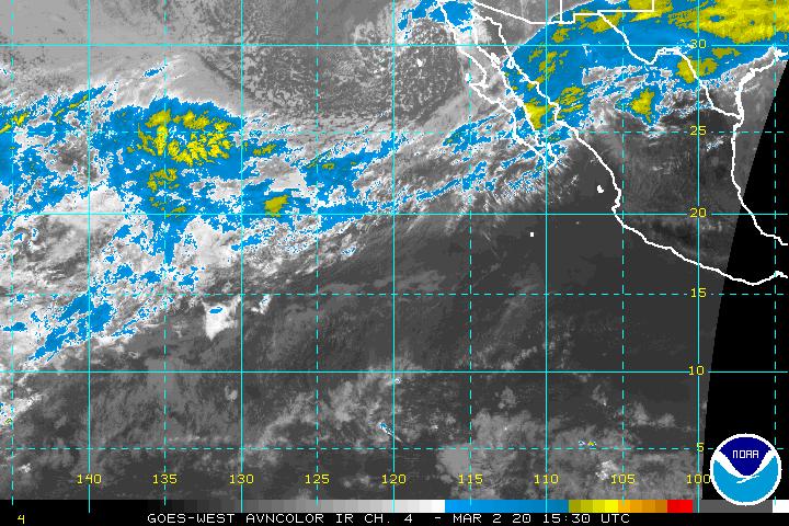
Still NRL does not have it at their site but SSD identifies as 96E the disturbance well SW of 95E.It looks good in the pic.

Image

The EPAC still is very active considering it's mid november with three systems,Rosa,Invest 95E and Invest 96E.
Last edited by cycloneye on Thu Nov 09, 2006 7:25 pm, edited 4 times in total.
0 likes   

User avatar
WmE
Category 2
Category 2
Posts: 696
Age: 36
Joined: Sat Jun 17, 2006 11:23 am
Location: Vienna, Austria

#2 Postby WmE » Thu Nov 09, 2006 2:35 pm

000
ABPZ20 KNHC 091728
TWOEP
TROPICAL WEATHER OUTLOOK
NWS TPC/NATIONAL HURRICANE CENTER MIAMI FL
1000 AM PST THU NOV 9 2006

FOR THE EASTERN NORTH PACIFIC...EAST OF 140 DEGREES WEST LONGITUDE..

AN AREA OF DISTURBED WEATHER HAS DEVELOPED ABOUT 1700 MILES
SOUTHWEST OF THE SOUTHERN TIP OF BAJA CALIFORNIA. THIS SYSTEM IS
SHOWING SIGNS OF ORGANIZATION...AND SOME SLOW DEVELOPMENT IS
POSSIBLE OVER THE NEXT DAY OR SO.

ELSEWHERE...TROPICAL STORM FORMATION IS NOT EXPECTED THROUGH FRIDAY.

$$
FORECASTER RHOME


____

Looking good indeed!
0 likes   

User avatar
cycloneye
Admin
Admin
Posts: 146109
Age: 69
Joined: Thu Oct 10, 2002 10:54 am
Location: San Juan, Puerto Rico

#3 Postby cycloneye » Thu Nov 09, 2006 7:24 pm

ABPZ20 KNHC 100014
TWOEP
TROPICAL WEATHER OUTLOOK
NWS TPC/NATIONAL HURRICANE CENTER MIAMI FL
400 PM PST THU NOV 9 2006

FOR THE EASTERN NORTH PACIFIC...EAST OF 140 DEGREES WEST LONGITUDE..

THE NATIONAL HURRICANE CENTER IS ISSUING ADVISORIES ON TROPICAL
STORM ROSA...LOCATED ABOUT 235 MILES SOUTH-SOUTHWEST OF MANZANILLO
MEXICO.

THERE HAS BEEN LITTLE CHANGE IN THE AREA OF DISTURBED WEATHER
LOCATED ABOUT 1650 MILES SOUTHWEST OF THE SOUTHERN TIP OF BAJA
CALIFORNIA. SOME SLOW DEVELOPMENT OF THIS NEARLY-STATIONARY SYSTEM
IS POSSIBLE OVER THE NEXT DAY OR SO.

ELSEWHERE...TROPICAL STORM FORMATION IS NOT EXPECTED THROUGH FRIDAY.

$$
FORECASTER PASCH


NRL site still has not have invest 96E in their two sites.So I edited the title to take out Invest 96E until they have it.
0 likes   
Visit the Caribbean-Central America Weather Thread where you can find at first post web cams,radars
and observations from Caribbean basin members Click Here

Return to “Talkin' Tropics”

Who is online

Users browsing this forum: AnnularCane, Argcane, Cpv17, Hypercane_Kyle, IcyTundra, LAF92, skillz305, Stratton23, wzrgirl1 and 124 guests