
Its interesting because there is clearly some energy there that most models seem to be picking up, the GFs palces it further east whilst UKMO and the ECM places it further west in the EPAC.
This does look to be possibly the first real area we will have to watch, exactly in what basin isn't certain yet but chances of something developing looks to be on the rise...and if the ECM is right maybe quite a strong system as well.
Possible Development in EPAC
Moderator: S2k Moderators
Forum rules

The posts in this forum are NOT official forecasts and should not be used as such. They are just the opinion of the poster and may or may not be backed by sound meteorological data. They are NOT endorsed by any professional institution or STORM2K. For official information, please refer to products from the National Hurricane Center and National Weather Service.
-
gatorcane

- S2K Supporter

- Posts: 23703
- Age: 47
- Joined: Sun Mar 13, 2005 3:54 pm
- Location: Boca Raton, FL
Re:
KWT wrote:Its interesting because there is clearly some energy there that most models seem to be picking up, the GFs palces it further east whilst UKMO and the ECM places it further west in the EPAC.
This does look to be possibly the first real area we will have to watch, exactly in what basin isn't certain yet but chances of something developing looks to be on the rise...and if the ECM is right maybe quite a strong system as well.
Th GFS 06Z MSLP even at 144 hours which has a reasonable amount of accuracy is showing the low forming in the SW Caribbean. Thoughts?

0 likes
Well you can see the two pieces of energy from that, the little extension into the EPAC of that lower pressure but it is centered on the GFS in the SW Caribbean...whilst the ECM develops it further west in the EPAC. Will be interesting to see what the 12z ECM does tonight but both models have been consitant on thier own solution.
0 likes
-
gatorcane
- S2K Supporter
- Posts: 23703
- Age: 47
- Joined: Sun Mar 13, 2005 3:54 pm
- Location: Boca Raton, FL
Re:
KWT wrote:Well you can see the two pieces of energy from that, the little extension into the EPAC of that lower pressure but it is centered on the GFS in the SW Caribbean...whilst the ECM develops it further west in the EPAC. Will be interesting to see what the 12z ECM does tonight but both models have been consitant on thier own solution.
The 8:05 TWD mentions the presence of a strong jet stream with estimated winds of 90 to 100K across the northern GOM and a sw upper-flow that is drawing in upper-level moisture from the EPAC. In the long-term through this Sunday we expect to see a long wave trough dig SW into the western Atlantic and EC. I am wondering if the GFS is expecting this long wave to be strong enough to bring up some of the EPAC moisture into the Western Caribbean to get this low going?
0 likes


-
Meso

- Category 5

- Posts: 1609
- Age: 39
- Joined: Mon Aug 09, 2004 12:14 pm
- Location: South Africa
- Contact:
Re: Possible Development in EPAC or SW Carribbean

CMC

UKMET

NOGAPS
Along with the EURO and GFS of course... Lots of model support for something to happen there
0 likes
-
Ed Mahmoud
Re: Possible Development in EPAC or SW Carribbean
Deleted Euro image, Meso had already posted it
That is what I get for reading from the bottom up...
That is what I get for reading from the bottom up...
Last edited by Ed Mahmoud on Fri May 23, 2008 9:27 am, edited 1 time in total.
0 likes
Yep the models are starting to come into agreement now of a EPAC system developing and it does look fairly decent for the time of year according to the models in a region that typically can support such systems in late May readily. Will have to watch all the convection.
Also even if the GFS system doesn't form if this one does and track northwards it will have top be watched if the remains come into the gulf/SW Caribbean.
Also even if the GFS system doesn't form if this one does and track northwards it will have top be watched if the remains come into the gulf/SW Caribbean.
0 likes
-
Stratosphere747
- Category 5
- Posts: 3772
- Joined: Thu Sep 11, 2003 8:34 pm
- Location: Surfside Beach/Freeport Tx
- Contact:
Re: Possible Development in EPAC or SW Carribbean
Little to much focus on the Atlantic side when in fact the energy is most likely going to come from the EPAC. This is the "kick starter" to look for....
TROPICAL WEATHER DISCUSSION
NWS TPC/NATIONAL HURRICANE CENTER MIAMI FL
1605 UTC SUN MAY 25 2008
TROPICAL WEATHER DISCUSSION FOR THE EASTERN PACIFIC OCEAN
FROM THE EQUATOR TO 32N...EAST OF 140W.
...TROPICAL WAVES...
TROPICAL WAVE IS ANALYZED OVER LAND N OF 13N ALONG 89W/90W AND
REMAINS NEARLY STATIONARY. THE WAVE IS EMBEDDED IN A VERY BROAD
AREA OF CYCLONIC TURNING...WITH WESTERLY WINDS NOTED TO THE
SOUTH AND WEST OF THE WAVE. THESE WESTERLY WINDS CONTINUE TO
MAKE THE WAVE DIFFICULT TO DETECT AS A DISTINCT FEATURE AT THIS
TIME. MOST OF THE STRONG CONVECTION THAT WAS ASSOCIATED WITH THE
WAVE IS NOW WELL WEST OF THE WAVE...GENERALLY WITHIN 180 NM OF
THE ITCZ BETWEEN 93W AND 102W. GLOBAL MODELS ARE FORECASTING A
BROAD AREA OF LOW PRESSURE TO DEVELOP IN THE AREA OF THE WAVE
OVER THE NEXT SEVERAL DAYS.
0 likes
I quite agree its not hard to see where the energy is focusing in on right now, but the trend is for the system to lift up into the Caribbean eventually in say 4-6 days time and develop close to the Yucatan....however till then the area to watch for the building blocks of any possible system will be in this region IMO.
0 likes

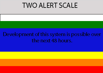
A BROAD AREA OF LOW PRESSURE EXTENDS FROM CENTRAL AMERICA
WEST-SOUTHWESTWARD FOR SEVERAL HUNDRED MILES INTO THE EASTERN
PACIFIC. ASSOCIATED SHOWERS AND THUNDERSTORMS ARE DISORGANIZED AND
THERE ARE NO SIGNS OF DEVELOPMENT WITHIN THIS AREA. HOWEVER...SOME
SLOW DEVELOPMENT OF THIS SYSTEM IS POSSIBLE OVER THE NEXT COUPLE OF
DAYS AS IT REMAINS NEARLY STATIONARY OR DRIFTS EASTWARD.
REGARDLESS OF DEVELOPMENT...LOCALLY HEAVY RAINFALL IS POSSIBLE OVER
PORTIONS OF CENTRAL AMERICA DURING THE NEXT FEW DAYS...ESPECIALLY
IN PANAMA... COSTA RICA...AND NICARAGUA.
0 likes


Haha cool image, indeed I would say this bears watching as soon as 36-48hrs, not sure what will happen to it but it looks like a nearly closed off circulation (may even be totally closed off.) and thus the only thing we need is an increase in convective coverage. As I said in the other thread I expect Invest 90E to be with us in the next 24hrs.
0 likes
-
Stratosphere747
- Category 5
- Posts: 3772
- Joined: Thu Sep 11, 2003 8:34 pm
- Location: Surfside Beach/Freeport Tx
- Contact:
-
Ed Mahmoud
Re:
Stratosphere747 wrote:No love for the EPAC...
As KWT mentioned this could become an invest fairly soon. Once established it should cut off any likely chance for something on the Atlantic side to become established. Otherwise folks will have to look for a crossover if they want a system on that side of the basin.
Hurakan just started the 90E thread...
0 likes
-
cycloneye

- Admin

- Posts: 148740
- Age: 69
- Joined: Thu Oct 10, 2002 10:54 am
- Location: San Juan, Puerto Rico
Re: Possible Development in EPAC
gatorcane,this thread is now locked as invest 90E is now up.
0 likes
Who is online
Users browsing this forum: Google [Bot] and 122 guests