628
ABPZ20 KNHC 032344
TWOEP
TROPICAL WEATHER OUTLOOK
NWS TPC/NATIONAL HURRICANE CENTER MIAMI FL
500 PM PDT FRI JUL 3 2009
FOR THE EASTERN NORTH PACIFIC...EAST OF 140 DEGREES WEST LONGITUDE..
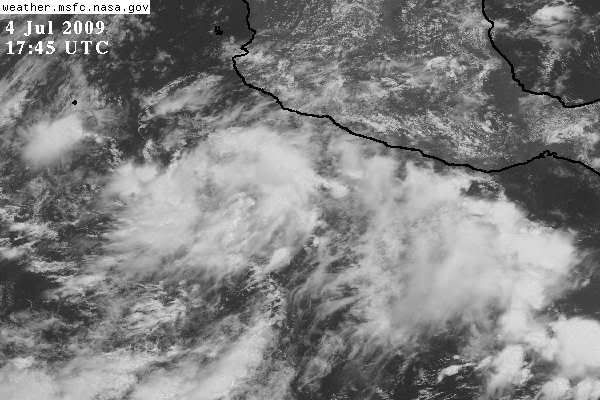
SHOWER AND THUNDERSTORM ACTIVITY ASSOCIATED WITH A TROUGH OF LOW
PRESSURE LOCATED SEVERAL HUNDRED MILES SOUTH-SOUTHWEST OF ACAPULCO
MEXICO HAS INCREASED OVER THE PAST SEVERAL HOURS. UPPER-LEVEL
WINDS ARE EXPECTED TO BECOME MORE CONDUCIVE FOR SLOW DEVELOPMENT OF
THIS SYSTEM OVER THE NEXT COUPLE OF DAYS AS IT MOVES WEST-
NORTHWESTWARD AT 5 TO 10 MPH. THERE IS A LOW CHANCE...LESS THAN 30
PERCENT...OF THIS SYSTEM BECOMING A TROPICAL CYCLONE DURING THE
NEXT 48 HOURS.
ELSEWHERE...TROPICAL CYCLONE FORMATION IS NOT EXPECTED DURING THE
NEXT 48 HOURS.
$$
FORECASTER BERG