P.M. Central Atlantic Graphics

This is the general tropical discussion area. Anyone can take their shot at predicting a storms path.

Moderator: S2k Moderators

Forum rules

The posts in this forum are NOT official forecasts and should not be used as such. They are just the opinion of the poster and may or may not be backed by sound meteorological data. They are NOT endorsed by any professional institution or STORM2K. For official information, please refer to products from the National Hurricane Center and National Weather Service.

Help Support Storm2K
Message
Author
chadtm80

P.M. Central Atlantic Graphics

#1 Postby chadtm80 » Mon Aug 18, 2003 10:45 pm

Image


.
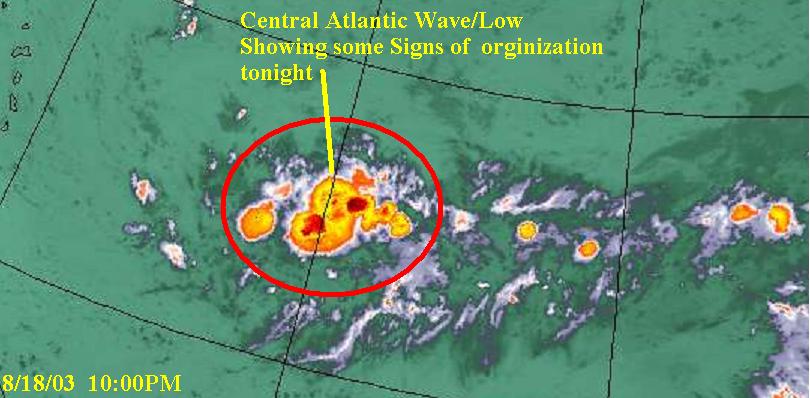
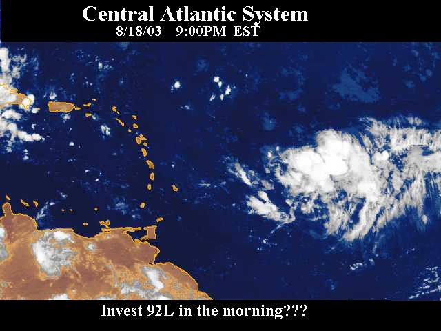
System Continues to impress me tonight... Convection still very persistant, and even more worrying is that it continues to move West... Time is running our for the Islands... Keep your eyes on the sea


.
. . . . . . . . . . . . . . . Image


.

Lets see what the early morning hours bring
0 likes   

Return to “Talkin' Tropics”

Who is online

Users browsing this forum: Blown Away, Cdenton12, RomP and 45 guests