Tropical Wave east of lesser antilles

This is the general tropical discussion area. Anyone can take their shot at predicting a storms path.

Moderator: S2k Moderators

Forum rules

The posts in this forum are NOT official forecasts and should not be used as such. They are just the opinion of the poster and may or may not be backed by sound meteorological data. They are NOT endorsed by any professional institution or STORM2K. For official information, please refer to products from the National Hurricane Center and National Weather Service.

Help Support Storm2K
Message
Author
User avatar
Gustywind
Category 5
Category 5
Posts: 12334
Joined: Mon Sep 03, 2007 7:29 am
Location: Baie-Mahault, GUADELOUPE

Tropical Wave east of lesser antilles

#1 Postby Gustywind » Tue Aug 25, 2015 2:17 pm

Here is a new guest after Danny and Erika...?

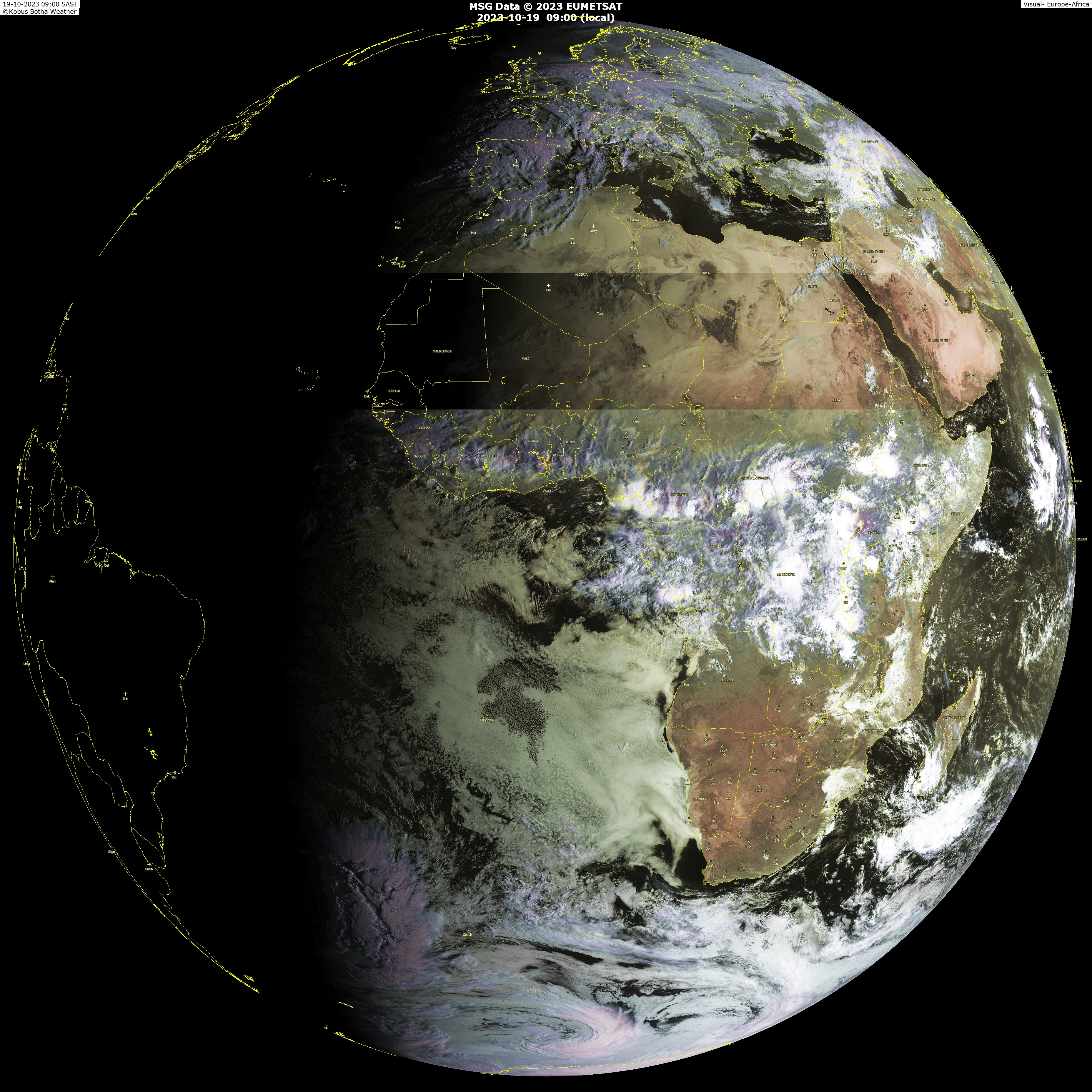
As surely many of you i've monitored this pretty huge twave on Africa.
:rarrow: http://www.weatherphotos.co.za/photos/world_big.jpg

Will this one stays as a moderate and decent twave or turn into something much more stronger as a TS or much more during it trip on the Atlantic Ocean?
One thing going in favor is climo as is almost late August and September is not so far. But as usual down the road is the question on how it encounter dry air/shear. I don't know if models are hinting at it having some development. Time will tell.
You can post all the infos related to this feature: models, etc. I will be glad to share all these infos with you :)
Regards :)
Gustywind

http://www.ssd.noaa.gov/eumet/eatl/flash-rb.html
Seems to be at low lattitude near 10°N when this will moving offshore.
0 likes   

User avatar
Gustywind
Category 5
Category 5
Posts: 12334
Joined: Mon Sep 03, 2007 7:29 am
Location: Baie-Mahault, GUADELOUPE

#2 Postby Gustywind » Wed Aug 26, 2015 8:43 pm

TROPICAL WEATHER DISCUSSION
NWS NATIONAL HURRICANE CENTER MIAMI FL
805 PM EDT WED AUG 26 2015

A TRPCL WAVE CAME OFF THE WEST AFRICAN COAST EARLIER THIS
AFTERNOON. ITS AXIS IS APPROXIMATELY ALONG 18W AND IS EXPECTED
TO MOVE W AT 10-15 KT WITHIN THE NEXT 48 HOURS. MODERATE
MOISTURE IS ASSOCIATED WITH THIS WAVE FROM THE SURFACE TO 850 MB
AS INDICATED BY CIRA LAYER PRECIPITABLE WATER IMAGERY. LOW-LEVEL
MOISTURE CONVERGENCE SUPPORTS ISOLATED SHOWERS AND TSTMS FROM
07N TO 14N BETWEEN 18W AND 25W. FURTHER CONVECTION IS BEING
HINDERED BY THE PRESENCE OF SAHARAN DRY AIR AND DUST IN THE
NORTHERN WAVE ENVIRONMENT.
0 likes   

HurricaneFan
Tropical Storm
Tropical Storm
Posts: 192
Age: 41
Joined: Tue Jan 18, 2011 6:16 pm
Location: Anguilla,Leeward Islands 18.3N 63.0W

Re: Strong Tropical Wave about to move off Africa

#3 Postby HurricaneFan » Thu Aug 27, 2015 10:14 am

Is this same Tropical Wave now just passing 10N 30W?
0 likes   

User avatar
abajan
S2K Supporter
S2K Supporter
Posts: 4232
Joined: Sun Sep 07, 2003 5:10 am
Location: Barbados

Re: Strong Tropical Wave about to move off Africa

#4 Postby abajan » Fri Aug 28, 2015 4:53 am

If this is the wave near 40W, it's looking pretty healthy:

Image
0 likes   

User avatar
Gustywind
Category 5
Category 5
Posts: 12334
Joined: Mon Sep 03, 2007 7:29 am
Location: Baie-Mahault, GUADELOUPE

Re: Strong Tropical Wave about to move off Africa

#5 Postby Gustywind » Fri Aug 28, 2015 5:12 am

abajan wrote:If this is the wave near 40W, it's looking pretty healthy:

Image

Agree with you! She's really in good shape! But i Wonder? Seems to be related to the one located at 32W.Remember Wednesday twave was located on the 18W. Looks more credible IMO that this should be the good one :darrow: But maybe our Pro Mets will give us a better idea. :) We will see.

TROPICAL WEATHER DISCUSSION
NWS NATIONAL HURRICANE CENTER MIAMI FL
205 AM EDT FRI AUG 28 2015

A TROPICAL WAVE IS OVER THE E ATLANTIC WITH AXIS EXTENDING FROM
15N32W TO A 1012 LOW NEAR 10N34W TO 07N34W...MOVING W AT ABOUT
20 KT OVER THE PAST 24 HOURS. MODERATE MOISTURE PREVAILS IN THE
ENVIRONMENT OF THIS WAVE AS NOTED IN TPW IMAGERY. SCATTERED
MODERATE CONVECTION IS FROM 07N-14N BETWEEN 31W-42W.
0 likes   

User avatar
Gustywind
Category 5
Category 5
Posts: 12334
Joined: Mon Sep 03, 2007 7:29 am
Location: Baie-Mahault, GUADELOUPE

#6 Postby Gustywind » Fri Aug 28, 2015 7:29 am

TROPICAL WEATHER DISCUSSION...AMENDED
NWS NATIONAL HURRICANE CENTER MIAMI FL
805 AM EDT FRI AUG 28 2015

...TROPICAL WAVES...

A TROPICAL WAVE IS OVER THE E ATLANTIC WITH AXIS EXTENDING FROM
15N33W TO A 1012 LOW NEAR 10N34W TO 07N35W...MOVING W AT 15-20
KT OVER THE PAST 24 HOURS. MODERATE MOISTURE PREVAILS IN THE
ENVIRONMENT OF THIS WAVE AS NOTED IN TPW IMAGERY. SCATTERED
MODERATE CONVECTION IS FROM 11N-14N BETWEEN 33W-37W.
0 likes   

YoshiMike
Tropical Storm
Tropical Storm
Posts: 106
Age: 29
Joined: Wed Aug 27, 2014 9:18 pm
Location: Hattiesburg, MS
Contact:

Re: Tropical Wave east of lesser antilles

#7 Postby YoshiMike » Fri Aug 28, 2015 12:01 pm

Wow that thing looks huge
0 likes   
Okay guys, just because I want to BE a meteorologist, want to go to school for meteorology, DOES NOT MAKE ME A METEOROLOGIST. Anything I say about tropical weather is either me learning something new, or is just an opinion and nothing more than that. I can almost guarantee you that I will be wrong about pretty much everything.

User avatar
Hurricane Cheese
Category 1
Category 1
Posts: 364
Joined: Thu Aug 12, 2004 12:40 am
Location: Green Bay, WI (UWGB Earth Science Alum)

Re: Tropical Wave east of lesser antilles

#8 Postby Hurricane Cheese » Fri Aug 28, 2015 2:33 pm

How is this not an invest!?
0 likes   
"If we are afraid to be different...how can we make a difference in the world?"

- Rev. John I. Jenkins C.S.C, President, University of Notre Dame

User avatar
abajan
S2K Supporter
S2K Supporter
Posts: 4232
Joined: Sun Sep 07, 2003 5:10 am
Location: Barbados

#9 Postby abajan » Sat Aug 29, 2015 4:52 am

It seems to have a circulation around 46W but convection has diminished considerably. There's lots of dry air out there.
0 likes   

User avatar
Gustywind
Category 5
Category 5
Posts: 12334
Joined: Mon Sep 03, 2007 7:29 am
Location: Baie-Mahault, GUADELOUPE

#10 Postby Gustywind » Sat Aug 29, 2015 7:22 am

Good catch Abajan...


NWS NATIONAL HURRICANE CENTER MIAMI FL
805 AM EDT SAT AUG 29 2015


A TROPICAL WAVE IS OVER THE CENTRAL ATLANTIC ASSOCIATED WITH A
1013 MB LOW EMBEDDED IN THE MONSOON TROUGH NEAR 10N44W. THE WAVE
AXIS EXTENDS FROM 17N42W TO 08N45W. THESE FEATURES ARE MOVING W
AT ABOUT 15-20 KT OVER THE LAST 24 HOURS. MODERATE MOISTURE IS
ASSOCIATED WITH THIS WAVE FROM THE SURFACE TO 700 MB AS
INDICATED BY CIRA LAYER PRECIPITABLE WATER IMAGERY. UPPER-LEVEL
DIFFLUENCE W OF THE LOW SUPPORTS ISOLATED MODERATE CONVECTION
FROM 11N-17N BETWEEN 45W-48W WHILE ISOLATED MODERATE CONVECTION
PREVAILS E OF THE WAVE AXIS FROM 14N-16N BETWEEN 39W-42W.


By the way, this twave is expected by Our Pro Mets to bring rains and tstorms Monday and especially Tuesday.
0 likes   

User avatar
abajan
S2K Supporter
S2K Supporter
Posts: 4232
Joined: Sun Sep 07, 2003 5:10 am
Location: Barbados

Re:

#11 Postby abajan » Sat Aug 29, 2015 10:02 am

Gustywind wrote:... By the way, this twave is expected by Our Pro Mets to bring rains and tstorms Monday and especially Tuesday.
We could certainly do with that sort of weather. Except for a few showers, it's mostly been a hot and dry August. (We hardly got anything out of Erika.)
0 likes   

User avatar
Gustywind
Category 5
Category 5
Posts: 12334
Joined: Mon Sep 03, 2007 7:29 am
Location: Baie-Mahault, GUADELOUPE

Re: Re:

#12 Postby Gustywind » Sat Aug 29, 2015 10:27 am

abajan wrote:
Gustywind wrote:... By the way, this twave is expected by Our Pro Mets to bring rains and tstorms Monday and especially Tuesday.
We could certainly do with that sort of weather. Except for a few showers, it's mostly been a hot and dry August. (We hardly got anything out of Erika.)

:) yeah let's hope that beneficial rains may bring towards the EC especially Bardados.
0 likes   

User avatar
Gustywind
Category 5
Category 5
Posts: 12334
Joined: Mon Sep 03, 2007 7:29 am
Location: Baie-Mahault, GUADELOUPE

#13 Postby Gustywind » Sun Aug 30, 2015 7:15 am

TROPICAL WEATHER DISCUSSION
NWS NATIONAL HURRICANE CENTER MIAMI FL
805 AM EDT SUN AUG 30 2015

TROPICAL WAVE IN THE CENTRAL TROPICAL ATLC EXTENDS ALONG 48W/
49W FROM 9N-19N WITH A 1013 MB LOW ALONG THE WAVE NEAR 13N
MOVING W 10-15 KT OVER THE PAST 24 HOURS. SSMI TPW INDICATES THE
WAVE IS EMBEDDED WITHIN A SURGE OF DEEP MOISTURE AND THE FIRST
VISIBLE SATELLITE IMAGES SHOW AN AREA OF AEROSOLS OR DUST RIDING
N OF THE INVERTED V THAT IS THE WAVE AXIS. NO ASSOCIATED DEEP
CONVECTION.
0 likes   


Return to “Talkin' Tropics”

Who is online

Users browsing this forum: Google [Bot], hurricanes1234, MarioProtVI, SconnieCane, StormWeather, Stratton23 and 40 guests