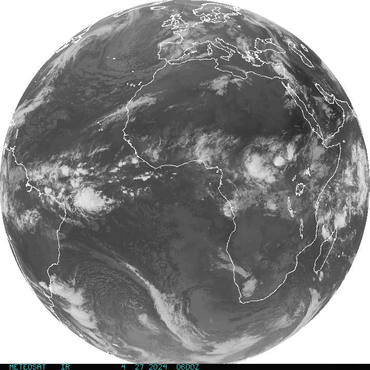
This does not look good.
Moderator: S2k Moderators
Forum rules
The posts in this forum are NOT official forecasts and should not be used as such. They are just the opinion of the poster and may or may not be backed by sound meteorological data. They are NOT endorsed by any professional institution or STORM2K. For official information, please refer to products from the National Hurricane Center and National Weather Service.
-
Guest
This does not look good.
Good candidates for back to back to back systems in Africa heading off the coast.

0 likes
-
Guest
-
Guest
Aquawind wrote:Here is the next beast to emerge!!
http://rapidfire.sci.gsfc.nasa.gov/real ... A042151325
Just because they come off the coast looking impressive...about what percentage of these "big ones" actually survive? 10%? It seems to me (as an amateur) that the size of the system as it exits contential Africa has little to nothing to do with its eventual strength...yes? No? Maybe?
Great site, y'aw. I learning a lot here.
0 likes
- The Dark Knight
- Category 3

- Posts: 800
- Joined: Fri Jun 18, 2004 11:18 am
- Location: Mashpee, Cape Cod, MA
- Contact:
-
Guest
- vbhoutex
- Storm2k Executive

- Posts: 29140
- Age: 74
- Joined: Wed Oct 09, 2002 11:31 pm
- Location: Cypress, TX
- Contact:
alxfamlaw wrote:If it were only 10% then the most of the predictions out there would be wrong. If you have a large system that exits off the African Coast the majority end up being doozies. Am I wrong on this people?
Yes you are wrong, imo. Of course that is somewhat subjective based on what you consider large. Wheteher these systems coming off the COA develop is more tied to the conditions out ahead of them as opposed as to how large they are upon exiting the coast. We've seen several very impressive systems fizzle already this year thanks to the SAL. It also helps a lot towards development if there is already a low associated with the system as it exits the COA.
0 likes
-
Stormchaser16
- Category 5

- Posts: 1013
- Joined: Thu Aug 21, 2003 10:25 pm
- Location: NW Jersey
- Contact:
-
Guest
vbhoutex wrote:alxfamlaw wrote:If it were only 10% then the most of the predictions out there would be wrong. If you have a large system that exits off the African Coast the majority end up being doozies. Am I wrong on this people?
Yes you are wrong, imo. Of course that is somewhat subjective based on what you consider large. Wheteher these systems coming off the COA develop is more tied to the conditions out ahead of them as opposed as to how large they are upon exiting the coast. We've seen several very impressive systems fizzle already this year thanks to the SAL. It also helps a lot towards development if there is already a low associated with the system as it exits the COA.
Vbhoutex/others,
The satellite images, radar, etc. that are available to on the NOAA sites don't indicate if the clusters of thunderstorms coming off the COA have low pressure systems embedded under them. Is there a way of telling from the images we can view on the eastern Atlantic images that give us a clue? Is there a site to visit that will let us know which of these clusters are associated with lows?
Thanks for the lesson. It's greatly appreciated.
0 likes
Approximately 10% of all tropical easterly waves in the Atlantic go on to develop into named tropical cyclones.
Yeah, but when? My guess is the number would be well below 10% for June, July, October, and November, and a shade higher than 10% for August and September.
Seems to me we're in a climatologically more favorable time (August to September), so it's reasonable to assume that more would develop now.
Some years have even seen four or five cape verde waves develop back to back, which would mean that for those days the percentage was 100%.
Percentage is highly subjective since it never deals with the question of 'when'
0 likes
- Stormsfury
- Category 5

- Posts: 10549
- Age: 53
- Joined: Wed Feb 05, 2003 6:27 pm
- Location: Summerville, SC
Stormchaser16 wrote:Well he said "actually survive" which i take to mean not develop but hold their own.... i believe this number would be a fair larger percentile
Correct and incorrect at the same time ... here's what I mean ...
yes, 10% of the waves (100 or so) generally develop in a given tropical season ... however, most of them don't end up looking like these MCV's with embedded circulations ... those stand a much better chance than 10% (but I don't know the exact numbers) ...
A good indicator of better potential is looking at the OBS from Dakar, Senegal as a wave passes across ... some of the systems that have become doozies had a pretty impressive history as they crossed Dakar, Senegal.
SF
0 likes
- PTrackerLA
- Category 5

- Posts: 5281
- Age: 42
- Joined: Thu Oct 10, 2002 8:40 pm
- Location: Lafayette, LA
Who is online
Users browsing this forum: Hurricane2022 and 45 guests


