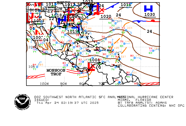
EPAC / Caribbean development later this week?
Moderator: S2k Moderators
Forum rules
The posts in this forum are NOT official forecasts and should not be used as such. They are just the opinion of the poster and may or may not be backed by sound meteorological data. They are NOT endorsed by any professional institution or STORM2K. For official information, please refer to products from the National Hurricane Center and National Weather Service.
- cycloneye
- Admin

- Posts: 148736
- Age: 69
- Joined: Thu Oct 10, 2002 10:54 am
- Location: San Juan, Puerto Rico
Re: SW Caribbean development next week?
What I know is that NOGAPS is one of the most conservative global models around and to do what is doing so far speaks volumes.
0 likes
Visit the Caribbean-Central America Weather Thread where you can find at first post web cams,radars
and observations from Caribbean basin members Click Here
and observations from Caribbean basin members Click Here
- Ivanhater
- Storm2k Moderator

- Posts: 11166
- Age: 39
- Joined: Fri Jul 01, 2005 8:25 am
- Location: Pensacola
Re: SW Caribbean development next week?
tolakram wrote:Has nogaps ever been right about anything?
Yes
0 likes
Michael
- Ivanhater
- Storm2k Moderator

- Posts: 11166
- Age: 39
- Joined: Fri Jul 01, 2005 8:25 am
- Location: Pensacola
Re: SW Caribbean development next week?
This may not be the system the models are developing but the low near the Yucatan is a fighter 


0 likes
Michael
-
tolakram
- Admin

- Posts: 20168
- Age: 62
- Joined: Sun Aug 27, 2006 8:23 pm
- Location: Florence, KY (name is Mark)
Re: SW Caribbean development next week?
Shear is dropping in that area.

0 likes
M a r k
- - - - -
Join us in chat: Storm2K Chatroom Invite. Android and IOS apps also available.
The posts in this forum are NOT official forecasts and should not be used as such. Posts are NOT endorsed by any professional institution or STORM2K.org. For official information and forecasts, please refer to NHC and NWS products.
-
jaxfladude
- Category 5

- Posts: 1249
- Joined: Wed Aug 24, 2005 9:36 pm
- Location: Jacksonville, Fla
-
lonelymike
- S2K Supporter

- Posts: 634
- Joined: Sat Jul 26, 2008 10:12 am
- Location: walton county fla
Yep big convective blow-up occuring with the Yucatan low, I think this region can't totally be discounted given there is already a circulation in place, esp if shear eases off somewhat...
0 likes
Personal Forecast Disclaimer:
The posts in this forum are NOT official forecast and should not be used as such. They are just the opinion of the poster and may or may not be backed by sound meteorological data. They are NOT endorsed by any professional institution or storm2k.org. For official information, please refer to the NHC and NWS products
The posts in this forum are NOT official forecast and should not be used as such. They are just the opinion of the poster and may or may not be backed by sound meteorological data. They are NOT endorsed by any professional institution or storm2k.org. For official information, please refer to the NHC and NWS products
- Evil Jeremy
- S2K Supporter

- Posts: 5463
- Age: 32
- Joined: Mon Apr 10, 2006 2:10 pm
- Location: Los Angeles, CA
- cycloneye
- Admin

- Posts: 148736
- Age: 69
- Joined: Thu Oct 10, 2002 10:54 am
- Location: San Juan, Puerto Rico
Re: SW Caribbean development next week?

0 likes
Visit the Caribbean-Central America Weather Thread where you can find at first post web cams,radars
and observations from Caribbean basin members Click Here
and observations from Caribbean basin members Click Here
Re: SW Caribbean development next week?
Looks like the TPC thinks it will move off to the NW or NNW and die off. sounds good to me!


0 likes
The following post is NOT an official forecast and should not be used as such. It is just the opinion of the poster and may or may not be backed by sound meteorological data. It is NOT endorsed by any professional institution including storm2k.org For Official Information please refer to the NHC and NWS products.
Re: SW Caribbean development next week?
If it were June/July there would be recon scheduled...
0 likes
- Hurricanehink
- S2K Supporter

- Posts: 2046
- Joined: Sun Nov 16, 2003 2:05 pm
- Location: New Jersey
Re: SW Caribbean development next week?
Wow, looks very impressive right now. Let's see if the convection persists.
0 likes
- gatorcane
- S2K Supporter

- Posts: 23703
- Age: 47
- Joined: Sun Mar 13, 2005 3:54 pm
- Location: Boca Raton, FL
Not going to happen with the Western Caribbean low. Shear is too strong. Only matter of time before the convection is sheared off. Probably by tomorrow morning it will be nearly sheared. Even 72 hours from now the shear is still too strong. A large Upper-level Low dives down from the Great lakes and off the SE US only enhancing the upper-level winds across the GOM and NW Caribbean. In fact this is the low that eventually could form the subtropical low that is sparking some interest in the other thread. Still not impressed with SW Caribbean chances or with this subtropical low possibility off the SE US.
Here we are at 72 hours. Shear is ripping across all of the GOM, Florida, Western Atlantic, and NW Caribbean, typical of May.

Here we are at 72 hours. Shear is ripping across all of the GOM, Florida, Western Atlantic, and NW Caribbean, typical of May.

0 likes
- southerngale
- Retired Staff

- Posts: 27418
- Joined: Thu Oct 10, 2002 1:27 am
- Location: Southeast Texas (Beaumont area)
Re: SW Caribbean development next week?
Guys, please try to remember to save the images you post, then upload them with tinypic, ImageHosting, ImageShack, etc. instead of just hotlinking. When you post them with the original links, the image will eventually change and then you have a disparity between the image and the accompanying comments.
We've requested this numerous times over the years, but many people still hotlink.
We've requested this numerous times over the years, but many people still hotlink.
0 likes
- stormpulsematt
- Tropical Wave

- Posts: 2
- Joined: Thu May 20, 2010 11:00 pm
- Location: West Palm Beach, FL
- Contact:
Re: SW Caribbean development next week?
(First time poster, long time reader...)
Which if any of the models account for the high-shear environment? Sounds like that is going to be the limiting factor ...
Which if any of the models account for the high-shear environment? Sounds like that is going to be the limiting factor ...
0 likes
Who is online
Users browsing this forum: Hurricanehink and 46 guests


 my Cowboys