Tropical Wave Midway Between Africa and Lesser Antilles

This is the general tropical discussion area. Anyone can take their shot at predicting a storms path.

Moderator: S2k Moderators

Forum rules

The posts in this forum are NOT official forecasts and should not be used as such. They are just the opinion of the poster and may or may not be backed by sound meteorological data. They are NOT endorsed by any professional institution or STORM2K. For official information, please refer to products from the National Hurricane Center and National Weather Service.

Help Support Storm2K
Message
Author
User avatar
windstorm99
S2K Supporter
S2K Supporter
Posts: 1578
Age: 47
Joined: Sat May 26, 2007 8:10 am
Location: Miami, Florida
Contact:

Re: Tropical Wave WSW of Cape Verde Islands

#101 Postby windstorm99 » Sat Sep 01, 2007 3:33 am

The wave in the eastern atlantic has continued to flare up tonight....

NHC 2:05am Discussion...

...TROPICAL WAVES...
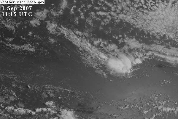
TROPICAL WAVE IS TILTED ALONG 20N31W 9N36W MOVING W AT ABOUT
12 KT WITH A 1010 MB LOW ALONG THE WAVE NEAR 14N. THE WAVE AND
LOW ARE EMBEDDED WITHIN A WELL ESTABLISHED MONSOON TROUGH THAT
IS PRESENT WITH WEST TO SOUTHWEST WINDS AT THE SURFACE AND 850
MB FROM WEST AFRICA OUT TO 40W BETWEEN 5 AND 15N. A CLUSTER OF
MODERATE CONVECTION IS WITHIN 150 NM WEST OF THE LOW CENTER.


Image
0 likes   

User avatar
cycloneye
Admin
Admin
Posts: 143867
Age: 68
Joined: Thu Oct 10, 2002 10:54 am
Location: San Juan, Puerto Rico

Re: Tropical Wave Midway Between Africa and Lesser Antilles

#102 Postby cycloneye » Sat Sep 01, 2007 5:29 am

000
ABNT20 KNHC 010929
TWOAT
TROPICAL WEATHER OUTLOOK
NWS TPC/NATIONAL HURRICANE CENTER MIAMI FL
530 AM EDT SAT SEP 1 2007

FOR THE NORTH ATLANTIC...CARIBBEAN SEA AND THE GULF OF MEXICO...

THE NATIONAL HURRICANE CENTER IS ISSUING ADVISORIES ON
RECENTLY-UPGRADED TROPICAL STORM FELIX...CENTERED NEAR GRENADA IN
THE SOUTHERN WINDWARD ISLANDS.

SHOWER ACTIVITY HAS INCREASED SOMEWHAT IN ASSOCIATION WITH A
TROPICAL WAVE LOCATED ABOUT MIDWAY BETWEEN AFRICA AND THE LESSER
ANTILLES. UPPER-LEVEL WINDS ARE FORECAST TO GRADUALLY BECOME MORE
FAVORABLE FOR SLOW DEVELOPMENT OF THIS SYSTEM DURING THE NEXT
COUPLE OF DAYS AS IT MOVES WESTWARD AT ABOUT 15 TO 20 MPH.

ELSEWHERE...TROPICAL CYCLONE FORMATION IS NOT EXPECTED DURING THE
NEXT 48 HOURS.

PUBLIC ADVISORIES ON TROPICAL STORM FELIX ARE ISSUED UNDER WMO
HEADER WTNT31 KNHC AND UNDER AWIPS HEADER MIATCPAT1.
FORECAST/ADVISORIES ON TROPICAL STORM FELIX ARE ISSUED UNDER WMO
HEADER WTNT21 KNHC AND UNDER AWIPS HEADER MIATCMAT1.

$$

FORECASTER KNABB

0 likes   

User avatar
storms in NC
S2K Supporter
S2K Supporter
Posts: 2338
Joined: Thu Jul 28, 2005 2:58 pm
Location: Wallace,NC 40 miles NE of Wilm
Contact:

#103 Postby storms in NC » Sat Sep 01, 2007 6:23 am

Looks good this moring. Just see how it goes today. This one will not be like the others and stay west. Maybe be a fish.
0 likes   

User avatar
punkyg
Category 2
Category 2
Posts: 770
Joined: Mon Apr 23, 2007 7:37 pm
Location: sanford florida

#104 Postby punkyg » Sat Sep 01, 2007 6:33 am

Looks like Felix may not be the only storm. come on little Gabby grab my hands. :lol:
0 likes   

User avatar
HURAKAN
Professional-Met
Professional-Met
Posts: 46086
Age: 38
Joined: Thu May 20, 2004 4:34 pm
Location: Key West, FL
Contact:

#105 Postby HURAKAN » Sat Sep 01, 2007 6:39 am

Image

You may be looking @ Invest 98L.
0 likes   

User avatar
windstorm99
S2K Supporter
S2K Supporter
Posts: 1578
Age: 47
Joined: Sat May 26, 2007 8:10 am
Location: Miami, Florida
Contact:

Re:

#106 Postby windstorm99 » Sat Sep 01, 2007 6:49 am

HURAKAN wrote:Image

You may be looking @ Invest 98L.


Yep...I expect something from NRL in the next 2-3 days if not sooner.It being futher north then previous systems will atleast make things interesting.Adrian
0 likes   

User avatar
punkyg
Category 2
Category 2
Posts: 770
Joined: Mon Apr 23, 2007 7:37 pm
Location: sanford florida

#107 Postby punkyg » Sat Sep 01, 2007 6:50 am

is this wave at a higher latitude then dean was or is it at the same level?
0 likes   

User avatar
cycloneye
Admin
Admin
Posts: 143867
Age: 68
Joined: Thu Oct 10, 2002 10:54 am
Location: San Juan, Puerto Rico

Re:

#108 Postby cycloneye » Sat Sep 01, 2007 6:53 am

punkyg wrote:is this wave at a higher latitude then dean was or is it at the same level?


Higher,around 14.0n.
0 likes   

User avatar
HURAKAN
Professional-Met
Professional-Met
Posts: 46086
Age: 38
Joined: Thu May 20, 2004 4:34 pm
Location: Key West, FL
Contact:

#109 Postby HURAKAN » Sat Sep 01, 2007 6:54 am

Image
0 likes   

User avatar
HURAKAN
Professional-Met
Professional-Met
Posts: 46086
Age: 38
Joined: Thu May 20, 2004 4:34 pm
Location: Key West, FL
Contact:

#110 Postby HURAKAN » Sat Sep 01, 2007 6:57 am

01/06Z

Image

They expect the system to move south of due west over the next 24 hrs in response to the high pressure to the north.
0 likes   

User avatar
HURAKAN
Professional-Met
Professional-Met
Posts: 46086
Age: 38
Joined: Thu May 20, 2004 4:34 pm
Location: Key West, FL
Contact:

#111 Postby HURAKAN » Sat Sep 01, 2007 7:08 am

TWD 805:

...TROPICAL WAVES...
TROPICAL WAVE IS TILTED ALONG 18N32W 8N37W MOVING W AT ABOUT 12
KT WITH A 1010 MB LOW ALONG THE WAVE NEAR 13N. THE WAVE AND LOW
ARE EMBEDDED WITHIN A WELL ESTABLISHED MONSOON TROUGH THAT IS
PRESENT WITH WEST TO SOUTHWEST WINDS AT THE SURFACE AND 850 MB
FROM WEST AFRICA OUT TO 40W BETWEEN 5 AND 15N. MODERATE TO
ISOLATED STRONG CONVECTION IS FROM 12N-15N BETWEEN 35W-39W.
0 likes   

User avatar
windstorm99
S2K Supporter
S2K Supporter
Posts: 1578
Age: 47
Joined: Sat May 26, 2007 8:10 am
Location: Miami, Florida
Contact:

Re: Tropical Wave Midway Between Africa and Lesser Antilles

#112 Postby windstorm99 » Sat Sep 01, 2007 7:26 am

Image
0 likes   

User avatar
punkyg
Category 2
Category 2
Posts: 770
Joined: Mon Apr 23, 2007 7:37 pm
Location: sanford florida

Re: Tropical Wave Midway Between Africa and Lesser Antilles

#113 Postby punkyg » Sat Sep 01, 2007 7:28 am

windstorm99 wrote:Image

Why you put up the same picture i put up?
0 likes   

Derek Ortt

#114 Postby Derek Ortt » Sat Sep 01, 2007 7:29 am

I do not expect conditions to remain favorable

an upper trough is dropping behind felix (which would be expected due to the high building over Felix). This may cause some shearing over this wave
0 likes   

User avatar
cycloneye
Admin
Admin
Posts: 143867
Age: 68
Joined: Thu Oct 10, 2002 10:54 am
Location: San Juan, Puerto Rico

Re: Tropical Wave Midway Between Africa and Lesser Antilles

#115 Postby cycloneye » Sat Sep 01, 2007 7:40 am

Thread is locked as is a invest now.Go to active storms forum for details and discussions.
0 likes   


Return to “Talkin' Tropics”

Who is online

Users browsing this forum: Google Adsense [Bot] and 194 guests