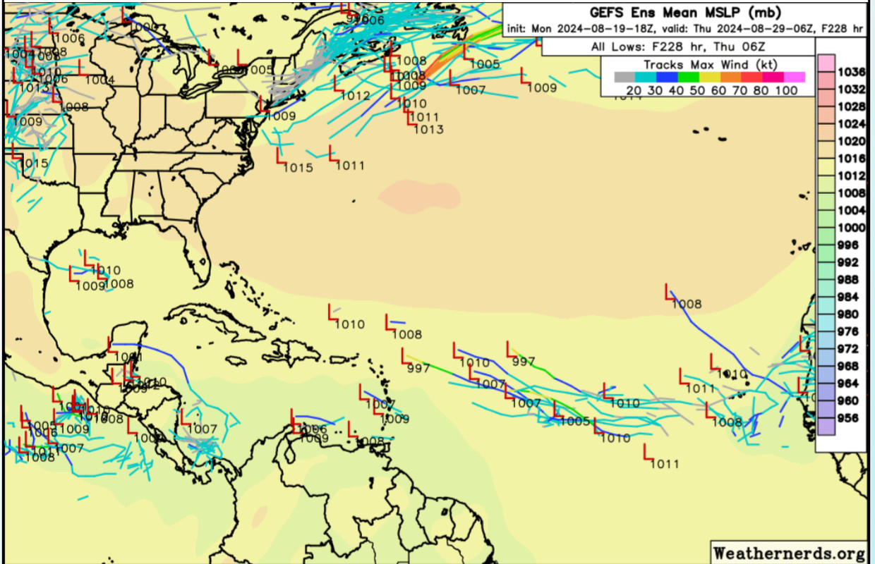
wxman57 wrote:It's amazing that we're approaching the peak of the season in 3 weeks and the models are not showing any significant development over the next two weeks. Some here are resorting to finding a possible storm in an odd ensemble member or two. Typically, about half the storms develop prior to Sept. 10th. We might be able to squeeze out another 2-3 named storms by then, making the total 7-8 named storms for the first half of the season (with Sept. 10 as the mid-point). It's going to be hard to reach even 20 named storms unless September turns out to be extremely active with 8-10 named storms and October is equally active. ACE is another story. A single long-tracked major hurricane can generate 50-60 ACE points, so we could be "hyperactive" ACE-wise but a little above normal numbers-wise. I know how quickly the tropics can switch "on", though, but my numbers are now 19/8/5 and that may be a bit too high.
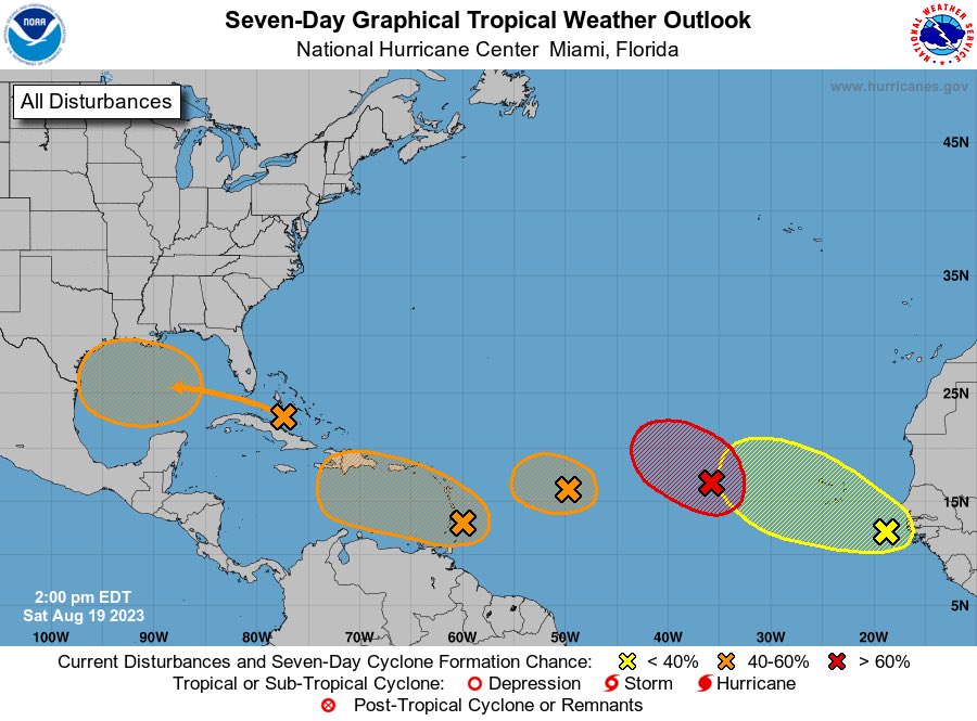
Numbers don't really matter, though. What matters is where the storms track. For now, the Bermuda high is weaker than predicted. We can track waves moving across the MDR, but they're having trouble generating convection due to dry, sinking air. Will this suddenly change over the next 2-3 weeks? The year started off as I suspected, with a long-tracked strong hurricane tracking across the Caribbean. After Beryl, though, things changed. Debby recurved over the NE Caribbean, and other waves just can't generate convection in the MDR.
Those of you in the NE Caribbean, like Luis, are certainly not "out of the woods", as conditions across the MDR will likely become more favorable eventually. Just because waves can't maintain convection in the Caribbean now doesn't mean Gulf Coast residents are safe from any hurricane threat. I've seen many convectionless waves move across the Caribbean suddenly blow up into hurricanes near the Yucatan and move north into the coast. I keep telling my team to track all waves moving across the MDR and Caribbean, as they can blow up in the NW Caribbean and become a "surprise" hurricane in the Gulf.
Let's hope for the best (fewer storms and a reduced risk) but always prepare for the worst.
There is no way that the Atlantic only manages a measly 2 storms between now and September 10. That would take a 2021/2022-level shutdown to occur, which is not happening at all. We’ve gone through this exact same process every year where people downcast when the Atlantic is dead or inactive in August and they think the rest of the season will be pitiful. Hell, in 2017, by mid-August right around when Harvey formed people were doing exactly what they are doing now, calling bust and 2013 repeat because it wasn’t active enough and pointing to a “dead” MDR on the models (in fact they were giving hints of the signal to pre-Irma well over a week in advance). Once Harvey regenerated, all hell broke loose as Irma developed and we know what happened from there. We’re not strawgrabbing at ensembles though, we’re generally seeing the precursor signs to a big TC outbreak. It takes a while for them to eventually latch onto it and begin uptrending - and the models have been especially notable this year for poorly forecasting genesis - they did not catch onto Beryl, Debby and Ernesto until only a few days (3-4) before they actually developed. Additionally the conditions will become increasingly favorable so I cannot fathom how only 2 named storms would develop in the timeframe between now and peak season. Patience is a virtue!