Hammy wrote:
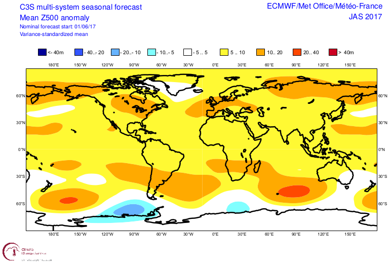
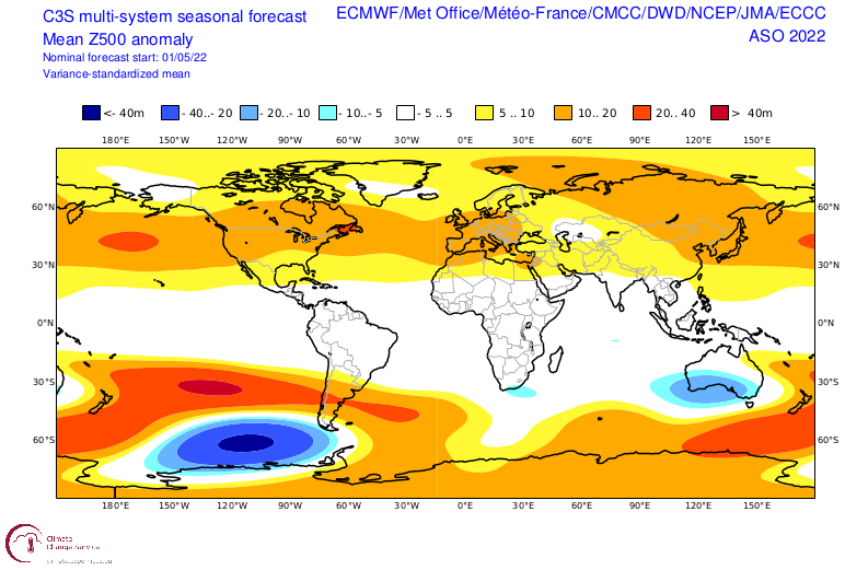
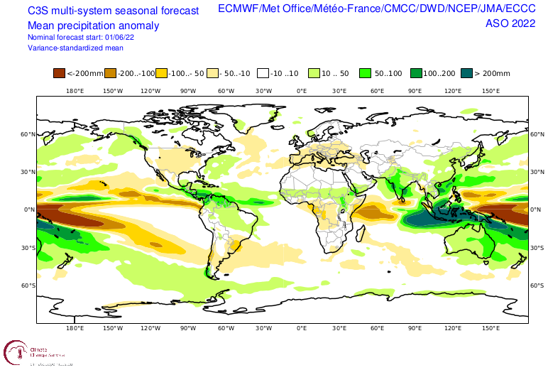
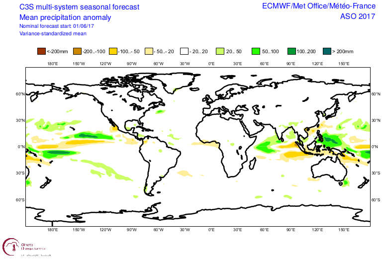
Another takeaway that probably needs more attention is how much farther north the ITCZ is on this year's forecast compared to the last two, and that large area of below normal precip in the MDR is gone.
Wasn't the ITCZ too far north in 2020 and sent storms like Paulette, Rene and Vicky into cooler waters (combined with the TUTT)? I'm curious how C3S still forecast the below normal precipitation in the MDR despite a northward displaced ITCZ in reality (even though the relatively lackluster MDR activity did verify).