
Loop sat image and you can see the spin:
http://rammb.cira.colostate.edu/ramsdis ... display=24
Moderator: S2k Moderators


cycloneye wrote:Surprised nobody posted the Eurothat has this wave in GOM to Louisiana from days 7 thru 10.


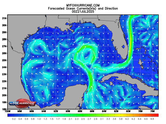
jasons wrote:So yesterday the models had this moving mostly towards Louisiana. Today it’s shifted to South Texas. This one needs to be watched as the Gulf is boiling with untapped energy.
TheStormExpert wrote:jasons wrote:So yesterday the models had this moving mostly towards Louisiana. Today it’s shifted to South Texas. This one needs to be watched as the Gulf is boiling with untapped energy.
Yes and the Gulf is likely the most favorable regions in the basin at the moment.


Astromanía wrote:Hi! I'm new in this forum
Is there a chance for this 'potentially system' to get Mexico? most especifically Nuevo Leon? we need the rain quickly, Monterrey is in crisis, dry year so far and state dams at 40% level.
abajan wrote:Astromanía wrote:Hi! I'm new in this forum
Is there a chance for this 'potentially system' to get Mexico? most especifically Nuevo Leon? we need the rain quickly, Monterrey is in crisis, dry year so far and state dams at 40% level.
Welcome Aboard!
As to your question, at this point in time, it's impossible to state with any level of certainty, where this potential system will go, assuming it even develops. The best I can advise, is to keep monitoring its progress.
gatorcane wrote:Despite models backing off some on development (for now), this wave needs close watching if it makes it into the Gulf or Bahamas given the untapped energy that awaits with the high SSTs.

Users browsing this forum: kevin and 121 guests


