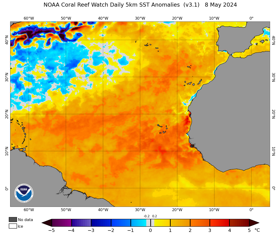
2021 Indicators: SST's / SAL / MSLP / Shear / Steering / Instability / Sat Images

This is the general tropical discussion area. Anyone can take their shot at predicting a storms path.

Moderator: S2k Moderators

Forum rules

The posts in this forum are NOT official forecasts and should not be used as such. They are just the opinion of the poster and may or may not be backed by sound meteorological data. They are NOT endorsed by any professional institution or STORM2K. For official information, please refer to products from the National Hurricane Center and National Weather Service.

Help Support Storm2K
Message
Author
User avatar
NotSparta
Professional-Met
Professional-Met
Posts: 1668
Age: 23
Joined: Fri Aug 18, 2017 8:24 am
Location: Naples, FL
Contact:

Re: 2021 Indicators: SST's / SAL / MSLP / Shear / Steering / Instability / Sat Images

#1241 Postby NotSparta » Wed Jul 14, 2021 10:00 am

Shell Mound wrote:
NotSparta wrote:
Shell Mound wrote:If the NAO is strongly positive during the same timeframe, then the coolish MDR + any EPAC convection + TUTT + ITCZ-related VWS could really kill the CV season.


EPAC convection looks suppressed, and you can't have the TUTT and an active ITCZ shearing the tropics at the same time. If the ITCZ is that strong, all the upper level heat release and -VP generation will severely stunt the TUTT

Do you think the active ITCZ could partly offset the coolish MDR (implied stability) and thus still produce some large storms, à la Frances, Ivan, or Irma?

https://twitter.com/DerekOrtt/status/1415076770743832581


Well the cool anomalies aren't really where the ITCZ so as long it doesn't move into the cooler waters there's no real stability at that latitude. Wouldn't be surprised to see some genesis modes similar to Elsa where a low latitude wave gets helped by low level westerly surges
3 likes   
This post was probably an opinion of mine, and in no way is official. Please refer to http://www.hurricanes.gov for official tropical analysis and advisories.

My website, with lots of tropical wx graphics, including satellite and recon: http://cyclonicwx.com

User avatar
Teban54
Category 5
Category 5
Posts: 3204
Joined: Sat May 19, 2018 1:19 pm

Re: 2021 Indicators: SST's / SAL / MSLP / Shear / Steering / Instability / Sat Images

#1242 Postby Teban54 » Wed Jul 14, 2021 10:05 am

Question from a newbie: So it seems like several 2021 VP forecasts, as well as analyses of past active seasons, show sinking air in the western MDR, Caribbean and Gulf. Why is that not a negative factor?
0 likes   

User avatar
aspen
Category 5
Category 5
Posts: 8818
Joined: Sat Oct 12, 2019 7:10 pm
Location: Connecticut, USA

Re: 2021 Indicators: SST's / SAL / MSLP / Shear / Steering / Instability / Sat Images

#1243 Postby aspen » Wed Jul 14, 2021 10:12 am

Shell Mound wrote:
NotSparta wrote:
Shell Mound wrote:If the NAO is strongly positive during the same timeframe, then the coolish MDR + any EPAC convection + TUTT + ITCZ-related VWS could really kill the CV season.


EPAC convection looks suppressed, and you can't have the TUTT and an active ITCZ shearing the tropics at the same time. If the ITCZ is that strong, all the upper level heat release and -VP generation will severely stunt the TUTT

Do you think the active ITCZ could partly offset the coolish MDR (implied stability) and thus still produce some large storms, à la Frances, Ivan, or Irma?

https://twitter.com/DerekOrtt/status/1415076770743832581

I’m thinking that due to the active and south-displaced ITCZ, we could see tracks similar to Dennis, Ivan, Felix, Maria, and Dorian — low-latitude genesis in the western half of the MDR or very close to the Lesser Antilles, where the systems either continue west (Ivan, Felix) or turn north earlier (Dennis, Maria, Dorian). This would indeed offset the possible negative impacts of an SST configuration like this: any developing waves would remains out of the way of cooler SSTs and stable air. An alternative possibility is that we get MDR storms like Paulette and Teddy, where they don’t reach their peak until they get north of 20N and into the subtropics. However, the strong ridging forecasts that SFLcane has been posting could prevent this.

Or this season becomes yet another year of west-based development and a lackluster MDR compared to the Caribbean and Gulf.
4 likes   
Irene '11 Sandy '12 Hermine '16 5/15/2018 Derecho Fay '20 Isaias '20 Elsa '21 Henri '21 Ida '21

I am only a meteorology enthusiast who knows a decent amount about tropical cyclones. Look to the professional mets, the NHC, or your local weather office for the best information.

AlphaToOmega
Category 5
Category 5
Posts: 1448
Joined: Sat Jun 26, 2021 10:51 am
Location: Somewhere in Massachusetts

Re: 2021 Indicators: SST's / SAL / MSLP / Shear / Steering / Instability / Sat Images

#1244 Postby AlphaToOmega » Wed Jul 14, 2021 10:21 am

aspen wrote:
Shell Mound wrote:
NotSparta wrote:
EPAC convection looks suppressed, and you can't have the TUTT and an active ITCZ shearing the tropics at the same time. If the ITCZ is that strong, all the upper level heat release and -VP generation will severely stunt the TUTT

Do you think the active ITCZ could partly offset the coolish MDR (implied stability) and thus still produce some large storms, à la Frances, Ivan, or Irma?

https://twitter.com/DerekOrtt/status/1415076770743832581

I’m thinking that due to the active and south-displaced ITCZ, we could see tracks similar to Dennis, Ivan, Felix, Maria, and Dorian — low-latitude genesis in the western half of the MDR or very close to the Lesser Antilles, where the systems either continue west (Ivan, Felix) or turn north earlier (Dennis, Maria, Dorian). This would indeed offset the possible negative impacts of an SST configuration like this: any developing waves would remains out of the way of cooler SSTs and stable air. An alternative possibility is that we get MDR storms like Paulette and Teddy, where they don’t reach their peak until they get north of 20N and into the subtropics. However, the strong ridging forecasts that SFLcane has been posting could prevent this.

Or this season becomes yet another year of west-based development and a lackluster MDR compared to the Caribbean and Gulf.


Just like 2005 and 2020

It is quite interesting that the most active hurricanes seasons (2005 and 2020) were not heavy MDR seasons.
6 likes   

User avatar
SFLcane
S2K Supporter
S2K Supporter
Posts: 10163
Age: 47
Joined: Sat Jun 05, 2010 1:44 pm
Location: Lake Worth Florida

Re: 2021 Indicators: SST's / SAL / MSLP / Shear / Steering / Instability / Sat Images

#1245 Postby SFLcane » Wed Jul 14, 2021 10:27 am

AlphaToOmega wrote:
aspen wrote:
Shell Mound wrote:Do you think the active ITCZ could partly offset the coolish MDR (implied stability) and thus still produce some large storms, à la Frances, Ivan, or Irma?

https://twitter.com/DerekOrtt/status/1415076770743832581

I’m thinking that due to the active and south-displaced ITCZ, we could see tracks similar to Dennis, Ivan, Felix, Maria, and Dorian — low-latitude genesis in the western half of the MDR or very close to the Lesser Antilles, where the systems either continue west (Ivan, Felix) or turn north earlier (Dennis, Maria, Dorian). This would indeed offset the possible negative impacts of an SST configuration like this: any developing waves would remains out of the way of cooler SSTs and stable air. An alternative possibility is that we get MDR storms like Paulette and Teddy, where they don’t reach their peak until they get north of 20N and into the subtropics. However, the strong ridging forecasts that SFLcane has been posting could prevent this.

Or this season becomes yet another year of west-based development and a lackluster MDR compared to the Caribbean and Gulf.


Just like 2005 and 2020

It is quite interesting that the most active hurricanes seasons (2005 and 2020) were not heavy MDR seasons.


No, but they did have much warmer SSTs in the Caribbean and Western Atlantic than we have now.
0 likes   

User avatar
Category5Kaiju
Category 5
Category 5
Posts: 4095
Joined: Thu Dec 24, 2020 12:45 pm
Location: Seattle

Re: 2021 Indicators: SST's / SAL / MSLP / Shear / Steering / Instability / Sat Images

#1246 Postby Category5Kaiju » Wed Jul 14, 2021 10:42 am

Image

Image

Image

Interesting sst setup to say the least. I do wonder though if that EGULF cool wake is from Elsa.
7 likes   
Unless explicitly stated, all info in my posts is based on my own opinions and observations. Tropical storms and hurricanes can be extremely dangerous. Do not think you can beat Mother Nature. Refer to an accredited weather research agency or meteorologist if you need to make serious decisions regarding an approaching storm.

User avatar
captainbarbossa19
Professional-Met
Professional-Met
Posts: 1092
Age: 27
Joined: Wed Aug 21, 2019 11:09 pm
Location: Beaumont, TX

Re: 2021 Indicators: SST's / SAL / MSLP / Shear / Steering / Instability / Sat Images

#1247 Postby captainbarbossa19 » Wed Jul 14, 2021 11:00 am


Looks like the MDR may be beginning to heat up. It is certainly not too late for the MDR to recover in time for peak season activity. The Gulf can quickly rebound too in a few weeks. An example of this was last year with Hurricane Hanna cooling the western Gulf. By the time Hurricane Laura arrived, the Gulf had completely recovered from the previous cooling.
2 likes   

User avatar
Teban54
Category 5
Category 5
Posts: 3204
Joined: Sat May 19, 2018 1:19 pm

Re: 2021 Indicators: SST's / SAL / MSLP / Shear / Steering / Instability / Sat Images

#1248 Postby Teban54 » Wed Jul 14, 2021 11:05 am

aspen wrote:
Shell Mound wrote:
NotSparta wrote:
EPAC convection looks suppressed, and you can't have the TUTT and an active ITCZ shearing the tropics at the same time. If the ITCZ is that strong, all the upper level heat release and -VP generation will severely stunt the TUTT

Do you think the active ITCZ could partly offset the coolish MDR (implied stability) and thus still produce some large storms, à la Frances, Ivan, or Irma?

https://twitter.com/DerekOrtt/status/1415076770743832581

I’m thinking that due to the active and south-displaced ITCZ, we could see tracks similar to Dennis, Ivan, Felix, Maria, and Dorian — low-latitude genesis in the western half of the MDR or very close to the Lesser Antilles, where the systems either continue west (Ivan, Felix) or turn north earlier (Dennis, Maria, Dorian). This would indeed offset the possible negative impacts of an SST configuration like this: any developing waves would remains out of the way of cooler SSTs and stable air. An alternative possibility is that we get MDR storms like Paulette and Teddy, where they don’t reach their peak until they get north of 20N and into the subtropics. However, the strong ridging forecasts that SFLcane has been posting could prevent this.

Or this season becomes yet another year of west-based development and a lackluster MDR compared to the Caribbean and Gulf.


Teddy actually reached Cat 4 just south of 20N, and peaked at 120 kts at 20.4N. Close enough to be considered in MDR imo.

Edit: Also, even such a scenario can also be potentially damaging. Florence '18 is a great example: it was pretty far north by the time it weakened to a TS, before it continued west, entered the (anomalously) warm subtropical region, and became a Cat 4 threatening the US mainland.
Last edited by Teban54 on Wed Jul 14, 2021 11:15 am, edited 1 time in total.
2 likes   

User avatar
GrayLancer18
Tropical Depression
Tropical Depression
Posts: 88
Joined: Mon Sep 02, 2019 2:45 pm
Contact:

Re: 2021 Indicators: SST's / SAL / MSLP / Shear / Steering / Instability / Sat Images

#1249 Postby GrayLancer18 » Wed Jul 14, 2021 11:13 am

Looks like things might be quiet into August but will get wild from Sep into October.

 https://twitter.com/webberweather/status/1415342177136386051


0 likes   
Hugo (1989) Hortense (1996) Georges (1998) Jeanne (2004) Irene (2011) Maria (2017)

I am NOT a professional meteorologist nor weather professional. Opinions are my own.
Consult with NHC and NOAA for official forecasts and advisories.

User avatar
Category5Kaiju
Category 5
Category 5
Posts: 4095
Joined: Thu Dec 24, 2020 12:45 pm
Location: Seattle

Re: 2021 Indicators: SST's / SAL / MSLP / Shear / Steering / Instability / Sat Images

#1250 Postby Category5Kaiju » Wed Jul 14, 2021 11:24 am

After the past recent years, it almost seems as if hurricane season has been shifted later into the calendar year; what I mean by this is it has been a while since we last saw a season with a lot of August and September activity with little October activity rather than the more recent patterns of little August activity but a lot of September and October activity. In fact, the past active stretch of seasons since 2016 did not feature their first major hurricane until late August or so. I wonder if 2021 will follow this trend or if it will surprise us with a major hurricane earlier than late August or so.
0 likes   
Unless explicitly stated, all info in my posts is based on my own opinions and observations. Tropical storms and hurricanes can be extremely dangerous. Do not think you can beat Mother Nature. Refer to an accredited weather research agency or meteorologist if you need to make serious decisions regarding an approaching storm.

Shell Mound
Category 5
Category 5
Posts: 2434
Age: 32
Joined: Thu Sep 07, 2017 3:39 pm
Location: St. Petersburg, FL → Scandinavia

Re: 2021 Indicators: SST's / SAL / MSLP / Shear / Steering / Instability / Sat Images

#1251 Postby Shell Mound » Wed Jul 14, 2021 11:29 am

I suspect that the very +NAO and enhanced WAR during ASO implies that the U.S. may be less at risk in 2021 than, say, Central America. 2007 comes to mind.

With more homegrown and subtropical development vs. formation in the MDR, I suspect that ACE will likely underperform relative to expectations once again.
Last edited by Shell Mound on Wed Jul 14, 2021 11:35 am, edited 1 time in total.
0 likes   
CVW / MiamiensisWx / Shell Mound
The posts in this forum are NOT official forecasts and should not be used as such. They are just the opinion of the poster and may or may not be backed by sound meteorological data. They are NOT endorsed by any professional institution or STORM2K. For official information, please refer to products from the NHC and NWS.

User avatar
Category5Kaiju
Category 5
Category 5
Posts: 4095
Joined: Thu Dec 24, 2020 12:45 pm
Location: Seattle

Re: 2021 Indicators: SST's / SAL / MSLP / Shear / Steering / Instability / Sat Images

#1252 Postby Category5Kaiju » Wed Jul 14, 2021 11:35 am

Shell Mound wrote:I suspect that the very +NAO and enhanced WAR during ASO implies that the U.S. may be less at risk in 2021 than, say, Central America. 2007 comes to mind.


While I am definitely not implying in any way that I'd rather have the storms hit other countries in any way, I really hope Central America does not experience another 2007 per se; they've had enough with Eta and Iota from last year.
2 likes   
Unless explicitly stated, all info in my posts is based on my own opinions and observations. Tropical storms and hurricanes can be extremely dangerous. Do not think you can beat Mother Nature. Refer to an accredited weather research agency or meteorologist if you need to make serious decisions regarding an approaching storm.

psyclone
S2K Supporter
S2K Supporter
Posts: 4762
Joined: Wed Aug 24, 2005 9:04 pm
Location: palm harbor fl

Re: 2021 Indicators: SST's / SAL / MSLP / Shear / Steering / Instability / Sat Images

#1253 Postby psyclone » Wed Jul 14, 2021 11:43 am

This thread has added 14 pages in a week. One thing i've noticed over the years...when there's lots happening here, there's nothing happening out there. Here's to hoping for another month of this at a minimum.
12 likes   

User avatar
Category5Kaiju
Category 5
Category 5
Posts: 4095
Joined: Thu Dec 24, 2020 12:45 pm
Location: Seattle

Re: 2021 Indicators: SST's / SAL / MSLP / Shear / Steering / Instability / Sat Images

#1254 Postby Category5Kaiju » Wed Jul 14, 2021 11:53 am

psyclone wrote:This thread has added 14 pages in a week. One thing i've noticed over the years...when there's lots happening here, there's nothing happening out there. Here's to hoping for another month of this at a minimum.


When there's an active storm (especially one that is threatening land or becoming a very powerful threat), I could only imagine how quiet the indicators thread would be but the thread dedicated to that storm extremely busy.
1 likes   
Unless explicitly stated, all info in my posts is based on my own opinions and observations. Tropical storms and hurricanes can be extremely dangerous. Do not think you can beat Mother Nature. Refer to an accredited weather research agency or meteorologist if you need to make serious decisions regarding an approaching storm.

psyclone
S2K Supporter
S2K Supporter
Posts: 4762
Joined: Wed Aug 24, 2005 9:04 pm
Location: palm harbor fl

Re: 2021 Indicators: SST's / SAL / MSLP / Shear / Steering / Instability / Sat Images

#1255 Postby psyclone » Wed Jul 14, 2021 11:57 am

Category5Kaiju wrote:
psyclone wrote:This thread has added 14 pages in a week. One thing i've noticed over the years...when there's lots happening here, there's nothing happening out there. Here's to hoping for another month of this at a minimum.


When there's an active storm (especially one that is threatening land or becoming a very powerful threat), I could only imagine how quiet the indicators thread would be but the thread dedicated to that storm extremely busy.


This is true and i thoroughly enjoy both the discussion and the downtime. We're probably going to have a season that's at least somewhat above normal so enjoy the intermission.
0 likes   

BYG Jacob

Re: 2021 Indicators: SST's / SAL / MSLP / Shear / Steering / Instability / Sat Images

#1256 Postby BYG Jacob » Wed Jul 14, 2021 12:36 pm

The southern, and much warmer, band of the MDR is colocated with the ITCZ currently.
7 likes   

User avatar
Stormybajan
Category 1
Category 1
Posts: 448
Joined: Thu May 20, 2021 3:21 pm
Location: Windward Islands

Re: 2021 Indicators: SST's / SAL / MSLP / Shear / Steering / Instability / Sat Images

#1257 Postby Stormybajan » Wed Jul 14, 2021 1:01 pm

The way I see it, theres more positive signals in the atlantic than negative. Im not sure stability realistically will be a problem, hasnt the last 5 years generally had "below average instability" from that chart I see every once in a while? Look where we are with 5 above average seasons in a row. The ITCZ right now I am not sure if it is indeed more south than usual for mid July, or not, but it does look quite convectively active to me..in a negative MJO background state.However, the big factor as I've stated before is the return of cool neutral or weak La Nina conditions which means less shear overall in the Atlantic basin. Finally, based on the SST set up right now favoring the lower MDR region I must say that I am still extremely wary of a strong Hurricane moving through the islands and then into the caribbean big or small in size
6 likes   
Sad West Indies and Manchester United fan ⚽️

MarioProtVI
Category 4
Category 4
Posts: 935
Age: 24
Joined: Sun Sep 29, 2019 7:33 pm
Location: New Jersey

Re: 2021 Indicators: SST's / SAL / MSLP / Shear / Steering / Instability / Sat Images

#1258 Postby MarioProtVI » Wed Jul 14, 2021 1:57 pm

Shell Mound wrote:I suspect that the very +NAO and enhanced WAR during ASO implies that the U.S. may be less at risk in 2021 than, say, Central America. 2007 comes to mind.

With more homegrown and subtropical development vs. formation in the MDR, I suspect that ACE will likely underperform relative to expectations once again.

Let’s see how this post stacks up in real time later on (likely will be wrong) You said Florida wouldnt be at risk last year and we know how that turned out. Things can change quickly, and I think the MDR and ACE will outdo predictions by a bit.
0 likes   

User avatar
Category5Kaiju
Category 5
Category 5
Posts: 4095
Joined: Thu Dec 24, 2020 12:45 pm
Location: Seattle

Re: 2021 Indicators: SST's / SAL / MSLP / Shear / Steering / Instability / Sat Images

#1259 Postby Category5Kaiju » Wed Jul 14, 2021 2:07 pm

MarioProtVI wrote:
Shell Mound wrote:I suspect that the very +NAO and enhanced WAR during ASO implies that the U.S. may be less at risk in 2021 than, say, Central America. 2007 comes to mind.

With more homegrown and subtropical development vs. formation in the MDR, I suspect that ACE will likely underperform relative to expectations once again.

Let’s see how this post stacks up in real time later on (likely will be wrong) You said Florida wouldnt be at risk last year and we know how that turned out. Things can change quickly, and I think the MDR and ACE will outdo predictions by a bit.


Florida did not get hit with any major hurricanes last year though, but it did still experience some TS hits, like from Eta. I do think this year may be different though. If Gulf ridging is not strong this year, then the predicted strong ridging over Eastern Canada could send storms westward but allow them to curve northward (kind of like what we saw with Elsa), and this would almost certainly put Florida at risk later this season if the ridging pattern comes to fruition.
0 likes   
Unless explicitly stated, all info in my posts is based on my own opinions and observations. Tropical storms and hurricanes can be extremely dangerous. Do not think you can beat Mother Nature. Refer to an accredited weather research agency or meteorologist if you need to make serious decisions regarding an approaching storm.

User avatar
Yellow Evan
Professional-Met
Professional-Met
Posts: 16143
Age: 27
Joined: Fri Jul 15, 2011 12:48 pm
Location: Henderson, Nevada/Honolulu, HI
Contact:

Re: 2021 Indicators: SST's / SAL / MSLP / Shear / Steering / Instability / Sat Images

#1260 Postby Yellow Evan » Wed Jul 14, 2021 2:11 pm

3 likes   


Return to “Talkin' Tropics”

Who is online

Users browsing this forum: No registered users and 37 guests