TD 10...Back Again

This is the general tropical discussion area. Anyone can take their shot at predicting a storms path.

Moderator: S2k Moderators

Forum rules

The posts in this forum are NOT official forecasts and should not be used as such. They are just the opinion of the poster and may or may not be backed by sound meteorological data. They are NOT endorsed by any professional institution or STORM2K. For official information, please refer to products from the National Hurricane Center and National Weather Service.

Help Support Storm2K
Message
Author
NorthGaWeather

#1301 Postby NorthGaWeather » Sat Aug 20, 2005 2:33 pm

gkrangers wrote:There appears to be a thunderstorm NNW of Puerto Rico.


And even more due North of PR. :P
0 likes   

User avatar
WindRunner
Category 5
Category 5
Posts: 5806
Age: 34
Joined: Fri Jul 29, 2005 8:07 pm
Location: Warrenton, VA, but Albany, NY for school
Contact:

#1302 Postby WindRunner » Sat Aug 20, 2005 2:38 pm

I know there isn't going to be any regen any time soon, but look at the plots sending it into the GOM! Even the smallest bit of rotating energy left (if any) would develop on this track with 89F water in the straights.

Image
0 likes   

Sanibel
Category 5
Category 5
Posts: 10375
Joined: Mon Aug 30, 2004 11:06 pm
Location: Offshore SW Florida

#1303 Postby Sanibel » Sat Aug 20, 2005 2:42 pm

It's not another wave. It is the sheared remnant deep convection of TD10 following along right behind it.

People criticize us for following such a weak feature, but an interesting thing is happening. The weak surface feature has vanished, so it is now possible that the remnant convection will find favorability and form a new surface center...
0 likes   

User avatar
x-y-no
Category 5
Category 5
Posts: 8359
Age: 65
Joined: Wed Aug 11, 2004 12:14 pm
Location: Fort Lauderdale, FL

#1304 Postby x-y-no » Sat Aug 20, 2005 2:47 pm

Sanibel wrote:It's not another wave. It is the sheared remnant deep convection of TD10 following along right behind it.

People criticize us for following such a weak feature, but an interesting thing is happening. The weak surface feature has vanished, so it is now possible that the remnant convection will find favorability and form a new surface center...


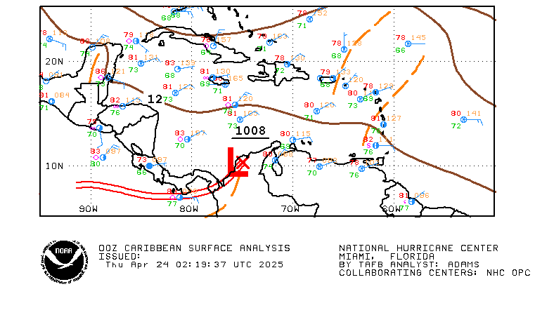
TAFB depicts another wave there, and they've been showing that wave slowly creeping up on TD10R's wave for days now:

Image
0 likes   

Derek Ortt

#1305 Postby Derek Ortt » Sat Aug 20, 2005 3:00 pm

SST is meaningless if the other parameters are not favorable. Plus, while SST is always warm in the GOM, the heat content is some of the lowest in the basin
0 likes   

WeatherEmperor
S2K Supporter
S2K Supporter
Posts: 4806
Age: 41
Joined: Thu Sep 04, 2003 2:54 pm
Location: South Florida

#1306 Postby WeatherEmperor » Sat Aug 20, 2005 3:01 pm

Derek Ortt wrote:SST is meaningless if the other parameters are not favorable. Plus, while SST is always warm in the GOM, the heat content is some of the lowest in the basin


thanks for putting that to good use Derek. Hopefully that will end some of this regarding TD10 coming back.

<RICKY>
0 likes   

User avatar
LSU2001
S2K Supporter
S2K Supporter
Posts: 1711
Age: 57
Joined: Sat Sep 11, 2004 11:01 pm
Location: Cut Off, Louisiana

#1307 Postby LSU2001 » Sat Aug 20, 2005 3:18 pm

Derek I understand that heat content of GOM is lowest in the Atlantic basin but there have been some very, very significant tropical cyclones that have developed in the GOM. You seem to always downplay the GOM potential and I really do not understand your thinking. Could you explain why you seem to dismiss the GOM??
I am not questioning your professional judgement I am only asking so that I may learn something
TIm :D
0 likes   
Personal Forecast Disclaimer:
The posts in this forum are NOT official forecast and should not be used as such. They are NOT endorsed by any professional institution or storm2k.org. For official information, please refer to the NHC and NWS products.

User avatar
WindRunner
Category 5
Category 5
Posts: 5806
Age: 34
Joined: Fri Jul 29, 2005 8:07 pm
Location: Warrenton, VA, but Albany, NY for school
Contact:

#1308 Postby WindRunner » Sat Aug 20, 2005 3:26 pm

From what I understand, he is refering to the 26C isotherm depth and heat-potential maps that always show the gulf as baking on the surface and cooling off rather quickly as the depth increases.
0 likes   

User avatar
SouthFloridawx
S2K Supporter
S2K Supporter
Posts: 8346
Age: 46
Joined: Tue Jul 26, 2005 1:16 am
Location: Sarasota, FL
Contact:

hmm

#1309 Postby SouthFloridawx » Sat Aug 20, 2005 3:35 pm

Image
0 likes   

User avatar
WindRunner
Category 5
Category 5
Posts: 5806
Age: 34
Joined: Fri Jul 29, 2005 8:07 pm
Location: Warrenton, VA, but Albany, NY for school
Contact:

#1310 Postby WindRunner » Sat Aug 20, 2005 3:46 pm

WHOA! Where did that hi-qual image come from?
0 likes   

User avatar
SouthFloridawx
S2K Supporter
S2K Supporter
Posts: 8346
Age: 46
Joined: Tue Jul 26, 2005 1:16 am
Location: Sarasota, FL
Contact:

#1311 Postby SouthFloridawx » Sat Aug 20, 2005 3:50 pm

WindRunner wrote:WHOA! Where did that hi-qual image come from?


here

http://www.atmos.washington.edu/~ovens/ ... nhanced+12
0 likes   

elysium

#1312 Postby elysium » Sat Aug 20, 2005 4:01 pm

Has two areas of interest. The primary area to the north, and weaker secondary area just off the NE coast of Puerto Rico.
0 likes   

NorthGaWeather

#1313 Postby NorthGaWeather » Sat Aug 20, 2005 4:12 pm

Derek Ortt wrote:SST is meaningless if the other parameters are not favorable. Plus, while SST is always warm in the GOM, the heat content is some of the lowest in the basin


Really, well it looks like from the maps I've seen that the Central/Southeastern Gulf has some good heat content.
0 likes   

elysium

#1314 Postby elysium » Sat Aug 20, 2005 4:14 pm

The following post is NOT an official forecast and should NOT be used as such. It is just the opinion of the poster and may or may NOT be backed by sound meteorological data. It is NOT endorsed by any professional institution including storm2k.org. For official information please refer to the NHC and NWS products.

The area off the NE coast of Puerto Rico appears to have closed, and looks like the primary center. We should be getting the upgrade very soon. Initial indications are that it is moving slightly north of due west at around 10 to 15 mph.
0 likes   

Derek Ortt

#1315 Postby Derek Ortt » Sat Aug 20, 2005 4:20 pm

most of the rapid intensification in the GOM is usually associated with a trough interaction; thus, is not pure tropical intensification. This was even the case with Charley. PV advection enabled the last minute rapid intensification

We must remember, that the vast majority of major hurricanes in the GOM entered the GOM as a classified TC. Even Opal entered as a tropical storm
0 likes   

jkt21787
Category 5
Category 5
Posts: 2061
Joined: Tue Aug 31, 2004 5:27 pm
Location: Memphis, TN

#1316 Postby jkt21787 » Sat Aug 20, 2005 4:25 pm

elysium wrote:The following post is NOT an official forecast and should NOT be used as such. It is just the opinion of the poster and may or may NOT be backed by sound meteorological data. It is NOT endorsed by any professional institution including storm2k.org. For official information please refer to the NHC and NWS products.

The area off the NE coast of Puerto Rico appears to have closed, and looks like the primary center. We should be getting the upgrade very soon. Initial indications are that it is moving slightly north of due west at around 10 to 15 mph.

NHC disagrees strongly...5:30 TWO...

CLOUDINESS AND SHOWERS EXTENDING FROM THE BAHAMAS EASTWARD FOR SEVERAL HUNDRED MILES ARE ASSOCIATED WITH THE REMNANTS OF TROPICAL DEPRESSION TEN AND A WESTWARD MOVING TROPICAL WAVE. MOST OF THE SHOWER ACTIVITY IS NOW ASSOCIATED WITH THE WAVE AND IS CENTERED ABOUT 150 MILES NORTH OF PUERTO RICO. ALTHOUGH UPPER-LEVEL WINDS ARE FAVORABLE FOR SOME DEVELOPMENT...PRESSURES ARE NOT FALLING AND THERE ARE NO SIGNS OF SURFACE CIRCULATION. THIS ACTIVITY IS EXPECTED TO SPREAD WESTWARD DURING THE NEXT DAY OR TWO.
0 likes   

Frank P
S2K Supporter
S2K Supporter
Posts: 2776
Joined: Fri Aug 29, 2003 10:52 am
Location: Biloxi Beach, Ms
Contact:

#1317 Postby Frank P » Sat Aug 20, 2005 4:28 pm

Derek Ortt wrote:most of the rapid intensification in the GOM is usually associated with a trough interaction; thus, is not pure tropical intensification. This was even the case with Charley. PV advection enabled the last minute rapid intensification

We must remember, that the vast majority of major hurricanes in the GOM entered the GOM as a classified TC. Even Opal entered as a tropical storm


I'm not sure this is totally accurate Derek... from my recollection I think Hurricane Opal originated from an area of disturbed weather to the east of Cozumel, Mexico in late September. Passing over the Yucatan Peninsula, Opal didn't reached tropical storm strength until September 30 in the southwestern Gulf of Mexico....
0 likes   

WeatherEmperor
S2K Supporter
S2K Supporter
Posts: 4806
Age: 41
Joined: Thu Sep 04, 2003 2:54 pm
Location: South Florida

#1318 Postby WeatherEmperor » Sat Aug 20, 2005 4:29 pm

Frank P wrote:
Derek Ortt wrote:most of the rapid intensification in the GOM is usually associated with a trough interaction; thus, is not pure tropical intensification. This was even the case with Charley. PV advection enabled the last minute rapid intensification

We must remember, that the vast majority of major hurricanes in the GOM entered the GOM as a classified TC. Even Opal entered as a tropical storm


I'm not sure this is totally accurate Derek... from my recollection I think Hurricane Opal originated from an area of disturbed weather to the east of Cozumel, Mexico in late September. Passing over the Yucatan Peninsula, Opal didn't reached tropical storm strength until September 30 in the southwestern Gulf of Mexico....


That is correct. Take a look at this graphic.

<RICKY>

http://weather.unisys.com/hurricane/atl ... /track.gif
0 likes   

User avatar
Ivanhater
Storm2k Moderator
Storm2k Moderator
Posts: 11162
Age: 38
Joined: Fri Jul 01, 2005 8:25 am
Location: Pensacola

#1319 Postby Ivanhater » Sat Aug 20, 2005 4:30 pm

Hurricane Opal originated from an area of disturbed weather to the east of Cozumel, Mexico in late September. Passing over the Yucatan Peninsula, Opal reached tropical storm strength on September 30 in the southwestern Gulf of Mexico. Opal reached hurricane intensity on October 2nd, and begin a slow northward motion in response to an upper level trough moving the through the central United States. A hurricane watch was issued on October 3 from Morgan City, Louisiana to Pensacola, Florida.
0 likes   

jkt21787
Category 5
Category 5
Posts: 2061
Joined: Tue Aug 31, 2004 5:27 pm
Location: Memphis, TN

#1320 Postby jkt21787 » Sat Aug 20, 2005 4:31 pm

WeatherEmperor wrote:
Frank P wrote:
Derek Ortt wrote:most of the rapid intensification in the GOM is usually associated with a trough interaction; thus, is not pure tropical intensification. This was even the case with Charley. PV advection enabled the last minute rapid intensification

We must remember, that the vast majority of major hurricanes in the GOM entered the GOM as a classified TC. Even Opal entered as a tropical storm


I'm not sure this is totally accurate Derek... from my recollection I think Hurricane Opal originated from an area of disturbed weather to the east of Cozumel, Mexico in late September. Passing over the Yucatan Peninsula, Opal didn't reached tropical storm strength until September 30 in the southwestern Gulf of Mexico....


That is correct. Take a look at this graphic.

<RICKY>

http://weather.unisys.com/hurricane/atl ... /track.gif

Looks like the Gulf to me.

Sorry, Derek.
0 likes   


Return to “Talkin' Tropics”

Who is online

Users browsing this forum: Cdenton12 and 75 guests