Development with Tropical Wave in MDR?

This is the general tropical discussion area. Anyone can take their shot at predicting a storms path.

Moderator: S2k Moderators

Forum rules

The posts in this forum are NOT official forecasts and should not be used as such. They are just the opinion of the poster and may or may not be backed by sound meteorological data. They are NOT endorsed by any professional institution or STORM2K. For official information, please refer to products from the National Hurricane Center and National Weather Service.

Help Support Storm2K
Message
Author
lonelymike
S2K Supporter
S2K Supporter
Posts: 634
Joined: Sat Jul 26, 2008 10:12 am
Location: walton county fla

Re: Development with Strong Tropical Wave in MDR?

#141 Postby lonelymike » Tue Jul 14, 2009 6:17 pm

[quote="lonelymike"]The ratings...er Weather channel is already pushing this as the first major depression of 2009. If it even hints of bleeding it leads :spam:[/quote

And Stephanie Abrahms will be bringing us live updates tomorrow nite from a dinghy in the middle of the Atlantic charting those 20mph gusts:)

FYI just having some fun at the expense of NBC Universal don't mean anything by it before someone gets offended.
0 likes   

User avatar
lester
S2K Supporter
S2K Supporter
Posts: 1305
Age: 36
Joined: Sat Aug 27, 2005 5:21 pm
Location: Washington, DC
Contact:

Re: Development with Strong Tropical Wave in MDR?

#142 Postby lester » Tue Jul 14, 2009 6:42 pm

lonelymike wrote:
lonelymike wrote:The ratings...er Weather channel is already pushing this as the first major depression of 2009. If it even hints of bleeding it leads :spam:[/quote

And Stephanie Abrahms will be bringing us live updates tomorrow nite from a dinghy in the middle of the Atlantic charting those 20mph gusts:)

FYI just having some fun at the expense of NBC Universal don't mean anything by it before someone gets offended.


lol it was pretty funny to me :cheesy:
0 likes   

User avatar
HURAKAN
Professional-Met
Professional-Met
Posts: 46086
Age: 38
Joined: Thu May 20, 2004 4:34 pm
Location: Key West, FL
Contact:

#143 Postby HURAKAN » Tue Jul 14, 2009 6:43 pm

910
ABNT20 KNHC 142340
TWOAT
TROPICAL WEATHER OUTLOOK
NWS TPC/NATIONAL HURRICANE CENTER MIAMI FL
800 PM EDT TUE JUL 14 2009

FOR THE NORTH ATLANTIC...CARIBBEAN SEA AND THE GULF OF MEXICO...

TROPICAL CYCLONE FORMATION IS NOT EXPECTED DURING THE NEXT 48 HOURS.

$$
FORECASTER BROWN

0 likes   

User avatar
lester
S2K Supporter
S2K Supporter
Posts: 1305
Age: 36
Joined: Sat Aug 27, 2005 5:21 pm
Location: Washington, DC
Contact:

Re:

#144 Postby lester » Tue Jul 14, 2009 6:47 pm

HURAKAN wrote:910
ABNT20 KNHC 142340
TWOAT
TROPICAL WEATHER OUTLOOK
NWS TPC/NATIONAL HURRICANE CENTER MIAMI FL
800 PM EDT TUE JUL 14 2009

FOR THE NORTH ATLANTIC...CARIBBEAN SEA AND THE GULF OF MEXICO...

TROPICAL CYCLONE FORMATION IS NOT EXPECTED DURING THE NEXT 48 HOURS.

$$
FORECASTER BROWN


guess we're going to have to wait and see if the wave hangs tough during the next day or two.. :wink:
0 likes   

floridasun78
Category 5
Category 5
Posts: 3755
Joined: Sun May 17, 2009 10:16 pm
Location: miami fl

Re: Development with Strong Tropical Wave in MDR?

#145 Postby floridasun78 » Tue Jul 14, 2009 6:49 pm

it like nhc want to see it like this by getting to 50 west or 55 west their want to see if shear or dry air donot kill all those storm by wed morning
0 likes   

User avatar
cycloneye
Admin
Admin
Posts: 145619
Age: 68
Joined: Thu Oct 10, 2002 10:54 am
Location: San Juan, Puerto Rico

Re: Development with Strong Tropical Wave in MDR?

#146 Postby cycloneye » Tue Jul 14, 2009 6:57 pm

It has some low level convergence to work with.

Image
0 likes   

Derek Ortt

#147 Postby Derek Ortt » Tue Jul 14, 2009 7:22 pm

we also do not expect development of anything in the E Atl through the next several days
0 likes   

User avatar
BigA
Professional-Met
Professional-Met
Posts: 1317
Joined: Sun Jul 24, 2005 10:56 pm

Re: Development with Strong Tropical Wave in MDR?

#148 Postby BigA » Tue Jul 14, 2009 7:25 pm

I guarantee that if this system was identical, but was located 100 miles off the Florida coast the tropical outlook would not say "tropical storm formation is not expected through Wednesday." I can't really blame the Hurricane Center for this, as they have far better access to information closer to the United States.

That said, its a purely academic matter unless it actually has the potential to become a strong system or threaten land
0 likes   

User avatar
gatorcane
S2K Supporter
S2K Supporter
Posts: 23692
Age: 47
Joined: Sun Mar 13, 2005 3:54 pm
Location: Boca Raton, FL

#149 Postby gatorcane » Tue Jul 14, 2009 7:41 pm

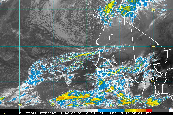
Huge blob of convection is about ready to exit Africa...If anything these huge blobs are going to put a dent in that SAL out in the MDR, possibly allowing for a low SAL environment down the road.

Also if you put this loop in motion, you will see some good cyclonic turning already west of this big blob over Africa..yet another wave about ready to emerge...
http://www.ssd.noaa.gov/eumet/eatl/loop-avn.html

I see 4 areas of interest in that one image. Pretty decent for July. But only about a 5-10% chance of any of them developing though. In fact I don't think any of them will be the first named storm. If it were about 1 month later, things could be different.

Image
Last edited by gatorcane on Tue Jul 14, 2009 7:55 pm, edited 1 time in total.
0 likes   

User avatar
Tropics Guy
Tropical Storm
Tropical Storm
Posts: 167
Age: 62
Joined: Tue Aug 31, 2004 8:12 pm
Location: Hallandale beach & Vero beach, FL

Re: Development with Strong Tropical Wave in MDR?

#150 Postby Tropics Guy » Tue Jul 14, 2009 7:47 pm

Even though the East Atlantic wave looks like it may be organizing at the moment, they (NHC) will probably wait til tomorrow until mentioning it in the TWO, IF it is still intact.
TG
0 likes   

User avatar
wxman57
Moderator-Pro Met
Moderator-Pro Met
Posts: 22984
Age: 67
Joined: Sat Jun 21, 2003 8:06 pm
Location: Houston, TX (southwest)

Re: Development with Strong Tropical Wave in MDR?

#151 Postby wxman57 » Tue Jul 14, 2009 8:07 pm

BigA wrote:I guarantee that if this system was identical, but was located 100 miles off the Florida coast the tropical outlook would not say "tropical storm formation is not expected through Wednesday." I can't really blame the Hurricane Center for this, as they have far better access to information closer to the United States.

That said, its a purely academic matter unless it actually has the potential to become a strong system or threaten land


The difference is that systems typically move off the coast of Africa and weaken within the first 24-48 hours in July, whereas that's not necessarily the case near Florida. And a system near land has the potential to be a threat very quickly. So a system that looks like this near Florida would warrant much greater attention.

Oh, and the convection is decreasing quite rapidly now. I still think it'll be another few weeks before Ana forms. I keep thinking August 8th for some reason...
0 likes   

User avatar
dixiebreeze
S2K Supporter
S2K Supporter
Posts: 5140
Joined: Wed Sep 03, 2003 5:07 pm
Location: crystal river, fla.

Re: Development with Strong Tropical Wave in MDR?

#152 Postby dixiebreeze » Tue Jul 14, 2009 8:25 pm

0 likes   

User avatar
HURAKAN
Professional-Met
Professional-Met
Posts: 46086
Age: 38
Joined: Thu May 20, 2004 4:34 pm
Location: Key West, FL
Contact:

#153 Postby HURAKAN » Tue Jul 14, 2009 8:36 pm

Image

Still has a good blob.
0 likes   

User avatar
GeneratorPower
S2K Supporter
S2K Supporter
Posts: 1648
Age: 45
Joined: Sun Dec 18, 2005 11:48 pm
Location: Huntsville, AL

Re: Development with Strong Tropical Wave in MDR?

#154 Postby GeneratorPower » Tue Jul 14, 2009 9:07 pm

cycloneye, where did you get that infrared loop with the 30 minute updates on the east Atlantic? Can you post the link to the site?
0 likes   

User avatar
cycloneye
Admin
Admin
Posts: 145619
Age: 68
Joined: Thu Oct 10, 2002 10:54 am
Location: San Juan, Puerto Rico

Re: Development with Strong Tropical Wave in MDR?

#155 Postby cycloneye » Tue Jul 14, 2009 9:12 pm

GeneratorPower wrote:cycloneye, where did you get that infrared loop with the 30 minute updates on the east Atlantic? Can you post the link to the site?


Tropical Ramsdis site.

http://rammb.cira.colostate.edu/ramsdis ... opical.asp
0 likes   

OuterBanker
S2K Supporter
S2K Supporter
Posts: 1735
Joined: Wed Feb 26, 2003 10:53 am
Location: Nags Head, NC
Contact:

#156 Postby OuterBanker » Tue Jul 14, 2009 9:18 pm

Wow, how pretty. All to no avail for awhile I'm afraid. Don't think it has a chance with all the dry air and easterlies ahead. Look at anything from 0 to 15 N nada. Unless this gets above 20N I don't think it has a chance. But for now it looks good.
0 likes   

User avatar
GeneratorPower
S2K Supporter
S2K Supporter
Posts: 1648
Age: 45
Joined: Sun Dec 18, 2005 11:48 pm
Location: Huntsville, AL

Re: Development with Strong Tropical Wave in MDR?

#157 Postby GeneratorPower » Tue Jul 14, 2009 9:27 pm

cycloneye wrote:
GeneratorPower wrote:cycloneye, where did you get that infrared loop with the 30 minute updates on the east Atlantic? Can you post the link to the site?


Tropical Ramsdis site.

http://rammb.cira.colostate.edu/ramsdis ... opical.asp


Thanks, cycloneye. However, it looks like the useful products are all password protected. Which link are you using?
0 likes   

User avatar
cycloneye
Admin
Admin
Posts: 145619
Age: 68
Joined: Thu Oct 10, 2002 10:54 am
Location: San Juan, Puerto Rico

Re: Development with Strong Tropical Wave in MDR?

#158 Postby cycloneye » Tue Jul 14, 2009 9:35 pm

The loops are restricted so you have to aquire them through the image URL which is in a sequence, then download them and then animate them.
0 likes   

User avatar
GeneratorPower
S2K Supporter
S2K Supporter
Posts: 1648
Age: 45
Joined: Sun Dec 18, 2005 11:48 pm
Location: Huntsville, AL

Re: Development with Strong Tropical Wave in MDR?

#159 Postby GeneratorPower » Tue Jul 14, 2009 9:46 pm

cycloneye wrote:The loops are restricted so you have to aquire them through the image URL which is in a sequence, then download them and then animate them.


That is epic awesome, cycloneye. Excellent. And thank you!
0 likes   

floridasun78
Category 5
Category 5
Posts: 3755
Joined: Sun May 17, 2009 10:16 pm
Location: miami fl

Re: Development with Strong Tropical Wave in MDR?

#160 Postby floridasun78 » Tue Jul 14, 2009 9:50 pm

cycloneye wrote:The loops are restricted so you have to aquire them through the image URL which is in a sequence, then download them and then animate them.

how you do that????
0 likes   


Return to “Talkin' Tropics”

Who is online

Users browsing this forum: duilaslol, Stratton23 and 505 guests