2011 WPAC Season
Moderator: S2k Moderators
Forum rules

The posts in this forum are NOT official forecasts and should not be used as such. They are just the opinion of the poster and may or may not be backed by sound meteorological data. They are NOT endorsed by any professional institution or STORM2K. For official information, please refer to products from the National Hurricane Center and National Weather Service.


Re: 2011 WPAC Season
HKO summary for month of August.
Under the prolonged dominance of the sub-tropical ridge, Hong Kong experienced one of the hottest August since records began in 1884. The monthly mean temperature soared to 29.5 degrees, equaling the record set in 1990 and 1998 and was 1.1 degrees above normal. The month was sunnier than usual. The monthly total duration of bright sunshine was 242.0 hours, 52.3 hours higher than normal. The month was also dry with a total rainfall of 157.6 millimetres, only 35 percent of the normal figure and the accumulated rainfall since 1 January of 1092.3 millimetres suffered a deficit of 42 percent compared to the normal figure of 1873.7 millimetres for the same period.
Under the prolonged dominance of the sub-tropical ridge, Hong Kong experienced one of the hottest August since records began in 1884. The monthly mean temperature soared to 29.5 degrees, equaling the record set in 1990 and 1998 and was 1.1 degrees above normal. The month was sunnier than usual. The monthly total duration of bright sunshine was 242.0 hours, 52.3 hours higher than normal. The month was also dry with a total rainfall of 157.6 millimetres, only 35 percent of the normal figure and the accumulated rainfall since 1 January of 1092.3 millimetres suffered a deficit of 42 percent compared to the normal figure of 1873.7 millimetres for the same period.
0 likes
-
Typhoon Hunter
- WesternPacificWeather.com

- Posts: 1222
- Joined: Wed Oct 11, 2006 11:37 am
- Location: Tokyo
- Contact:
-
StormingB81

- S2K Supporter

- Posts: 5676
- Age: 44
- Joined: Thu Aug 27, 2009 1:45 am
- Location: Rockledge, Florida
-
euro6208
Re: 2011 WPAC Season
Now ECMWF has a large depression developing in the South China Sea. Let's wait and see...
0 likes
-
dexterlabio
- Category 5

- Posts: 3499
- Joined: Sat Oct 24, 2009 11:50 pm
Re: 2011 WPAC Season
Oh you guys have already been talking about the euro.  Yeah they've been showing something brewing in the coming weeks. I think I should wait until Thursday and if the models still gonna show the same thing, then that's it...
Just to show the last 3 runs from Euro. It's been consistent in showing something to develop in SCS and Philippine Sea.


Just to show the last 3 runs from Euro. It's been consistent in showing something to develop in SCS and Philippine Sea.
0 likes
Personal Forecast Disclaimer:
The posts in this forum are NOT official forecast and should not be used as such. They are just the opinion of the poster and may or may not be backed by sound meteorological data. They are NOT endorsed by any professional institution or storm2k.org. For official information, please refer to the NHC and NWS products.
The posts in this forum are NOT official forecast and should not be used as such. They are just the opinion of the poster and may or may not be backed by sound meteorological data. They are NOT endorsed by any professional institution or storm2k.org. For official information, please refer to the NHC and NWS products.
-
Typhoon Hunter
- WesternPacificWeather.com
- Posts: 1222
- Joined: Wed Oct 11, 2006 11:37 am
- Location: Tokyo
- Contact:
-
dexterlabio
- Category 5
- Posts: 3499
- Joined: Sat Oct 24, 2009 11:50 pm
Re: 2011 WPAC Season

Doesn't look good, especially to those area hit by Nanmadol last month. As per this run (if you're gonna look at the map with yellow, green and blue color thing, uhh...what do you call that?
Last edited by dexterlabio on Mon Sep 19, 2011 11:35 pm, edited 1 time in total.
0 likes
Personal Forecast Disclaimer:
The posts in this forum are NOT official forecast and should not be used as such. They are just the opinion of the poster and may or may not be backed by sound meteorological data. They are NOT endorsed by any professional institution or storm2k.org. For official information, please refer to the NHC and NWS products.
The posts in this forum are NOT official forecast and should not be used as such. They are just the opinion of the poster and may or may not be backed by sound meteorological data. They are NOT endorsed by any professional institution or storm2k.org. For official information, please refer to the NHC and NWS products.
-
dexterlabio
- Category 5
- Posts: 3499
- Joined: Sat Oct 24, 2009 11:50 pm
Re: 2011 WPAC Season
Oh if ever this is gonna hit Luzon on the said date (for goodness' sake I hope this won't verify), it will be near the 2nd anniversary of Ketsana's onslaught, and Parma. Also Xangxane in 2006. I can't remember exactly but they existed between Sept 25-Oct1. (?)
0 likes
Personal Forecast Disclaimer:
The posts in this forum are NOT official forecast and should not be used as such. They are just the opinion of the poster and may or may not be backed by sound meteorological data. They are NOT endorsed by any professional institution or storm2k.org. For official information, please refer to the NHC and NWS products.
The posts in this forum are NOT official forecast and should not be used as such. They are just the opinion of the poster and may or may not be backed by sound meteorological data. They are NOT endorsed by any professional institution or storm2k.org. For official information, please refer to the NHC and NWS products.
-
euro6208
Re: 2011 WPAC Season
during la nina years, storms can develop really close to land as the warm waters are further west so countries to philippines to japan will be at risk.
0 likes
-
phwxenthusiast
- Category 2

- Posts: 637
- Joined: Wed Mar 24, 2010 3:10 am
- Location: Holbrook, NY (Long Island)
-
Typhoon Hunter
- WesternPacificWeather.com
- Posts: 1222
- Joined: Wed Oct 11, 2006 11:37 am
- Location: Tokyo
- Contact:
Re: 2011 WPAC Season
They are Pat. ECMWF look like a Hagupit mkII (from 2008).
GFS, UKMET and CMC also all developing this and bringing it in general direction of Luzon!
GFS, UKMET and CMC also all developing this and bringing it in general direction of Luzon!
0 likes
-
dexterlabio
- Category 5
- Posts: 3499
- Joined: Sat Oct 24, 2009 11:50 pm
Re: 2011 WPAC Season
I see this beginning to happen now, with 98W developing south of Philippine Sea. Now I'm gonna trust Euro that this won't deepen that much before it gets near. Though as of now I don't see any reason to be alarmed, part of me still thinking that this may act just like Roke which veered NE instead of proceeding towards Okinawa.
0 likes
Personal Forecast Disclaimer:
The posts in this forum are NOT official forecast and should not be used as such. They are just the opinion of the poster and may or may not be backed by sound meteorological data. They are NOT endorsed by any professional institution or storm2k.org. For official information, please refer to the NHC and NWS products.
The posts in this forum are NOT official forecast and should not be used as such. They are just the opinion of the poster and may or may not be backed by sound meteorological data. They are NOT endorsed by any professional institution or storm2k.org. For official information, please refer to the NHC and NWS products.

The next name on the list would be Nesat.
2005's Nesat was a Super Typhoon.
It's so uncanny this year that mostly the same names in 2005 became super typhoons again in 2011 - Songda, Nanmadol, Muifa, Ma-on etc... while most of those that were TS in 2005 remained a TS again in 2011.
Just sayin'.
The posts in this forum are NOT official forecast and should not be used as such. They are just the opinion of the poster and may or may not be backed by sound meteorological data. They are NOT endorsed by any professional institution or storm2k.org. For official information, please refer to the NHC and NWS products.
0 likes
-
dexterlabio
- Category 5
- Posts: 3499
- Joined: Sat Oct 24, 2009 11:50 pm
Re: 2011 WPAC Season
Euro 00z run shows a nastier scenario, bringing it closer to the national capital.
Just asking, do we have a dry phase of MJO next week?
Just asking, do we have a dry phase of MJO next week?
0 likes
Personal Forecast Disclaimer:
The posts in this forum are NOT official forecast and should not be used as such. They are just the opinion of the poster and may or may not be backed by sound meteorological data. They are NOT endorsed by any professional institution or storm2k.org. For official information, please refer to the NHC and NWS products.
The posts in this forum are NOT official forecast and should not be used as such. They are just the opinion of the poster and may or may not be backed by sound meteorological data. They are NOT endorsed by any professional institution or storm2k.org. For official information, please refer to the NHC and NWS products.
-
euro6208
Re: 2011 WPAC Season
the mjo is currently weak but is showing signs of strengthening as it moves to the east.
this is from cpc:
• There are signs that the MJO may be strengthening. Most dynamical model MJO
index forecasts indicate an eastward propagating MJO signal during the next two
weeks with the enhanced phase shifting across the Maritime continent to the western
Pacific by the end of the period.
• Based on recent observations and model MJO index forecasts, the MJO is forecast to
strengthen during the period.

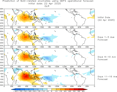
currently conditions in the west pacific are favorable for development .If the forecast does happen, the wpac should be even more favorable for all storms to strengthen
this is from cpc:
• There are signs that the MJO may be strengthening. Most dynamical model MJO
index forecasts indicate an eastward propagating MJO signal during the next two
weeks with the enhanced phase shifting across the Maritime continent to the western
Pacific by the end of the period.
• Based on recent observations and model MJO index forecasts, the MJO is forecast to
strengthen during the period.
currently conditions in the west pacific are favorable for development .If the forecast does happen, the wpac should be even more favorable for all storms to strengthen
0 likes
-
euro6208
Re: 2011 WPAC Season
earlier this year, i forecast 2 category 5 landfalls somewhere in the west pacific. i'm starting to think 98W might be one of them. let's wait and watch...
0 likes
Who is online
Users browsing this forum: No registered users and 61 guests