
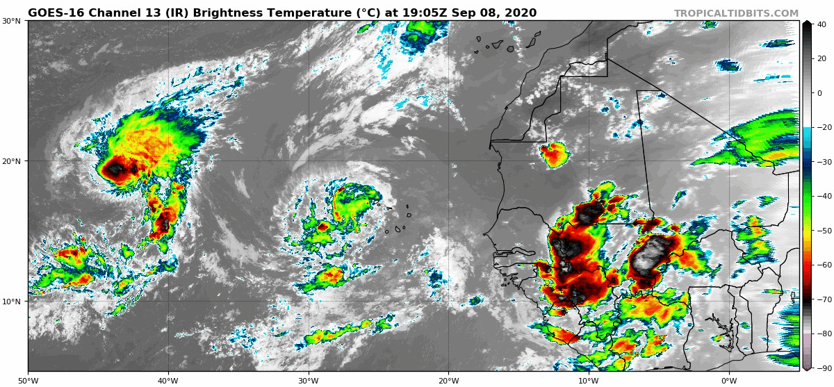
Tropical Wave has emerged from West Africa (Is Invest 95L)
Moderator: S2k Moderators
Forum rules

The posts in this forum are NOT official forecasts and should not be used as such. They are just the opinion of the poster and may or may not be backed by sound meteorological data. They are NOT endorsed by any professional institution or STORM2K. For official information, please refer to products from the National Hurricane Center and National Weather Service.
-
cycloneye

- Admin

- Posts: 149501
- Age: 69
- Joined: Thu Oct 10, 2002 10:54 am
- Location: San Juan, Puerto Rico
Re: Tropical Wave inside Africa
Wave with low Pressure has been introduced on the 18z surface analysis. Low around 11n.
1 likes
Visit the Caribbean-Central America Weather Thread where you can find at first post web cams,radars
and observations from Caribbean basin members Click Here
and observations from Caribbean basin members Click Here
-
SFLcane

- S2K Supporter

- Posts: 10281
- Age: 48
- Joined: Sat Jun 05, 2010 1:44 pm
- Location: Lake Worth Florida
Re: Tropical Wave inside Africa
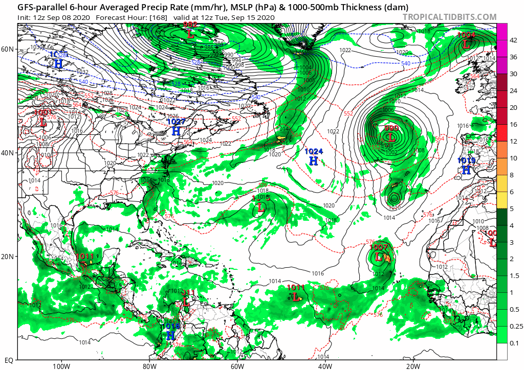
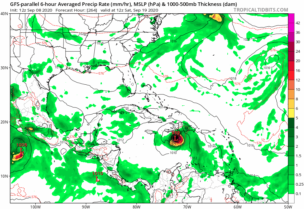
gatorcane wrote:12Z GFS parallel 168 to 300 hours:
https://i.postimg.cc/zfpHY6z6/gfsp-mslp-pcpn-atl-fh168-300.gif
0 likes
-
gatorcane

- S2K Supporter
- Posts: 23708
- Age: 48
- Joined: Sun Mar 13, 2005 3:54 pm
- Location: Boca Raton, FL
Re: Tropical Wave inside Africa
This wave definitely looks concerning since it will be emerging more south and could make it across possibly recurving much further west.
2 likes
-
USTropics
- Professional-Met

- Posts: 2738
- Joined: Sun Aug 12, 2007 3:45 am
- Location: Florida State University
Re: Tropical Wave inside Africa
Spacecoast wrote:Question: Why are the Global operationals so much further south, and west than their ensemble counterparts?
I would think that the operationals would be track close to the middle of the ensemble pack of members.
I was just comparing GFS-Para global vs GFS-Para ensembles, GFS vs GEFS, and ECMWF VS ECENS.
They all seem to track the most south, and west member(s).
That's a great question and ties intricately with the synoptics of forecasting. First and foremost, it's important to understand forecast skill past 120 hours (5 days) diminishes exponentially the further out in time you go. There's not even a trackable system yet, genesis isn't guaranteed (although highly likely and supported by the entire model suites), and we begin to introduce more variables as forecast time increases. But in theory, let's say you do need to make a 7-10 day forecast for interests in the Caribbean (as some meteorologists are required to do), you would never use just one model suite. Operational models also provide very little input in theory at this time frame, I would simply use them to see how they compare to their ensemble means, various trends, and compare their model output to other model outputs. Why? Well let's just use the GFS for this AEW at 10 days and look at the last 4 runs:

There's just not much consistency there with multiple systems in the Atlantic in just 4 runs. Maybe some trends are developing, but we need more runs to say with any confidence. The better question to ask is what variables are changing that are creating these fluctuations? Perhaps Paulette no longer having a signature in the past 3 runs has led to these corrections in the GFS? Perhaps ridging is allowed to build back in because of this? That's why it's strongly recommended to use ensembles instead. Preferably, you could use a blend (or trend) of optimally 4 runs (e.g., 00z, 06z, 12z, 18z) as stated above. Here is the GFS ensemble member MSLP trend:

We can see in the past 3 GFS ensemble runs, we've had a concentration of tracks very close to the islands or just north. However, there is quite a bit of spread which still makes this low confidence. If we compare each run to the operational runs (operational runs do in theory have the best starting parameters of data), we can see the position hasn't really matched the ensembles either. For example, here is the 12z GFS ensemble members MSLP (with the operational colored in pink):

This tells us the questionable genesis on the 12z GFS is likely contributing to the more forward and southerly position compared to the ensembles. Discounting this somewhat, we are heavily invested in the ensembles now that we have a general idea of potential tracks. Of course we don't want to just use one model, we would also want to compare this to other outputs to see with what confidence we believe in the GFS ensemble adjustments over the past 3 runs.

While some members are bit more north of the GFS ensembles, we do have some agreement on general tracks. Again, adjustments seem to be in response to Paulette's evolution. We would also want to look at overall steering patterns, and what type of adjustments/trends we're seeing.

We can see the GFS has adjusted to more ridging over the past 2 runs (we'd prefer 4 runs to call this a "trend"). We'd again compare this to the ECMWF ensembles, which have pretty consistent with what the 12z GFS ensembles has been showing in terms of ridging:

TL;DR Watch for trends in the ensembles in terms of Paulette's evolution as well as adjustments to NA 500mb pattern. This will be critical in future tracks:
Last edited by USTropics on Tue Sep 08, 2020 4:40 pm, edited 1 time in total.
7 likes
-
ConvergenceZone
.gif)
- Category 5

- Posts: 5241
- Joined: Fri Jul 29, 2005 1:40 am
- Location: Northern California
-
northjaxpro

- S2K Supporter
- Posts: 8900
- Joined: Mon Sep 27, 2010 11:21 am
- Location: Jacksonville, FL
Re: Tropical Wave inside Africa
ConvergenceZone wrote:8 pages for a wave in Africa. You don’t get that very often
LOL.. Crazy isn't? Well it is 2020 after all....
Last edited by northjaxpro on Tue Sep 08, 2020 4:46 pm, edited 1 time in total.
0 likes
NEVER, EVER SAY NEVER in the tropics and weather in general, and most importantly, with life itself!!
________________________________________________________________________________________
Fay 2008 Beryl 2012 Debby 2012 Colin 2016 Hermine 2016 Julia 2016 Matthew 2016 Irma 2017 Dorian 2019
________________________________________________________________________________________
Fay 2008 Beryl 2012 Debby 2012 Colin 2016 Hermine 2016 Julia 2016 Matthew 2016 Irma 2017 Dorian 2019
-
northjaxpro
- S2K Supporter
- Posts: 8900
- Joined: Mon Sep 27, 2010 11:21 am
- Location: Jacksonville, FL
Re: Tropical Wave inside Africa
The Low is already analyzed at 1008 mb OVER the continent. This system will be literally designated, or even named Sally as soon as it gets off the coast, provided that 94L doesn't get named first, which right now looks like will not happen before this Low Pressure moves off the Africa coast in the next couple of days.
3 likes
NEVER, EVER SAY NEVER in the tropics and weather in general, and most importantly, with life itself!!
________________________________________________________________________________________
Fay 2008 Beryl 2012 Debby 2012 Colin 2016 Hermine 2016 Julia 2016 Matthew 2016 Irma 2017 Dorian 2019
________________________________________________________________________________________
Fay 2008 Beryl 2012 Debby 2012 Colin 2016 Hermine 2016 Julia 2016 Matthew 2016 Irma 2017 Dorian 2019
-
toad strangler

- S2K Supporter
- Posts: 4546
- Joined: Sun Jul 28, 2013 3:09 pm
- Location: Earth
- Contact:
Re: Tropical Wave inside Africa
That kind of hit angle on the FL peninsula is needle in a haystack type stuff even 72 hours out let alone 300 plus Alice In Wonderland hours.
We all know that, but I'd figured I'd state the obvious anyway.
2 likes
My Weather Station
https://www.wunderground.com/dashboard/pws/KFLPORTS603
https://www.wunderground.com/dashboard/pws/KFLPORTS603
-
ElectricStorm

- Category 5
- Posts: 5147
- Age: 25
- Joined: Tue Aug 13, 2019 11:23 pm
- Location: Norman, OK
Re: Tropical Wave inside Africa
Has there ever been a wave that was designated an invest while it was still over Africa? If not then this may be the first one of it does
0 likes
B.S Meteorology, University of Oklahoma '25
Please refer to the NHC, NWS, or SPC for official information.
Please refer to the NHC, NWS, or SPC for official information.
-
Shell Mound
- Category 5
- Posts: 2432
- Age: 33
- Joined: Thu Sep 07, 2017 3:39 pm
- Location: St. Petersburg, FL → Scandinavia
Re: Tropical Wave inside Africa
0 likes
CVW / MiamiensisWx / Shell Mound
The posts in this forum are NOT official forecasts and should not be used as such. They are just the opinion of the poster and may or may not be backed by sound meteorological data. They are NOT endorsed by any professional institution or STORM2K. For official information, please refer to products from the NHC and NWS.
-
TheStormExpert
Re: Tropical Wave inside Africa
Weather Dude wrote:Has there ever been a wave that was designated an invest while it was still over Africa? If not then this may be the first one of it does
I believe there has, many to be in fact.
0 likes
-
ElectricStorm
- Category 5
- Posts: 5147
- Age: 25
- Joined: Tue Aug 13, 2019 11:23 pm
- Location: Norman, OK
Re: Tropical Wave inside Africa
TheStormExpert wrote:Weather Dude wrote:Has there ever been a wave that was designated an invest while it was still over Africa? If not then this may be the first one of it does
I believe there has, many to be in fact.
Haha never mind then I just can't think of any of them right now
0 likes
B.S Meteorology, University of Oklahoma '25
Please refer to the NHC, NWS, or SPC for official information.
Please refer to the NHC, NWS, or SPC for official information.
-
Spacecoast

- Category 2

- Posts: 773
- Joined: Thu Aug 31, 2017 2:03 pm
Re: Tropical Wave inside Africa
USTropics wrote:Spacecoast wrote:Question: Why are the Global operationals so much further south, and west than their ensemble counterparts?
I would think that the operationals would be track close to the middle of the ensemble pack of members.
I was just comparing GFS-Para global vs GFS-Para ensembles, GFS vs GEFS, and ECMWF VS ECENS.
They all seem to track the most south, and west member(s).
That's a great question and ties intricately with the synoptics of forecasting........
TL;DR Watch for trends in the ensembles in terms of Paulette's evolution as well as adjustments to NA 500mb pattern. This will be critical in future tracks:
Thanks US, as always you have thoroughly answered my question. Very helpful
1 likes
-
USTropics
- Professional-Met
- Posts: 2738
- Joined: Sun Aug 12, 2007 3:45 am
- Location: Florida State University
Re: Tropical Wave inside Africa
Weather Dude wrote:TheStormExpert wrote:Weather Dude wrote:Has there ever been a wave that was designated an invest while it was still over Africa? If not then this may be the first one of it does
I believe there has, many to be in fact.
Haha never mind then I just can't think of any of them right now
90L in 2018 (would become Hurricane Florence)

93L also in 2018 (would become Hurricane Helene):

There were also two in 1978:

Christine in 1973:

2 likes
-
SouthFLTropics

- Category 5
- Posts: 4258
- Age: 50
- Joined: Thu Aug 14, 2003 8:04 am
- Location: Port St. Lucie, Florida
Re: Tropical Wave inside Africa
Geez, talk about different solutions between runs. Nothing like having good, consistent modeling huh?

1 likes
Fourth Generation Florida Native
Personal Storm History: David 79, Andrew 92, Erin 95, Floyd 99, Irene 99, Frances 04, Jeanne 04, Wilma 05, Matthew 16, Irma 17, Ian 22, Nicole 22, Milton 24
Personal Storm History: David 79, Andrew 92, Erin 95, Floyd 99, Irene 99, Frances 04, Jeanne 04, Wilma 05, Matthew 16, Irma 17, Ian 22, Nicole 22, Milton 24
-
TheStormExpert
Re: Tropical Wave inside Africa
Once again the 18z GFS seems to have stopped rolling in on Tropical Tidbits near day 10. Anyone else having this problem again?
0 likes
-
SouthFLTropics
- Category 5
- Posts: 4258
- Age: 50
- Joined: Thu Aug 14, 2003 8:04 am
- Location: Port St. Lucie, Florida
Re: Tropical Wave inside Africa
TheStormExpert wrote:Once again the 18z GFS seems to have stopped rolling in on Tropical Tidbits near day 10. Anyone else having this problem again?
Yep, stuck at 222 hours.
0 likes
Fourth Generation Florida Native
Personal Storm History: David 79, Andrew 92, Erin 95, Floyd 99, Irene 99, Frances 04, Jeanne 04, Wilma 05, Matthew 16, Irma 17, Ian 22, Nicole 22, Milton 24
Personal Storm History: David 79, Andrew 92, Erin 95, Floyd 99, Irene 99, Frances 04, Jeanne 04, Wilma 05, Matthew 16, Irma 17, Ian 22, Nicole 22, Milton 24
Who is online
Users browsing this forum: No registered users and 244 guests