


Category5Kaiju wrote:Woofde wrote:Needless to say this season has absolutely not acted like an El nino thus far at all. 3 major hurricanes in, and we have a potential record beater in Lee. I'm doubtful of the season dropping off late despite the nino. There's just wayyy too much anomalous warmth out there, even with Lee's probable large cool wake. It wouldn't surprise me at all to see an extended MDR season with the Carribean and Gulf kicking in October as we've seen in recent years.https://uploads.tapatalk-cdn.com/20230908/897bfbda0d7c9d7140163afa3330df41.jpg
Yeah I agree with you. I know there's been a lot of talk, especially early on this season, about how October and beyond should be dead quiet (I myself thought something similar as well), but I think we're definitely seeing how absurdly warm ssts like that indeed have the power to win over El Nino's effects. Heck, I would say that we could potentially see a major hurricane or two during the October-November timeframe before this season truly ends.
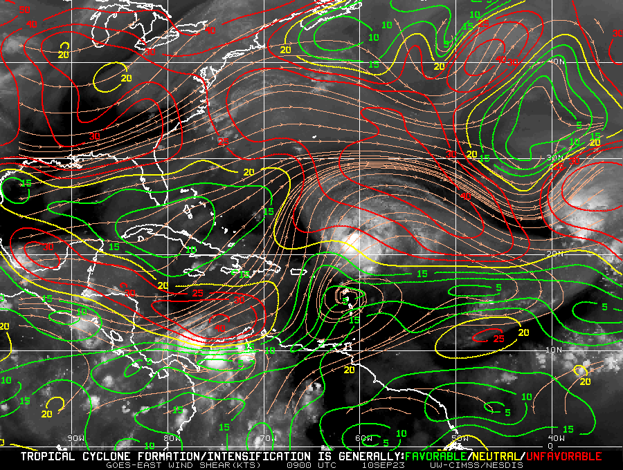
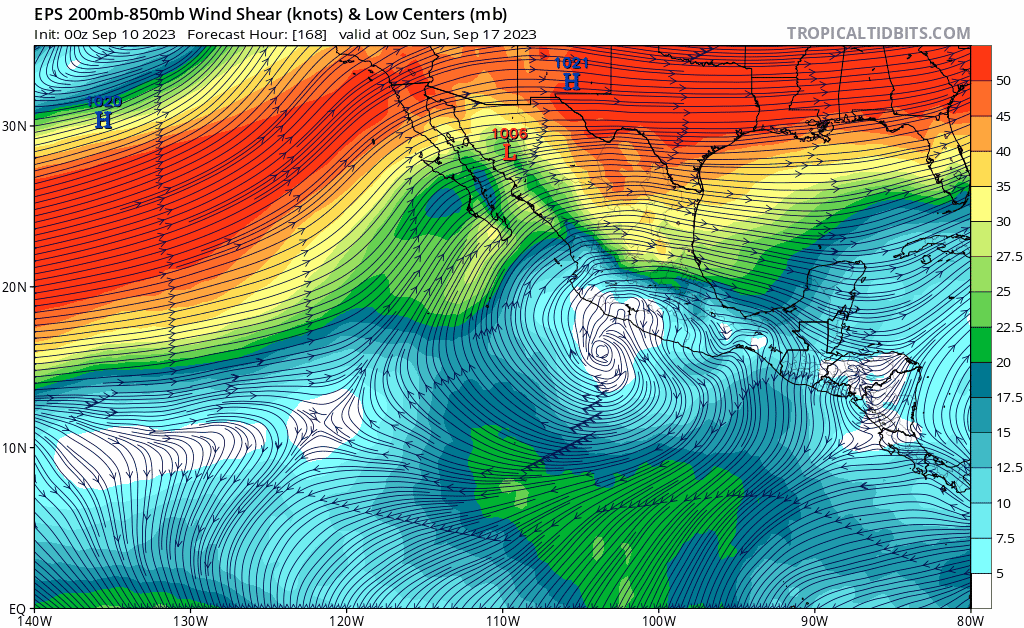
I have to agree as well. I am reluctant to believe that what is occurring in the Atlantic basin is as simplistic as a NINO vs. SST battle which NINO has simply "lost". SST's have clearly played a role in top end intensity and RI we've seen thus far. Those high SST's and their effect on the Atlantic are no doubt connected to "Global Warming" (as Larry above suggested). The more imminent question to me though relates to how the remainder of the season plays out in light of the head-scratching question regarding lack of +ENSO impact to the Atlantic thus far. I thought Emmett_Brown's post (from this past Thurs) was particularly insightful given the persistent E. CONUS pattern and the assumption that +ENSO conditions may well NOT insure an assumed early end to the season (which I was fully anticipating). Minus any broadscale pattern change or sudden arrival of strong westerlies that would typically decapitate any October/November hurricane daring to develop in the far W. Atlantic (let along track north of 20N), the increased threat as a result of anomalous SST's may well suggest a significantly enhanced threat for not only Florida but possibly Central America, Mexico, Cuba, Northern GOM, and the Bahamas. At this point, until someone is able to accurately answer the question "Where's Waldo" (+ENSO associated zonal pattern/UL shear), then I'd have to assume that we are not fast approaching the end of the Atlantic season AND have not seen the last '23 Atlantic major hurricane yet. If a major hurricane were to develop in the W. Caribbean or GOM in October or November though, there's a far greater risk of dangerous impact then what Lee's current forecast track would suggest.


