cycloneye wrote:Aric Dunn wrote:w a t c h the south west c a rr i b e a n today.
11N-78W.
http://www.ssd.noaa.gov/goes/east/carb/flash-vis.html
that would be it.
Moderator: S2k Moderators


cycloneye wrote:Aric Dunn wrote:w a t c h the south west c a rr i b e a n today.
11N-78W.
http://www.ssd.noaa.gov/goes/east/carb/flash-vis.html


TeamPlayersBlue wrote:So we have three diff areas where low pressures may develop?Crazy.
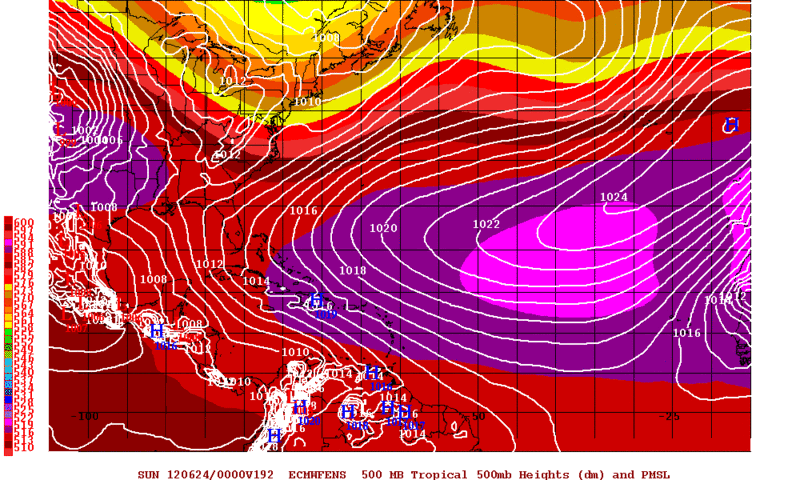
Also, quick question, JB always said tropical lows track around which isobar... Is it 1012MB, or 1016? Now that were back in tropical cyclone mode for the summer, im trying to brush up on my knowledge again!!! Thanks again


USTropics wrote:TeamPlayersBlue wrote:So we have three diff areas where low pressures may develop?
Also, quick question, JB always said tropical lows track around which isobar... Is it 1012MB, or 1016? Now that were back in tropical cyclone mode for the summer, im trying to brush up on my knowledge again!!! Thanks again
If I'm reading your question correctly the short answer is 1016MB.
Isobars are lines used to link common areas of the same pressure together. An isobar showing a pressure of 1016MB would indicate a high pressure system. Since tropical cyclones are influenced by lowering pressures (i.e. they follow the path of lower pressures), a high pressure system would act as a blocking mechanism. So in theory, a 1016MB isobar located north of a tropical low would act as a blocking mechanism, steering the low westward until it encounters the edge of the high pressure system, where the tropical low would then begin to turn more north.
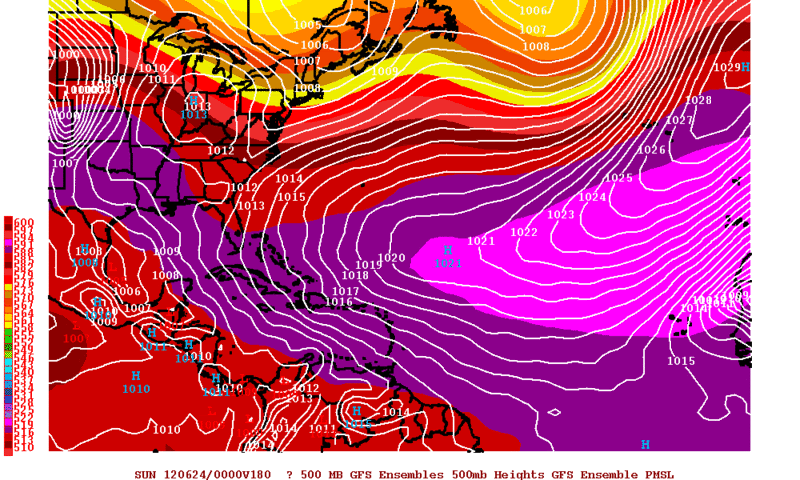
South Texas Storms wrote:The 12z CMC looks like it has a Houston landfall in about a week.
http://moe.met.fsu.edu/cgi-bin/cmctc2.c ... =Animation
Users browsing this forum: bird, Google [Bot] and 89 guests
