Fancy1002 wrote:I think I saw some 930s and 940s in the EPS ensemble.
There was a 931 mb anomaly heading towards Houston, and another 941 mb anomaly into Mexico.

https://s11.gifyu.com/images/SgIvK.gif
Moderator: S2k Moderators


Fancy1002 wrote:I think I saw some 930s and 940s in the EPS ensemble.


SFLcane wrote:Whatever does form will be quite large. you can see it it taking shape already
https://i.postimg.cc/6513QtK4/gggg.gif
SFLcane wrote:Whatever does form will be quite large. you can see it it taking shape already
https://i.postimg.cc/6513QtK4/gggg.gif
Iceresistance wrote:Fancy1002 wrote:I think I saw some 930s and 940s in the EPS ensemble.
There was a 931 mb anomaly heading towards Houston, and another 941 mb anomaly into Mexico.
https://s11.gifyu.com/images/SgIvK.gif
https://s11.gifyu.com/images/SgIvK.gif
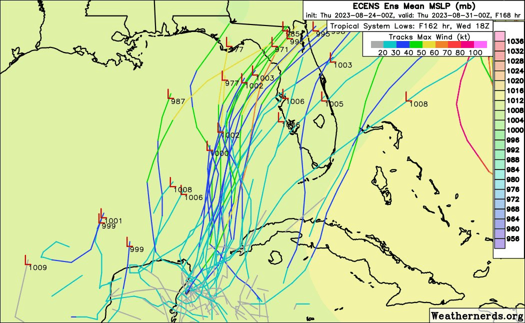
SFLcane wrote:EPS shifted south 00z vs 12z
5-6 days to go expect more change.
https://i.postimg.cc/T33TgSdM/ecmwf.gif


Ianswfl wrote:SFLcane wrote:EPS shifted south 00z vs 12z
5-6 days to go expect more change.
https://i.postimg.cc/T33TgSdM/ecmwf.gif
South members are weaker. Northern camps are strong. Do you think it's more time over water the stronger northern solutions, or it has more favorable winds if it takes a more northern path? Southern tracks seem more like it would have more shear too.
Fancy1002 wrote:Iceresistance wrote:Fancy1002 wrote:I think I saw some 930s and 940s in the EPS ensemble.
There was a 931 mb anomaly heading towards Houston, and another 941 mb anomaly into Mexico.
https://s11.gifyu.com/images/SgIvK.gif
https://s11.gifyu.com/images/SgIvK.gif
I didn’t even notice those two, I was talking about the ones heading towards Florida.


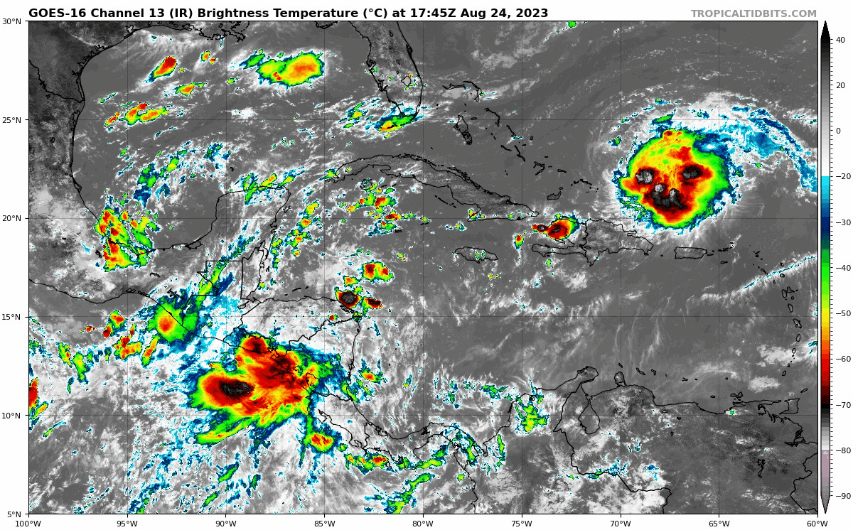
Hurricaneman wrote:Looks as though there’s a broad low over the borders of El Salvador, Honduras and Nicaragua, might be in the Caribbean by tonight or tomorrow


Users browsing this forum: Ulf and 155 guests


