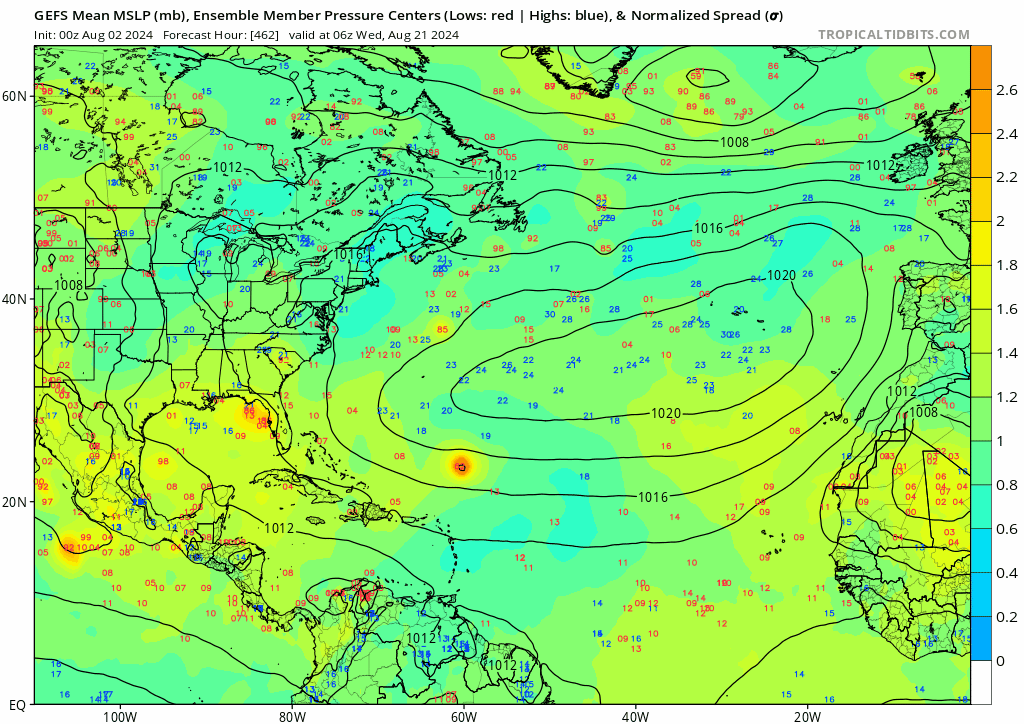
Hammy wrote:I'm starting to wonder if we're going to come in below the named storm forecasts and see a largely dead central and eastern MDR and Subtropics as far as formation goes, but the flip side of having most of the activity clustered west of 60 and in the Caribbean and Gulf, similarly (but more active than) 1985, since the models are starting to pick up some storms in the medium range, and all western-based
I mean I guess it's possible, but as we all know these models can see so accurately into the future up to a certain point; it's also possible that we get a bona fide Cape Verde storm like Ivan, Irma, or Florence that is born adjacent to the Cape Verde Islands and continues westward in late August-September. I don't see anything that would scream to me at this point that this isn't a possibility for this season.
Additionally, while I was under the impression that we could end up with slightly less than the 20some NSs that appeared in the seasonal predictions, I think much of that relies on the idea that seasons like 2004 and 2017 happened. However, both of those years wound down after September-early October, so it remains to be seen in 2024 follows suit or if it produces activity into November as other first year La Nina seasons typically do.
Unless explicitly stated, all info in my posts is based on my own opinions and observations. Tropical storms and hurricanes can be extremely dangerous. Refer to an accredited weather research agency or meteorologist if you need to make serious decisions regarding an approaching storm.