https://x.com/BMcNoldy/status/1821553728199221578
All four of those seasons were very active and impactful.
2024 Indicators: SST's, MSLP, Shear, SAL, Steering, Instability (Day 16+ Climate Models)
Moderator: S2k Moderators
Forum rules

The posts in this forum are NOT official forecasts and should not be used as such. They are just the opinion of the poster and may or may not be backed by sound meteorological data. They are NOT endorsed by any professional institution or STORM2K. For official information, please refer to products from the National Hurricane Center and National Weather Service.
-
WeatherBoy2000
- Category 1

- Posts: 460
- Joined: Mon Apr 10, 2023 9:29 am
-
SFLcane

- S2K Supporter

- Posts: 10281
- Age: 48
- Joined: Sat Jun 05, 2010 1:44 pm
- Location: Lake Worth Florida
Re: 2024 Indicators: SST's, MSLP, Shear, SAL, Steering, Instability (Day 16+ Climate Models)
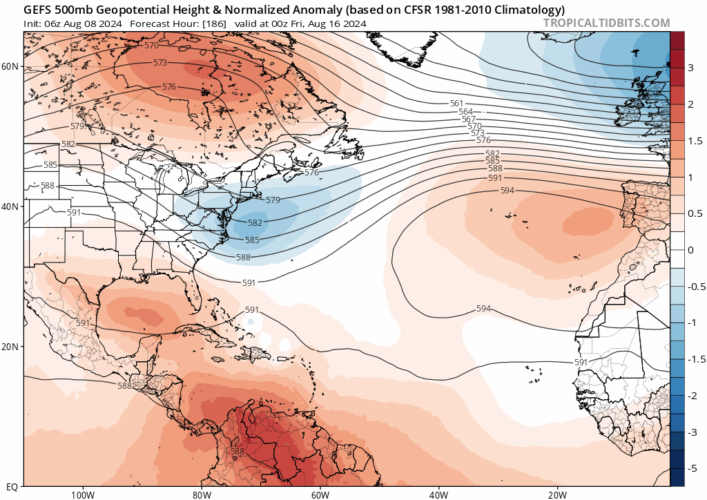
GEFS shows the ridge building after the first wave. Likely to have 3 tc's spinning out there within the next 2 weeks.
0 likes

Re: 2024 Indicators: SST's, MSLP, Shear, SAL, Steering, Instability (Day 16+ Climate Models)
"The time is nigh" 
I'm pretty confident that the light-switch will be officially flipped on beginning with Ernesto. Global models and their ensembles are certainly picking up on an increase of activity. Seems to me that this season has already teased out some hints for recurring storm tracks. If I were in the Leeward Islands and Puerto Rico, my head would be on a swivel for the next 8 weeks.
I'm pretty confident that the light-switch will be officially flipped on beginning with Ernesto. Global models and their ensembles are certainly picking up on an increase of activity. Seems to me that this season has already teased out some hints for recurring storm tracks. If I were in the Leeward Islands and Puerto Rico, my head would be on a swivel for the next 8 weeks.
3 likes
Andy D
(For official information, please refer to the NHC and NWS products.)
(For official information, please refer to the NHC and NWS products.)
Re: 2024 Indicators: SST's, MSLP, Shear, SAL, Steering, Instability (Day 16+ Climate Models)
WeatherBoy2000 wrote: https://x.com/BMcNoldy/status/1821553728199221578
All four of those seasons were very active and impactful.
These are the 4 seasons: 2005 1933 1926 1916
For CONUS from this date forward:
-All 4 years had 1 Aug H impact with 3 of 4 a Gulf MH
-3 of 4 years had 1+ Sep H impact with all 3 having 1-2 MH and with at least 1 of these a Gulf MH
-3 of 4 years had 1 Oct H impact with 1 of these a MH
-2 of 4 years had a H impact in all of Aug, Sep, Oct
-Other 2 years had a H impact in 2 of the 3 months
-# of H impacts 8/8+ ranged from 2 to 4 with 3.25 avg
-# of MH impacts 8/8+ ranged from 1 to 3 with 2 avg
-So based on these 4 years, my best guess is 3-4 more CONUS H impacts with 2 of the 3-4 being MH
-Best guess 1 more in Aug (good chance to be MH), 2 in Sep (good chance for 1 to be MH), and 1 in Oct
-3-4 more H impacts would mean 5-6 full season vs record of 6
6 likes
Personal Forecast Disclaimer:
The posts in this forum are NOT official forecasts and should not be used as such. They are just the opinion of the poster and may or may not be backed by sound meteorological data. They are NOT endorsed by any professional institution or storm2k.org. For official information, please refer to the NHC and NWS products.
The posts in this forum are NOT official forecasts and should not be used as such. They are just the opinion of the poster and may or may not be backed by sound meteorological data. They are NOT endorsed by any professional institution or storm2k.org. For official information, please refer to the NHC and NWS products.

Re: 2024 Indicators: SST's, MSLP, Shear, SAL, Steering, Instability (Day 16+ Climate Models)
Yep agree 100%, the "preseason" if you will is over now. Climatology supports this too. Historically things begin to ramp up on the 10th, and we reach peak season pace by the 20th. There's a lot of activity that's gonna be crammed between now and late October if we're gonna make it to 200 ACE. Hope everyone is prepared!chaser1 wrote:"The time is nigh"
I'm pretty confident that the light-switch will be officially flipped on beginning with Ernesto. Global models and their ensembles are certainly picking up on an increase of activity. Seems to me that this season has already teased out some hints for recurring storm tracks. If I were in the Leeward Islands and Puerto Rico, my head would be on a swivel for the next 8 weeks.
1 likes
Re: 2024 Indicators: SST's, MSLP, Shear, SAL, Steering, Instability (Day 16+ Climate Models)
Here's another way to think of where we are. Rather than time, we'll use the percentage of activity left in a typical season. A typical August 9th has 12.3 ACE. A typical recent season ends with 122.5 ACE. Divide 12.3 by 122.5. You get 0.1, aka 10%. We are about 10% of the way through the season thus far.
No other basin comes even close to packing all its action into such a tight timeframe.
No other basin comes even close to packing all its action into such a tight timeframe.
4 likes
-
WaveBreaking

- Category 2

- Posts: 717
- Joined: Sun Jun 30, 2024 11:33 am
- Location: US
Re: 2024 Indicators: SST's, MSLP, Shear, SAL, Steering, Instability (Day 16+ Climate Models)
Possible switch to +PDO?

0 likes
I am NOT a professional meteorologist, so take all of my posts with a grain of salt. My opinions are mine and mine alone.
Re: 2024 Indicators: SST's, MSLP, Shear, SAL, Steering, Instability (Day 16+ Climate Models)
I see very little chance anytime soon for a switch to a +PDO. It continues to be extremely negative with the last few months near -3. Currently it is also near -3. The WPAC marine heatwave (off Japan) is anchoring this very strong -PDO.
2 likes
Personal Forecast Disclaimer:
The posts in this forum are NOT official forecasts and should not be used as such. They are just the opinion of the poster and may or may not be backed by sound meteorological data. They are NOT endorsed by any professional institution or storm2k.org. For official information, please refer to the NHC and NWS products.
The posts in this forum are NOT official forecasts and should not be used as such. They are just the opinion of the poster and may or may not be backed by sound meteorological data. They are NOT endorsed by any professional institution or storm2k.org. For official information, please refer to the NHC and NWS products.
-
skyline385

- Category 5

- Posts: 2728
- Age: 35
- Joined: Wed Aug 26, 2020 11:15 pm
- Location: Houston TX
Re: 2024 Indicators: SST's, MSLP, Shear, SAL, Steering, Instability (Day 16+ Climate Models)
Just another annual reminder that the Atlantic tends to be the most active when the descending phase of the MJO is entering the basin, like it will be in late August ( ~ Aug 25th ish) this year.
The impacts of lower deep-layer wind shear, reduced SAL intrusions, enhanced low-level relative vorticity from westerly wind anomalies, cumulative column water vapor in the preceding active phase, & the lagged effect of stronger AEWs moving out into the Atlantic are all more important than local vertical motion anomalies, especially near the peak of the hurricane season.
The impacts of lower deep-layer wind shear, reduced SAL intrusions, enhanced low-level relative vorticity from westerly wind anomalies, cumulative column water vapor in the preceding active phase, & the lagged effect of stronger AEWs moving out into the Atlantic are all more important than local vertical motion anomalies, especially near the peak of the hurricane season.
https://x.com/webberweather/status/1821919755777012099
3 likes
-
Kingarabian

- S2K Supporter
- Posts: 16345
- Joined: Sat Aug 08, 2009 3:06 am
- Location: Honolulu, Hawaii
Re: 2024 Indicators: SST's, MSLP, Shear, SAL, Steering, Instability (Day 16+ Climate Models)
Yeah as LarryWx mentioned above, the stubborn warm waters east of Japan mean that there can literally be no +PDO unless we see record warmth off of NWAmerica.
But that warm horseshoe has been presistent the past couple of years and seems to help EPAC activity.
2 likes
RIP Kobe Bryant

Re: 2024 Indicators: SST's, MSLP, Shear, SAL, Steering, Instability (Day 16+ Climate Models)
Obvious implications for the 2024 season aside, just from the point of view of generic seasonal activity:
While the ACE anomaly map is hardly surprising, I find it interesting that despite the selection of years featuring both high and low land impacts (or even specifically CONUS impacts), the general pattern of high ACE anomalies still almost looks like an OTS recurve pattern.
I think the gist of it is: Having one or more storms on a "generic" OTS track doesn't preclude the season from being impactful. Statistically speaking, most CV storms are fish storms. But active years have more attempts at forming powerful storms that aren't fish storms, whether it's because a wave started at a low latitude (Ivan) or happened to be blocked by a ridge (Frances). Years like 2005 and 2020 with few CV hurricanes relative to the whole season are the anomalies, not the norm.
2 likes
TC naming lists: retirements and intensity
Most aggressive Advisory #1's in North Atlantic (cr. kevin for starting the list)
Most aggressive Advisory #1's in North Atlantic (cr. kevin for starting the list)
Re: 2024 Indicators: SST's, MSLP, Shear, SAL, Steering, Instability (Day 16+ Climate Models)
WeatherBoy2000 wrote: https://x.com/BMcNoldy/status/1821553728199221578
All four of those seasons were very active and impactful.
These are the seasons with 25+ ACE through 8/8 along with their ACE through 8/8 and their 8/9+ ACE:
2024 41 ?
2008 40 106
2005 74 171
1980 40 109
1966 34 111
1934 28 51
1933 54 205
1926 47 183
1916 42 102
1899 25 126
1887 34 147
1886 36 130
-Avg ACE 8/9+ is ~~105 since 1950 but only ~70 1900-50. Longtime avg likely ~85
-These 11 seasons averaged 140, 55 above longtime avg
-Of these only 1934’s 8/9+ was BN
-3 were NN. 7 were AN (including 1916 since NN was only ~70 then). 6 were MAN (50+ AN for their time)
-So, a fast start like 2024 favors a strong rest of season. These years suggest range of total ACE centered near 200 for the complete 2024!
1 likes
Personal Forecast Disclaimer:
The posts in this forum are NOT official forecasts and should not be used as such. They are just the opinion of the poster and may or may not be backed by sound meteorological data. They are NOT endorsed by any professional institution or storm2k.org. For official information, please refer to the NHC and NWS products.
The posts in this forum are NOT official forecasts and should not be used as such. They are just the opinion of the poster and may or may not be backed by sound meteorological data. They are NOT endorsed by any professional institution or storm2k.org. For official information, please refer to the NHC and NWS products.
-
gatorcane

- S2K Supporter
- Posts: 23708
- Age: 48
- Joined: Sun Mar 13, 2005 3:54 pm
- Location: Boca Raton, FL
Re: 2024 Indicators: SST's, MSLP, Shear, SAL, Steering, Instability (Day 16+ Climate Models)
Teban54 wrote:
Obvious implications for the 2024 season aside, just from the point of view of generic seasonal activity:
While the ACE anomaly map is hardly surprising, I find it interesting that despite the selection of years featuring both high and low land impacts (or even specifically CONUS impacts), the general pattern of high ACE anomalies still almost looks like an OTS recurve pattern.
I think the gist of it is: Having one or more storms on a "generic" OTS track doesn't preclude the season from being impactful. Statistically speaking, most CV storms are fish storms. But active years have more attempts at forming powerful storms that aren't fish storms, whether it's because a wave started at a low latitude (Ivan) or happened to be blocked by a ridge (Frances). Years like 2005 and 2020 with few CV hurricanes relative to the whole season are the anomalies, not the norm.
For Florida, particularly South Florida, it's generally difficult to get hit from the east by a major. Seasons like 2004 and even 2017 are quite rare. I am more concerned about the period from late September to late October with a hit from the south as the Caribbean should be active late season given the La Nina and above normal Caribbean SSTs.
0 likes
-
Hypercane_Kyle

- Category 5
- Posts: 3465
- Joined: Sat Mar 07, 2015 7:58 pm
- Location: Cape Canaveral, FL
Re: 2024 Indicators: SST's, MSLP, Shear, SAL, Steering, Instability (Day 16+ Climate Models)
Soon-to-be Ernesto will likely be a massive ACE bump.
1 likes
My posts are my own personal opinion, defer to the National Hurricane Center (NHC) and other NOAA products for decision making during hurricane season.
-
toad strangler

- S2K Supporter
- Posts: 4546
- Joined: Sun Jul 28, 2013 3:09 pm
- Location: Earth
- Contact:
Re: 2024 Indicators: SST's, MSLP, Shear, SAL, Steering, Instability (Day 16+ Climate Models)
gatorcane wrote:Teban54 wrote:
Obvious implications for the 2024 season aside, just from the point of view of generic seasonal activity:
While the ACE anomaly map is hardly surprising, I find it interesting that despite the selection of years featuring both high and low land impacts (or even specifically CONUS impacts), the general pattern of high ACE anomalies still almost looks like an OTS recurve pattern.
I think the gist of it is: Having one or more storms on a "generic" OTS track doesn't preclude the season from being impactful. Statistically speaking, most CV storms are fish storms. But active years have more attempts at forming powerful storms that aren't fish storms, whether it's because a wave started at a low latitude (Ivan) or happened to be blocked by a ridge (Frances). Years like 2005 and 2020 with few CV hurricanes relative to the whole season are the anomalies, not the norm.
For Florida, particularly South Florida, it's generally difficult to get hit from the east by a major. Seasons like 2004 and even 2017 are quite rare. I am more concerned about the period from late September to late October with a hit from the south as the Caribbean should be active late season given the La Nina and above normal Caribbean SSTs.
gatorcane, I don’t agree with this assessment at all. Neither does NOAA return rates for majors. We know these things don’t happen in any regularly scheduled timeframe. But tend to happen in spurts as history has shown. Definitely not rare. It might feel like that to us, But our conscious history is just a blink of an eye.
4 likes
My Weather Station
https://www.wunderground.com/dashboard/pws/KFLPORTS603
https://www.wunderground.com/dashboard/pws/KFLPORTS603
-
Spacecoast

- Category 2
- Posts: 773
- Joined: Thu Aug 31, 2017 2:03 pm
Re: 2024 Indicators: SST's, MSLP, Shear, SAL, Steering, Instability (Day 16+ Climate Models)
LarryWx wrote:
-Avg ACE 8/9+ is ~~105 since 1950 but only ~70 1900-50. Longtime avg likely ~85
-These 11 seasons averaged 140, 55 above longtime avg
-Of these only 1934’s 8/9+ was BN
-3 were NN. 7 were AN (including 1916 since NN was only ~70 then). 6 were MAN (50+ AN for their time)
-So, a fast start like 2024 favors a strong rest of season. These years suggest range of total ACE centered near 200 for the complete 2024!
A strong season, for sure.
These are full NATL basin numbers, right?
It would be interesting to break out W of 60 ACE numbers, if possible.
From June CSU forecast:
We find that 51% of basinwide ACE occurred west of 60°W in El Niño years, while 60% of basinwide ACE occurred west of 60°W in La Niña years.
In neutral ENSO years, 59% of basinwide ACE occurred west of 60°W. Given that we are favoring La Niña with this outlook, we are estimating ~60% of basinwide ACE to occur
west of 60°W in 2024.
Hurricane Beryl is an excellent example of why ACE west of 60°W is an important metric.
As of today, basin wide ACE = 40.7, most of it west of 60...
(I estimate approx 85% of basinwide ACE occurred west of 60°W, but cannot find exact, updated data).
CSU is forecasting 108 ACE w of 60 for remainder of season, (which is only 60% of 191 basinwide remainder).
This seems like it could easily reach 155 ACE w of 60, which increases landfall probabilities significantly:

1 likes
Re: 2024 Indicators: SST's, MSLP, Shear, SAL, Steering, Instability (Day 16+ Climate Models)
Just an oversimplification but even if one were to carve away all storm production leading to a track close to or just north of Puerto Rico and suggest that none of those tropical cyclone events would result in a Bahamas, CONUS or Maritime Canada impact. Keep in mind that a significant percentage of those storms would likely pose a serious risk to the Leewards and Puerto Rico. In an average season that may well leave a far smaller number of tropical cyclones to potentially impact the CONUS however in an overactive season one need be very wary of those storm tracks that push well into the Caribbean or in fact develop in the Caribbean. Of those that do, there will essentially be a split of storm tracks. Those that somewhat mirror the former northwest and northward bending storm tracks in response to any east US weakness in the ridge, and those Caribbean Cruisers that might be far enough to the south to continue westward and impact Central America, or perhaps Yucatan and on toward the Texas coastline. While a fortuitous recurving pattern may bring some sense of relief to those in the S.E. CONUS or Northern GOM, I'd be especially wary of those other storms that either track further south or develop in the Caribbean between 60W - 70W and potentially see a storm threat approaching from the south (rather than from the east).
If you really want to consider the "Threat Perspective" for your specific locale (whether that be Corpus Cristi, Port Arthur, Tampa, or Cozumel), you better focus on where present steering might result in a direct threat to you in the event a tropical cyclone gets to that location or forms there. Thats one reason alone that multiple storms forming across the basin during a busy season suddenly pose potential unique risk to different locations. Those odds might be fairly minimal during any one average year, but that risk increases a good deal in an overactive year as is anticipated. With all that said, steering patterns shift and sometimes completely change altogether too. That's like getting slapped when you least expect to.
If you really want to consider the "Threat Perspective" for your specific locale (whether that be Corpus Cristi, Port Arthur, Tampa, or Cozumel), you better focus on where present steering might result in a direct threat to you in the event a tropical cyclone gets to that location or forms there. Thats one reason alone that multiple storms forming across the basin during a busy season suddenly pose potential unique risk to different locations. Those odds might be fairly minimal during any one average year, but that risk increases a good deal in an overactive year as is anticipated. With all that said, steering patterns shift and sometimes completely change altogether too. That's like getting slapped when you least expect to.
7 likes
Andy D
(For official information, please refer to the NHC and NWS products.)
(For official information, please refer to the NHC and NWS products.)
Re: 2024 Indicators: SST's, MSLP, Shear, SAL, Steering, Instability (Day 16+ Climate Models)
The models are suggesting a shot at the highest daily SOIs in 2 yrs with +35+ possible in 7-10 days. This is largely due to strong HP S of Tahiti. The GFS suite is saying there could be a 1019+ mb peak there though others are ~1018.
There’s some lagging correlation between SOI and Atlantic activity/US landfalls. I fear that this in combo with the near record warm MDR and the very active early season leading indicator could mean a very active and dangerous late Aug and Sept. is on the way.
There’s some lagging correlation between SOI and Atlantic activity/US landfalls. I fear that this in combo with the near record warm MDR and the very active early season leading indicator could mean a very active and dangerous late Aug and Sept. is on the way.
0 likes
Personal Forecast Disclaimer:
The posts in this forum are NOT official forecasts and should not be used as such. They are just the opinion of the poster and may or may not be backed by sound meteorological data. They are NOT endorsed by any professional institution or storm2k.org. For official information, please refer to the NHC and NWS products.
The posts in this forum are NOT official forecasts and should not be used as such. They are just the opinion of the poster and may or may not be backed by sound meteorological data. They are NOT endorsed by any professional institution or storm2k.org. For official information, please refer to the NHC and NWS products.
Re: 2024 Indicators: SST's, MSLP, Shear, SAL, Steering, Instability (Day 16+ Climate Models)
Spacecoast wrote:LarryWx wrote:
-Avg ACE 8/9+ is ~~105 since 1950 but only ~70 1900-50. Longtime avg likely ~85
-These 11 seasons averaged 140, 55 above longtime avg
-Of these only 1934’s 8/9+ was BN
-3 were NN. 7 were AN (including 1916 since NN was only ~70 then). 6 were MAN (50+ AN for their time)
-So, a fast start like 2024 favors a strong rest of season. These years suggest range of total ACE centered near 200 for the complete 2024!
A strong season, for sure.
These are full NATL basin numbers, right?
It would be interesting to break out W of 60 ACE numbers, if possible.From June CSU forecast:
We find that 51% of basinwide ACE occurred west of 60°W in El Niño years, while 60% of basinwide ACE occurred west of 60°W in La Niña years.
In neutral ENSO years, 59% of basinwide ACE occurred west of 60°W. Given that we are favoring La Niña with this outlook, we are estimating ~60% of basinwide ACE to occur
west of 60°W in 2024.
Hurricane Beryl is an excellent example of why ACE west of 60°W is an important metric.
As of today, basin wide ACE = 40.7, most of it west of 60...
(I estimate approx 85% of basinwide ACE occurred west of 60°W, but cannot find exact, updated data).
CSU is forecasting 108 ACE w of 60 for remainder of season, (which is only 60% of 191 basinwide remainder).
This seems like it could easily reach 155 ACE w of 60, which increases landfall probabilities significantly:
https://i.ibb.co/GHM1vV9/scat.jpg
I think your 85% W of 60W for 2024 through Debby is a very good estimate. By eyeballing the track maps for the 11 seasons with 25+ ACE as of Aug 8, here are my very rough estimates for % of 8/9+ ACE W of 60W:
-2008: 85%
-2005: 75%
-1980: 25%
-1966: 65%
-1934: 75%
-1933: 85%
-1926: 80%
-1916: 80%
-1899: 80%
-1887: 75%
-1886: 90%
However, I’d think that the pre satellite era %s of W of 60W, which average ~80%, are somewhat overdone and thus they probably should be reduced some. The outlier 1980 and also 1966 weren’t incoming La Niñas.
Based on this, I’m educatedly guessing that ~75% of the 8/9+ ACE will be W of 60W. I’m guessing that there will be another 160 ACE 8/9+. So, 75% of 160 is 120. So, I’m guessing the 8/9+ W of 60W ACE will be 120.
2 likes
Personal Forecast Disclaimer:
The posts in this forum are NOT official forecasts and should not be used as such. They are just the opinion of the poster and may or may not be backed by sound meteorological data. They are NOT endorsed by any professional institution or storm2k.org. For official information, please refer to the NHC and NWS products.
The posts in this forum are NOT official forecasts and should not be used as such. They are just the opinion of the poster and may or may not be backed by sound meteorological data. They are NOT endorsed by any professional institution or storm2k.org. For official information, please refer to the NHC and NWS products.
Who is online
Users browsing this forum: No registered users and 68 guests