2012 WPAC season

This is the general tropical discussion area. Anyone can take their shot at predicting a storms path.

Moderator: S2k Moderators

Forum rules

The posts in this forum are NOT official forecasts and should not be used as such. They are just the opinion of the poster and may or may not be backed by sound meteorological data. They are NOT endorsed by any professional institution or STORM2K. For official information, please refer to products from the National Hurricane Center and National Weather Service.

Help Support Storm2K
Message
Author
euro6208

Re: 2012 WPAC season

#181 Postby euro6208 » Thu Aug 09, 2012 10:19 am

Image

interesting...our current storm, kirogi, has been used 3 times since 2000 the first time it was used was in 2000...when it peaked at category 4 115 knots typhoon!...kirogi made landfall as a category 1 typhoon near tokyo...

Image

then in 2005, kirogi was even stronger...125 knots...category 4 strength, just shy of super typhoon strength, but good thing is that it missed japan by a few hundred miles....

2012 kirogi is by far weaker...peaking at only moderate tropical storm and affecting no one...
0 likes   

dexterlabio
Category 5
Category 5
Posts: 3468
Joined: Sat Oct 24, 2009 11:50 pm

Re: 2012 WPAC season

#182 Postby dexterlabio » Thu Aug 09, 2012 10:23 pm

models show possible development of our next TC...euro's latest shows it Taiwan/China-bound again but is very weak or barely a storm.
0 likes   
Personal Forecast Disclaimer:
The posts in this forum are NOT official forecast and should not be used as such. They are just the opinion of the poster and may or may not be backed by sound meteorological data. They are NOT endorsed by any professional institution or storm2k.org. For official information, please refer to the NHC and NWS products.

RobWESTPACWX
WestPACMet
WestPACMet
Posts: 1616
Joined: Fri Sep 17, 2010 2:26 am
Location: Tokyo, Japan
Contact:

#183 Postby RobWESTPACWX » Thu Aug 09, 2012 11:14 pm

The area to the East of the PI needs to be watched as well, if that forms it could enhance that SW monsoon again and really put another blow on to Manila.
0 likes   
Satellites, Charts and Forecasting tools for East Asia at WESTERNPACIFICWEATHER.COM

dexterlabio
Category 5
Category 5
Posts: 3468
Joined: Sat Oct 24, 2009 11:50 pm

Re: 2012 WPAC season

#184 Postby dexterlabio » Fri Aug 10, 2012 1:40 am

That could be what the models have been hinting to develop early next week. If it tracks towards Taiwan, SW monsoon would be enhanced again...
0 likes   
Personal Forecast Disclaimer:
The posts in this forum are NOT official forecast and should not be used as such. They are just the opinion of the poster and may or may not be backed by sound meteorological data. They are NOT endorsed by any professional institution or storm2k.org. For official information, please refer to the NHC and NWS products.

dexterlabio
Category 5
Category 5
Posts: 3468
Joined: Sat Oct 24, 2009 11:50 pm

Re: 2012 WPAC season

#185 Postby dexterlabio » Mon Aug 13, 2012 10:17 am

The brewing El Nino might be central-based one as I read in the ENSO thread. I suppose 2004 El Nino had more warming in the central Pacific rather than the east. I don't know how would that affect TC activity in WPAC throughout the year if it would extend the season into the last quarter of the year or the opposite...
0 likes   
Personal Forecast Disclaimer:
The posts in this forum are NOT official forecast and should not be used as such. They are just the opinion of the poster and may or may not be backed by sound meteorological data. They are NOT endorsed by any professional institution or storm2k.org. For official information, please refer to the NHC and NWS products.

euro6208

Re: 2012 WPAC season

#186 Postby euro6208 » Mon Aug 13, 2012 1:09 pm

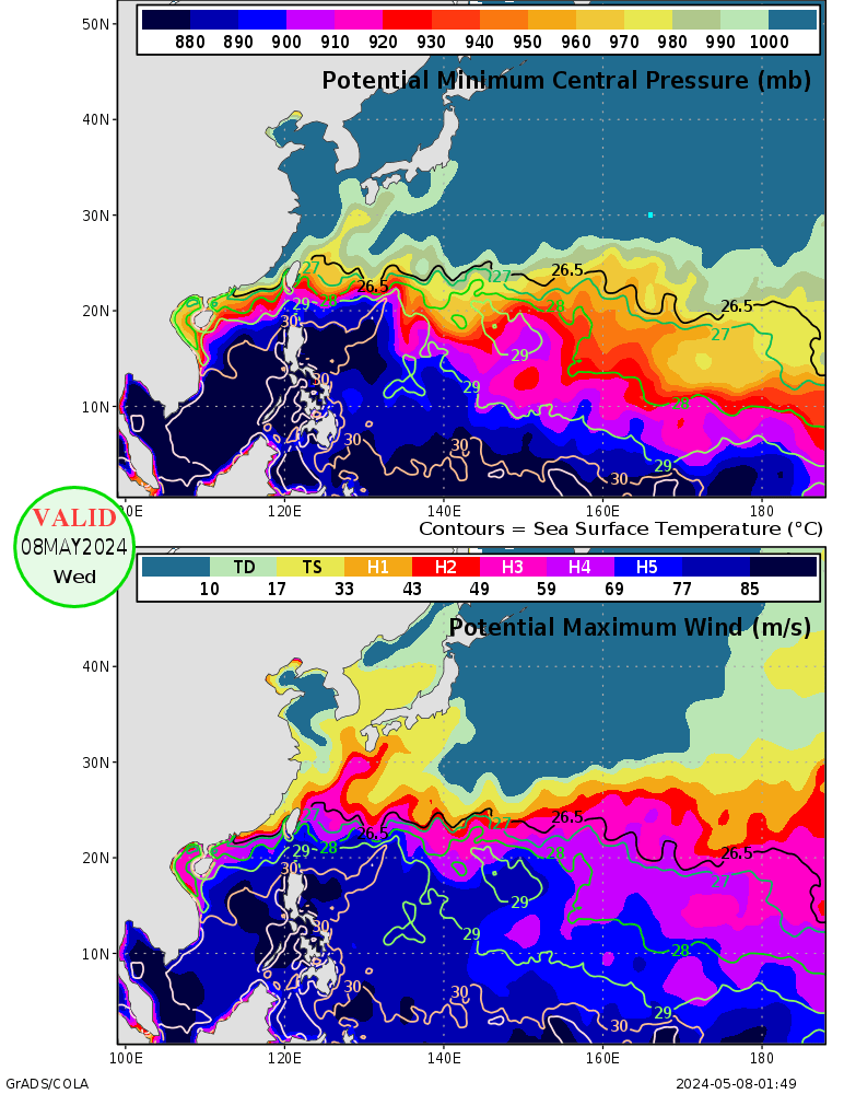
the environment in the west pacific is extremely favorable..once el nino kicks in, then it's hell...the most hellish enviroment in the world...

Image

Image

Image

Image

Image

see page 1...
0 likes   

euro6208

Re: 2012 WPAC season

#187 Postby euro6208 » Mon Aug 13, 2012 1:16 pm

Image

the west pacific is truly the hottest real estate for tropical cyclones in the world.. amazing..!
0 likes   

dexterlabio
Category 5
Category 5
Posts: 3468
Joined: Sat Oct 24, 2009 11:50 pm

Re: 2012 WPAC season

#188 Postby dexterlabio » Tue Aug 14, 2012 8:08 pm

WPAC is in a dry phase but we still keep on seeing TC activity with Kai-tak in the Philippines and the models showing another development by next week. GFS has been showing a system moving towards Southern Japan and Euro on the other hand showing a weak system in Southern China.

With the rate this is going, I think we are really in for an active typhoon season. If I'm not mistaken, we have seen above average number of tropical cyclones as of this date, isn't it?
0 likes   
Personal Forecast Disclaimer:
The posts in this forum are NOT official forecast and should not be used as such. They are just the opinion of the poster and may or may not be backed by sound meteorological data. They are NOT endorsed by any professional institution or storm2k.org. For official information, please refer to the NHC and NWS products.

Typhoon Hunter
WesternPacificWeather.com
Posts: 1221
Joined: Wed Oct 11, 2006 11:37 am
Location: Tokyo
Contact:

Re: 2012 WPAC season

#189 Postby Typhoon Hunter » Wed Aug 15, 2012 3:27 am

Dexter, we're currently exactly 2 storms above average, 13 named so far, average by 15th August is 11.

The last time the Wpac had an above average named storms in a season was in 2004, yes 8 years ago!!
0 likes   
James - Documenting tropical cyclones...

http://www.youtube.com/TyphoonHunter

euro6208

Re: 2012 WPAC season

#190 Postby euro6208 » Wed Aug 15, 2012 10:59 am

Image

the ITCZ runs from east of luzon to north of guam, i think thats why our storms are forming more north this year...

During Week-1 and Week-2, tropical cyclone formation is more likely than average across the western north Pacific, in an area displaced to the north from the climatological average formation locations. Additionally, tropical (or sub-tropical) storm formation is likely across the central Pacific.

what a change from the last update showing the week 1 with development and week 2, which we are now at, showing no development...although kai-tak developed...
0 likes   

euro6208

Re: 2012 WPAC season

#191 Postby euro6208 » Thu Aug 16, 2012 12:37 am

impressive...kai-tak is now our 9th typhoon this year...the *ber* months is closing in and the enviroment is extremely favorable, add in el nino... :double:
0 likes   

Typhoon Hunter
WesternPacificWeather.com
Posts: 1221
Joined: Wed Oct 11, 2006 11:37 am
Location: Tokyo
Contact:

Re: 2012 WPAC season

#192 Postby Typhoon Hunter » Thu Aug 16, 2012 8:06 pm

euro6208 wrote:impressive...kai-tak is now our 9th typhoon this year...the *ber* months is closing in and the enviroment is extremely favorable, add in el nino... :double:


Yup GFS showing two more storms in the latest 12z run, both heading for Japan or Korea. Busy times ahead and I think this year could be the first above average since 2004!
0 likes   
James - Documenting tropical cyclones...

http://www.youtube.com/TyphoonHunter

User avatar
somethingfunny
ChatStaff
ChatStaff
Posts: 3926
Age: 37
Joined: Thu May 31, 2007 10:30 pm
Location: McKinney, Texas

Re: 2012 WPAC season

#193 Postby somethingfunny » Fri Aug 17, 2012 1:34 am

I guess this is the thread where I should post this video. I have to share this video from Typhoon Haikui. :lol:

[youtube]http://www.youtube.com/watch?v=Z1TkIxIhGhk&feature=player_embedded[/youtube]
0 likes   
I am not a meteorologist, and any posts made by me are not official forecasts or to be interpreted as being intelligent. These posts are just my opinions and are probably silly opinions.

dexterlabio
Category 5
Category 5
Posts: 3468
Joined: Sat Oct 24, 2009 11:50 pm

Re: 2012 WPAC season

#194 Postby dexterlabio » Fri Aug 17, 2012 9:22 am

^weather reporting at its best. wow i know it's kinda fun and thrilling to be in the middle of extreme weather like typhoons but really that was a risky spot to do a news report. :eek:
0 likes   
Personal Forecast Disclaimer:
The posts in this forum are NOT official forecast and should not be used as such. They are just the opinion of the poster and may or may not be backed by sound meteorological data. They are NOT endorsed by any professional institution or storm2k.org. For official information, please refer to the NHC and NWS products.

euro6208

Re: 2012 WPAC season

#195 Postby euro6208 » Fri Aug 17, 2012 11:00 am

Image

Image

Image

gosh they keep coming! another storm headed for the philippine/taiwan area and strengthening!
0 likes   

dexterlabio
Category 5
Category 5
Posts: 3468
Joined: Sat Oct 24, 2009 11:50 pm

Re: 2012 WPAC season

#196 Postby dexterlabio » Fri Aug 17, 2012 11:10 pm

Euro finally shows something significant in the long range...I remember Euro was not too impressed with Kai-tak then but the storm grew into a typhoon and they adjusted. GFS is also showing development in the same area. I know it is long range and there can be changes but I will be keeping an eye on this phantom storm as much as I keep an eye on the TD off northeastern Luzon.
0 likes   
Personal Forecast Disclaimer:
The posts in this forum are NOT official forecast and should not be used as such. They are just the opinion of the poster and may or may not be backed by sound meteorological data. They are NOT endorsed by any professional institution or storm2k.org. For official information, please refer to the NHC and NWS products.

euro6208

Re: 2012 WPAC season

#197 Postby euro6208 » Fri Aug 17, 2012 11:31 pm

what is with the storms this year? they seem to want to make landfall somewhere...will this continue throughout 2012?
0 likes   

dexterlabio
Category 5
Category 5
Posts: 3468
Joined: Sat Oct 24, 2009 11:50 pm

Re: 2012 WPAC season

#198 Postby dexterlabio » Sat Aug 18, 2012 12:02 am

^things will get more critical by the last quarter of the year when the high pressure area over Japan is at its strongest and tends to steer far-fetched Pacific systems to the west, thus increasing landfall risk for SE Asia.

Though I've read some info and learned that El Nino is also characterized by stronger mid-latitude troughs and the break in the stirring ridge is located near 130E to 135E longitude...meaning that while storms tend to become more intense, there's a chance that they would get picked by the trough before even reaching the SE Asia landmass...but the risk is still there for the Pacific islands and Japanese archipelago. Best example would be the 1997 season.

The recent El Nino years (2004, 2006, 2009) however, had shown higher incidents of strong tropical cyclones making landfall in East/SE Asia.
0 likes   
Personal Forecast Disclaimer:
The posts in this forum are NOT official forecast and should not be used as such. They are just the opinion of the poster and may or may not be backed by sound meteorological data. They are NOT endorsed by any professional institution or storm2k.org. For official information, please refer to the NHC and NWS products.

euro6208

Re: 2012 WPAC season

#199 Postby euro6208 » Sat Aug 18, 2012 12:25 am

dexterlabio wrote:^things will get more critical by the last quarter of the year when the high pressure area over Japan is at its strongest and tends to steer far-fetched Pacific systems to the west, thus increasing landfall risk for SE Asia.

Though I've read some info and learned that El Nino is also characterized by stronger mid-latitude troughs and the break in the stirring ridge is located near 130E to 135E longitude...meaning that while storms tend to become more intense, there's a chance that they would get picked by the trough before even reaching the SE Asia landmass...but the risk is still there for the Pacific islands and Japanese archipelago. Best example would be the 1997 season.

The recent El Nino years (2004, 2006, 2009) however, had shown higher incidents of strong tropical cyclones making landfall in East/SE Asia.


interesting...1997 is an east based el nino. less tropical cyclone landfalls but a high number of strong typhoons...10 category 5 alone! (Paka hit Guam in December of that year)

2004,2006, and 2009 are modoki el ninos...more tropical cyclone landfalls with slightly less number of strong typhoons (category 4,5)...

i think it all depends whether this year's el nino will be east based or modoki...

but it seems like each season, with or without el nino or even with la nina, a strong typhoon or typhoons makes landfall somewhere...
0 likes   

euro6208

Re: 2012 WPAC season

#200 Postby euro6208 » Sun Aug 19, 2012 11:23 am

according to euro, taiwan is going to get smacked hard from tembin and another monster that's developing west of guam...
0 likes   


Return to “Talkin' Tropics”

Who is online

Users browsing this forum: ElectricStorm, Stratton23, USTropics and 45 guests