2019 Tropics: Global Model Runs Discussion (Out to day 16)

This is the general tropical discussion area. Anyone can take their shot at predicting a storms path.

Moderator: S2k Moderators

Forum rules

The posts in this forum are NOT official forecasts and should not be used as such. They are just the opinion of the poster and may or may not be backed by sound meteorological data. They are NOT endorsed by any professional institution or STORM2K. For official information, please refer to products from the National Hurricane Center and National Weather Service.

Help Support Storm2K
Message
Author
User avatar
drezee
S2K Supporter
S2K Supporter
Posts: 3644
Joined: Mon Jun 09, 2003 12:49 pm
Location: FL

Re: 2019 Tropics: Global Model Runs Discussion (Out to day 16)

#181 Postby drezee » Fri Jul 05, 2019 9:03 pm

drezee wrote:That is one heck of a wave coming off Africa. It has the monsoon tail and a LLC per surface obs. If it was mid-August...the NHC wiuld be calling near 100% odds

Sierra Leone surface winds turned from W to S and SSE after passage

Ok...if this thing says below 11N until 45W...then why not? Dust is lower...SSTs warm enough...shear lessening...
0 likes   

User avatar
gatorcane
S2K Supporter
S2K Supporter
Posts: 23499
Age: 46
Joined: Sun Mar 13, 2005 3:54 pm
Location: Boca Raton, FL

Re: 2019 Tropics: Global Model Runs Discussion (Out to day 16)

#182 Postby gatorcane » Fri Jul 05, 2019 9:09 pm

drezee wrote:
drezee wrote:That is one heck of a wave coming off Africa. It has the monsoon tail and a LLC per surface obs. If it was mid-August...the NHC wiuld be calling near 100% odds

Sierra Leone surface winds turned from W to S and SSE after passage

Ok...if this thing says below 11N until 45W...then why not? Dust is lower...SSTs warm enough...shear lessening...


Shear not so bad but the SAL looks to be too much for this wave which should strip it of significant convection over the next couple of days, typical for this time of year:

Image
1 likes   

User avatar
KatDaddy
Category 5
Category 5
Posts: 2815
Joined: Mon Oct 21, 2002 6:23 pm
Location: League City, Texas

Re: 2019 Tropics: Global Model Runs Discussion (Out to day 16)

#183 Postby KatDaddy » Fri Jul 05, 2019 9:38 pm

And the time of year has arrived again. Tropic Watch has started across the Atlantic Basin. This is the time to make sure family, friends, and co-workers have a plan ready. Memories of Rita 2005 alway come flooding back......I was not ready and learned a life lesson which I carry forward thus my post this evening.
3 likes   
The following post is NOT an official forecast and should not be used as such. It is just the opinion of the poster and may or may not be backed by sound meteorological data. It is NOT endorsed by any professional institution including storm2k.org For Official Information please refer to the NHC and NWS products.

User avatar
drezee
S2K Supporter
S2K Supporter
Posts: 3644
Joined: Mon Jun 09, 2003 12:49 pm
Location: FL

Re: 2019 Tropics: Global Model Runs Discussion (Out to day 16)

#184 Postby drezee » Fri Jul 05, 2019 9:57 pm

gatorcane wrote:
drezee wrote:
drezee wrote:That is one heck of a wave coming off Africa. It has the monsoon tail and a LLC per surface obs. If it was mid-August...the NHC wiuld be calling near 100% odds

Sierra Leone surface winds turned from W to S and SSE after passage

Ok...if this thing says below 11N until 45W...then why not? Dust is lower...SSTs warm enough...shear lessening...


Shear not so bad but the SAL looks to be too much for this wave which should strip it of significant convection over the next couple of days, typical for this time of year:

https://i.postimg.cc/5NC6WJxd/gfs-mid-RH-eatl-13.png

As long as it stays low, the moisture will be there. How many times have we seen this play out? SAL and dry air on the doorstep but a system stays alive on that ITCZ feed...it might die...but if it stays low it wont be the SAL
0 likes   

User avatar
drezee
S2K Supporter
S2K Supporter
Posts: 3644
Joined: Mon Jun 09, 2003 12:49 pm
Location: FL

Re: 2019 Tropics: Global Model Runs Discussion (Out to day 16)

#185 Postby drezee » Fri Jul 05, 2019 9:59 pm

Visibles tomorrow AM will be interesting
0 likes   

User avatar
NDG
S2K Supporter
S2K Supporter
Posts: 14945
Joined: Sun Jul 09, 2006 10:14 pm
Location: Orlando, FL

Re: 2019 Tropics: Global Model Runs Discussion (Out to day 16)

#186 Postby NDG » Sat Jul 06, 2019 3:21 am

If and only if the latest Euro run was to be correct it shows the system dropping down to the GOM becoming a hurricane making landfall near Gulfport MS. Let’s take this as a grain of salt, the Euro has basically no other model support and has not been really that good past 4-5 days range with tropical systems, IMO.
Image
Image
Image
1 likes   

User avatar
N2FSU
S2K Supporter
S2K Supporter
Posts: 1012
Joined: Thu Sep 04, 2003 2:04 pm
Location: Tallahassee, FL

Re: 2019 Tropics: Global Model Runs Discussion (Out to day 16)

#187 Postby N2FSU » Sat Jul 06, 2019 3:28 am

0z Euro:

Image
0 likes   

User avatar
TheStormExpert
Category 5
Category 5
Posts: 8487
Age: 30
Joined: Wed Feb 16, 2011 5:38 pm
Location: Palm Beach Gardens, FL

Re: 2019 Tropics: Global Model Runs Discussion (Out to day 16)

#188 Postby TheStormExpert » Sat Jul 06, 2019 3:36 am

I’m really skeptical about the latest Euro run showing a hurricane hitting the North-Central Gulf Coast next week, for the last several runs it has been jumping all over the place with location and intensity, not to mention that no other model develops this. Heck, even the 00z EPS support is lackluster.

Image
0 likes   
The following post is NOT an official forecast and should not be used as such. It is just the opinion of the poster and may or may not be backed by sound meteorological data. It is NOT endorsed by storm2k.org.

User avatar
cycloneye
Admin
Admin
Posts: 139596
Age: 67
Joined: Thu Oct 10, 2002 10:54 am
Location: San Juan, Puerto Rico

Re: 2019 Tropics: Global Model Runs Discussion (Out to day 16)

#189 Postby cycloneye » Sat Jul 06, 2019 6:50 am

0 likes   
Visit the Caribbean-Central America Weather Thread where you can find at first post web cams,radars
and observations from Caribbean basin members Click Here

Dean4Storms
S2K Supporter
S2K Supporter
Posts: 6356
Age: 61
Joined: Sun Aug 31, 2003 1:01 pm
Location: Miramar Bch. FL

Re: 2019 Tropics: Global Model Runs Discussion (Out to day 16)

#190 Postby Dean4Storms » Sat Jul 06, 2019 7:27 am

Yes, the ECM stands pretty much alone with the Gulf development this morning. I think all depends on how far offshore the boundary gets.
0 likes   

User avatar
NDG
S2K Supporter
S2K Supporter
Posts: 14945
Joined: Sun Jul 09, 2006 10:14 pm
Location: Orlando, FL

Re: 2019 Tropics: Global Model Runs Discussion (Out to day 16)

#191 Postby NDG » Sat Jul 06, 2019 8:28 am

One thing that the GFS agrees with the Euro is that there will be an environment very good UL winds present across the northern GOM. We shall see how far south that disturbance drops.
1 likes   

User avatar
Siker
Category 4
Category 4
Posts: 904
Age: 27
Joined: Thu Oct 25, 2012 7:36 pm
Location: Miami, FL

Re: 2019 Tropics: Global Model Runs Discussion (Out to day 16)

#192 Postby Siker » Sat Jul 06, 2019 8:45 am

00z UKMET:

NEW TROPICAL CYCLONE FORECAST TO DEVELOP AFTER 84 HOURS
FORECAST POSITION AT T+ 84 : 35.8N 70.5W

LEAD CENTRAL MAXIMUM WIND
VERIFYING TIME TIME POSITION PRESSURE (MB) SPEED (KNOTS)
-------------- ---- -------- ------------- -------------
1200UTC 09.07.2019 84 35.8N 70.5W 1010 34
0000UTC 10.07.2019 96 35.9N 66.5W 1006 40
1200UTC 10.07.2019 108 36.6N 59.5W 999 49
0000UTC 11.07.2019 120 39.4N 51.0W 986 59
1200UTC 11.07.2019 132 46.7N 45.0W 980 48
0000UTC 12.07.2019 144 49.2N 47.3W 973 45
0 likes   

User avatar
wxman57
Moderator-Pro Met
Moderator-Pro Met
Posts: 22506
Age: 66
Joined: Sat Jun 21, 2003 8:06 pm
Location: Houston, TX (southwest)

Re: 2019 Tropics: Global Model Runs Discussion (Out to day 16)

#193 Postby wxman57 » Sat Jul 06, 2019 8:58 am

Though not all the models indicate surface development, they all have the same feature as the source. The models indicate an upper-level low over Georgia that drifts southward across northern Florida then loops clockwise over the NE Gulf before moving back inland between Mississippi and the western FL Panhandle. Models often incorrectly predict tropical development from upper-level lows, and they develop these tropical cyclones way too quickly. For now, I think it is looking like increased rain chances for the NE Gulf coast late next week. Slight chance of tropical development, but something to watch.
4 likes   

User avatar
Hypercane_Kyle
Category 5
Category 5
Posts: 2902
Joined: Sat Mar 07, 2015 7:58 pm
Location: Cape Canaveral, FL

Re: 2019 Tropics: Global Model Runs Discussion (Out to day 16)

#194 Postby Hypercane_Kyle » Sat Jul 06, 2019 9:41 am

This will be an interesting field test for the new GFS as far as tropical cyclone genesis in the Atlantic goes.
3 likes   
My posts are my own personal opinion, defer to the National Hurricane Center (NHC) and other NOAA products for decision making during hurricane season.

User avatar
cycloneye
Admin
Admin
Posts: 139596
Age: 67
Joined: Thu Oct 10, 2002 10:54 am
Location: San Juan, Puerto Rico

Re: 2019 Tropics: Global Model Runs Discussion (Out to day 16)

#195 Postby cycloneye » Sat Jul 06, 2019 9:42 am

Hypercane_Kyle wrote:This will be an interesting field test for the new GFS as far as tropical cyclone genesis in the Atlantic goes.


Also for ECMWF that was upgraded.
0 likes   
Visit the Caribbean-Central America Weather Thread where you can find at first post web cams,radars
and observations from Caribbean basin members Click Here

stormlover2013
Category 5
Category 5
Posts: 2312
Joined: Thu Aug 22, 2013 12:06 pm
Location: Lumberton, Texas

Re: 2019 Tropics: Global Model Runs Discussion (Out to day 16)

#196 Postby stormlover2013 » Sat Jul 06, 2019 9:59 am

Gfs showed it first and then euro came on board, the board and gfs dropped it and euro still has it but I mean models aren’t doing bad we know one thing for sure going to be good rains, we will have a good idea on Monday or Tuesday.
0 likes   

gulf701
Tropical Depression
Tropical Depression
Posts: 58
Age: 74
Joined: Mon Jun 14, 2010 4:43 pm
Location: Wewahitchka, FL

Re: 2019 Tropics: Global Model Runs Discussion (Out to day 16)

#197 Postby gulf701 » Sat Jul 06, 2019 10:02 am

Gulf and Bay Counties along with several inland counties in the Florida Panhandle are still working to recover from Michael. Our area stability is still weak and even a minor system may create setbacks for everyone. One would normally wish all the models would perform with credibility to provide good development and tracking data for the safety and well being for all, however, we sure hope the data is wrong and leads to no development. Based on my limited knowledge, this may be a year that the models will seriously challenged for accuracy.
0 likes   

PSUHiker31
Tropical Storm
Tropical Storm
Posts: 114
Joined: Tue Oct 03, 2017 2:36 pm

Re: 2019 Tropics: Global Model Runs Discussion (Out to day 16)

#198 Postby PSUHiker31 » Sat Jul 06, 2019 10:40 am

The GFS did not *drop* it. It is clearly still there on model runs, just it is so far north in the Gulf that it has trouble organizing to the point that the Euro is showing.

This is all going to be very dependent on how far that boundary drops into the Gulf.
2 likes   

psyclone
S2K Supporter
S2K Supporter
Posts: 4510
Joined: Wed Aug 24, 2005 9:04 pm
Location: palm harbor fl

Re: 2019 Tropics: Global Model Runs Discussion (Out to day 16)

#199 Postby psyclone » Sat Jul 06, 2019 11:11 am

WPC is depicting buckets of QPF over the northeastern Gulf and up off the southeast coast especially after day 5. No matter what happens some significant rain appears to be on tap for someone. It's going to be worth monitoring subsequent outlooks as the timeframe reels in.
https://www.wpc.ncep.noaa.gov/qpf/day1-7.shtml
0 likes   

User avatar
chaser1
S2K Supporter
S2K Supporter
Posts: 4750
Age: 63
Joined: Sat Oct 15, 2005 5:59 pm
Location: Longwood, Fl

Re: 2019 Tropics: Global Model Runs Discussion (Out to day 16)

#200 Postby chaser1 » Sat Jul 06, 2019 11:14 am

I'm pretty sure the CMC (GEM) has been somewhat neutered since last year? Still, I think i'll just sit back and watch the CMC as the canary in this particular coal mine. Given it's general propensity for spurious ghost storms, I'd at least expect "it" to be sniffing out something if there were more then a remote chance of development.

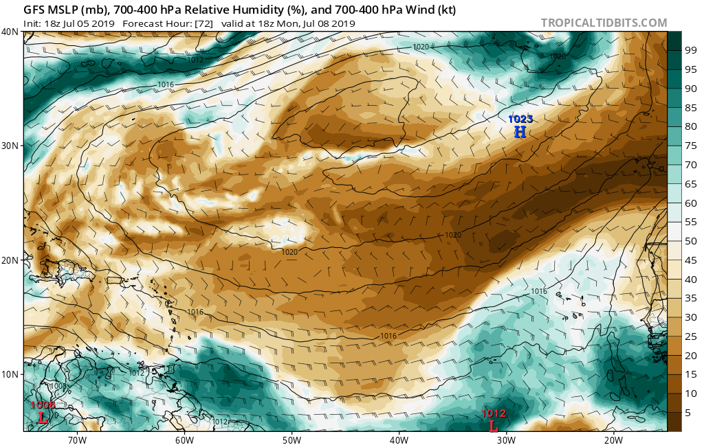
It will be interesting to see if nothing materializes and it turns out that the bait which the EURO was biting on did end up being nothing more then some small mid to upper level "TUTT-like" feature or energy that it see's getting pinched off over the N.E. Gulf, as Wxman suggests. Looking at the latest 12Z GFS run, it's 500mb vorticity forecast maps for late in the week are suggesting broad cyclonic flow in the E. Gulf in conjunction with an increase in mid level vorticity stretching from the E. GOM, ENE'ward for several hundred miles. Even still, the latest GFS is only suggesting a very broad and north/south elongated cyclonic flow at 850mb with lowest surface pressures still over the Fla. panhandle area.
0 likes   
Personal Forecast Disclaimer:
The posts in this forum are NOT official forecast and should not be used as such. They are just the opinion of the poster and may or may not be backed by sound meteorological data. They are NOT endorsed by any professional institution or storm2k.org. For official information, please refer to the NHC and NWS products.


Return to “Talkin' Tropics”

Who is online

Users browsing this forum: Gums, HurakaYoshi, nlosrgr8, sphelps8681 and 82 guests