Possible Development Near the GA/Bahamas (Is Invest 98L)

This is the general tropical discussion area. Anyone can take their shot at predicting a storms path.

Moderator: S2k Moderators

Forum rules

The posts in this forum are NOT official forecasts and should not be used as such. They are just the opinion of the poster and may or may not be backed by sound meteorological data. They are NOT endorsed by any professional institution or STORM2K. For official information, please refer to products from the National Hurricane Center and National Weather Service.

Help Support Storm2K
Message
Author
User avatar
cycloneye
Admin
Admin
Posts: 139593
Age: 67
Joined: Thu Oct 10, 2002 10:54 am
Location: San Juan, Puerto Rico

Re: Possible Development Near the GA/Bahamas Early Next Week (40/70)

#181 Postby cycloneye » Sat Nov 05, 2022 12:41 pm

WEATHER RECONNAISSANCE FLIGHTS
CARCAH, NATIONAL HURRICANE CENTER, MIAMI, FL.
0135 PM EDT SAT 05 NOVEMBER 2022
SUBJECT: TROPICAL CYCLONE PLAN OF THE DAY (TCPOD)
VALID 06/1100Z TO 07/1100Z NOVEMBER 2022
TCPOD NUMBER.....22-162 CORRECTION

I. ATLANTIC REQUIREMENTS
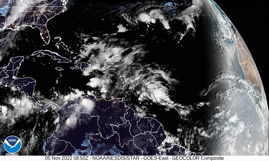
1. SUSPECT AREA (EAST OF BAHAMAS)
FLIGHT ONE - NOAA 43
A. 07/1200Z (CHANGED)
B. NOAA3 01KKA TDR
C. 07/0800Z (CHANGED)
D. 24.5N 71.0W
E. 07/0900Z TO 07/1500Z
F. 10,000 TO 25,000 FT
G. TAIL DOPPLER RADAR

2. OUTLOOK FOR SUCCEEDING DAY:
A. POSSIBLE LOW LEVEL INVEST NEAR 25.0N 72.0W FOR 07/1730Z.
B. TWO MORE NOAA P-3 TAIL DOPPLER RADAR MISSIONS,
DEPARTING KLAL AT 07/2000Z AND 08/0800Z.
0 likes   
Visit the Caribbean-Central America Weather Thread where you can find at first post web cams,radars
and observations from Caribbean basin members Click Here

User avatar
chaser1
S2K Supporter
S2K Supporter
Posts: 4749
Age: 63
Joined: Sat Oct 15, 2005 5:59 pm
Location: Longwood, Fl

Re: Possible Development Near the GA/Bahamas Early Next Week (40/70)

#182 Postby chaser1 » Sat Nov 05, 2022 12:42 pm

:uarrow:

That "40% within 48 hr.s" is a bit disconcerting considering only a broad area low pressure. GCANE may be right about that small spin southwest of PR. I assumed it would simply be the first of multiple eddies until a more cohesive LLC were to try and develop north of the Greater Antilles under a more centralized convective mass.
0 likes   
Personal Forecast Disclaimer:
The posts in this forum are NOT official forecast and should not be used as such. They are just the opinion of the poster and may or may not be backed by sound meteorological data. They are NOT endorsed by any professional institution or storm2k.org. For official information, please refer to the NHC and NWS products.


User avatar
NDG
S2K Supporter
S2K Supporter
Posts: 14945
Joined: Sun Jul 09, 2006 10:14 pm
Location: Orlando, FL

Re: Possible Development Near the GA/Bahamas Early Next Week (40/70)

#183 Postby NDG » Sat Nov 05, 2022 12:47 pm

Very important if the current vortex that is going to swing around Hispaniola where it ends up, if it gets underneath the ULL that is where it will find less shear and transition into a tropical system, which is what the runs of the latest 12z GFS shows, as well as yesterday's 12z & 18z runs.
2 likes   

User avatar
cycloneye
Admin
Admin
Posts: 139593
Age: 67
Joined: Thu Oct 10, 2002 10:54 am
Location: San Juan, Puerto Rico

Re: Possible Development Near the GA/Bahamas Early Next Week (40/70)

#184 Postby cycloneye » Sat Nov 05, 2022 12:50 pm

Key messages.

Image
0 likes   
Visit the Caribbean-Central America Weather Thread where you can find at first post web cams,radars
and observations from Caribbean basin members Click Here

User avatar
InfernoFlameCat
Category 5
Category 5
Posts: 1966
Age: 21
Joined: Mon Dec 14, 2020 10:52 am
Location: Buford, GA

Re: Possible Development Near the GA/Bahamas Early Next Week (40/70)

#185 Postby InfernoFlameCat » Sat Nov 05, 2022 12:54 pm

November is the new October.
Quite the active basin out there. We could see a marginal hurricane out of this.
1 likes   
I am by no means a professional. DO NOT look at my forecasts for official information or make decisions based on what I post.

Goal: to become a registered expert over tropical and subtropical cyclones.

jlauderdal
S2K Supporter
S2K Supporter
Posts: 6810
Joined: Wed May 19, 2004 5:46 am
Location: NE Fort Lauderdale
Contact:

Re: Possible Development Near the GA/Bahamas Early Next Week (40/70)

#186 Postby jlauderdal » Sat Nov 05, 2022 1:02 pm

cycloneye wrote:
Blown Away wrote:
cycloneye wrote:Blown Away, UKMET is always a conservative model and to have that solution is telling.


GCANE observed the AOI moving through Mona Pass instead of over or E of you in PR. That may be the reason PR is now getting more rain & wind and may bring a stronger system into Bahamas/FL?


Is raining in all the island with flooding occuring in some places.

Image
Stay safe, that looks juicy
1 likes   

User avatar
chaser1
S2K Supporter
S2K Supporter
Posts: 4749
Age: 63
Joined: Sat Oct 15, 2005 5:59 pm
Location: Longwood, Fl

Re: Possible Development Near the GA/Bahamas Early Next Week (40/70)

#187 Postby chaser1 » Sat Nov 05, 2022 1:05 pm

Evidence of some small rotation at the very lower-left side of that PR radar
1 likes   
Personal Forecast Disclaimer:
The posts in this forum are NOT official forecast and should not be used as such. They are just the opinion of the poster and may or may not be backed by sound meteorological data. They are NOT endorsed by any professional institution or storm2k.org. For official information, please refer to the NHC and NWS products.


jlauderdal
S2K Supporter
S2K Supporter
Posts: 6810
Joined: Wed May 19, 2004 5:46 am
Location: NE Fort Lauderdale
Contact:

Re: RE: Re: Possible Development Near the GA/Bahamas Early Next Week (40/70)

#188 Postby jlauderdal » Sat Nov 05, 2022 1:05 pm

chaser1 wrote::uarrow:

That "40% within 48 hr.s" is a bit disconcerting considering only a broad area low pressure. GCANE may be right about that small spin southwest of PR. I assumed it would simply be the first of multiple eddies until a more cohesive LLC were to try and develop north of the Greater Antilles under a more centralized convective mass.
Get concerned at 70+
2 likes   

BobHarlem
Category 5
Category 5
Posts: 1668
Joined: Thu Oct 20, 2005 6:11 pm

Re: Possible Development Near the GA/Bahamas Early Next Week (40/70)

#189 Postby BobHarlem » Sat Nov 05, 2022 1:18 pm

Euro coming in a bit stronger this run, but not as strong as cmc/gfs
Last edited by BobHarlem on Sat Nov 05, 2022 1:23 pm, edited 1 time in total.
0 likes   

User avatar
Hypercane_Kyle
Category 5
Category 5
Posts: 2902
Joined: Sat Mar 07, 2015 7:58 pm
Location: Cape Canaveral, FL

Re: Possible Development Near the GA/Bahamas Early Next Week (40/70)

#190 Postby Hypercane_Kyle » Sat Nov 05, 2022 1:18 pm

This is an extremely complex genesis scenario. Ian, in comparison, was much more simple. A huge mess that could turn into anything.

Image
0 likes   
My posts are my own personal opinion, defer to the National Hurricane Center (NHC) and other NOAA products for decision making during hurricane season.

User avatar
AtlanticWind
S2K Supporter
S2K Supporter
Posts: 1809
Age: 65
Joined: Sun Aug 08, 2004 9:57 pm
Location: Plantation,Fla

Re: Possible Development Near the GA/Bahamas Early Next Week (40/70)

#191 Postby AtlanticWind » Sat Nov 05, 2022 1:24 pm

Euro has 1003 mb near key largo
0 likes   

User avatar
Blown Away
S2K Supporter
S2K Supporter
Posts: 9874
Joined: Wed May 26, 2004 6:17 am

Re: Possible Development Near the GA/Bahamas Early Next Week (40/70)

#192 Postby Blown Away » Sat Nov 05, 2022 1:26 pm

AtlanticWind wrote:Euro has 1003 mb near key largo


Image

12z Euro… Circulation much better defined than all previous runs. Timing about same as GFS and slightly L of GFS, so the middle of GFS/Euro is @Miami.
Last edited by Blown Away on Sat Nov 05, 2022 1:27 pm, edited 1 time in total.
0 likes   
Hurricane Eye Experience: David 79, Irene 99, Frances 04, Jeanne 04, Wilma 05... EYE COMING MY WAY IN 2024…
Hurricane Brush Experience: Andrew 92, Erin 95, Floyd 99, Matthew 16, Irma 17, Ian 22, Nicole 22…

User avatar
chaser1
S2K Supporter
S2K Supporter
Posts: 4749
Age: 63
Joined: Sat Oct 15, 2005 5:59 pm
Location: Longwood, Fl

Re: Possible Development Near the GA/Bahamas Early Next Week (40/70)

#193 Postby chaser1 » Sat Nov 05, 2022 1:26 pm

Euro 12Z run has it sitting over Key Largo Thursday morn. moving a bit south of due west at 1003mb. That's about 3mb stronger than it's prior 6Z run.
0 likes   
Personal Forecast Disclaimer:
The posts in this forum are NOT official forecast and should not be used as such. They are just the opinion of the poster and may or may not be backed by sound meteorological data. They are NOT endorsed by any professional institution or storm2k.org. For official information, please refer to the NHC and NWS products.


User avatar
chaser1
S2K Supporter
S2K Supporter
Posts: 4749
Age: 63
Joined: Sat Oct 15, 2005 5:59 pm
Location: Longwood, Fl

Re: Possible Development Near the GA/Bahamas Early Next Week (40/70)

#194 Postby chaser1 » Sat Nov 05, 2022 1:28 pm

Looks like a set-up for a second landfall around Tally perhaps?
0 likes   
Personal Forecast Disclaimer:
The posts in this forum are NOT official forecast and should not be used as such. They are just the opinion of the poster and may or may not be backed by sound meteorological data. They are NOT endorsed by any professional institution or storm2k.org. For official information, please refer to the NHC and NWS products.


User avatar
GCANE
S2K Supporter
S2K Supporter
Posts: 10787
Joined: Mon Oct 22, 2007 8:03 am

Re: Possible Development Near the GA/Bahamas Early Next Week (40/70)

#195 Postby GCANE » Sat Nov 05, 2022 1:30 pm

Looking to see convection fire up around 23N 70W by tomorrow morning.
Expecting development during the day then.
1 likes   

jlauderdal
S2K Supporter
S2K Supporter
Posts: 6810
Joined: Wed May 19, 2004 5:46 am
Location: NE Fort Lauderdale
Contact:

Re: RE: Re: Possible Development Near the GA/Bahamas Early Next Week (40/70)

#196 Postby jlauderdal » Sat Nov 05, 2022 1:36 pm

AtlanticWind wrote:Euro has 1003 mb near key largo
1007 yesterday
0 likes   

User avatar
Category5Kaiju
Category 5
Category 5
Posts: 3437
Age: 22
Joined: Thu Dec 24, 2020 12:45 pm
Location: Seattle

Re: Possible Development Near the GA/Bahamas Early Next Week (40/70)

#197 Postby Category5Kaiju » Sat Nov 05, 2022 1:37 pm

I do not anticipate future 98L to become anywhere near as strong, but here's an example of a memorable hurricane that took a WSW turn right before hitting the East Coast of Florida (1929):

Image
0 likes   
Unless explicitly stated, all information covered in my posts is based on my opinions and observations. Please refer to a professional meteorologist or an accredited weather research agency otherwise, especially if serious decisions must be made in the event of a potentially life-threatening tropical storm or hurricane.

Sciencerocks
Category 5
Category 5
Posts: 7300
Age: 38
Joined: Thu Jul 06, 2017 1:51 am

Re: Possible Development Near the GA/Bahamas Early Next Week (40/70)

#198 Postby Sciencerocks » Sat Nov 05, 2022 1:40 pm

Image
0 likes   

jlauderdal
S2K Supporter
S2K Supporter
Posts: 6810
Joined: Wed May 19, 2004 5:46 am
Location: NE Fort Lauderdale
Contact:

Re: RE: Re: Possible Development Near the GA/Bahamas Early Next Week (40/70)

#199 Postby jlauderdal » Sat Nov 05, 2022 1:40 pm

Category5Kaiju wrote:I do not anticipate future 98L to become anywhere near as strong, but here's an example of a memorable hurricane that took a WSW turn right before hitting the East Coast of Florida (1929):

Image
Katrina took a dive too...i almost got hit by a flying stop sign that day
0 likes   

User avatar
GCANE
S2K Supporter
S2K Supporter
Posts: 10787
Joined: Mon Oct 22, 2007 8:03 am

Re: Possible Development Near the GA/Bahamas Early Next Week (40/70)

#200 Postby GCANE » Sat Nov 05, 2022 1:45 pm

chaser1 wrote:Evidence of some small rotation at the very lower-left side of that PR radar


Seeing a couple vortices in the heavy convection on Punta Cana radar
0 likes   


Return to “Talkin' Tropics”

Who is online

Users browsing this forum: Blown Away, cajungal, Google Adsense [Bot], jgh, JtSmarts, NDG, Pas_Bon, Tireman4, Wampadawg and 115 guests