Analysis,Models,Sat Pics of Low in Western Atlantic

This is the general tropical discussion area. Anyone can take their shot at predicting a storms path.

Moderator: S2k Moderators

Forum rules

The posts in this forum are NOT official forecasts and should not be used as such. They are just the opinion of the poster and may or may not be backed by sound meteorological data. They are NOT endorsed by any professional institution or STORM2K. For official information, please refer to products from the National Hurricane Center and National Weather Service.

Help Support Storm2K
Message
Author
User avatar
punkyg
Category 2
Category 2
Posts: 770
Joined: Mon Apr 23, 2007 7:37 pm
Location: sanford florida

#181 Postby punkyg » Sun May 06, 2007 2:33 pm

Rainband wrote:
feederband wrote:
punkyg wrote:Its raining where i live YES! :rain:


Could you PM some please... :wink:
Your going to get hammered later on this afternoon. Don't worry you will see rain. :D


I think mother nature loves me.she so nice that she gave me a severe thunderstorm warning. :D
oh yay i'm getting more rain and now lightning! hopefully i see hail.
0 likes   

User avatar
NDG
S2K Supporter
S2K Supporter
Posts: 15446
Joined: Sun Jul 09, 2006 10:14 pm
Location: Orlando, FL

#182 Postby NDG » Sun May 06, 2007 2:35 pm

The new 12z Euro keeps insisting in a track towards FL, through FL and into the GOM as a weak area of low pressure as it moves through FL.

Image
Last edited by NDG on Sun May 06, 2007 2:40 pm, edited 1 time in total.
0 likes   

User avatar
Tampa Bay Hurricane
Category 5
Category 5
Posts: 5597
Age: 37
Joined: Fri Jul 22, 2005 7:54 pm
Location: St. Petersburg, FL

#183 Postby Tampa Bay Hurricane » Sun May 06, 2007 2:37 pm

I hope that 12z euro verifies and the low pummels me with heavy rain!!!!! WHOHOO! I love
the Euro!! Come on low pressure...get cranking to a depression and rain all over
me!!!!!!
0 likes   

cpdaman
Category 5
Category 5
Posts: 3131
Joined: Sat Jun 10, 2006 11:44 am
Location: SPB county (gulf stream)

#184 Postby cpdaman » Sun May 06, 2007 2:43 pm

storm is sliding se as forecast it has just past to the north of the east hatteras bouy

where winds went from S to SW to N sustained at 40 plus gusting to 55mph over 2 hours with a modest pressure down to 29.79 so far a 1000kmb low= 29.52
0 likes   

OuterBanker
S2K Supporter
S2K Supporter
Posts: 1728
Joined: Wed Feb 26, 2003 10:53 am
Location: Nags Head, NC
Contact:

What a mess.

#185 Postby OuterBanker » Sun May 06, 2007 2:51 pm

NOAA weather radio. Storm Warning, High Wind Warning, Coastal Flood Warning. Seas building to 16 to 19 ft this afternoon, 18 to 21 ft tonight through tommorow. Current winds 30 to 40 sustained. NOAA warning 40 to 50 kts this afternoon gusts to 60 kts. Tonight 50 to 60 kts gusts to 75. Air temp 55 and will probably stay there, it was 89 with 2 ft swells on Wednesday. But not to worry, seas will diminish to 10 ft and winds will subside to 20 to 25 kts on Thursday. Geeze, I wonder if the Outer Banks will look the same on Thursday.

PS I almost forgot: High Surf Advisory, people should stay out of the water, even the best of swimmers can drown in high rip currents (personally I think anyone that goes swimming will probably recieve the Darwin award). . Already lost most of the flowers that have bloomed recently. It was the most beautiful display in years.
0 likes   

User avatar
cycloneye
Admin
Admin
Posts: 143871
Age: 68
Joined: Thu Oct 10, 2002 10:54 am
Location: San Juan, Puerto Rico

#186 Postby cycloneye » Sun May 06, 2007 3:16 pm

Bouy 41001

:uarrow: :uarrow: :uarrow:

Tropical Storm force winds blowing thru that bouy.
0 likes   
Visit the Caribbean-Central America Weather Thread where you can find at first post web cams,radars
and observations from Caribbean basin members Click Here

Opal storm

#187 Postby Opal storm » Sun May 06, 2007 4:24 pm

0 likes   

User avatar
cycloneye
Admin
Admin
Posts: 143871
Age: 68
Joined: Thu Oct 10, 2002 10:54 am
Location: San Juan, Puerto Rico

#188 Postby cycloneye » Sun May 06, 2007 4:42 pm

AFDMHX

AREA FORECAST DISCUSSION
NATIONAL WEATHER SERVICE NEWPORT/MOREHEAD CITY NC
456 PM EDT SUN MAY 6 2007

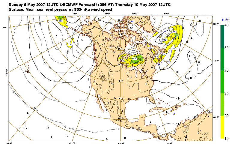
.SHORT TERM /TONIGHT THROUGH WEDNESDAY/...INTENSE LOW DEVELOPING
OFFSHORE OF HAT WILL PRODUCUE WIND AND COASTAL FLOODING PROBLEMS AT
LEAST INTO TUE. 12Z NAM AND GFS VERY CLOSE IN HANDLING THIS LOW
THROUGH 00Z WED...THEN DIVERGE ON TRACK. LEANED TO NAM12 SOLUTION.
SOME POTENTIAL FOR DEEPENING STRONGER THAN FCST WITH WARM WATER
TEMPS AND GOOD BAROCLINIE ZONE...THUS LEANED TO HIGHER WIND SPEED
GDNC PER MARINE SECTION BELOW. CONTINUED HIGH WIND WARNINGS COASTAL
SECTIONS AND WITH ADVISORY INLAND THROUGH MON EVENING. COAST COULD
SEE WIND ADVISORIES MON NIGHT INTO TUE NIGHT AFTER HIGH WIND
WARNINGS EXPIRE. BACKED OFF ON PCPN THREAT TONIGHT AND MON AS MODELS
INDICATE ANY ACTIVITY WILL REMAIN OFF COAST. POTENTIAL FOR
WRAP-AROUND BANDS INCREASES LATE MON NIGHT THROUGH REST OF PERIOD
AND WENT WITH 20 POPS INLAND TO 40 COAST.

SIGNIFICANT COASTAL FLOODING THREAT WITH THIS SYSTEM...WITH MAJOR
FLOODING MAINLY NRN OUTER BANKS AND SRN END OF PAMLICO SOUND.
ALREADY HAVE REPORTS OF WATER LEVELS AROUND 2 FEET ABOVE NORMAL AT
BACK CREEK IN CARTERET COUNTY AND NEAR NEW BERN. NO CHANGES TO
PREVIOUSLY ISSUED COASTAL FLOOD WARNINGS.

&&

.LONG TERM /WEDNESDAY NIGHT THROUGH SUNDAY/...REST OF FCST WILL
DEPEND ON THE TIME THE LOW REMAINS OVER THE SE COAST...BUT FOR NOW
WILL FOLLOW HPC LEAD AND WITH THE LOW STAYING S AND NOT
STRENGTHENING AFTER MON NT. THE LOW IS EXPECTED WASHOUT OVER FL ON
FRI ALLOWING A RIDGE TO BUILD IN OVER THE SE. THIS WILL ALLOW TEMSP
TO WARM BACK INTO THE 80S FOR THE WEEKEND.


&&

.AVIATION /20Z-18Z/...VFR EXPECTED DURING PERIOD EXCEPT SOME MVFR
CIGS OUTER BANKS LATE THIS AFTN AND ON MON.

&&

.MARINE...FCST RUNNING ON TRACK WITH CONDITIONS EXPECTED TO CONTINUE
TO INCREASE THROUGH THE OVERNIGHT AND INTO MONDAY TIME FRAME. THERE
CONTINUES TO BE A PUSH OF SUBSIDENCE OVER THE REGION WITH PRES RISES
OF 3MB/3HRS AS STRONG (FOR SPRING) HIGH PRES NOSES S. MEANWHILE THE
LOW IS STARTING TO TAKE SHAPE WELL OFF THE NC COAST...BUT CLOSE
ENOUGH TO INCREASE PRES GRAD TO GENERATE STRONG GALES/STORM FORCE
WINDS. HAVE SEEN VERIFICATION OF ABOUT HALF THE WIND WARNINGS FOR
COASTAL COUNTIES...AND DESPITE NIGHTTIME APPROACHING STILL
ANTICIPATE WINDS TO INCREASE OVERNIGHT (EXCEPT INLAND) AS MIXING
POTENTIAL INCREASES WITH LLJ AROUND 60-70KT IN THE FAR E. THE WARM
COASTAL WATERS HAVE ALLOWED FOR GOOD MIXING...AND AS THE WINDS
PICKED UP THIS MORNING SAW SEAS RESPOND QUICKER THAN ANTICIPATED
DOWN S. AS WINDS REACH THERE PEAK LATE TONIGHT/MON WILL SEE SEAS
CAPPED AROUND THE LOWER 20S (HIGHEST NEAR HAT)...15 TO 20 KT N OF
HAT...AND 10-15 FT S OF LOOKOUT FOR MON. SOME OF THE HIGHER SEAS
NEAR HAT MAY BUMP SEAS UP SOME IN S WATERS MON NT/TUE AS THE LOW
STALLS AND THEN MOVES W. AT THAT POINT HOWEVER WINDS WILL BEGIN TO
SLACKEN OFF AS THE LOW BECOMES VERTICALLY STACKED AND THE LOW STOPS
DEEPENING. STILL LOOKING AT GALE FORCE WINDS FOR THE BETTER PART OF
TUE/TUE NT AS THE PRES GRAD IS SLOW TO WEAKEN. ALSO CONCERNED WITH
POTENTIAL FOR STORM TO BECOME A HYBRID STORM WHICH WOULD MEAN EVEN
LONGER DURATION OF HIGH SEAS AND AT LEAST SCA WINDS OVER THE COASTAL
WATERS FOR THE ENTIRE FCST. FOR NOW...AM FOLLOWING HPC/OPC LEAD AND
GOING WITH THE STRONGEST OF GUIDANCE FOR WINDS (WHICH HAS WORKED OUT
WELL SO FAR) OVER THE NEXT COUPLE DAYS. OVERALL ONLY MINOR
ADJUSTMENTS FROM PREV FCST...WITH ALL HEADLINES CONTINUING
UNCHANGED. CONCERNS FOR HEADLINES WILL BE DEPENDANT ON
TRACK/INTENSITY OF THE LOW AS IT LINGERS OFF THE S COAST FOR SEVERAL
DAYS...WHICH WOULD IMPACT SOUNDSIDE FLOODING FOR A NUMBER OF DAYS
(THOUGH WORSE SHOULD BE MON WITH STRONGEST NE WINDS). SEAS WILL BE
SLOW TO COME DOWN WITH SEAS ABOVE 6FT FOR REST OF FCST.

http://www.srh.noaa.gov/data/MHX/AFDMHX

The above is from the afternoon's Morehead City NWS discussion.
0 likes   
Visit the Caribbean-Central America Weather Thread where you can find at first post web cams,radars
and observations from Caribbean basin members Click Here

User avatar
Tampa Bay Hurricane
Category 5
Category 5
Posts: 5597
Age: 37
Joined: Fri Jul 22, 2005 7:54 pm
Location: St. Petersburg, FL

#189 Postby Tampa Bay Hurricane » Sun May 06, 2007 4:56 pm

Looks like a possible subtropical storm
offshore the SE US coast.

As for me, I give up
all hope of seeing a drop of
rain until June 2007, as all
storms have missed me to
the east, thanks to the
counterclockwise flow of
this low.
0 likes   

User avatar
feederband
S2K Supporter
S2K Supporter
Posts: 3423
Joined: Wed Oct 01, 2003 6:21 pm
Location: Lakeland Fl

#190 Postby feederband » Sun May 06, 2007 4:59 pm

Rainband wrote:
feederband wrote:
punkyg wrote:Its raining where i live YES! :rain:


Could you PM some please... :wink:
Your going to get hammered later on this afternoon. Don't worry you will see rain. :D


I wish I would of got hammered..I've been in-between all the heavy stuff...So far just maybe 10 minutes of rain...and it looks like I'm inbetween the rest of the stuff out there.. :grr:
0 likes   

Coredesat

#191 Postby Coredesat » Sun May 06, 2007 4:59 pm

Tampa Bay Hurricane wrote:Looks like a possible subtropical storm
offshore the SE US coast.


I highly doubt it seeing as there's still a cold front there. It's just a deep extratropical system interacting with a strong high pressure ridge to produce strong winds. The models don't seem to do anything with it for the next 72 hours.
0 likes   

User avatar
cycloneye
Admin
Admin
Posts: 143871
Age: 68
Joined: Thu Oct 10, 2002 10:54 am
Location: San Juan, Puerto Rico

#192 Postby cycloneye » Sun May 06, 2007 5:43 pm

18z NAM Loop

:uarrow: :uarrow: :uarrow:

The 18z NAM moves the cold core low SW towards the coast.

The only question about this low pressure is if it can adquire some baroclinic enviroment that may allow some subtropical or even tropical caracteristics before it starts to fill.Because it's a core cold low,no invest has poped up.But if in the next couple of days,the low shows some signs of more warm core chacteristics,then you will see invest 90L.
0 likes   

User avatar
ronjon
Category 5
Category 5
Posts: 4811
Joined: Fri Aug 19, 2005 5:17 pm
Location: Hernando Beach, FL

#193 Postby ronjon » Sun May 06, 2007 6:10 pm

12Z suite of global models still show that the Euro, NOGAPs, and UKMET pushing a weakened system into FL with the Euro maintaining a weak low pressure in the eastern GOM. The CMC, GFS, and NAM take a stronger low west then NW to the coast of SC. Still no clear cut consensus yet - maybe with tomorrows runs. The HPC pm discussion sides with the NCEP ensemble mean which closely follows the 12Z Euro.
0 likes   

User avatar
cycloneye
Admin
Admin
Posts: 143871
Age: 68
Joined: Thu Oct 10, 2002 10:54 am
Location: San Juan, Puerto Rico

#194 Postby cycloneye » Sun May 06, 2007 7:05 pm

WESTERN ATLANTIC...
THE BIG STORY IS ASSOCIATED WITH A STRENGTHENING LOW PRES SYSTEM
OFF THE CAROLINA COASTLINE....ANALYZED 1009 MB NEAR 35N74W. A
BACK DOOR COLD FRONT IS PROGRESSING SWD FROM THE LOW TO NE
FLORIDA. THIS LOW HAS AN IMPRESSIVE LARGE CIRCULATION WITH
MULTIPLE BOUNDARIES ROTATING AROUND IT PRODUCING SCATTERED
SHOWERS N OF 28N W OF 70W. THE MAIN IMPACT IS THE STRONG WINDS
AS A VERY TIGHT PRES GRADIENT HAS SET UP BETWEEN THE LOW AND
STRONG HIGH PRES OVER THE ERN GREAT LAKES. SHIPS/BUOYS ARE
REPORTING NLY WINDS TO 40 KT NOT FAR OFF THE SE COAST. GLOBAL
MODELS ARE NOW IN PRETTY GOOD AGREEMENT SHOWING THE SYSTEM
STRENGTHENING FURTHER AS IT TAKES A LOOPING OR SLOW WWD MOTION
TOWARD THE SE COAST. SEVERAL MODELS ARE ALSO SHOWING THE SYSTEM
BECOMING LESS FRONTAL IN NATURE OVER THE NEXT COUPLE DAYS.

http://www.storm2k.org/wx/modules.php?n ... ge&pid=109

The above is the part of the TPC 8 PM discussion related to the developing low.
0 likes   
Visit the Caribbean-Central America Weather Thread where you can find at first post web cams,radars
and observations from Caribbean basin members Click Here

User avatar
TexasSam
Category 2
Category 2
Posts: 573
Age: 65
Joined: Thu Aug 28, 2003 12:16 am
Location: Port Arthur, Texas

#195 Postby TexasSam » Sun May 06, 2007 7:14 pm

About 6:50pm central time, the weather channel said something like "possible first tropical storm of the season" I about fell out of my chair!
0 likes   

HurricaneHunter914
Category 5
Category 5
Posts: 4439
Age: 31
Joined: Fri Mar 10, 2006 7:36 pm
Location: College Station, TX

#196 Postby HurricaneHunter914 » Sun May 06, 2007 7:15 pm

I here a 90L Invest in the near future if this system continues to live on. We really got hammered here today. Mother Nature loves us!
0 likes   
Personal Forecast Disclaimer:
The posts in this forum are NOT official forecast and should not be used as such. They are just the opinion of the poster and may or may not be backed by sound meteorological data. They are NOT endorsed by any professional institution or storm2k.org. For official information, please refer to the NHC and NWS products.

User avatar
Tampa Bay Hurricane
Category 5
Category 5
Posts: 5597
Age: 37
Joined: Fri Jul 22, 2005 7:54 pm
Location: St. Petersburg, FL

#197 Postby Tampa Bay Hurricane » Sun May 06, 2007 7:18 pm

Come on low pressure become
90L invest become a tropical depression and
bring me some good hard rain!!! Yea baby!!
Yea with shear reduction, warm gulf stream waters
and moisture a tropical depression or storm is
possible

I wishfully forecast a tropical depression!!!! Wishful thinking HA!!!
Last edited by Tampa Bay Hurricane on Sun May 06, 2007 7:20 pm, edited 1 time in total.
0 likes   

User avatar
punkyg
Category 2
Category 2
Posts: 770
Joined: Mon Apr 23, 2007 7:37 pm
Location: sanford florida

#198 Postby punkyg » Sun May 06, 2007 7:20 pm

HurricaneHunter914 wrote:I here a 90L Invest in the near future if this system continues to live on. We really got hammered here today. Mother Nature loves us!


Thats what i said earlier, but it was about me. the mother nature part if you don't know what i'm talking about.
0 likes   

User avatar
Grease Monkey
Category 2
Category 2
Posts: 727
Joined: Fri Jun 09, 2006 9:25 pm

#199 Postby Grease Monkey » Sun May 06, 2007 7:34 pm

So I guess we can say huricanes must be Mother nature's act of tough love.
0 likes   

User avatar
cycloneye
Admin
Admin
Posts: 143871
Age: 68
Joined: Thu Oct 10, 2002 10:54 am
Location: San Juan, Puerto Rico

#200 Postby cycloneye » Sun May 06, 2007 7:39 pm

This thread will remain open (Until it reaches 25 pages) to all for discussions and analysis,to post sat pics of the low and to post the model runs.Also,it will remain open until invest 90L appears (Only it will pop up at the NRL Navy site if it turns warm core) in that case this thread closes and a new 90L invest thread will be created by any member.
0 likes   


Return to “Talkin' Tropics”

Who is online

Users browsing this forum: Blown Away and 193 guests