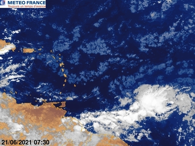
1. This area has been described repeatedly by NHC as a "tropical wave", yet TAFB has so far not identified it as a tropical wave on their 4-daily surface maps. Looks like a healthy twave to me.
Here in the eastern Caribbean, we all know well that tropical waves have weather consequences, they don't have to develop into cyclones. Garden-variety thunderstorms produce gusts of 20-30kt, tropical wave thunderstorms produce gusts 30-50kts, and I can refer you to some sailors who have experienced it first-hand in blow-downs, ripped sails and broken masts. Garden-variety clouds and rain produce showers that can be heavy, tropical waves dump buckets of water in a very short time.
It disturbs me that so far this season, TAFB has failed to identify so many tropical waves. And NWS/PR calls this a "perturbation in the westerlies" - isn't that part of the textbook definition of a tropical wave? (I believe I could go look this up and find those exact words in a definition online) Has it become politically incorrect to use the term? The general public here has come to understand what to expect from the term "tropical wave". They are much less informed what to expect from a "perturbation in the westerlies", or "trough".
2. The area is only days away from the islands, it deserves to have an invest, so that some information is available. Yes, I know about the experimental pouches. I'm talking about an invest that allows NRL sats, regular models, etc.
3. While it looks like upper air features could make it difficult to develop in the short term, the moisture is very deep (PW product, below). This looks like it could bring some very nasty weather to the islands, with potential threats in winds/seas, and rains/flooding/mudslides, even if not organized into a cyclone.


