Pouch P10L with low in Central Atlantic- (Is invest 91L)
Moderator: S2k Moderators
Forum rules

The posts in this forum are NOT official forecasts and should not be used as such. They are just the opinion of the poster and may or may not be backed by sound meteorological data. They are NOT endorsed by any professional institution or STORM2K. For official information, please refer to products from the National Hurricane Center and National Weather Service.

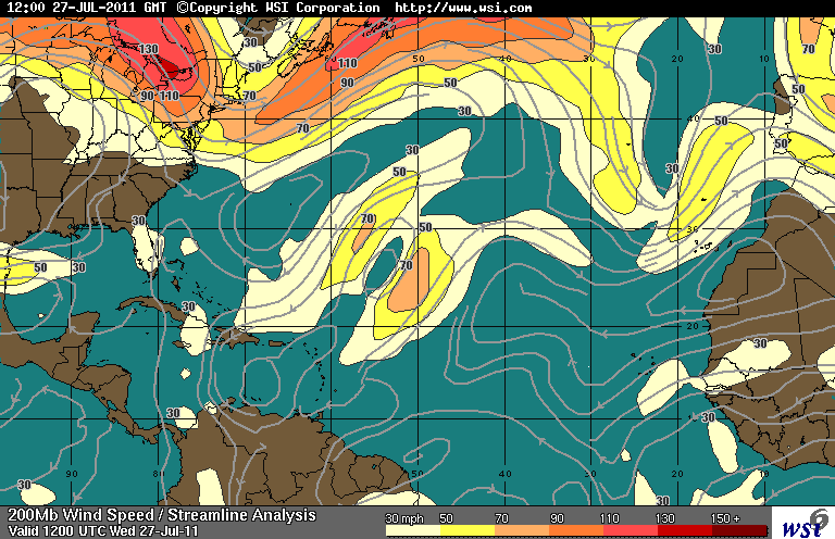
It has to be in an area of already low ambient background pressures, otherwise thats a pretty impressive low, and you can see why the ECM has been quite gung ho despite the dry air.
0 likes
Personal Forecast Disclaimer:
The posts in this forum are NOT official forecast and should not be used as such. They are just the opinion of the poster and may or may not be backed by sound meteorological data. They are NOT endorsed by any professional institution or storm2k.org. For official information, please refer to the NHC and NWS products
The posts in this forum are NOT official forecast and should not be used as such. They are just the opinion of the poster and may or may not be backed by sound meteorological data. They are NOT endorsed by any professional institution or storm2k.org. For official information, please refer to the NHC and NWS products
-
Gustywind

- Category 5

- Posts: 12334
- Joined: Mon Sep 03, 2007 7:29 am
- Location: Baie-Mahault, GUADELOUPE
Re: Pouch PO10L SW of CV islands
cycloneye wrote:This is the 18z surface analysis and the low pressure goes down to 1008 mbs.
Uploaded by imageshack.us

Oh damn
0 likes
-
Ivanhater

- Storm2k Moderator

- Posts: 11221
- Age: 39
- Joined: Fri Jul 01, 2005 8:25 am
- Location: Pensacola
Re: Pouch PO10L SW of CV islands
Thanks Luis for alerting me on this...that is one impressive low pressure
0 likes
Michael
-
cycloneye

- Admin

- Posts: 149426
- Age: 69
- Joined: Thu Oct 10, 2002 10:54 am
- Location: San Juan, Puerto Rico
Re: Pouch PO10L SW of CV islands
0 likes
Visit the Caribbean-Central America Weather Thread where you can find at first post web cams,radars
and observations from Caribbean basin members Click Here
and observations from Caribbean basin members Click Here

Cool looking system but totally lacking in convection. Another one that had it been a month later would probably be a TS already...given both 90L and this one is really looking good, I think that is rather suggestive of another big CV season IMO...
0 likes
Personal Forecast Disclaimer:
The posts in this forum are NOT official forecast and should not be used as such. They are just the opinion of the poster and may or may not be backed by sound meteorological data. They are NOT endorsed by any professional institution or storm2k.org. For official information, please refer to the NHC and NWS products
The posts in this forum are NOT official forecast and should not be used as such. They are just the opinion of the poster and may or may not be backed by sound meteorological data. They are NOT endorsed by any professional institution or storm2k.org. For official information, please refer to the NHC and NWS products
-
cycloneye
- Admin
- Posts: 149426
- Age: 69
- Joined: Thu Oct 10, 2002 10:54 am
- Location: San Juan, Puerto Rico
Re: Pouch PO10L SW of CV islands
For a second run in a row,GFS once again shows this pouch.


0 likes
Visit the Caribbean-Central America Weather Thread where you can find at first post web cams,radars
and observations from Caribbean basin members Click Here
and observations from Caribbean basin members Click Here
-
cycloneye
- Admin
- Posts: 149426
- Age: 69
- Joined: Thu Oct 10, 2002 10:54 am
- Location: San Juan, Puerto Rico
Re: Pouch PO10L SW of CV islands
8 PM TWD:
A TROPICAL WAVE IS OFF THE COAST OF WEST AFRICA FROM 15N27W TO
8N30W MOVING W AT 15-20 KT. A 1008 MB LOW IS EMBEDDED ON THE
WAVE AXIS NEAR 8N30W. THE SYSTEM IS WELL DEPICTED ON SSMI TOTAL
PRECIPITABLE WATER IMAGERY AND ON SATELLITE IMAGERY. CONVECTION
IS MAINLY CONFINED TO THE MONSOON TROUGH S OF THE WAVE.
0 likes
Visit the Caribbean-Central America Weather Thread where you can find at first post web cams,radars
and observations from Caribbean basin members Click Here
and observations from Caribbean basin members Click Here
-
plasticup
Re: Pouch PO10L SW of CV islands
This definitely looks promising. I love CV storms, and apparently so do the models! Except NOGAPS, which buries this thing 
0 likes
-
Evil Jeremy

- S2K Supporter

- Posts: 5463
- Age: 32
- Joined: Mon Apr 10, 2006 2:10 pm
- Location: Los Angeles, CA
Re: Pouch PO10L SW of CV islands
JB: "System at 10 north and 30 west may post problems to ne Caribbean by Monday"
0 likes
Frances 04 / Jeanne 04 / Katrina 05 / Wilma 05 / Fay 08 / Debby 12 / Andrea 13 / Colin 16 / Hermine 16 / Matthew 16 / Irma 17
-
cycloneye
- Admin
- Posts: 149426
- Age: 69
- Joined: Thu Oct 10, 2002 10:54 am
- Location: San Juan, Puerto Rico
Re: Pouch PO10L SW of CV islands
850 mb vorticity is superb.

0 likes
Visit the Caribbean-Central America Weather Thread where you can find at first post web cams,radars
and observations from Caribbean basin members Click Here
and observations from Caribbean basin members Click Here

Re: Pouch PO10L SW of CV islands
that is one tight circulation though got some SAL to the north and in front....development likely when it gets to the carib.....Luis I would keep my eye on this one....
0 likes
-
cycloneye
- Admin
- Posts: 149426
- Age: 69
- Joined: Thu Oct 10, 2002 10:54 am
- Location: San Juan, Puerto Rico
Re: Pouch PO10L SW of CV islands
The shear wont be a big problem if it stays below 15n.As you said ROCK,the dry air is the biggest hurdle.
0 likes
Visit the Caribbean-Central America Weather Thread where you can find at first post web cams,radars
and observations from Caribbean basin members Click Here
and observations from Caribbean basin members Click Here
-
Florida1118
Re: Pouch PO10L SW of CV islands
A system justs forms and Emily is on the horizon. I wonder if seasonal forcasts will be bumped up any...
0 likes
-
plasticup
Re: Pouch PO10L SW of CV islands
Florida1118 wrote:A system justs forms and Emily is on the horizon. I wonder if seasonal forcasts will be bumped up any...
Doubt it. We are getting to that time of year when every wave has a good shot. Remember, just two weeks ago people were asking if this season was a bust!
0 likes

Folks,
This one of any this year has my attention. I think it's a prime candidate to become the next TC and at this point all indications are this is westbound for some time. In fact, none of the long range guidance indicates recurvature..It also maintains and excellent presentation and envelope this evening...As it pases 50W there should be a marked increase in convection...The forecasted synoptics should move it into portions of the leeward islands by Sunday...Interesting days ahead...
This one of any this year has my attention. I think it's a prime candidate to become the next TC and at this point all indications are this is westbound for some time. In fact, none of the long range guidance indicates recurvature..It also maintains and excellent presentation and envelope this evening...As it pases 50W there should be a marked increase in convection...The forecasted synoptics should move it into portions of the leeward islands by Sunday...Interesting days ahead...
0 likes
-
cycloneye
- Admin
- Posts: 149426
- Age: 69
- Joined: Thu Oct 10, 2002 10:54 am
- Location: San Juan, Puerto Rico
Re: Pouch PO10L SW of CV islands
The 00z surface analysis by TAFB continues to show the low pressure.

Uploaded by imageshack.us
Uploaded by imageshack.us
0 likes
Visit the Caribbean-Central America Weather Thread where you can find at first post web cams,radars
and observations from Caribbean basin members Click Here
and observations from Caribbean basin members Click Here
-
Rgv20

- S2K Supporter
- Posts: 2466
- Age: 39
- Joined: Wed Jan 05, 2011 5:42 pm
- Location: Edinburg/McAllen Tx
Did a quick check of the models (been preoccupied with Don), this is the best candidate for 91L and it looks like it will be knocking on the Lesser Antilles Islands by Sunday evening or Monday.
0 likes
The following post is NOT an official forecast and should not be used as such. It is just the opinion of the poster and may or may not be backed by sound meteorological data. It is NOT endorsed by any professional institution including storm2k.org For Official Information please refer to the NHC and NWS products.


-
HurricaneWarning92
- Category 2

- Posts: 520
- Joined: Sat Jul 23, 2011 4:33 pm
- Location: Pembroke Pines, S. Florida (Lat: 26.00N, Lon: 80.22W)
could this feature head north of the islands or just brush them or is it too early to tell?
0 likes
The posts in this forum are NOT official forecast and should not be used as such. They are just the opinion of the poster and may or may not be backed by sound meteorological data. They are NOT endorsed by any professional institution or storm2k.org. For official information, please refer to the NHC and NWS products.
Who is online
Users browsing this forum: No registered users and 275 guests