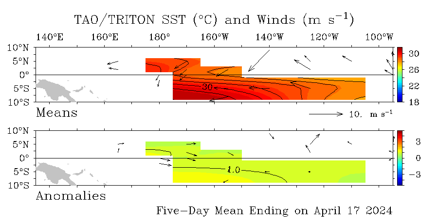
Update about ENSO=Neutral thru Hurricane Season 2005

This is the general tropical discussion area. Anyone can take their shot at predicting a storms path.

Moderator: S2k Moderators

Forum rules

The posts in this forum are NOT official forecasts and should not be used as such. They are just the opinion of the poster and may or may not be backed by sound meteorological data. They are NOT endorsed by any professional institution or STORM2K. For official information, please refer to products from the National Hurricane Center and National Weather Service.

Help Support Storm2K
Message
Author
User avatar
cycloneye
Admin
Admin
Posts: 148503
Age: 69
Joined: Thu Oct 10, 2002 10:54 am
Location: San Juan, Puerto Rico

#21 Postby cycloneye » Wed Mar 23, 2005 4:36 pm

Those blue colors are more dark now at el nino 1-2 but as I said before we have to watch if this cool pool expands westward.

Image

Blue colors are growing west of South America indicating cooling waters.Looks like the last Kelvin Wave was not strong enough to trigger a el nino event although some warming took place in the last couple of weeks.Looks neutral to me the pacific right now with some warmer anomalys at the dateline but cooler ones at el nino 1-2.As I posted before the SOI is up from the down trend it was in febuary.
0 likes   
Visit the Caribbean-Central America Weather Thread where you can find at first post web cams,radars
and observations from Caribbean basin members Click Here

HURRICANELONNY
Category 5
Category 5
Posts: 1387
Joined: Wed May 07, 2003 6:48 am
Location: HOLLYWOOD.FL

NEUTRAL FOR NOW.

#22 Postby HURRICANELONNY » Wed Mar 23, 2005 4:48 pm

If a El Nino forms it probably won't be till late this year. Depending if any more kelvin waves appear.
http://www.bom.gov.au/climate/enso/index.shtml :roll:
0 likes   

User avatar
cycloneye
Admin
Admin
Posts: 148503
Age: 69
Joined: Thu Oct 10, 2002 10:54 am
Location: San Juan, Puerto Rico

#23 Postby cycloneye » Thu Mar 24, 2005 5:14 pm

Image

I dont see according to the data that el nino is trying to wake up at all.-0.5c at el nino 1-2 region.More warmer at el nino 3 and 4 but it has not expanded in recent weeks.
0 likes   

HURRICANELONNY
Category 5
Category 5
Posts: 1387
Joined: Wed May 07, 2003 6:48 am
Location: HOLLYWOOD.FL

SUBSURFACE

#24 Postby HURRICANELONNY » Thu Mar 24, 2005 6:03 pm

It appears that different agencies use different graphics. In this one it shows the wave progressing east with anomalies approaching -4c.
http://www.cpc.ncep.noaa.gov/products/a ... xzteq.html
0 likes   

HURRICANELONNY
Category 5
Category 5
Posts: 1387
Joined: Wed May 07, 2003 6:48 am
Location: HOLLYWOOD.FL

GRAPHICS

#25 Postby HURRICANELONNY » Fri Mar 25, 2005 7:51 am

I meant +4c. :eek:
0 likes   

User avatar
x-y-no
Category 5
Category 5
Posts: 8359
Age: 65
Joined: Wed Aug 11, 2004 12:14 pm
Location: Fort Lauderdale, FL

Re: SUBSURFACE

#26 Postby x-y-no » Fri Mar 25, 2005 9:18 am

HURRICANELONNY wrote:It appears that different agencies use different graphics. In this one it shows the wave progressing east with anomalies approaching -4c.
http://www.cpc.ncep.noaa.gov/products/a ... xzteq.html


This graphic is showing a vertical column cross-section at the equator, as opposed to the surface maps above.

What this indicates is that the kelvin wave discussed here last month is still looking healthy, and we should probably see some surface warming relative to the norm somewhere in the vicinity of 120W in a few weeks.

Don't expect the warming once it gets to the surface to be anything near as dramatic as it looks at 100 - 150 meters in this animation, though.

I don't expect this to have a lasting effect into the season. That still looks likely to be just barely above neutral, with a similar temperature distribution as last year.
0 likes   


Return to “Talkin' Tropics”

Who is online

Users browsing this forum: No registered users and 474 guests