SW Pacific: Severe TC Larry (Ex TD 15)

This is the general tropical discussion area. Anyone can take their shot at predicting a storms path.

Moderator: S2k Moderators

Forum rules

The posts in this forum are NOT official forecasts and should not be used as such. They are just the opinion of the poster and may or may not be backed by sound meteorological data. They are NOT endorsed by any professional institution or STORM2K. For official information, please refer to products from the National Hurricane Center and National Weather Service.

Help Support Storm2K
Message
Author
User avatar
HURAKAN
Professional-Met
Professional-Met
Posts: 46086
Age: 38
Joined: Thu May 20, 2004 4:34 pm
Location: Key West, FL
Contact:

#21 Postby HURAKAN » Fri Mar 17, 2006 4:55 pm

Image

Image

WTPS21 PGTW 172130
MSGID/GENADMIN/NAVPACMETOCCEN PEARL HARBOR HI/JTWC//
SUBJ/TROPICAL CYCLONE FORMATION ALERT/172121ZMAR2006//
RMKS/
1. FORMATION OF A SIGNIFICANT TROPICAL CYCLONE IS POSSIBLE WITHIN
200 NM EITHER SIDE OF A LINE FROM 16.4S 158.2E TO 18.8S 152.1E
WITHIN THE NEXT 12 TO 24 HOURS. AVAILABLE DATA DOES NOT JUSTIFY
ISSUANCE OF NUMBERED TROPICAL CYCLONE WARNINGS AT THIS TIME.
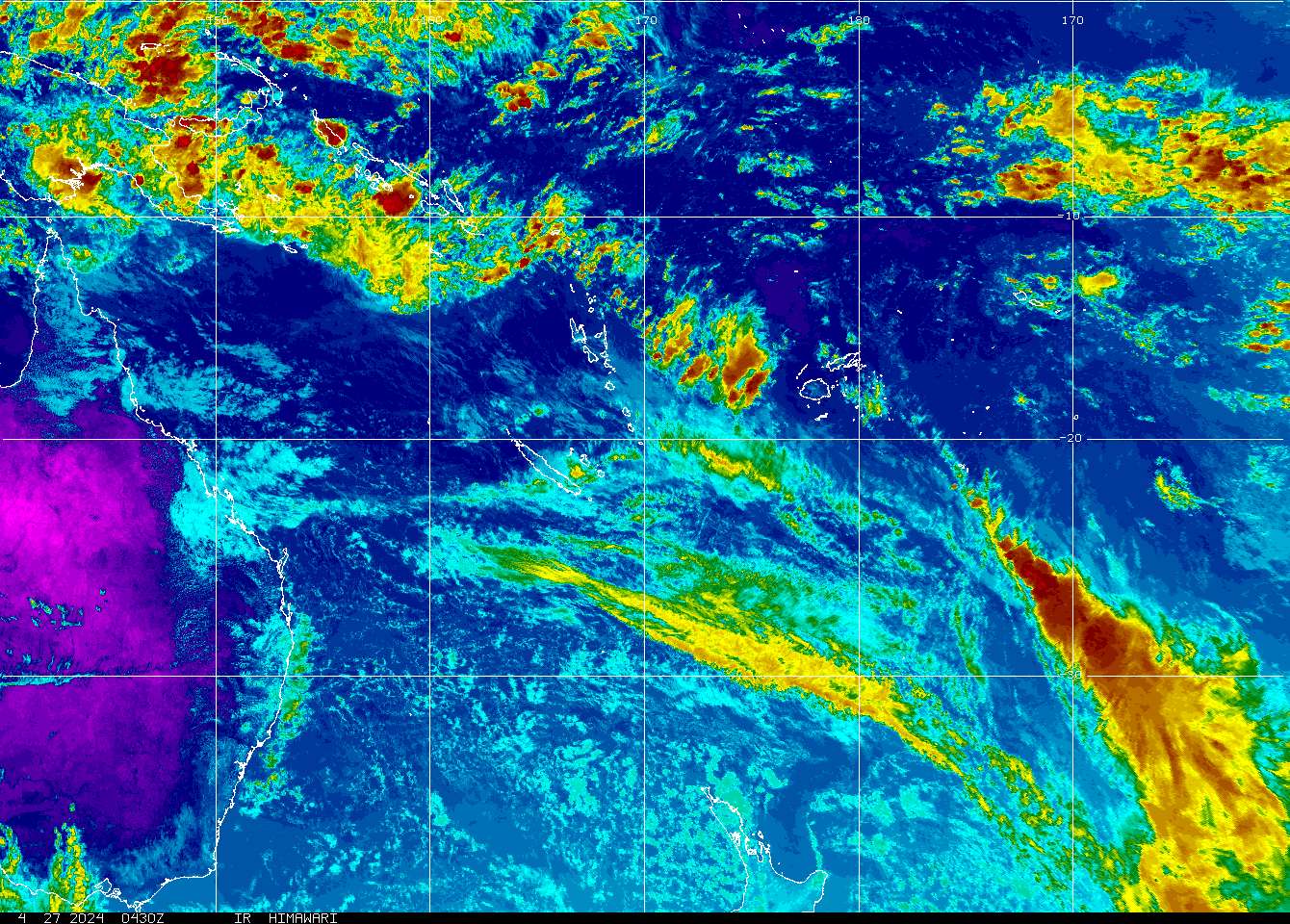
WINDS IN THE AREA ARE ESTIMATED TO BE 30 TO 35 KNOTS. METSAT IM­
AGERY AT 211800Z INDICATES THAT A CIRCULATION CENTER IS LOCATED
NEAR 16.5S 157.9E. THE SYSTEM IS MOVING SOUTHWESTWARD AT 13
KNOTS.
2. REMARKS: THE AREA OF CONVECTION PREVIOUSLY LOCATED NEAR 14.5S
160.1E IS NOW LOCATED NEAR 16.5S 157.9E, APPROXIMATELY 700 NM EAST
OF CAIRNS, AUSTRALIA. ANIMATED INFRARED SATELLITE IMAGERY DEPICTS A
INCREASED LOW TO MIDLEVEL ORGANIZATION AND FLARING CONVECTION OVER
THE PAST SIX HOURS. A RECENT 171828Z TRMM PASS REVEALS INCREASED LOW
LEVEL ORGANIZATION WITH STRONG BANDING CONVECTION ON THE SOUTHERN
PERIPHERAL. SUSTAINED DEEP CONVECTION IS CURRENTLY LIMITED BY A WEAK
UPPER LEVEL CYCLONE, WHICH HAS STARTED TO FILL OVER THE LAST 12
HOURS. UPPER LEVEL ANALYSIS ALSO INDICATES THE SYSTEM IS IN A WEAK
VERTICAL WIND SHEAR ENVIRONMENT. MAXIMUM SUSTAINED WINDS ARE ESTIM-
ATED AT 30 TO 35 KNOTS. MINIMUM SEA LEVEL PRESSURE IS ESTIMATED TO
BE NEAR 1000 MB. BASED ON IMPROVED LOW LEVEL ORGANIZATION AND THE
STRENGTHENING UPPER LEVEL ANTICYCLONE, THE POTENTIAL FOR THE
DEVELOPMENT OF A SIGNIFICANT TROPICAL CYCLONE WITHIN THE NEXT 24
HOURS IS UPGRADED TO GOOD.
3. THIS ALERT WILL BE REISSUED, UPGRADED TO WARNING OR CANCELLED BY
182130Z.//

0 likes   

User avatar
HURAKAN
Professional-Met
Professional-Met
Posts: 46086
Age: 38
Joined: Thu May 20, 2004 4:34 pm
Location: Key West, FL
Contact:

#22 Postby HURAKAN » Fri Mar 17, 2006 8:27 pm

Australian Government Bureau of Meteorology
Queensland
Tropical Cyclone Warning Centre

Media: The Standard Emergency Warning Signal should NOT be used with this
message.


PRIORITY
TROPICAL CYCLONE ADVICE NUMBER 2
Issued by the Bureau of Meteorology, Brisbane
Issued at 10:32am on Saturday the 18th of March 2006

A Cyclone WATCH has been issued for coastal and island communities
between Cape Tribulation and Proserpine.

At 10am, Tropical Cyclone Larry, Category 2, was centred near latitude
17.2 south longitude 156.6 east, which is 1150 kilometres east of Cairns.

Tropical Cyclone Larry is expected to intensify further and move in a westerly
direction over the weekend at about 25 km/h.

Tropical Cyclone Larry is expected to affect coastal and island areas between
Cape Tribulation and Proserpine early Monday morning.

People living between Cape Tribulation and Proserpine should consider actions
they will need to take if the cyclone threat increases and listen to the next
advice. If you are unsure about actions to be taken, information is available
from your local government or local State Emergency Service.

The next advice will be issued at 5pm EST Saturday.

This warning is also available through TV and Radio Broadcasts; the Bureau's
website at http://www.bom.gov.au or call 1300 659 212. The Bureau and the State
Emergency Service would appreciate this warning being broadcast regularly.


______________________________________________________________


HIGH SEAS WEATHER WARNING FOR METAREA 10 ISSUED BY THE AUSTRALIAN BUREAU OF
METEOROLOGY, BRISBANE 0039 UTC 18 March 2006

HURRICANE WARNING FOR NORTH EASTERN AREA

SITUATION
Tropical cyclone Larry with central pressure 985 hectopascals centred at
180000UTC near 17.2S 156.6E and moving WSW at 13 knots. Position good. The
cyclone is expected deepen.

AREA AFFECTED
Within 300nm of the low centre in the southern semi-circle and within 200 nm in
the northern semi-circle.

FORECAST
Clockwise winds 34/45 knots with maximum winds reaching 50 knots within 40 nm of
the centre. Maximum winds increasing to 65 knots within 40 nm of the centre in
the next 24 hours. Seas rising very rough to high.

Forecast positions
Near 17.3S 154.3E at 181200UTC with maximum winds 55 knots; and
Near 17.6S 151.6E at 190000UTC with maximum winds 65 knots.


REMARKS
All ships in the area please send weather reports every three hours. Regular
weather observing ships use normal channels. Other ships please use either
email to marwxqld@bom.gov.au or fax to +61732398776 or satellite to SAC 41
through Land Earth Station Perth 222.

WEATHER BRISBANE
0 likes   

MiamiensisWx

#23 Postby MiamiensisWx » Fri Mar 17, 2006 8:46 pm

I wonder if this could reach winds of at least 115MPH before landfall, since the environment seems to be fairly favorable. If this environment lasts and outflow/convection remains good, it may be possible.
0 likes   

User avatar
HURAKAN
Professional-Met
Professional-Met
Posts: 46086
Age: 38
Joined: Thu May 20, 2004 4:34 pm
Location: Key West, FL
Contact:

#24 Postby HURAKAN » Fri Mar 17, 2006 9:22 pm

Image

SUBJ: TROPICAL CYCLONE 17P (LARRY) WARNING NR 001
REF/A/MY/182121Z MAR 06//
AMPN/TROPICAL CYCLONE FORMATION ALERT//
WTPS31 PGTW 180300
1. TROPICAL CYCLONE 17P (LARRY) WARNING NR 001
01 ACTIVE TROPICAL CYCLONE IN SOUTHPAC
MAX SUSTAINED WINDS BASED ON ONE-MINUTE AVERAGE
---
WARNING POSITION:
180000Z --- NEAR 16.9S 156.9E
MOVEMENT PAST SIX HOURS - 245 DEGREES AT 10 KTS
POSITION ACCURATE TO WITHIN 040 NM
POSITION BASED ON CENTER LOCATED BY SATELLITE
PRESENT WIND DISTRIBUTION:
MAX SUSTAINED WINDS - 035 KT, GUSTS 045 KT
RADIUS OF 034 KT WINDS - 090 NM NORTHEAST QUADRANT
120 NM SOUTHEAST QUADRANT
120 NM SOUTHWEST QUADRANT
090 NM NORTHWEST QUADRANT
REPEAT POSIT: 16.9S 156.9E
---
FORECASTS:
12 HRS, VALID AT:
181200Z --- 17.6S 154.8E
MAX SUSTAINED WINDS - 040 KT, GUSTS 050 KT
RADIUS OF 034 KT WINDS - 100 NM NORTHEAST QUADRANT
130 NM SOUTHEAST QUADRANT
130 NM SOUTHWEST QUADRANT
100 NM NORTHWEST QUADRANT
VECTOR TO 24 HR POSIT: 255 DEG/ 12 KTS
---
24 HRS, VALID AT:
190000Z --- 18.2S 152.4E
MAX SUSTAINED WINDS - 045 KT, GUSTS 055 KT
RADIUS OF 034 KT WINDS - 120 NM NORTHEAST QUADRANT
140 NM SOUTHEAST QUADRANT
140 NM SOUTHWEST QUADRANT
120 NM NORTHWEST QUADRANT
VECTOR TO 36 HR POSIT: 250 DEG/ 11 KTS
---
36 HRS, VALID AT:
191200Z --- 18.9S 150.1E
MAX SUSTAINED WINDS - 050 KT, GUSTS 065 KT
RADIUS OF 034 KT WINDS - 125 NM NORTHEAST QUADRANT
150 NM SOUTHEAST QUADRANT
150 NM SOUTHWEST QUADRANT
OVER WATER
125 NM NORTHWEST QUADRANT
VECTOR TO 48 HR POSIT: 250 DEG/ 13 KTS
---
EXTENDED OUTLOOK:
48 HRS, VALID AT:
200000Z --- 19.7S 147.5E
MAX SUSTAINED WINDS - 045 KT, GUSTS 055 KT
DISSIPATING AS A SIGNIFICANT TROPICAL CYCLONE OVER LAND
RADIUS OF 034 KT WINDS - 115 NM NORTHEAST QUADRANT
OVER WATER
125 NM SOUTHEAST QUADRANT
OVER WATER
100 NM SOUTHWEST QUADRANT
OVER WATER
090 NM NORTHWEST QUADRANT
OVER WATER
VECTOR TO 72 HR POSIT: 250 DEG/ 08 KTS
---
72 HRS, VALID AT:
210000Z --- 20.8S 144.2E
MAX SUSTAINED WINDS - 030 KT, GUSTS 040 KT
DISSIPATING AS A SIGNIFICANT TROPICAL CYCLONE OVER LAND
---
REMARKS:
180300Z POSITION NEAR 17.1S 156.4E.

THIS WARNING SUPERSEDES AND CANCELS REF A, NAVPACMETOCCEN 182121Z
MAR 06 TROPICAL CYCLONE FORMATION ALERT (WTPS21 PGTW 182130 )
MAXIMUM SIGNIFICANT WAVE HEIGHT AT 180000Z IS 8 FEET.
NEXT WARNINGS AT 180900Z, 181500Z, 182100Z AND 190300Z.


QUEENSLAND, GET READY FOR LARRY. LETS HOPE IT DOESN'T INTENSIFY VERY MUCH AND IF HITS, HITS AN UNPOPULATED AREA!
0 likes   

User avatar
HURAKAN
Professional-Met
Professional-Met
Posts: 46086
Age: 38
Joined: Thu May 20, 2004 4:34 pm
Location: Key West, FL
Contact:

#25 Postby HURAKAN » Fri Mar 17, 2006 9:40 pm

Image

TC LARRY GETTING BETTER ORGANIZED AND TD 16 TO ITS EAST!
0 likes   

Coredesat

#26 Postby Coredesat » Fri Mar 17, 2006 11:04 pm

18/0233 UTC 17.0S 155.9E T3.0/3.0 LARRY
0 likes   

HurricaneBill
Category 5
Category 5
Posts: 3420
Joined: Sun Apr 11, 2004 5:51 pm
Location: East Longmeadow, MA, USA

#27 Postby HurricaneBill » Fri Mar 17, 2006 11:08 pm

Hopefully, Larry won't be another Ingrid.
0 likes   

User avatar
P.K.
Professional-Met
Professional-Met
Posts: 5149
Joined: Thu Sep 23, 2004 5:57 pm
Location: Watford, England
Contact:

#28 Postby P.K. » Sat Mar 18, 2006 2:16 am

Currently a cat 2, forecast to reach 80kts.

HIGH SEAS WEATHER WARNING FOR METAREA 10 ISSUED BY THE AUSTRALIAN BUREAU OF
METEOROLOGY, BRISBANE 0641 UTC 18 March 2006

HURRICANE WARNING FOR NORTH EASTERN AREA

SITUATION
Tropical cyclone Larry with central pressure 975 hectopascals centred at
180600UTC near 17.0S 155.5E and moving westwards at 12 knots. Position good. The
cyclone is expected to continue intensifying as it moves in a general westerly
direction.

AREA AFFECTED
Within 300nm of the low centre in the southern semi-circle and within 200 nm in
the northern semi-circle.

FORECAST
Clockwise winds 34/45 knots with maximum winds reaching 60 knots within 40 nm of
the centre. Maximum winds increasing to 80 knots within 40 nm of the centre in
the next 24 hours. Seas rising from very rough to phenomenal over the next 24
hours on a heavy swell.

Forecast positions
Near 18.0S 152.4E at 181800UTC with maximum winds 80 knots; and
Near 18.0S 149.4E at 190600UTC with maximum winds 80 knots.


REMARKS
All ships in the area please send weather reports every three hours. Regular
weather observing ships use normal channels. Other ships please use either
email to marwxqld@bom.gov.au or fax to +61732398776 or satellite to SAC 41
through Land Earth Station Perth 222.

WEATHER BRISBANE

Image
0 likes   

Coredesat

#29 Postby Coredesat » Sat Mar 18, 2006 5:46 am

Image

WTPS31 PGTW 180900
MSGID/GENADMIN/NAVPACMETOCCEN PEARL HARBOR HI/JTWC//
SUBJ/TROPICAL CYCLONE WARNING//
RMKS/
1. TROPICAL CYCLONE 17P (LARRY) WARNING NR 002
01 ACTIVE TROPICAL CYCLONE IN SOUTHPAC
MAX SUSTAINED WINDS BASED ON ONE-MINUTE AVERAGE
---
WARNING POSITION:
180600Z --- NEAR 17.2S 155.6E
MOVEMENT PAST SIX HOURS - 260 DEGREES AT 12 KTS
POSITION ACCURATE TO WITHIN 040 NM
POSITION BASED ON CENTER LOCATED BY SATELLITE
PRESENT WIND DISTRIBUTION:
MAX SUSTAINED WINDS - 045 KT, GUSTS 055 KT
RADIUS OF 034 KT WINDS - 065 NM NORTHEAST QUADRANT
075 NM SOUTHEAST QUADRANT
075 NM SOUTHWEST QUADRANT
065 NM NORTHWEST QUADRANT
REPEAT POSIT: 17.2S 155.6E
---
FORECASTS:
12 HRS, VALID AT:
181800Z --- 17.6S 153.2E
MAX SUSTAINED WINDS - 055 KT, GUSTS 070 KT
RADIUS OF 050 KT WINDS - 015 NM NORTHEAST QUADRANT
015 NM SOUTHEAST QUADRANT
015 NM SOUTHWEST QUADRANT
015 NM NORTHWEST QUADRANT
RADIUS OF 034 KT WINDS - 095 NM NORTHEAST QUADRANT
105 NM SOUTHEAST QUADRANT
105 NM SOUTHWEST QUADRANT
095 NM NORTHWEST QUADRANT
VECTOR TO 24 HR POSIT: 255 DEG/ 11 KTS
---
24 HRS, VALID AT:
190600Z --- 18.2S 150.9E
MAX SUSTAINED WINDS - 065 KT, GUSTS 080 KT
RADIUS OF 050 KT WINDS - 020 NM NORTHEAST QUADRANT
020 NM SOUTHEAST QUADRANT
020 NM SOUTHWEST QUADRANT
020 NM NORTHWEST QUADRANT
RADIUS OF 034 KT WINDS - 115 NM NORTHEAST QUADRANT
135 NM SOUTHEAST QUADRANT
135 NM SOUTHWEST QUADRANT
115 NM NORTHWEST QUADRANT
VECTOR TO 36 HR POSIT: 255 DEG/ 11 KTS
---
36 HRS, VALID AT:
191800Z --- 18.7S 148.7E
MAX SUSTAINED WINDS - 070 KT, GUSTS 085 KT
RADIUS OF 064 KT WINDS - 005 NM NORTHEAST QUADRANT
005 NM SOUTHEAST QUADRANT
005 NM SOUTHWEST QUADRANT
005 NM NORTHWEST QUADRANT
RADIUS OF 050 KT WINDS - 020 NM NORTHEAST QUADRANT
020 NM SOUTHEAST QUADRANT
020 NM SOUTHWEST QUADRANT
020 NM NORTHWEST QUADRANT
RADIUS OF 034 KT WINDS - 125 NM NORTHEAST QUADRANT
150 NM SOUTHEAST QUADRANT
150 NM SOUTHWEST QUADRANT
OVER WATER
125 NM NORTHWEST QUADRANT
VECTOR TO 48 HR POSIT: 255 DEG/ 12 KTS
---
EXTENDED OUTLOOK:
48 HRS, VALID AT:
200600Z --- 19.3S 146.2E
MAX SUSTAINED WINDS - 065 KT, GUSTS 080 KT
DISSIPATING AS A SIGNIFICANT TROPICAL CYCLONE OVER LAND
VECTOR TO 72 HR POSIT: 250 DEG/ 07 KTS
---
72 HRS, VALID AT:
210600Z --- 20.3S 143.5E
MAX SUSTAINED WINDS - 040 KT, GUSTS 050 KT
DISSIPATED AS A SIGNIFICANT TROPICAL CYCLONE OVER LAND
---
REMARKS:
180900Z POSITION NEAR 17.3S 155.0E.
TROPICAL CYCLONE (TC) 17P (LARRY), LOCATED APPROXIMATELY 560 NM EAST
OF CAIRNS, AUSTRALIA HAS TRACKED WESTWARD AT 12 KNOTS OVER THE PAST
SIX HOURS. TC 17P WILL CONTINUE TO TRACK ALONG THE NORTHERN PER-
IPHERY OF A RIDGE SITUATED TO THE SOUTH OVER THE FORECAST PERIOD.
THE SYSTEM WILL CONTINUE TO GRADUALLY STRENGTHEN IN A LOW VERTICAL
WIND SHEAR ENVIRONMENT ALTHOUGH THE LACK OF A WELL DEFINED OUTFLOW
CHANNEL WILL LIMIT INTENSIFICATION. MAXIMUM SIGNIFICANT WAVE HEIGHT
AT 180600Z IS 15 FEET. NEXT WARNINGS AT 181500Z, 182100Z, 190300Z
AND 190900Z.//

NNNN
0 likes   

User avatar
HURAKAN
Professional-Met
Professional-Met
Posts: 46086
Age: 38
Joined: Thu May 20, 2004 4:34 pm
Location: Key West, FL
Contact:

#30 Postby HURAKAN » Sat Mar 18, 2006 8:23 am

Australian Government Bureau of Meteorology
Queensland
Tropical Cyclone Warning Centre

Media: For Broadcast within the hour. The Standard Emergency Warning Signal
should NOT be used with this warning.


TOP PRIORITY
TROPICAL CYCLONE ADVICE NUMBER 5
Issued by the Bureau of Meteorology, Brisbane
Issued at 10:47pm on Saturday the 18th of March 2006

A Cyclone WARNING is now current for coastal and island communities from Cape
Flattery to Mackay.

At 10 pm AEST Saturday, Severe Tropical Cyclone Larry, category 3 with central
pressure 970 hectopascals, was centred in the Coral Sea near latitude 17.2 south
and longitude 154.2 east, about 900 km east of Cairns. The cyclone is expected
to intensify further, and move towards the west at about 22 km/h over the next
24 hours. The centre of Tropical Cyclone Larry is likely to be near the
Queensland coast early Monday morning.

Damaging winds with gusts to 120 km/h are expected to develop about the
Whitsunday Islands late Sunday afternoon, and extend to the coast between Cape
Flattery and Mackay overnight Sunday.

Very destructive winds, with gusts to 230 km/h, may develop on the coast between
Cape Tribulation and Bowen on Monday morning.

As the centre approaches the coast, sea levels are likely to rise well above the
normal tide, with damaging waves and flooding of some low-lying areas near the
shoreline.

Heavy to flood rains are likely to develop near the coast between Cairns and
Mackay during Sunday night.

Details of Severe Tropical Cyclone Larry, Category 3, for 10 PM AEST Saturday
Central Pressure : 970 Hectopascals
Location of Centre : within 40 kilometres of
latitude 17.2 degrees south
longitude 154.2 degrees east
about 900 kilometres east of Cairns
Recent Movement : West-southwest at 22 kilometres per hour
Destructive winds : out to 80 kilometres from the centre
Maximum wind gusts : 170 kilometres per hour, intensifying

People between Cape Flattery and Mackay should continue preparations, and in
particular secure boats and property.

The next advice will be issued at 2am AEST Sunday.

This warning is also available through TV and Radio Broadcasts; the Bureau's
website at http://www.bom.gov.au or call 1300 659 212. The Bureau and the State
Emergency Service would appreciate this warning being broadcast regularly.

__________________________________________________________________________________________________

HIGH SEAS WEATHER WARNING FOR METAREA 10 ISSUED BY THE AUSTRALIAN BUREAU OF
METEOROLOGY, BRISBANE 1238 UTC 18 March 2006

HURRICANE WARNING FOR NORTH EASTERN AREA

SITUATION
Tropical cyclone Larry with central pressure 970 hectopascals centred at
181200UTC near 17.2S 154.2E and moving westwards at 12 knots. Position good. The
cyclone is expected to continue intensifying as it moves in a general westerly
direction.

AREA AFFECTED
Within 250nm of the low centre in the southern semi-circle and within 150 nm in
the northern semi-circle.

FORECAST
Clockwise winds 34/45 knots with winds above 48 knots within 40nm and maximum
winds reaching 65 knots near the centre. Maximum winds increasing to 90 knots
near the centre in the next 12 to 24 hours. Seas rising from very rough to
phenomenal over the next 24 hours on a heavy swell.

Forecast positions
Near 17.6S 151.4E at 190000UTC with maximum winds 80 knots; and
Near 17.6S 148.4E at 191200UTC with maximum winds 90 knots.


REMARKS
All ships in the area please send weather reports every three hours. Regular
weather observing ships use normal channels. Other ships please use either
email to marwxqld@bom.gov.au or fax to +61732398776 or satellite to SAC 41
through Land Earth Station Perth 222.

WEATHER BRISBANE


SEVERE TROPICAL CYCLONE NOW; LARRY IS GOING UP AS FAST AS FLOODING WATER!
0 likes   

User avatar
HURAKAN
Professional-Met
Professional-Met
Posts: 46086
Age: 38
Joined: Thu May 20, 2004 4:34 pm
Location: Key West, FL
Contact:

#31 Postby HURAKAN » Sat Mar 18, 2006 8:51 am

Image

USUALLY WHEN A TROPICAL CYCLONE MAKES LANDFALL IN AUSTRALIA THERE'S NOTHING MUCH TO WORRY ABOUT BECAUSE THE COUNTRY'S LOW POPULATION DENSITY WHICH IS MOSTLY CONCENTRATED IN THE SE PART OF THE ISLAND/CONTINENT/COUNTRY. BUT THE SITUATION WITH LARRY IS A LITTLE BIT MORE SERIOUS, IT WILL PASS OVER A VERY TOURISTIC PART OF THE ISLAND AND DAMAGE COULD BE SEVERE.
0 likes   

apocalypt-flyer
Category 1
Category 1
Posts: 468
Joined: Sat Aug 27, 2005 11:51 am

#32 Postby apocalypt-flyer » Sat Mar 18, 2006 10:01 am

Doesn't look good at all ...
0 likes   

User avatar
P.K.
Professional-Met
Professional-Met
Posts: 5149
Joined: Thu Sep 23, 2004 5:57 pm
Location: Watford, England
Contact:

#33 Postby P.K. » Sat Mar 18, 2006 1:44 pm

HIGH SEAS WEATHER WARNING FOR METAREA 10 ISSUED BY THE AUSTRALIAN BUREAU OF
METEOROLOGY, BRISBANE 1812 UTC 18 March 2006

HURRICANE WARNING FOR NORTH EASTERN AREA

SITUATION
Tropical cyclone Larry with central pressure 965 hectopascals centred at
181800UTC near 17.4S 152.8E and moving westwards at 14 knots. Position good. The
cyclone is expected to continue intensifying as it moves in a general westerly
direction.

AREA AFFECTED
Within 250nm of the low centre in the southern semi-circle and within 150 nm in
the northern semi-circle.

FORECAST
Clockwise winds 34/45 knots with winds above 48 knots within 40nm and maximum
winds reaching 70 knots near the centre
. Maximum winds increasing to 90 knots
near the centre in the next 12 to 24 hours. Seas rising from very rough to
phenomenal over the next 24 hours on a heavy swell.

Forecast positions
Near 17.5S 149.9E at 190600UTC with maximum winds 80 knots; and
Near 17.5S 147.2E at 191800UTC with maximum winds 90 knots.


REMARKS
All ships in the area please send weather reports every three hours. Regular
weather observing ships use normal channels. Other ships please use either
email to marwxqld@bom.gov.au or fax to +61732398776 or satellite to SAC 41
through Land Earth Station Perth 222.

WEATHER BRISBANE
0 likes   

MiamiensisWx

#34 Postby MiamiensisWx » Sat Mar 18, 2006 2:17 pm

Image

Larry is looking much better organized, with hints of an eye seeming to show up. Winds are now up to 60KT and pressure is down to 980 millibars!
0 likes   

Matt-hurricanewatcher

#35 Postby Matt-hurricanewatcher » Sat Mar 18, 2006 2:31 pm

Looking good!!! 60 knots sound about right. I think this has a good chance to become 100 knots.
0 likes   

Matt-hurricanewatcher

#36 Postby Matt-hurricanewatcher » Sat Mar 18, 2006 3:27 pm

TROPICAL CYCLONE ADVICE NUMBER 7
Issued by the Bureau of Meteorology, Brisbane
Issued at 4:40am on Sunday the 19th of March 2006

A Tropical Cyclone WARNING is now current for coastal and island communities
from Cape Flattery to Mackay.

At 4 am AEST Sunday, Severe Tropical Cyclone Larry, category 3 with central
pressure 965 hectopascals, was centred in the Coral Sea near latitude 17.4 south
and longitude 152.8 east, about 750 km east of Cairns. The cyclone is expected
to intensify further, and move towards the west at about 25 km/h over the next
24 hours. The centre of Tropical Cyclone Larry is likely to be near the
Queensland coast early Monday morning.

Damaging winds with gusts to 120 km/h are expected to develop about the
Whitsunday Islands late this afternoon, and extend to the coast between Cape
Flattery and Mackay overnight Sunday.

Very destructive winds, with gusts to 230 km/h, may develop on the coast between
Cape Tribulation and Bowen on Monday morning.

As the centre approaches the coast, sea levels are likely to rise well above the
normal tide, with damaging waves and flooding of some low-lying areas near the
shoreline.

Heavy to flood rains are likely to develop near the coast between Cairns and
Mackay during Sunday night.

Details of Severe Tropical Cyclone Larry, Category 3, for 4 am AEST Sunday
Central Pressure : 965 Hectopascals
Location of Centre : within 40 kilometres of
latitude 17.4 degrees south
longitude 152.8 degrees east
about 750 kilometres east of Cairns
Recent Movement : West-southwest at 25 kilometres per hour
Destructive winds : out to 80 kilometres from the centre
Maximum wind gusts : 170 kilometres per hour, intensifying

People between Cape Flattery and Mackay should continue preparations, and in
particular secure boats and property.

The next advice will be issued at 8am AEST Sunday.

This warning is also available through TV and Radio Broadcasts; the Bureau's
website at http://www.bom.gov.au or call 1300 659 212. The Bureau and the State
Emergency Service would appreciate this warning being broadcast regularly.
0 likes   

User avatar
HURAKAN
Professional-Met
Professional-Met
Posts: 46086
Age: 38
Joined: Thu May 20, 2004 4:34 pm
Location: Key West, FL
Contact:

#37 Postby HURAKAN » Sat Mar 18, 2006 3:34 pm

Image

LOOKING REALLY NICE!
0 likes   

Matt-hurricanewatcher

#38 Postby Matt-hurricanewatcher » Sat Mar 18, 2006 6:25 pm

That cyclone gots a 4.0/4.0=65 knots...Deep convection is forming with a eye developing. Outflow is perfect. I think we got a another bomber about ready to go off.
0 likes   

HurricaneHunter914
Category 5
Category 5
Posts: 4439
Age: 31
Joined: Fri Mar 10, 2006 7:36 pm
Location: College Station, TX

#39 Postby HurricaneHunter914 » Sat Mar 18, 2006 6:32 pm

Holy Crap! Austrailia members stay safe this is a bad cyclone
0 likes   

User avatar
SouthFloridawx
S2K Supporter
S2K Supporter
Posts: 8346
Age: 46
Joined: Tue Jul 26, 2005 1:16 am
Location: Sarasota, FL
Contact:

#40 Postby SouthFloridawx » Sat Mar 18, 2006 7:10 pm

Hurricane Hunter 914 wrote:Holy Crap! Austrailia members stay safe this is a bad cyclone


Hey you can't say holy crap! only hurricanegirl can say that... LOL j/k
0 likes   


Return to “Talkin' Tropics”

Who is online

Users browsing this forum: dl20415, Google [Bot], Kludge, Stratton23, TampaWxLurker, wileytheartist and 40 guests