Trough of Low Pressure in Bay of Campeche / (Is INVEST 96L)
Moderator: S2k Moderators
Forum rules
The posts in this forum are NOT official forecasts and should not be used as such. They are just the opinion of the poster and may or may not be backed by sound meteorological data. They are NOT endorsed by any professional institution or STORM2K. For official information, please refer to products from the National Hurricane Center and National Weather Service.
Re: Trough of Low Pressure in Bay of Campeche / Some development in WGOM
any chance this scoots further east into Florida?
0 likes
Just like Jon Snow..."I know nothing" except what I know, and most of what I know is gathered by the fine people of the NHC
- cycloneye
- Admin

- Posts: 149223
- Age: 69
- Joined: Thu Oct 10, 2002 10:54 am
- Location: San Juan, Puerto Rico
Re: Trough of Low Pressure in Bay of Campeche / Some development in WGOM
0 likes
Visit the Caribbean-Central America Weather Thread where you can find at first post web cams,radars
and observations from Caribbean basin members Click Here
and observations from Caribbean basin members Click Here
-
USTropics
- Professional-Met

- Posts: 2736
- Joined: Sun Aug 12, 2007 3:45 am
- Location: Florida State University
Re: Trough of Low Pressure in Bay of Campeche / Some development in WGOM
zal0phus wrote:Call me crazy but I have a bad feeling about this system. Watching this is reminding me of watching Michael's earliest stages last year.
As GCANE alluded to earlier, the environment will be less than ideal. The GFS and CMC show a system that is subtropical in nature:


A weakening front will be extending into the GOM in 24 hours and will likely stall out for the next 72+ hours:

The most likely outcome is a stringed out vorticity stretched towards the NE (a typical pattern when we see this type of development along frontal lines, a north and east weighted system). The GFS solution isn't really a result of convective feedback, the SE flank of the ULL over Texas is starting to extend into the GOM, which could create an area of low pressure:

The ECMWF/UKMET would seem more likely (favoring the SW area of vorticity that is moving into the BOC), given the same GFS forecast at 48 hours shows 40-50 knots of shear over this given location:

The most intense model (the UKMET, which brings this to TS strength), has this transitioning to a cold-core system before landfall:

Also, as Larrywx stated, none of the 00z ECMWF ensembles take this much past 30-40 kts before landfall (one ensemble has this reaching a hurricane after it emerged into the Atlantic):

2 likes
- northjaxpro
- S2K Supporter

- Posts: 8900
- Joined: Mon Sep 27, 2010 11:21 am
- Location: Jacksonville, FL
Re: Trough of Low Pressure in Bay of Campeche / Some development in WGOM
06Z GFS has it a 1006 mb at landfall moving out of Apalachee Bay on the FL Big Bend coast on 06Z early Sunday morning. It will not matter much around the COC with a hybrid system like this, as the strongest wind and rain will likely be removed to the northeast and east of the of it.
0 likes
NEVER, EVER SAY NEVER in the tropics and weather in general, and most importantly, with life itself!!
________________________________________________________________________________________
Fay 2008 Beryl 2012 Debby 2012 Colin 2016 Hermine 2016 Julia 2016 Matthew 2016 Irma 2017 Dorian 2019
________________________________________________________________________________________
Fay 2008 Beryl 2012 Debby 2012 Colin 2016 Hermine 2016 Julia 2016 Matthew 2016 Irma 2017 Dorian 2019
- HurricaneAndre2008
- Category 1

- Posts: 356
- Age: 28
- Joined: Wed Jul 31, 2019 9:51 pm
- Contact:
Re: Trough of Low Pressure in Bay of Campeche / Some development in WGOM
If recon goes out, then this would be the first time that recon goes out on a system that has not been destignated as an invest
0 likes
Cindy(2005), Katrina(2005), Rita(2005), Erin(2007), Isaac(2012)
Re: Trough of Low Pressure in Bay of Campeche / Some development in WGOM
CronkPSU wrote:any chance this scoots further east into Florida?
Most of the models now scoot it east into Florida - the panhandle. I know most of us on the peninsula consider that another state.
1 likes
- Ivanhater
- Storm2k Moderator

- Posts: 11221
- Age: 39
- Joined: Fri Jul 01, 2005 8:25 am
- Location: Pensacola
Re: Trough of Low Pressure in Bay of Campeche / Some development in WGOM
northjaxpro wrote:06Z GFS has it a 1006 mb at landfall moving out of Apalachee Bay on the FL Big Bend coast on 06Z early Sunday morning. It will not matter much around the COC with a hybrid system like this, as the strongest wind and rain will likely be removed to the northeast and east of the of it.
Agreed, both gfs and euro bring beneficial rain to Pensacola and points north and east
0 likes
Michael
Re: Trough of Low Pressure in Bay of Campeche / Some development in WGOM
Convection blowing up this am in the BOC - right on schedule according to the models.
https://www.star.nesdis.noaa.gov/GOES/sector_band.php?sat=G16§or=gm&band=GEOCOLOR&length=12
https://www.star.nesdis.noaa.gov/GOES/sector_band.php?sat=G16§or=gm&band=GEOCOLOR&length=12
0 likes
- northjaxpro
- S2K Supporter

- Posts: 8900
- Joined: Mon Sep 27, 2010 11:21 am
- Location: Jacksonville, FL
Re: Trough of Low Pressure in Bay of Campeche / Some development in WGOM
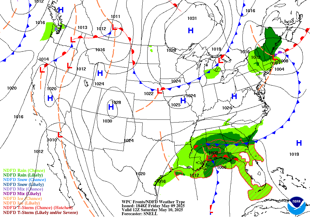
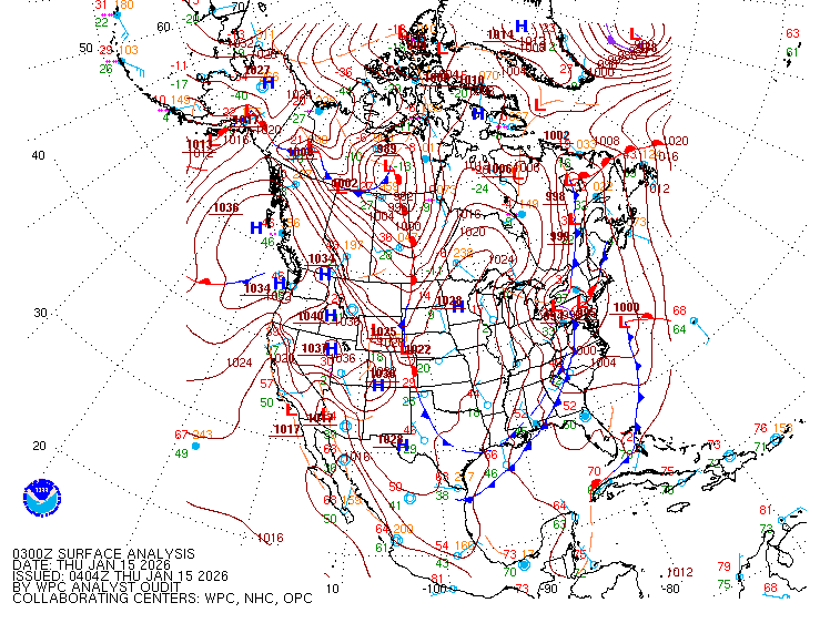
Surface analysis from NHC/WPC . 1007 mb Low in the BOC. Front already entering into the Northwest Gulf of Mexico. This will interact with our BOC Low later this week into the weekend.


1 likes
NEVER, EVER SAY NEVER in the tropics and weather in general, and most importantly, with life itself!!
________________________________________________________________________________________
Fay 2008 Beryl 2012 Debby 2012 Colin 2016 Hermine 2016 Julia 2016 Matthew 2016 Irma 2017 Dorian 2019
________________________________________________________________________________________
Fay 2008 Beryl 2012 Debby 2012 Colin 2016 Hermine 2016 Julia 2016 Matthew 2016 Irma 2017 Dorian 2019
- wxman57
- Moderator-Pro Met

- Posts: 23171
- Age: 68
- Joined: Sat Jun 21, 2003 8:06 pm
- Location: Houston, TX (southwest)
Re: Trough of Low Pressure in Bay of Campeche / Some development in WGOM
Looks like this one will develop into a weak TS in the Gulf by Friday afternoon. Should move inland into the FL Panhandle by Saturday afternoon. Increasing westerly wind shear may result in weakening below TS strength at landfall, though it won't likely be downgraded. All significant wind and rain will be to the right/east of the track. Could be 2-5 inches across the FL Panhandle, maybe 6-9 inches in a few spots where bands of squalls stream inland. I just cancelled my comp days that I was scheduled to take (from Dorian) tomorrow and Friday. We are initiating advisories today. Fortunately, it won't affect my Florida vacation next week. 
5 likes
- stormhunter7
- Category 2

- Posts: 763
- Joined: Mon May 26, 2008 3:13 pm
- Location: Panama City Beach, Florida
- Contact:
Re: Trough of Low Pressure in Bay of Campeche / Some development in WGOM
wxman57 wrote:Looks like this one will develop into a weak TS in the Gulf by Friday afternoon. Should move inland into the FL Panhandle by Saturday afternoon. Increasing westerly wind shear may result in weakening below TS strength at landfall, though it won't likely be downgraded. All significant wind and rain will be to the right/east of the track. Could be 2-5 inches across the FL Panhandle, maybe 6-9 inches in a few spots where bands of squalls stream inland. I just cancelled my comp days that I was scheduled to take (from Dorian) tomorrow and Friday. We are initiating advisories today. Fortunately, it won't affect my Florida vacation next week.
Thanks Wxman57! lol This place (Panama City Metro) will go into panic mode this afternoon when national weather tv starts blasting it. I still see many blue tarps in the area......
0 likes
The following post is NOT an official forecast and should not be used as such. It is just the opinion of the poster and may or may not be backed by sound meteorological data. It is NOT endorsed by any professional institution including storm2k.org For Official Information please refer to the NHC and NWS products. http://www.nhc.noaa.gov
- Emmett_Brown
- Category 5

- Posts: 1433
- Joined: Wed Aug 24, 2005 9:10 pm
- Location: Sarasota FL
Re: Trough of Low Pressure in Bay of Campeche / Some development in WGOM
This setup vaguely reminds me of 1996 TS Josephine: https://en.wikipedia.org/wiki/Tropical_ ... hine_(1996)
0 likes
-
TheStormExpert
Re: Trough of Low Pressure in Bay of Campeche / Some development in WGOM
Emmett_Brown wrote:This setup vaguely reminds me of 1996 TS Josephine: https://en.wikipedia.org/wiki/Tropical_ ... hine_(1996)
Probably weaker though, still track could be near identical.
0 likes
- HurricaneBelle
- S2K Supporter

- Posts: 1209
- Joined: Sun Aug 27, 2006 6:12 pm
- Location: Clearwater, FL
Re: Trough of Low Pressure in Bay of Campeche / Some development in WGOM
wxman57 wrote:Fortunately, it won't affect my Florida vacation next week.
Bring a cold front with you please.
0 likes
- wxman57
- Moderator-Pro Met

- Posts: 23171
- Age: 68
- Joined: Sat Jun 21, 2003 8:06 pm
- Location: Houston, TX (southwest)
Re: Trough of Low Pressure in Bay of Campeche / Some development in WGOM
stormhunter7 wrote:wxman57 wrote:Looks like this one will develop into a weak TS in the Gulf by Friday afternoon. Should move inland into the FL Panhandle by Saturday afternoon. Increasing westerly wind shear may result in weakening below TS strength at landfall, though it won't likely be downgraded. All significant wind and rain will be to the right/east of the track. Could be 2-5 inches across the FL Panhandle, maybe 6-9 inches in a few spots where bands of squalls stream inland. I just cancelled my comp days that I was scheduled to take (from Dorian) tomorrow and Friday. We are initiating advisories today. Fortunately, it won't affect my Florida vacation next week.
Thanks Wxman57! lol This place (Panama City Metro) will go into panic mode this afternoon when national weather tv starts blasting it. I still see many blue tarps in the area......
They're not going to see MY forecast, as it only goes out to our clients. Main impact for FL will be some rain.
0 likes
- wxman57
- Moderator-Pro Met

- Posts: 23171
- Age: 68
- Joined: Sat Jun 21, 2003 8:06 pm
- Location: Houston, TX (southwest)
Re: Trough of Low Pressure in Bay of Campeche / Some development in WGOM
HurricaneBelle wrote:wxman57 wrote:Fortunately, it won't affect my Florida vacation next week.
Bring a cold front with you please.
Looking like a weak cold front for the northern to central Peninsula on Tuesday, followed by a stronger front on Friday. I've been watching the weather closely, as we'll be in Orlando Mon-Sat next week. Every model run has a different solution with different frontal timing and strength.
1 likes
Re: Trough of Low Pressure in Bay of Campeche / Some development in WGOM
Current Obs.
BoC Buoy must have wind-direction sensor down. However, it's last report was 12 knts wind speed.

BoC Buoy must have wind-direction sensor down. However, it's last report was 12 knts wind speed.

0 likes
Re: Trough of Low Pressure in Bay of Campeche / Some development in WGOM
HurricaneAndre2008 wrote:If recon goes out, then this would be the first time that recon goes out on a system that has not been destignated as an invest
Even though recon is tentatively scheduled to fly out today, i'd be surprised if it did. I'd guess they cancel the flight and fly out tomorrow instead. This system has the earmarks of yet another NHC quick upgrade from an eventual "Potential Tropical Cyclone" event to a 12-18 hr. lifespan "T.S. Nestor" somewhere just south of Pensacola (whether or not there there will be more then one or two verifiable 35 kt. sustained wind obs within 50 miles of the COC is another topic altogether). I would imagine that there could be an enhanced tornado risk over from Mobile Alabama eastward to N. Florida. Right now it looks like the 12Z Icon is coming in a tad bit stronger (approx 1002 mb?) and slightly further east then it's prior model runs
0 likes
Andy D
(For official information, please refer to the NHC and NWS products.)
(For official information, please refer to the NHC and NWS products.)
- wxman57
- Moderator-Pro Met

- Posts: 23171
- Age: 68
- Joined: Sat Jun 21, 2003 8:06 pm
- Location: Houston, TX (southwest)
Re: Trough of Low Pressure in Bay of Campeche / Some development in WGOM
chaser1 wrote:HurricaneAndre2008 wrote:If recon goes out, then this would be the first time that recon goes out on a system that has not been designated as an invest
Even though recon is tentatively scheduled to fly out today, i'd be surprised if it did. I'd guess they cancel the flight and fly out tomorrow instead. This system has the earmarks of yet another NHC quick upgrade from an eventual "Potential Tropical Cyclone" event to a 12-18 hr. lifespan "T.S. Nestor" somewhere just south of Pensacola (whether or not there there will be more then one or two verifiable 35 kt. sustained wind obs within 50 miles of the COC is another topic altogether). I would imagine that there could be an enhanced tornado risk over from Mobile Alabama eastward to N. Florida. Right now it looks like the 12Z Icon is coming in a tad bit stronger (approx 1002 mb?) and slightly further east then it's prior model runs
Sounds good, to me. Brief TS that may have a few 35kt winds. Systems like this (moving into increasing westerly wind shear) tend to track farther east with time.
0 likes
Re: Trough of Low Pressure in Bay of Campeche / Some development in WGOM
'Tis the season (along with early season) to bet on right (eastward) adjustments to initial estimates should something form. For peninsular Florida folks looking to cash in on needed rainfall, those right adjustments would be necessary to bring rain over our way...at least based on the latest thinking from the WPC which continues to hold meaningful QPF west of the peninsula. I still think we're at least in the hunt to cash a ticket here...with some good rains and minimal overall hazards...a net benefit.
0 likes
Who is online
Users browsing this forum: cycloneye, Google Adsense [Bot] and 77 guests


