

WiscoWx02 wrote:Teban54 wrote:Given that a few days ago people were saying you couldn't even buy a thunderstorm in the Atlantic, the basin today is quite convectively active, honestly.
https://i.postimg.cc/brW2snGy/goes16-ir-atl.gif
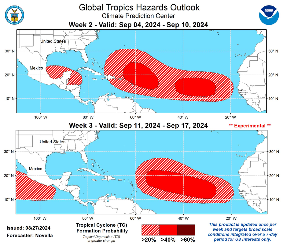
It sure is, but it forming a tropical cyclone is still likely a different matter. Model guidance has really backed off the last day or so, especially the EURO and honestly that’s the only model I trust given the GFS has missed every storm up to this point if memory serves, so can’t start trusting it now just because it shows something. Most likely the Atlantic continues to struggle because of the background state which is supposedly favorable but very clearly is not at this point. Something should give over the next few weeks and we see a couple storms, probably similar to 2014 style but that’s the ceiling imo.
Every year is different and unique. I see many people refer to climatology as the be all end all. While it can give you guidance and maybe even a a tic over 50/50 likelihood of occurring like the past, each year is different and unique. Every year we see new records being set , new trends being created and indeed another different type of year to mix into climatology trends. This year could just as easily be one of the highest performing back loaded seasons. We just have to wait and see.


