2024 Global Model Runs Discussion (Out thru day 16)

This is the general tropical discussion area. Anyone can take their shot at predicting a storms path.

Moderator: S2k Moderators

Forum rules

The posts in this forum are NOT official forecasts and should not be used as such. They are just the opinion of the poster and may or may not be backed by sound meteorological data. They are NOT endorsed by any professional institution or STORM2K. For official information, please refer to products from the National Hurricane Center and National Weather Service.

Help Support Storm2K
Message
Author
User avatar
Jr0d
S2K Supporter
S2K Supporter
Posts: 1394
Joined: Tue Aug 27, 2019 10:52 am
Location: Cayo Hueso

Re: 2024 Global Model Runs Discussion (Out thru day 16)

#2261 Postby Jr0d » Fri Oct 11, 2024 2:55 pm

jlauderdal wrote:
Jr0d wrote:It is interesting the operational run takes a storm into CA but it appears the majority of the ensembles take it north.

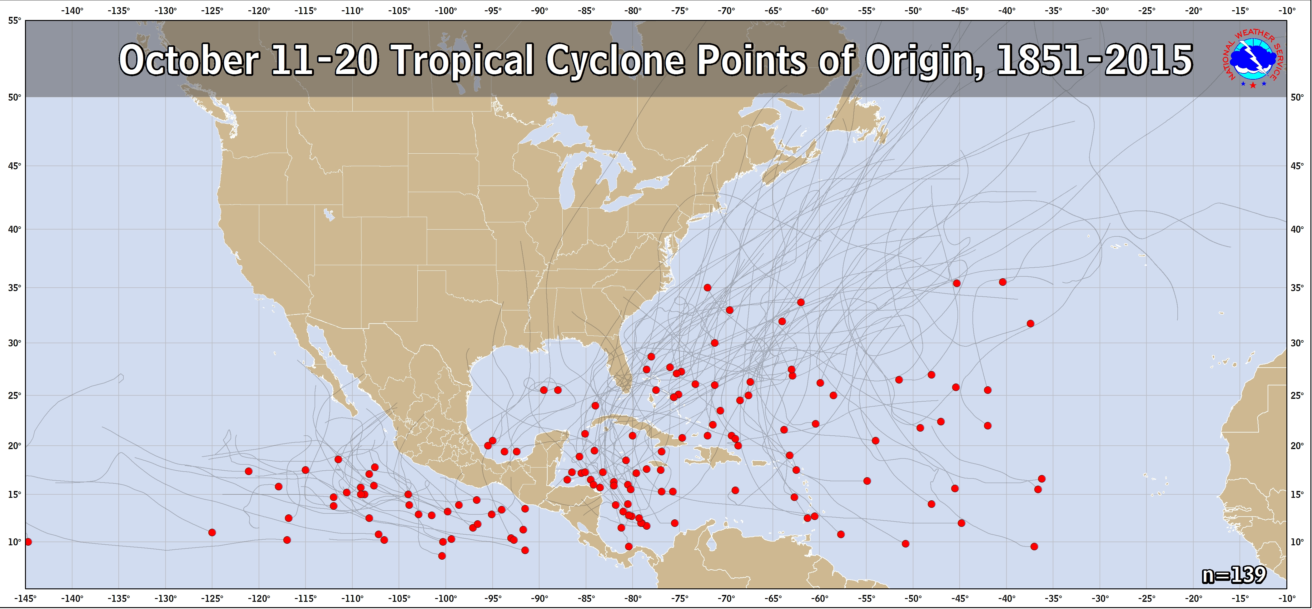
Also interesting that we also see a storm possibly making it that far west in mid to late October.
Ensembles at this range, op will windshield wiper for days like helene and milt.


Not sure how they weight the ensembles for the OP run, but it does seem like the majority ensemble runs prefer the north solution.

Still a "phantom storm" and the OP past 5 days is more or less guessing.

Until we get something to track, I will not give any weight to the OP runs and rely almost exclusively on Ensembles.

That said, the upper air forecast currently looks very favorable fir future development next week.
0 likes   

underthwx
Category 5
Category 5
Posts: 2351
Joined: Sat Jul 30, 2011 2:14 pm
Location: Brazoria County Texas

Re: 2024 Global Model Runs Discussion (Out thru day 16)

#2262 Postby underthwx » Fri Oct 11, 2024 3:12 pm

Im reading several different news agencies talking about another potential system forming in the Western Carribean in the coming days.....I hope not.....no news will be good news as far as I am concerned.....
0 likes   

underthwx
Category 5
Category 5
Posts: 2351
Joined: Sat Jul 30, 2011 2:14 pm
Location: Brazoria County Texas

Re: 2024 Global Model Runs Discussion (Out thru day 16)

#2263 Postby underthwx » Fri Oct 11, 2024 3:18 pm

From FOX 35 news..."ORLANDO, Fla. - The FOX 35 Storm Team is monitoring a potential weather system developing in the Caribbean Sea, with a more precise outlook expected in the coming days.

Hurricane Milton's departure is welcome news, with only a small chance of another storm developing over the next week. However, models are hinting at possible activity in the Western Caribbean Sea.

According to the GFS model, a significant cold front is expected to sweep across the eastern U.S. next week, bringing a blast of cooler air down to Central Florida by October 15. The European model is less confident in the development, but the potential remains"........

My question is.....does this next possible system compare to Helene or Milton's developmental stages?.....is this long-tange outlook comparable to these past 2 cyclones?.....I realize it's very premature at this point in time....but it seems similar....considering what has already occurred with Helene and Milton....and I need to be very clear....im not asking if any area of the US can expect more tropical activity....my interest is only on long range forecasts....
1 likes   

User avatar
Woofde
Category 1
Category 1
Posts: 475
Joined: Tue Jul 06, 2021 11:33 am

Re: 2024 Global Model Runs Discussion (Out thru day 16)

#2264 Postby Woofde » Fri Oct 11, 2024 5:16 pm

We probably need a lemon sooner than later, this is the GFS at hour 108, 998mb in under 5 days.Image
6 likes   

User avatar
cheezyWXguy
Category 5
Category 5
Posts: 6091
Joined: Mon Feb 13, 2006 12:29 am
Location: Dallas, TX

Re: 2024 Global Model Runs Discussion (Out thru day 16)

#2265 Postby cheezyWXguy » Fri Oct 11, 2024 5:51 pm

Image
18z gefs coming in hot…
2 likes   

USTropics
Category 5
Category 5
Posts: 2636
Joined: Sun Aug 12, 2007 3:45 am
Location: Florida State University

Re: 2024 Global Model Runs Discussion (Out thru day 16)

#2266 Postby USTropics » Fri Oct 11, 2024 6:16 pm

We can track the catalyst for the system the GFS is forming. In the NHC 12z analysis, there is a tropical wave currently located in the central Atlantic around 50W. We can also see the monsoonal trough/ITCZ is positioned further south in the Caribbean:
Image

A central Atlantic tropical wave is near 47W from 12N southward,
moving westward at 10-15 kt. Scattered showers are in the vicinity
of the wave axis.


A common area of low-level vorticity development due to the terrain is located near Columbia/Panama (highlighted in teal below). Essentially the orientation of the mountain range and valley in this region provides a topographical lift that assists in low-level vorticity forming here:
Image

The wave will provide some extra 'lift' for the vort streamer in ~72 hours as it becomes tilted, and this interaction is what the GFS has for development:
Image

While the GFS is all alone in its solution, the CMC has been trending towards increased vorticity in this region. The difference is, the lift isn't fully there on the CMC, and it moves across Central America into the EPAC before developing:
Image

This is also a climatological favorable region for development during this time period of October:
Image
7 likes   

User avatar
weeniepatrol
Category 5
Category 5
Posts: 1252
Joined: Sat Aug 22, 2020 5:30 pm
Location: WA State

Re: 2024 Global Model Runs Discussion (Out thru day 16)

#2267 Postby weeniepatrol » Fri Oct 11, 2024 6:52 pm

Image
3 likes   

TomballEd
Category 2
Category 2
Posts: 585
Age: 61
Joined: Wed Aug 16, 2023 4:52 pm
Location: Spring/Klein area, not Tomball

Re: 2024 Global Model Runs Discussion (Out thru day 16)

#2268 Postby TomballEd » Fri Oct 11, 2024 7:31 pm

GFS and ensembles has a tendency to be too bullish in the SW Caribbean. I'd be more confident if other models start showing support. If this does develop, and 94L stays weak long enough to reach the Caribbean, Florida's season may not be over. Maybe even two threats.
3 likes   

MarioProtVI
Category 4
Category 4
Posts: 932
Age: 23
Joined: Sun Sep 29, 2019 7:33 pm
Location: New Jersey

Re: 2024 Global Model Runs Discussion (Out thru day 16)

#2269 Postby MarioProtVI » Fri Oct 11, 2024 8:11 pm

USTropics wrote:We can track the catalyst for the system the GFS is forming. In the NHC 12z analysis, there is a tropical wave currently located in the central Atlantic around 50W. We can also see the monsoonal trough/ITCZ is positioned further south in the Caribbean:
https://i.imgur.com/e8rTxKe.png

A central Atlantic tropical wave is near 47W from 12N southward,
moving westward at 10-15 kt. Scattered showers are in the vicinity
of the wave axis.


A common area of low-level vorticity development due to the terrain is located near Columbia/Panama (highlighted in teal below). Essentially the orientation of the mountain range and valley in this region provides a topographical lift that assists in low-level vorticity forming here:
https://i.imgur.com/WR2tHHZ.png

The wave will provide some extra 'lift' for the vort streamer in ~72 hours as it becomes tilted, and this interaction is what the GFS has for development:
https://i.imgur.com/59pW0UK.gif

While the GFS is all alone in its solution, the CMC has been trending towards increased vorticity in this region. The difference is, the lift isn't fully there on the CMC, and it moves across Central America into the EPAC before developing:
https://i.imgur.com/Y4ctGdl.gif

This is also a climatological favorable region for development during this time period of October:
https://www.nhc.noaa.gov/climo/images/oct_11_20.png

Another possible reason Euro isn’t on board is perhaps it sees something we don’t. GFS is known to have a bias in this area especially late season to spin up storms from random vorticity off SA. NHC seems to agree with that..
2 likes   

USTropics
Category 5
Category 5
Posts: 2636
Joined: Sun Aug 12, 2007 3:45 am
Location: Florida State University

Re: 2024 Global Model Runs Discussion (Out thru day 16)

#2270 Postby USTropics » Fri Oct 11, 2024 8:39 pm

MarioProtVI wrote:
USTropics wrote:We can track the catalyst for the system the GFS is forming. In the NHC 12z analysis, there is a tropical wave currently located in the central Atlantic around 50W. We can also see the monsoonal trough/ITCZ is positioned further south in the Caribbean:
https://i.imgur.com/e8rTxKe.png

A central Atlantic tropical wave is near 47W from 12N southward,
moving westward at 10-15 kt. Scattered showers are in the vicinity
of the wave axis.


A common area of low-level vorticity development due to the terrain is located near Columbia/Panama (highlighted in teal below). Essentially the orientation of the mountain range and valley in this region provides a topographical lift that assists in low-level vorticity forming here:
https://i.imgur.com/WR2tHHZ.png

The wave will provide some extra 'lift' for the vort streamer in ~72 hours as it becomes tilted, and this interaction is what the GFS has for development:
https://i.imgur.com/59pW0UK.gif

While the GFS is all alone in its solution, the CMC has been trending towards increased vorticity in this region. The difference is, the lift isn't fully there on the CMC, and it moves across Central America into the EPAC before developing:
https://i.imgur.com/Y4ctGdl.gif

This is also a climatological favorable region for development during this time period of October:
https://www.nhc.noaa.gov/climo/images/oct_11_20.png

Another possible reason Euro isn’t on board is perhaps it sees something we don’t. GFS is known to have a bias in this area especially late season to spin up storms from random vorticity off SA. NHC seems to agree with that..


I would agree, until we get some more model agreement I don't put a lot weight on the GFS model suite solution on its own. However, I do hold some reserve on this being the usual GFS spurious vorticity bias (it's more common in the NW Caribbean) since we have a tropical wave also providing convergence out in front. The ECMWF does not develop this, but it does have the moisture plume entering the NW Caribbean before being stretched out along a frontal zone:
Image

While chances are low, the GFS solution is plausible and not necessarily from spurious vorticity, and the model did show the possibility of Milton (albeit it was inconsistent) even after all of the other models dropped it.
2 likes   

User avatar
ScottNAtlanta
Category 5
Category 5
Posts: 2360
Joined: Sat May 25, 2013 3:11 pm
Location: Atlanta, GA

Re: 2024 Global Model Runs Discussion (Out thru day 16)

#2271 Postby ScottNAtlanta » Fri Oct 11, 2024 8:43 pm

I have to say, the Euro has not been particularly good with the last 3 GOM systems...by a lot.
10 likes   
The posts in this forum are NOT official forecast and should not be used as such. They are just the opinion of the poster and may or may not be backed by sound meteorological data. They are NOT endorsed by any professional institution or storm2k.org. For official information, please refer to the NHC and NWS products.

User avatar
Hypercane_Kyle
Category 5
Category 5
Posts: 3344
Joined: Sat Mar 07, 2015 7:58 pm
Location: Cape Canaveral, FL

Re: 2024 Global Model Runs Discussion (Out thru day 16)

#2272 Postby Hypercane_Kyle » Fri Oct 11, 2024 11:14 pm

ScottNAtlanta wrote:I have to say, the Euro has not been particularly good with the last 3 GOM systems...by a lot.


Yeah, the Euro is unfortunately probably the worst model when it comes to TC genesis. Even the JMA seems to pick them up more often than the Euro does. It's not until the storm is literally on the doorstep of genesis that it starts development. The EC-AIFS, however, does appear to have some skill.
2 likes   
My posts are my own personal opinion, defer to the National Hurricane Center (NHC) and other NOAA products for decision making during hurricane season.

Fancy1002
Tropical Storm
Tropical Storm
Posts: 129
Joined: Sun Dec 25, 2022 3:47 pm

Re: 2024 Global Model Runs Discussion (Out thru day 16)

#2273 Postby Fancy1002 » Fri Oct 11, 2024 11:16 pm

00z is looking interesting.
0 likes   

User avatar
Kazmit
Category 5
Category 5
Posts: 2124
Age: 22
Joined: Mon Jul 25, 2016 8:49 am
Location: Williamsburg, VA / Bermuda

Re: 2024 Global Model Runs Discussion (Out thru day 16)

#2274 Postby Kazmit » Fri Oct 11, 2024 11:18 pm

00z GFS has a major hurricane 6 days from now. Wild.
Last edited by Kazmit on Fri Oct 11, 2024 11:32 pm, edited 1 time in total.
0 likes   
Igor 2010, Sandy 2012, Fay 2014, Gonzalo 2014, Joaquin 2015, Nicole 2016, Humberto 2019

I am only a tropical weather enthusiast. My predictions are not official and may or may not be backed by sound meteorological data. For official information, please refer to the NHC and NWS products.

User avatar
Category5Kaiju
Category 5
Category 5
Posts: 4051
Joined: Thu Dec 24, 2020 12:45 pm
Location: Seattle

Re: 2024 Global Model Runs Discussion (Out thru day 16)

#2275 Postby Category5Kaiju » Fri Oct 11, 2024 11:23 pm

GFS shows an Iota-like storm that just bombs out near Central America while headed toward it
1 likes   
Unless explicitly stated, all info in my posts is based on my own opinions and observations. Tropical storms and hurricanes can be extremely dangerous. Do not think you can beat Mother Nature. Refer to an accredited weather research agency or meteorologist if you need to make serious decisions regarding an approaching storm.

mantis83
Tropical Storm
Tropical Storm
Posts: 198
Joined: Fri Dec 05, 2003 4:47 pm

Re: 2024 Global Model Runs Discussion (Out thru day 16)

#2276 Postby mantis83 » Sat Oct 12, 2024 12:09 am

0Z gfs ensembles are further south more in line with the operational, this has little chance of affecting the gulf coast or florida……..good news for sure
3 likes   

WeatherBoy2000
Category 1
Category 1
Posts: 280
Joined: Mon Apr 10, 2023 9:29 am

Re: 2024 Global Model Runs Discussion (Out thru day 16)

#2277 Postby WeatherBoy2000 » Sat Oct 12, 2024 8:30 am

Something to keep in mind about the SW Caribbean disturbance:

 https://x.com/AndyHazelton/status/1845071713295335481


 https://x.com/dmorris9661/status/1845073568549232783


Overamplifying these features is a common gfs/gefs bias, the fact that they're largely on their own is a red flag for this being a ghost storm atm. Don't be surprised if nothing happens.
0 likes   

User avatar
wxman57
Moderator-Pro Met
Moderator-Pro Met
Posts: 22951
Age: 67
Joined: Sat Jun 21, 2003 8:06 pm
Location: Houston, TX (southwest)

Re: 2024 Global Model Runs Discussion (Out thru day 16)

#2278 Postby wxman57 » Sat Oct 12, 2024 8:38 am

One thing I see different next week is the movement of a strong cold front all the way south to the NW Caribbean. The jet stream dipping down all the way to the southern Gulf should shut down the potential for hurricane development in the Gulf. It would be more common for something to form in the SW Caribbean that moves west into Central America. Besides, our annual Orlando trip comes up in a week. I will not allow any hurricanes to impact Florida.
10 likes   

User avatar
ConvergenceZone
Category 5
Category 5
Posts: 5194
Joined: Fri Jul 29, 2005 1:40 am
Location: Northern California

Re: 2024 Global Model Runs Discussion (Out thru day 16)

#2279 Postby ConvergenceZone » Sat Oct 12, 2024 10:50 am

wxman57 wrote:One thing I see different next week is the movement of a strong cold front all the way south to the NW Caribbean. The jet stream dipping down all the way to the southern Gulf should shut down the potential for hurricane development in the Gulf. It would be more common for something to form in the SW Caribbean that moves west into Central America. Besides, our annual Orlando trip comes up in a week. I will not allow any hurricanes to impact Florida.


Have fun in Orlando WXMAN, and so glad to see the cold front moving into the Carib. It's nice to see the season "slowly" winding down. I would have no problem seeing a few more out to sea storms, but I think everyone is probably burned out on following the tropics at this point anyway lol.
Last edited by ConvergenceZone on Sat Oct 12, 2024 10:52 am, edited 1 time in total.
0 likes   

User avatar
Teban54
Category 5
Category 5
Posts: 3168
Joined: Sat May 19, 2018 1:19 pm

Re: 2024 Global Model Runs Discussion (Out thru day 16)

#2280 Postby Teban54 » Sat Oct 12, 2024 10:51 am

WeatherBoy2000 wrote:Something to keep in mind about the SW Caribbean disturbance:

 https://x.com/AndyHazelton/status/1845071713295335481


 https://x.com/dmorris9661/status/1845073568549232783


Overamplifying these features is a common gfs/gefs bias, the fact that they're largely on their own is a red flag for this being a ghost storm atm. Don't be surprised if nothing happens.

At this point it can probably go either way. GFS was also among the first models to sniff out Helene and Milton, even though Milton eventually formed much later and further NW than GFS initially expected. I don't think it has had any phantoms in the Caribbean so far this season.
1 likes   


Return to “Talkin' Tropics”

Who is online

Users browsing this forum: No registered users and 1177 guests